MANDA
-
Posts
2,965 -
Joined
-
Last visited
Content Type
Profiles
Blogs
Forums
American Weather
Media Demo
Store
Gallery
Everything posted by MANDA
-
Agreed. Until I see smoke drifting through my neighborhood this is not close to 2023, so far.
-
Best wishes to NJ State Climatologist Dave Robinson on his retirement. His name has been a fixture in NJ weather and climate for as long as I can remember. https://www.njweather.org/articles/june-2026-recap-plus-first-half-2026-review
-
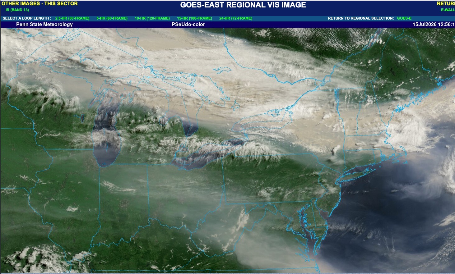
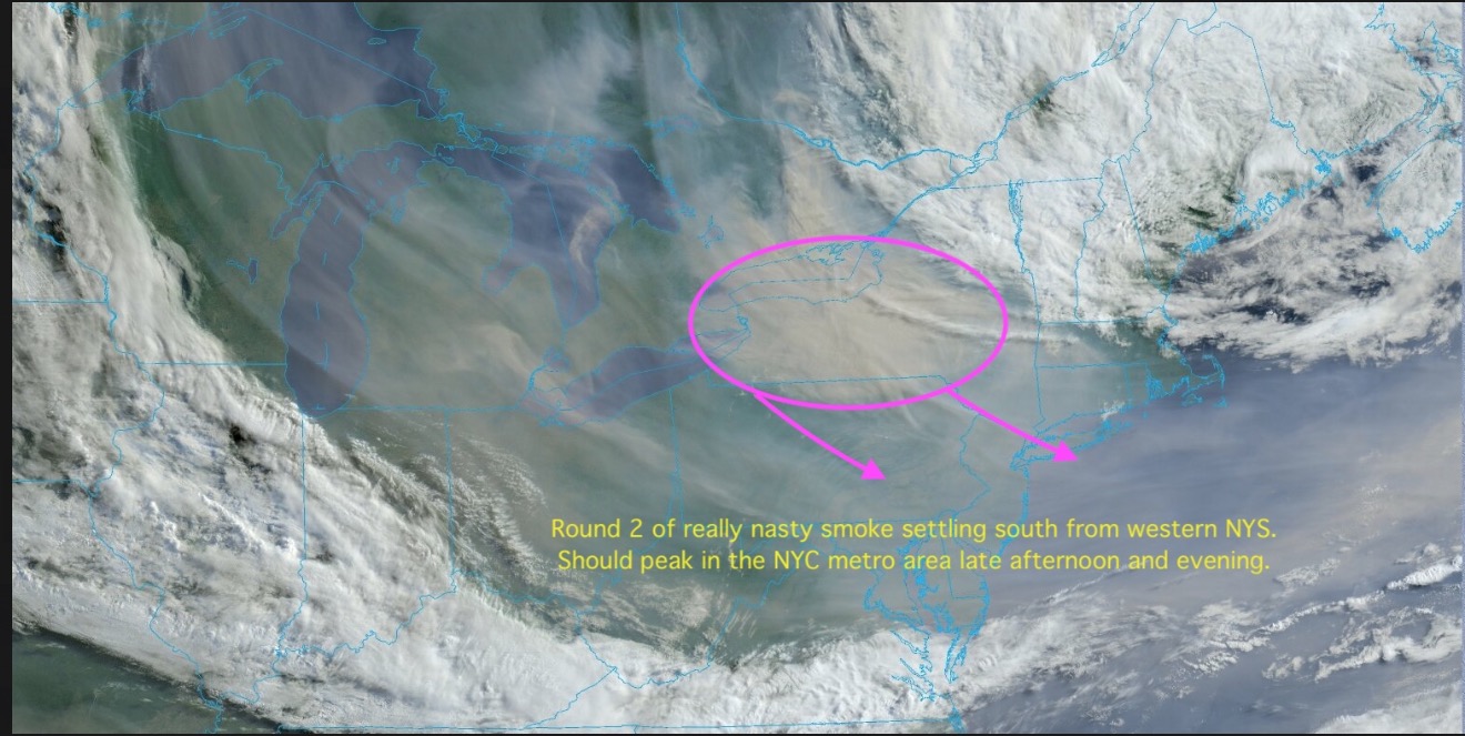
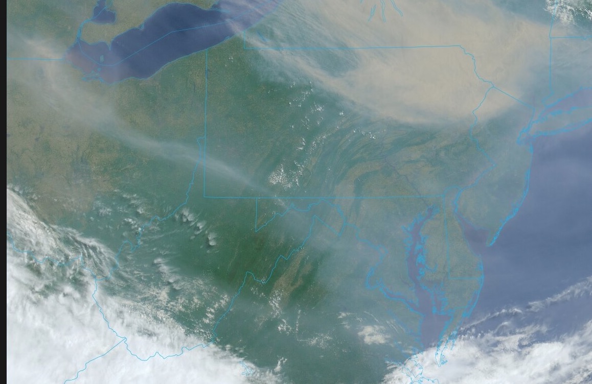
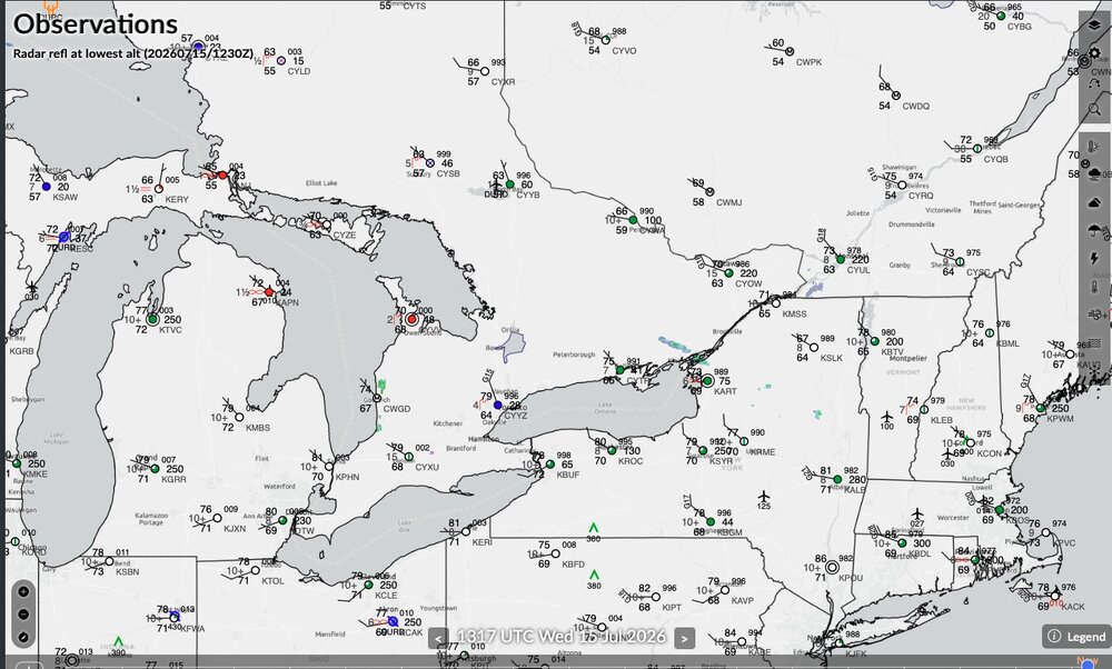
That is a nasty smoke plume shifting slowly south from New England. Visibilities not being affected significantly until you get into the Great Lakes area. Some reports there of 1-2 miles. At a minimum the skies will turn "dirty" looking again later today. Click to enlarge maps.

-
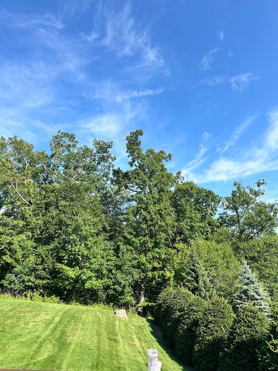
Much cleaner look to the sky up this way now. Mostly just some cirrus mixed with blue skies.
-
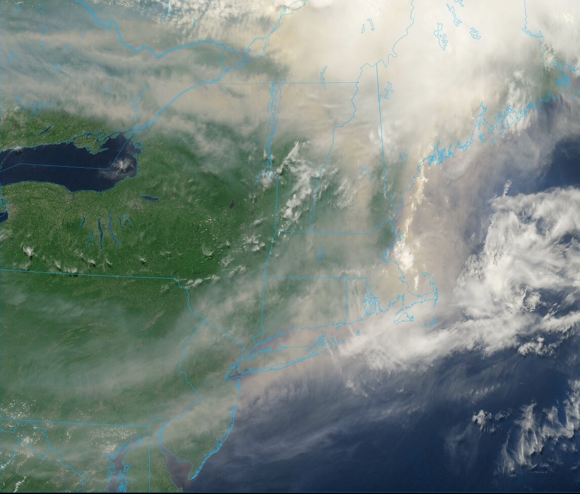
One more band of smoke to sink southeast across the area next few hours. That should be followed by somewhat clearer skies by late afternoon / evening from NW to SE.

-
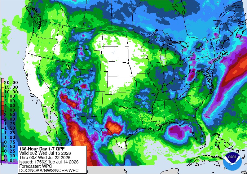
WPC take on rainfall next 7 days. Most of this falls Saturday into early Sunday. Tweaks I'm sure over the next few days but potential for some locally heavier totals over parts of the sub forum.
-
Fingers crossed for you. Been there done that. It does suck.
-
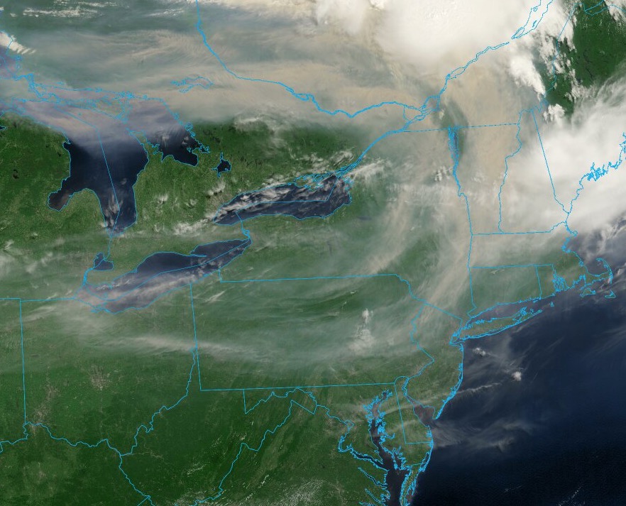
Current satellite of smoke plume. Surprised more air quality alerts are not being issued, at least for Upstate NY and New England?
-
Will be hard to beat that smoke plume from June 2023. That was something else. I remember driving along Rt. 80 in my area and smoke was at ground level blowing across the road. Visibility was low and the air smelled of burning wood. If you didn't know better you would have thought it was from a local forest fire, not something from up in Canada.


-
This is old news by now but there was quite a bit of damage with those holiday weekend storms. No wonder it took so long to get the power back. Next hurricane of substance that blows through the tri-state is going to be a big problem. Some people around my part of NJ were without power for a week. Something that affects the entire area with 60-80 mph winds is going to be a nightmare in terms of power outages. Not a matter of if but when.
-
I've not noticed that around here but maybe I'm just not paying close enough attention. I know many supermarkets put them in around here. The food loss during Sandy was extreme. I remember seeing food being loaded into dumpsters in the supermarket parking lots. We were out for 7-10 days around here. While a Sandy like track into the Jersey coast has a very high return period it would not take much more than a Cat 1 or a low Cat 2 on a track up along or just off the coast to cause similar or worse power outages over a large area.
-
I had friends in Sandy with portable generators. Problem was they could not get gas. Driving around looking for it. Many gas stations had no power to pump. In addition is was 2-3 days before you could get out of your local area since so many trees were blocking roads. Natural gas only way to go if you can. I know some can't.
-
They don't get a workout too often but nice to have one when you need one. No more flashlights or candles. No more freezing or roasting in the dark. You pretty much go on with normal life when the power is out. We did not have one for Sandy so that was the worst. If we had not had one now this would have run a close second with no a/c in a heatwave for 3 days.
-
A sound I don't want to hear again for a while after a 66 hour stretch recently.
-
Going to take something rouge to make it a memorable season. Always gotta watch out for something slow moving (TS or weak hurricane) that could cause serious flooding or that one rouge system that busts through and becomes a more memorable landfalling system. Barring that it looks like it could be a quiet season. Certainly nothing on the horizon through mid July. Seasonal ACE of 50 is pretty low. Not something we've been used to lately. Remember Andrew! El-Nino season and it fought its way back as a weak TD all the way back to a CAT 5. TPC almost wrote it off but hung onto it. @GaWx always enjoy your posts.
-
Socked in here all day. Even some mist / drizzle at times earlier. Temperature never got out of the 60's. High on the day 69.
-
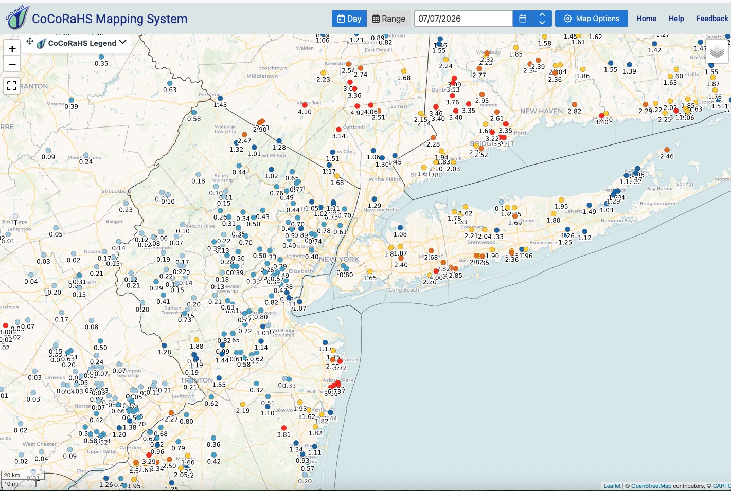
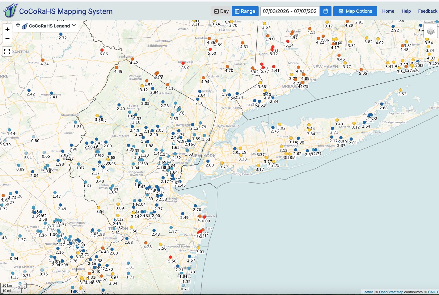
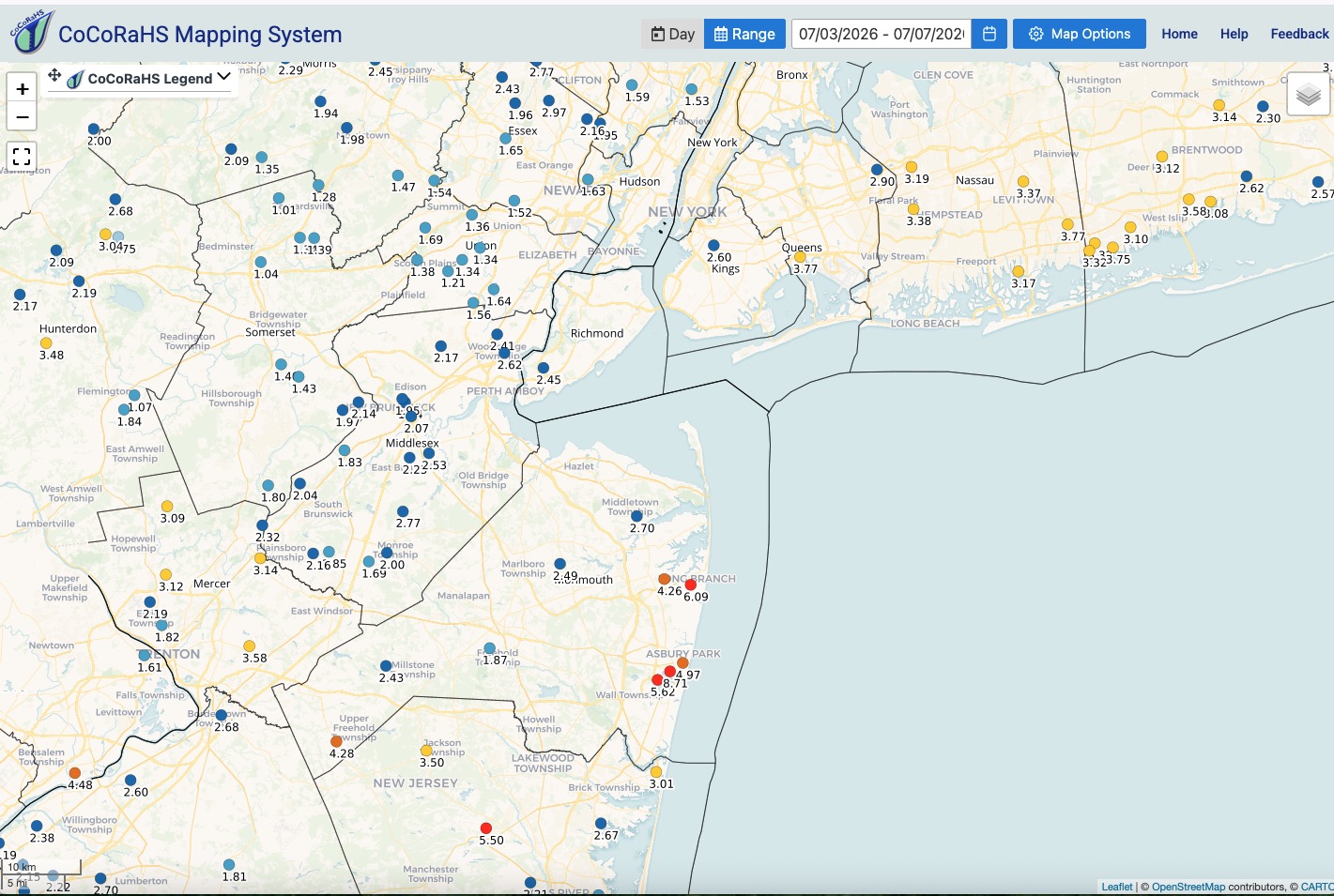
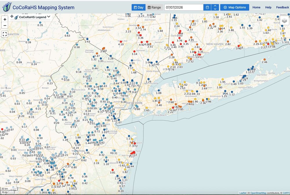
Received just .26" here yesterday. Rainfall maps: Yesterday and since Friday - click to enlarge. Everyone across this subform got a good soaking. Localized places too much. Everything has greened up nicely for early July. Won't have to water anything this week. As we move deeper into hurricane season I'm interested to see how it evolves. Hostile as it gets looking ahead the next 2-3 weeks based on any parameter you want to look at.

-
I'd make a hefty wager someone files a lawsuit and I'd wager if they do a settlement is reached. Emotional trauma or something along those lines.
-
I think the only exception to that was parts of Monmouth County, NJ and some locations on Staten Island and along the South shore. Certainly the northern locations with 5-7" it was spread out to avoid any flash flooding. Gotta believe BJ's is going to have lawsuits for not maintaining their rooftop drains. Litigious society and all.
-
Governor Sherrill....Bueller, Bueller. First the power outages and now flooding. Crickets. Could probably use a State of Emergency in a few counties about now.
-
Mine came back about 11:30 this morning. Hope you get it soon. Friend out it Pittstown still out with estimate still Wednesday evening.
-
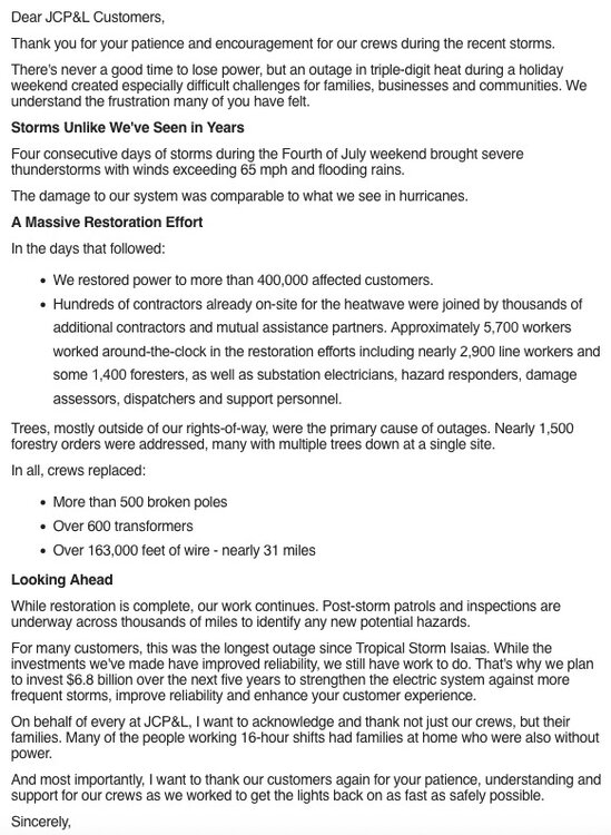
Still no power. Rainfall total as of 7:00 a.m. a beneficial and manageable 1.36". Thankfully the excessive totals did not pan out over a large area. Isolated excessive amounts only. @IrishRob17seems to have jack potted. Threat of Flash Flooding much reduced for rest of today but still some locally heavier showers around. Temperatures down but humidity is sky high. Very soupy out there this morning.
-
Pretty strongly worded. Some places could be in trouble along that stalled boundary.
-
Same here, power still out. Latest update is 11:00 tomorrow night for my area. Generator is saving the day but honestly I'm getting tired of hearing the noise. First world problem I know. Can't wait for the next time a Cat. 1 takes the right track. How the hell are they ever going to handle that? I know they are working hard and I'm not near as bad off as some but it seems to be taking so long. Friend in western Hunterdon County is Wednesday night and friend in Berkeley Heights is 9:00 Thursday night. I've got nothing to complain about so forgive me. I'm just cranky. I hope anyone that depends on a sump pump during heavy rain and is without power gets it back in time.
-
Seems overdone but going to be some local 5” totals in spots I think. How bad any flooding might be will depend on rainfall rates / training.