MANDA
-
Posts
2,965 -
Joined
-
Last visited
Content Type
Profiles
Blogs
Forums
American Weather
Media Demo
Store
Gallery
Everything posted by MANDA
-
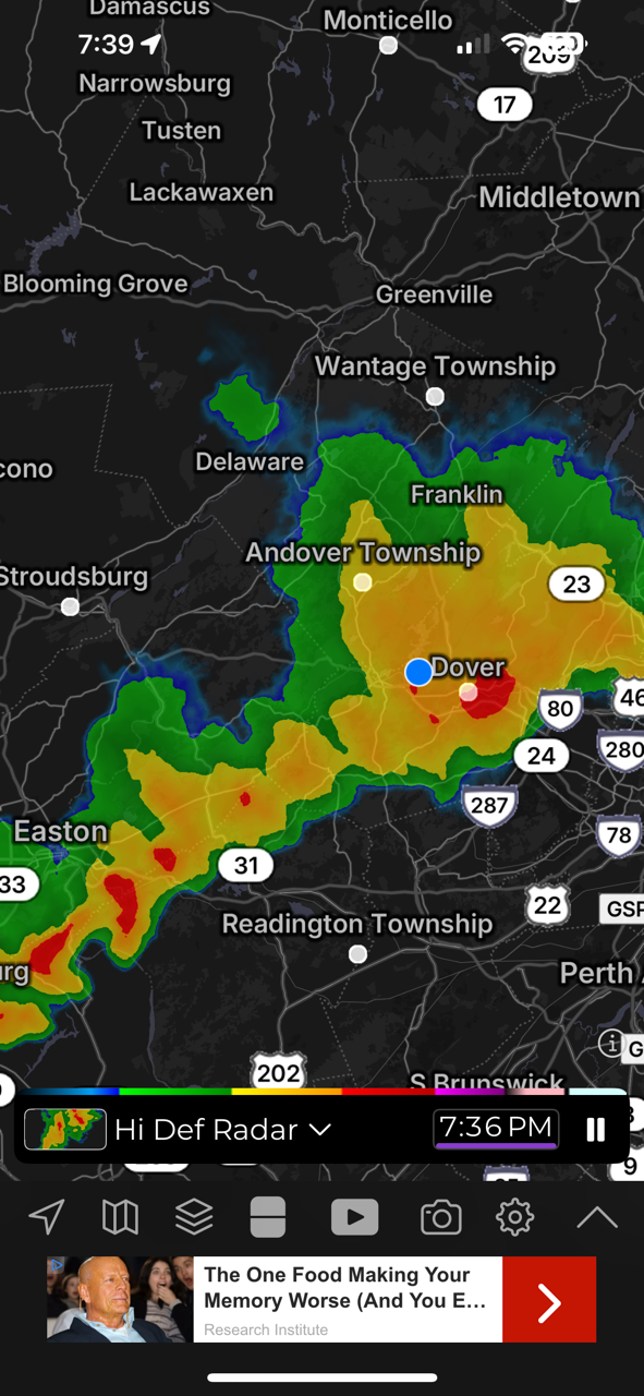
First storm of the evening just slid by to my north. Gusty downdraft and some sprinkles. Few rumbles of thunder as well. Mid Hudson Valley getting rocked at this hour.
-
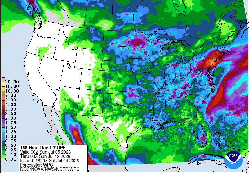
WPC going with the wetter guidance. Local 5" amounts verbatim over the next 7 days with most of that from later Sunday into Monday. Local flash flooding possible despite the ongoing dryness.
-
You as well! Not fun especially over a holiday weekend.
-
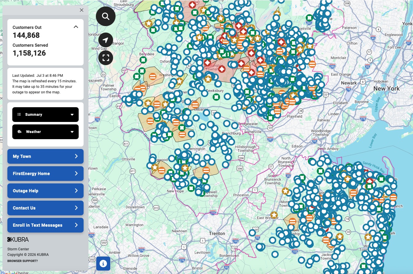
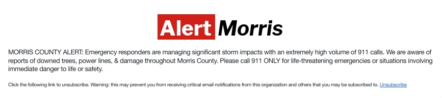
Power still out here. Finally received an update with expected restoration time of 7am tomorrow and crew has been dispatched. Anything severe later could delay restoration. Thankfully generator is humming away. Took 6 years but it finally paid for itself! Got it installed after Isaias in 2020. It was a 'WWI" purchase...wife wanted it. No way I was going to get away with putting it off any longer. Not after Sandy, Irene and numerous other snow / ice related outages over the years. She was having no part of it anymore. Cell service has been spotty at best. Internet was down but just came back. Have not been out but talked with people who have been and lots of trees and wires down. Picked up .71" rainfall in about 12 minutes with the storm last night. Happy 4th to all. Hopefully for those without power it will be restored sooner rather than later. I think several days for total restoration.
-
Reading between the lines I think it means they are doing little or nothing until daybreak.
-
Just got update from JCPL. For my area "estimated restoration times will not be available until tomorrow afternoon" This is not going to be a quick fix.
-
Not sure what happened in my area. My power went out before the winds really hit. We had a CTG strike, a boom of thunder and off went the power. Then the winds really picked up. Lighting must have hit something. Grid was probably pushed to the limit already with the heat.
-
JCPL outage map is lit up. Going to be a long time for full restoration on a holiday weekend I think. Could be days for some? My town seems to be leading the way with 95% of the power out. Chester area also up there with close to 80% out.
-
Might take a while to get the power back on over a holiday weekend. Thankful for the generator.
-
Temp fell like a rock. Currently 64 degrees.
-
Getting rocked here. Legit scary. CTG lightning and crashing thunder. Torrential rains. Winds gusting to est 60 mph. Debris all over. Power out. Generator on.

-
You gotta feel for people who have to work outside in this. Just horrible. Especially in highly urbanized areas (EWR, NYC PHL etc.) with the heat coming off the pavement and buildings. Also for those with no a/c. Just stifling outside overnight. Can't imagine no a/c. Yet people did it back in the day but I just can't imagine how miserable that must have been. Guidance suggesting some widespread rainfall later Sunday / Monday.
-
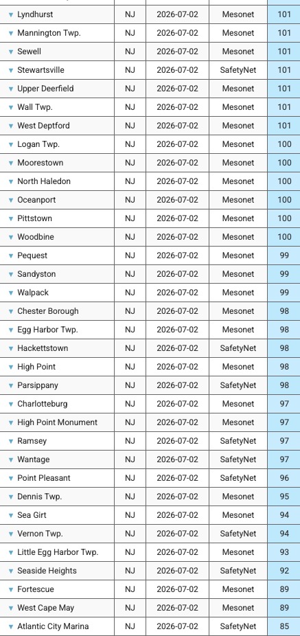
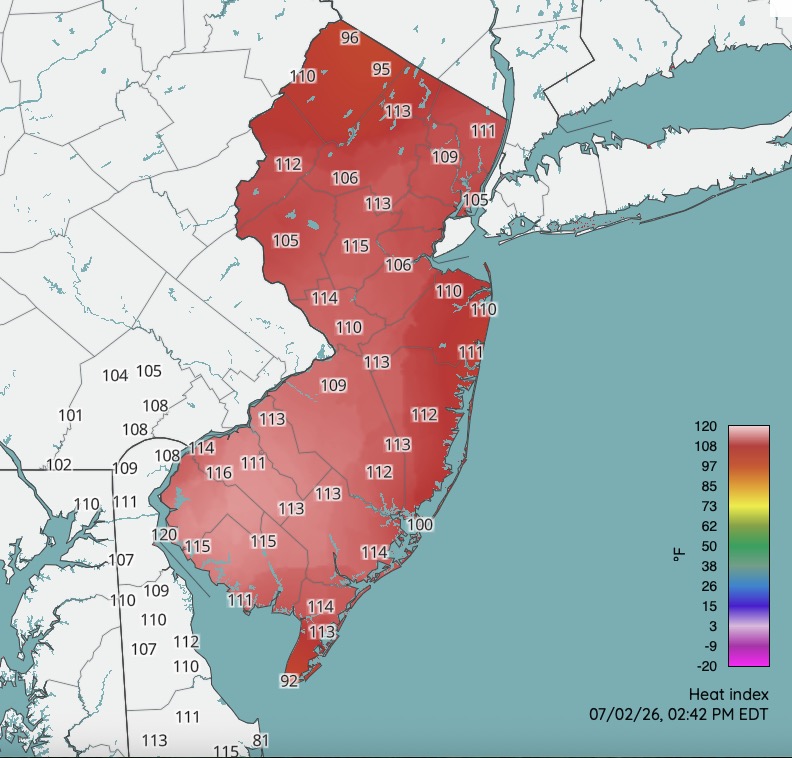
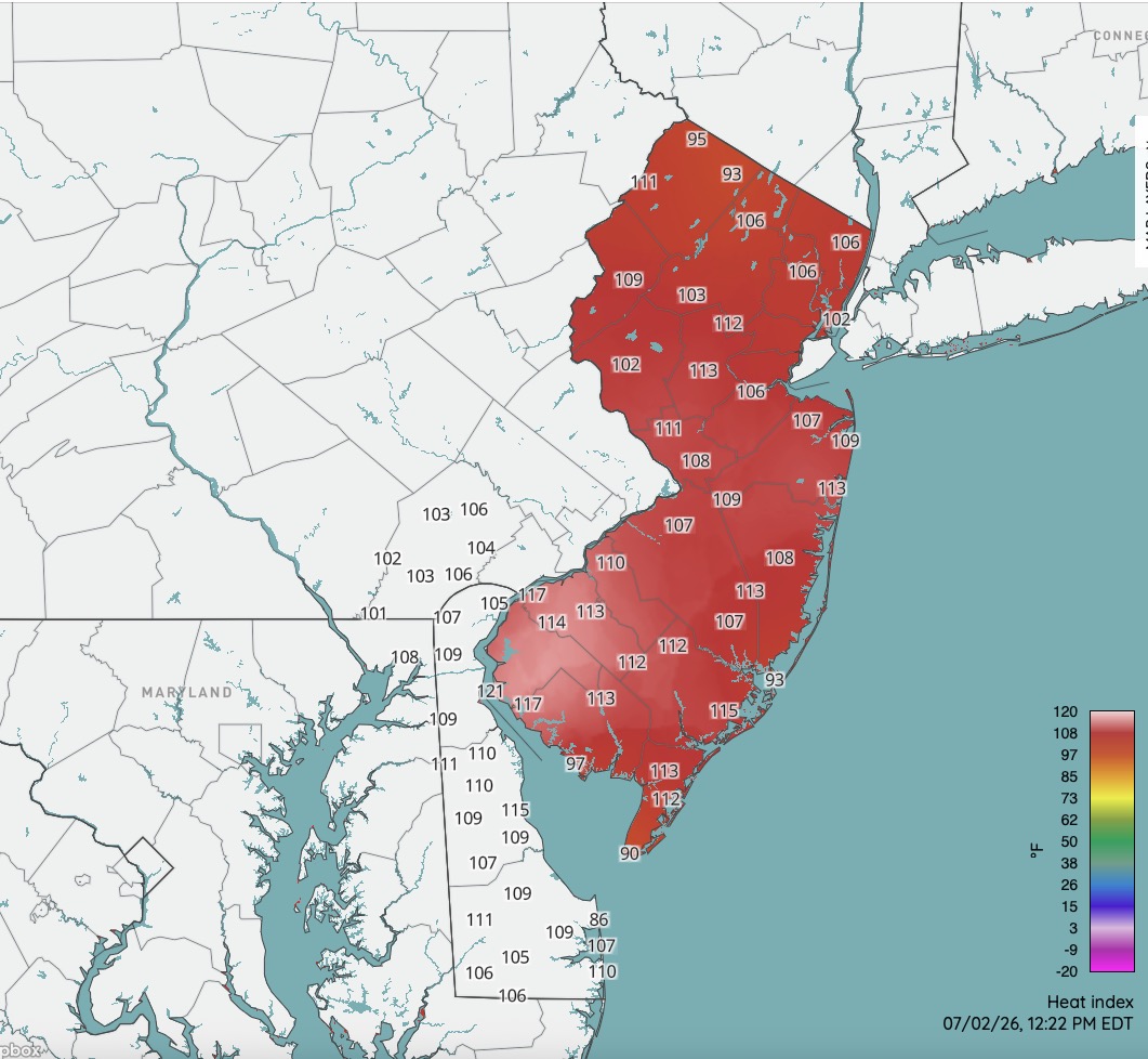
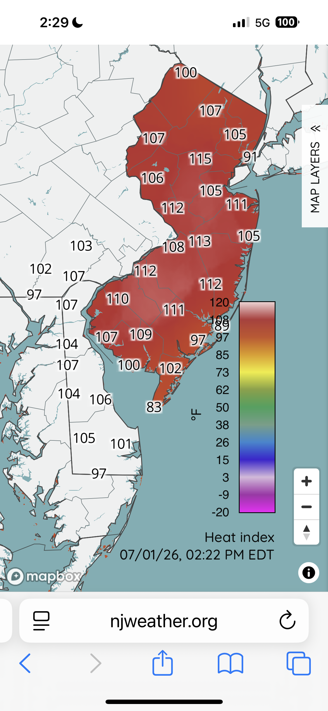
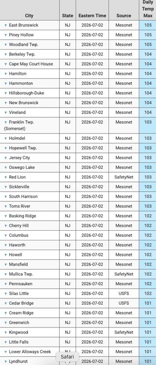
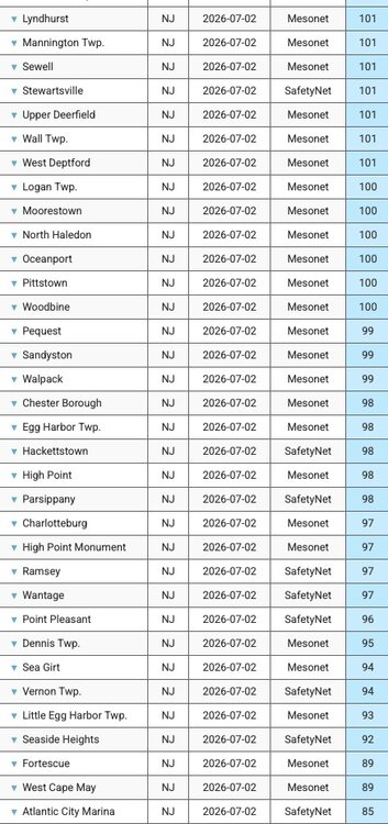
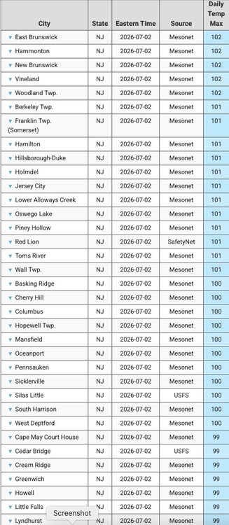
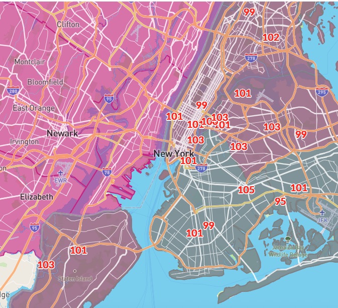
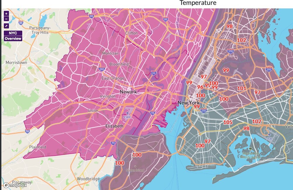
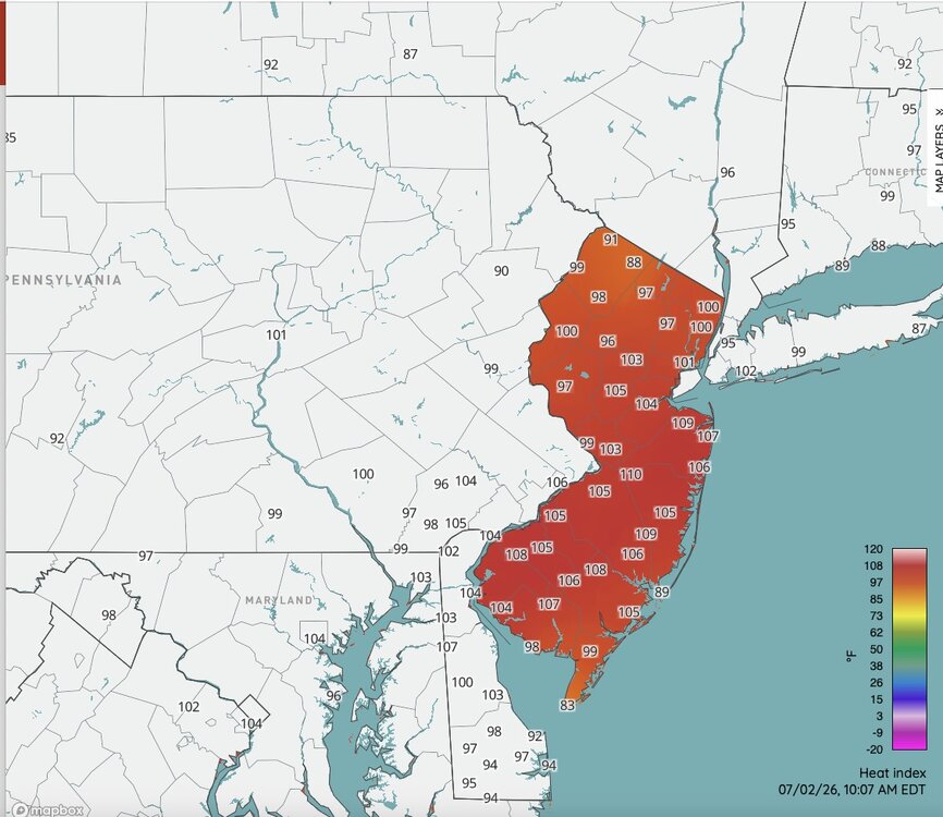
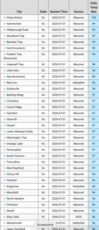
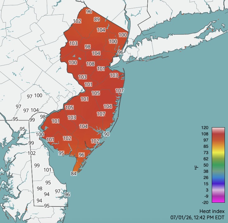
High temperatures across NJ today from Rutgers Weather Network. Most max heat index readings were between 108-115. There were some readings in excess of 115 over parts of NJ. Even as high as 120 over the southwest corner of the state. Hot day! One more similar day tomorrow. Still hot Saturday but "less hot".
-
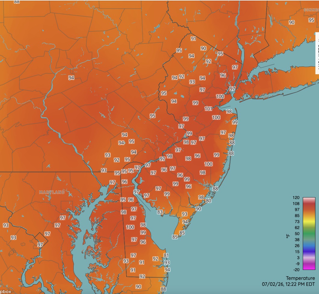
Currently 97 here. That might do it for me for a high. Been going between 96 and 97.


-
Air was so think and hot in 1995 you could choke. Never before or since have I felt it that hot and humid. Local heat indexes reached 120. I think EWR was over 100 degrees with a DP of 80 if I remember correctly. Worst heat I've ever experienced.
-
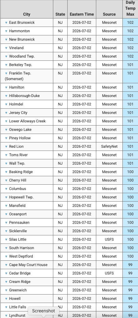
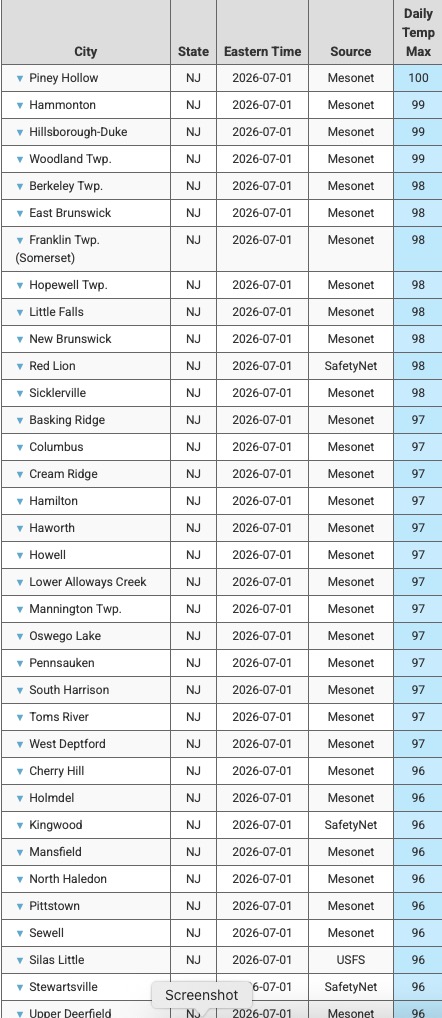
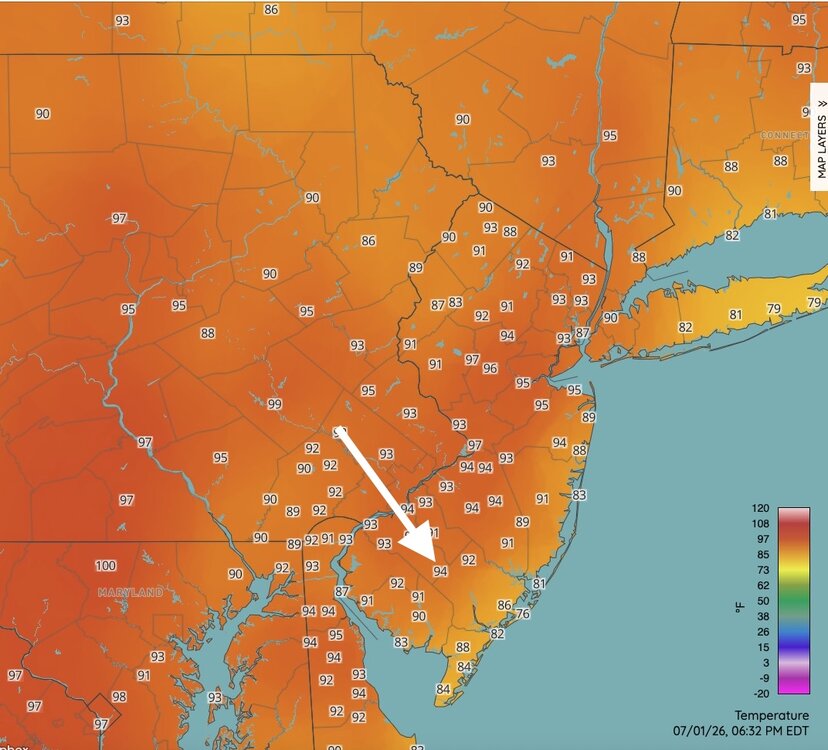
Lots of 100+ across NJ so far today. Currently 95 here.
-
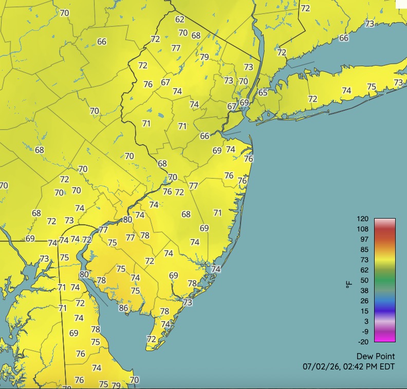
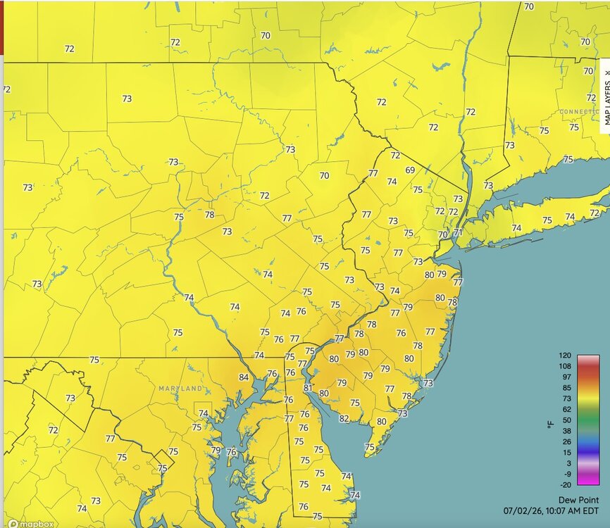
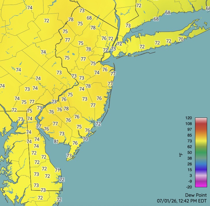
SW NJ is interesting with the high dews.


-
Yeah, we don't know how well placed they are. That's why I like the Rutgers network. They are all sited well.
-
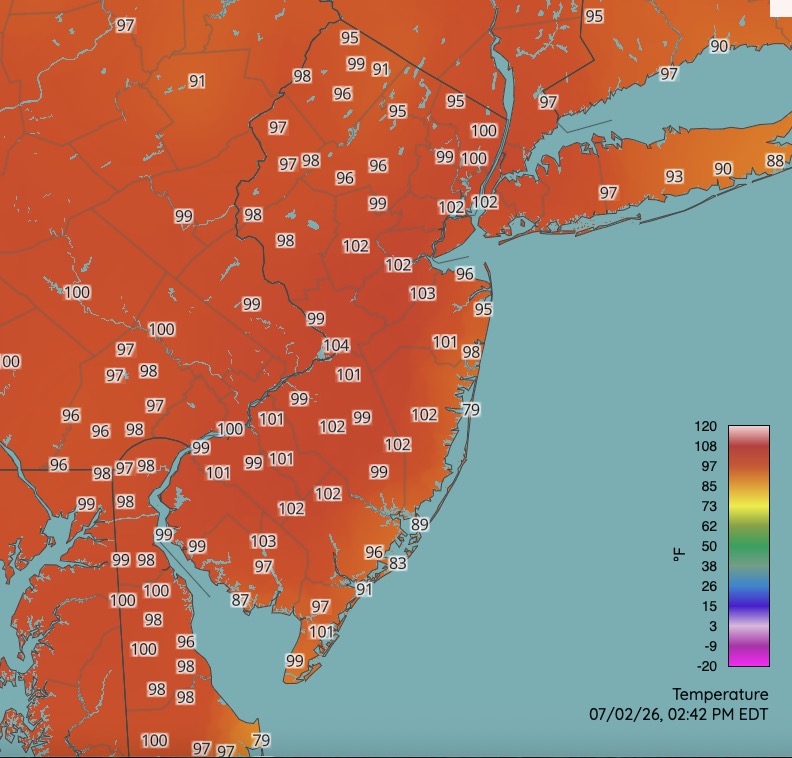
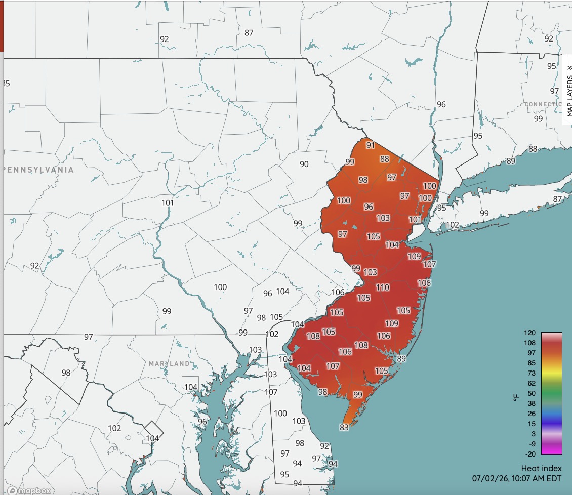
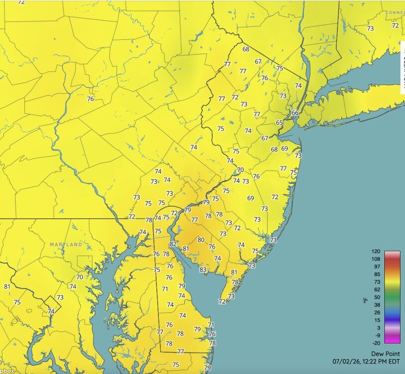
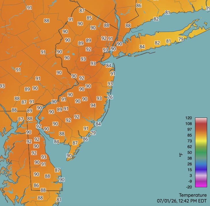
Nasty hot already. DP's will mix out some later but with temperatures 100-105 for most away from the immediate NJ shore the heat index readings this afternoon could reach 115+ across much of NJ. Approaching rare territory at those ranges.
-
but it is
-
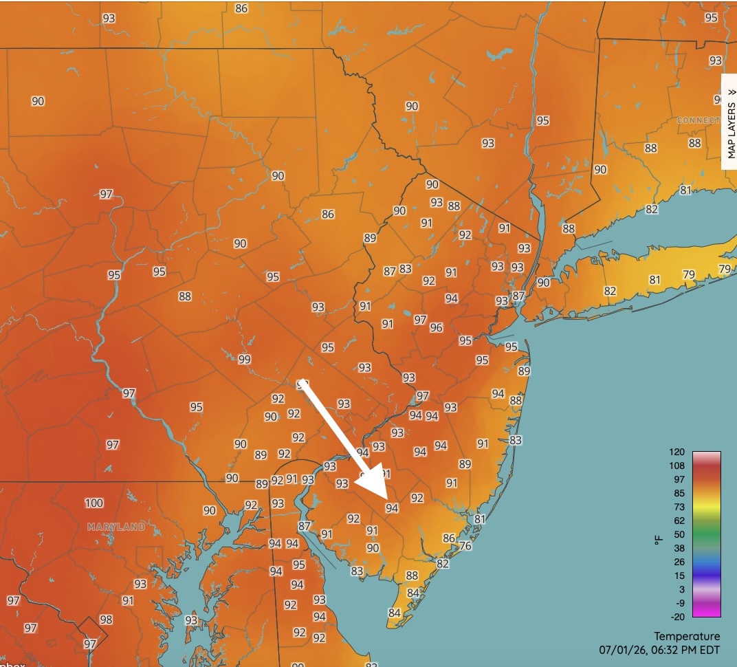
Was driving in your neck of the woods mid afternoon and car thermometer read 100. Seems legit. Very oppressive when I was out and about. Just one 100 degree reading to report from the Rutgers network but a few 99's for highs today.
-
Temps manageable....high dews making the HI nasty. Lots of sun through some slight haze.
-
I just don't understand how the "powers that be" let the CP climate record go to hell and don't seem to care. How difficult is it to properly site a temperature sensor? It was fine where it was at the castle and was much more reflective of the temperature in CP. Frustrating. The topic has been beaten like a rented mule so this will forever be my last comment on the subject. Don, thanks for the stats. as always.