uofmiami
-
Posts
2,304 -
Joined
-
Last visited
Content Type
Profiles
Blogs
Forums
American Weather
Media Demo
Store
Gallery
Everything posted by uofmiami
-
Dog's name isn't Jeb, is it?
-
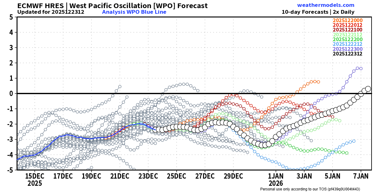
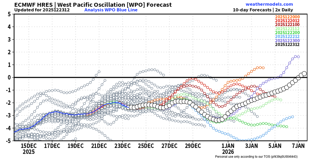
I think the -wpo didn't help
-
Warmth stayed S&W, no surprise. So much for the Scand block linking up with the SE ridge for a blowtorch over us as it transitioned to a -NAO. Got a quick warm shot the 18th & 19th, similar to late November instead. Looks like -5 departure from normal for the month.
-
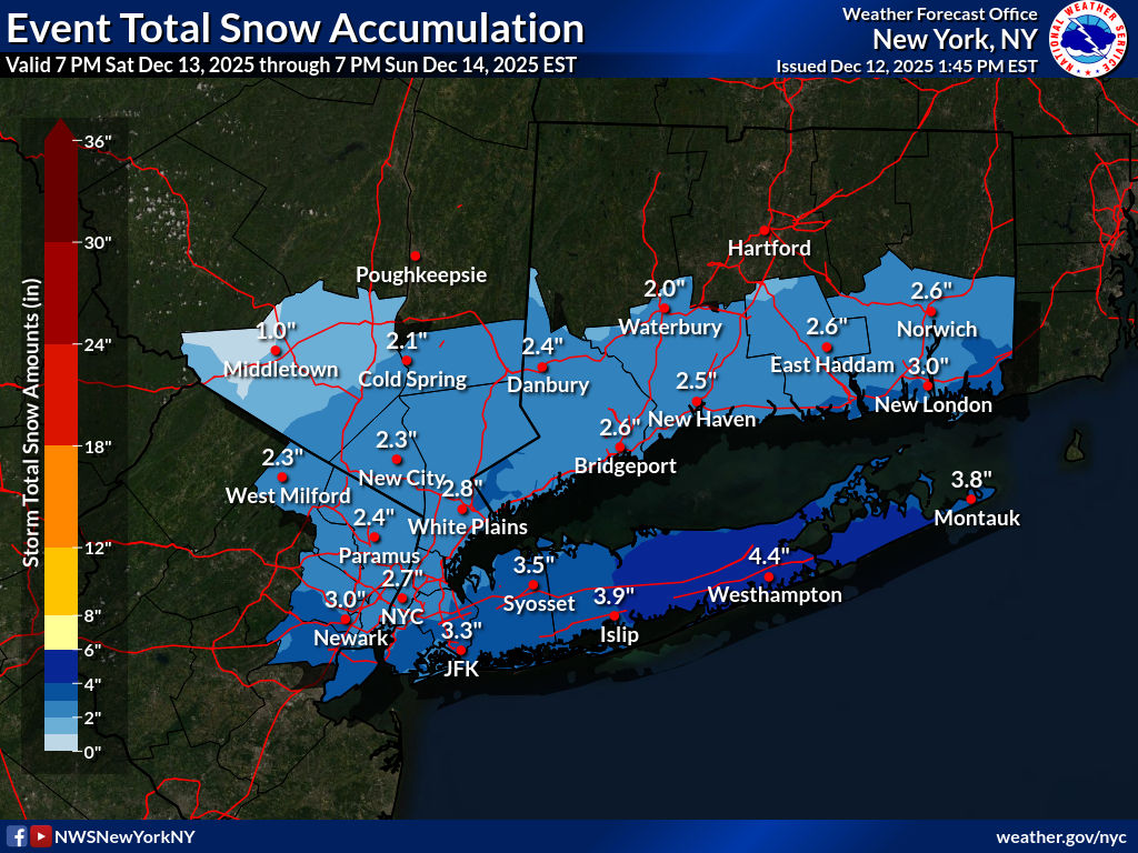
Flipped to rain around 11:30. Temp still under 35 currently but snow was done accumulating due to weak rates.
-
Another .3" in Syosset, .6" so far on the snowboard. 33 & still snowing.
-
.3” of snow at 8:35 here in Syosset. Everything coated in white & still snowing. Main roads just wet.
-
1-2" for myself on the N Shore, I'll take it.
-
Blowtorch effect
-
Only 46 at my stations (46.6 & 46.4), currently 45 at both.
-
Gusted to 49mph in Syosset with the line
-
46 mph at my Syosset station and 35 mph at my Muttontown station so far for highest gusts. Lots of trees down on northern blvd & power pole partially snapped around street corner from my house.
-
48 at both my stations for the high today.
-
-
Backed off your -2 to -3 finish from last week I see. We’ll probably finish around -5 when the month is done, as bulk of the warmth stays to our S&W.
-
I received 7" in Syosset on my snowboard (white azek board). I'm sure I could have gotten 8" plus going around my yard with a ruler into the ground.
-
I don’t. Probably put a ruler into the ground & called it a day. I think our area got around 7” with more further E into W Suffolk.
-
Syosset 9.0 in 0900 AM 12/15 COOP Coop Observer who is S of me and I think it's the Jericho Water District on Convent Road just E of my kid's elementary school.
-
7” Syosset with snowboard. Ruler into ground 7.5”
-
About 30 min ago was 4.8” on mine. Took 1st measurement a little after 8am then did another one since temp was just over 32. Temps dropping now so compaction shouldn’t be an issue.
-
You’re correct. 6” in 12hrs and 8” in 24 hrs is the criteria.
-
Moderate snowfall 12/14/2025 WWA up for most of the area
uofmiami replied to WeatherGeek2025's topic in New York City Metro

-
Hope there was no damage to the station in the fall.
-
Need to secure the tripod to some heavy stone blocks, that's how my Muttontown station is secured by pool patio.
-
-
Need a good extended torch for that to happen. The late November one ended up a dud overall compared to what was modeled in the extended.