stormy
-
Posts
2,104 -
Joined
-
Last visited
Content Type
Profiles
Blogs
Forums
American Weather
Media Demo
Store
Gallery
Everything posted by stormy
-
I pray that your wrong but I have concerns.
-
This would be nice but spoil dining plans:
-
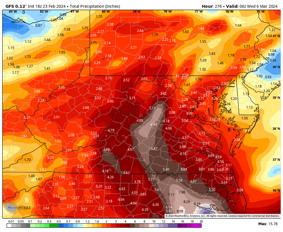
.38" last 24 hrs.. The Central Valley has been dry for the past month. The cutoff has been the Blue Ridge. Charlottesville received 1.00" past 24.
-
I'm looking forward to a warmer day after today's chill at 43 with a 10 - 15 mph southeast breeze. 7 degrees colder than normal. March 1 1962 was 71 degrees............................................. 5 days later, Staunton received 30 inches of SNOW..........................
-
My week ago prediction was colder and wet from March 15 - April 15. This fits in. Regarding early April snowfall? April 7, 1971, 8 inches in downtown Waynesboro with 17 inches at 1800 ft. on Afton Mt...
-
18 degrees this morning. That's 10 degrees colder than normal. Snow is falling at Snowshoe at 3:15.
-
GFS loses interest as the source of cold air erodes to the east instead of southwest :
-
Chris 78 posted a possibility earlier today that I agreed with and posted about. Guess What?? The 18z GFS is more bullish!....................................................................
-
That 1040 over Michigan would be ok with a 977 over Norfolk
-
I agree, If this verifies as presented, reposition that 1029 HP sw to Ontario as 1036 and things could work out.
-
It's a given with the pattern I posted about earlier
-
I am predicting a pattern reversal with colder than normal temperatures and wetter than normal from March 15 - April 15. This would almost certainly create accumulating snow threats for western areas with elevation. A persistent trough along the east coast should create these conditions.
-
Until next year or the year after.
-
Good News!! We have returned to near normal. It bottomed out at 91.34 ft. on November 21, now up to 71.16 ft..
-
How close to the little pond to the right of the trail was this?
-
Low of 18 this morning. 2" snow yesterday afternoon at Wintergreen.
-
32 degrees with light snow at 5:35. A heavy dusting with 1 - 3 inches in elevations above 2500 ft with traffic problems.
-
Moderate snow and 34 degrees at 4:45. Talked to a friend 20 miles northwest who reports .50" - 1.00".
-
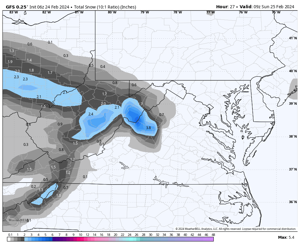
The 06z NAM 3k gave some 3500 elevations 15 miles to my south up to 6 inches. It has backed way off at 12z and now puts the best snow a little north of me. The 12z GFS dropped from 3" to 1". Just a little conversational snow would be nice. March has historically dumped some heavy snow on my area. I have high hopes!
-
Swift Run Gap on Rt 33 a few miles east of Elkton at the Skyline Drive is about 2400 ft.. North on the Skyline Drive would quickly put you up to 3000 ft. elevations. Good luck and have fun!
-
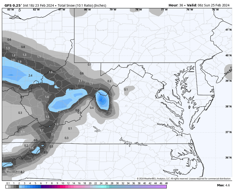
Weak low pressure over southern Ohio will move southeast across west/central Va. this afternoon and evening. NAM/GFS/ECM and GEM all give accumulating snow across portions of Augusta late afternoon and evening. Surface temps. below 2000 ft. will be marginal though column temps. look fine. Accumulation expectations range from 2 - 6 inches. This will be an elevation event for accumulations. 2000- 4000' 2 - 6 inches, 1000 - 2000 ft. a dusting - 1 inch.

-
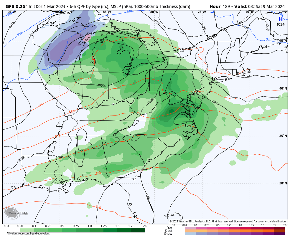
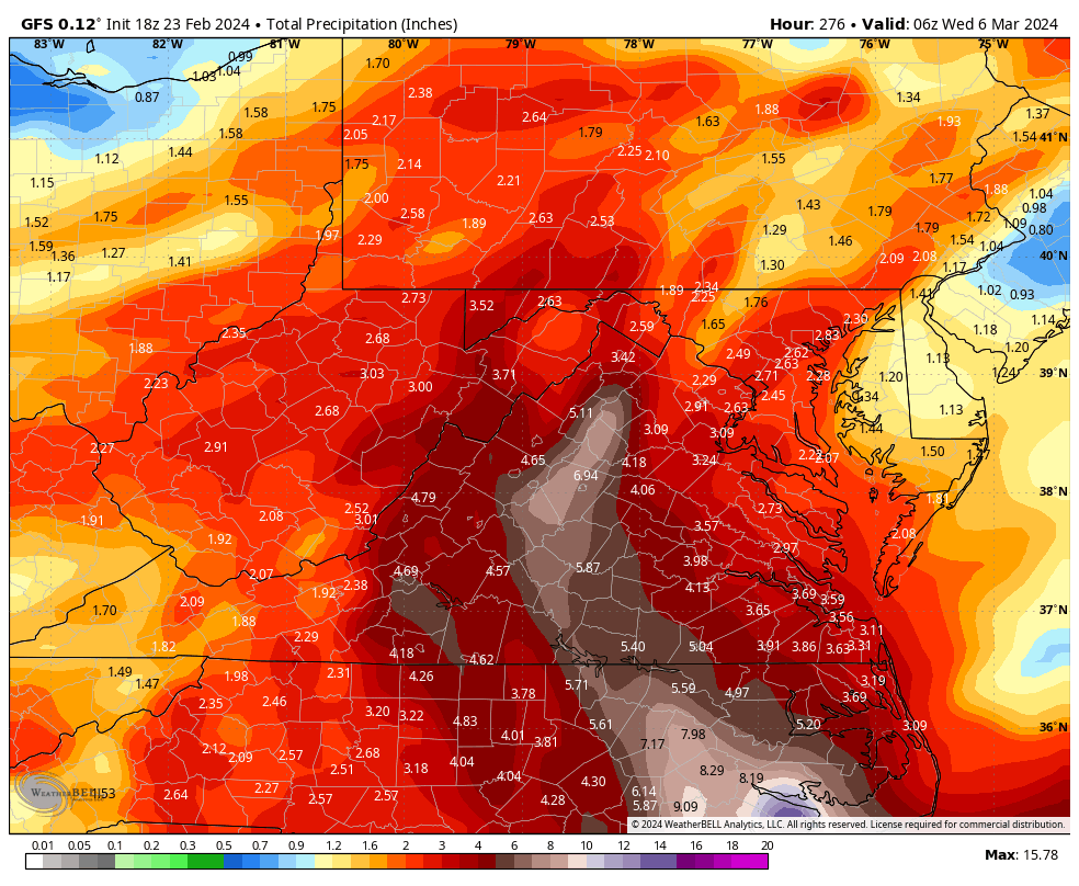
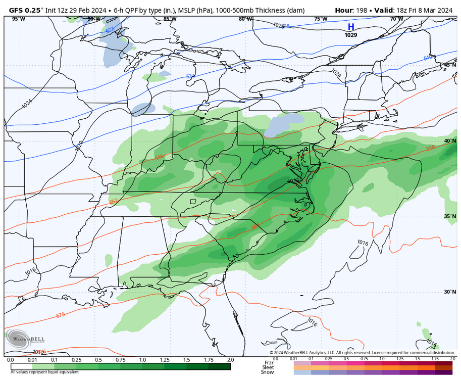
Strong Miller A development March 3 gives Augusta County 4 inches of rain!
-
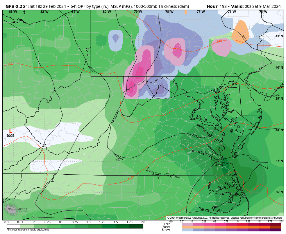
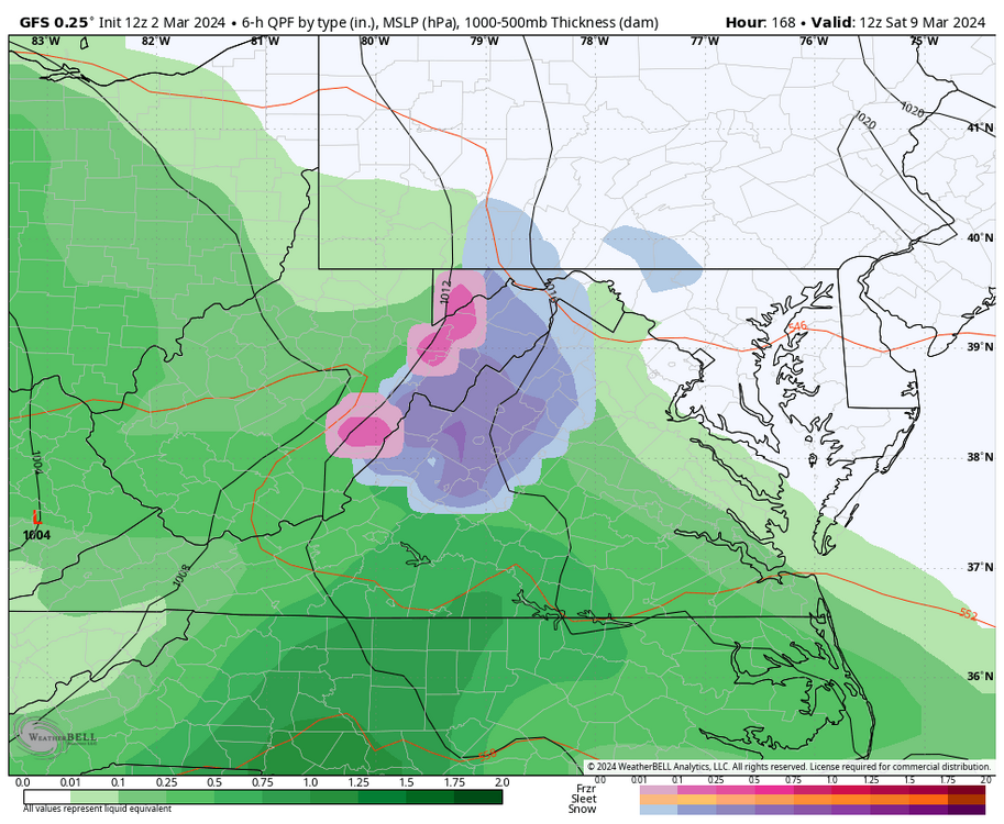
18z GFS drops 5 inches of snow 25 miles to my northwest late tomorrow. 18z NAM gives 2-3 inches.
-
Thanks Cape! My thoughts recently are that we stay warmer than normal thru about March 10 and colder than normal the last 20 days of March with snow threats based on CFSv2 and weeklies. Certainly, inland western areas will be more favored for snow. My snow season doesn't end until April 10. 4000 ft. within 20 miles of me doesn't end until May.
-
What Went Wrong in Winter 23-24/Base State/Will It Ever Snow Again??
stormy replied to WxUSAF's topic in Mid Atlantic
That is a hell of a good question!