mnchaserguy
-
Posts
247 -
Joined
-
Last visited
Content Type
Profiles
Blogs
Forums
American Weather
Media Demo
Store
Gallery
Everything posted by mnchaserguy
-
Stuck in a dry pocket on the north side. Sometimes I really hate that I care… .
-
I’d honestly be happy if we squeaked out a few inches from this after it looked like a complete miss for us. .
-
Yep, we had an inch or two on Halloween too. Not often we get a white Halloween and brown (or green) thanksgiving and Christmas. .
-
Looks like we’ll end up with more rain on Christmas than we did in May and June combined. .
-
Yup. It was fun while it lasted. .
-
Euro has picked up on it too, although not quite as drastic. .
-

April 2023 General Discussion
mnchaserguy replied to PositiveEPOEnjoyer's topic in Lakes/Ohio Valley
Tried posting a pic but it’s not working. It’s snowing again in MSP. It’s not much but it’s sticking in the grass in the yard. Officially over this crap. -
Severe Weather 4-19-23 through 4-21-23
mnchaserguy replied to cheese007's topic in Central/Western States
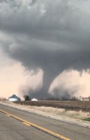
It doesn’t get much more classic than this earlier tonight. .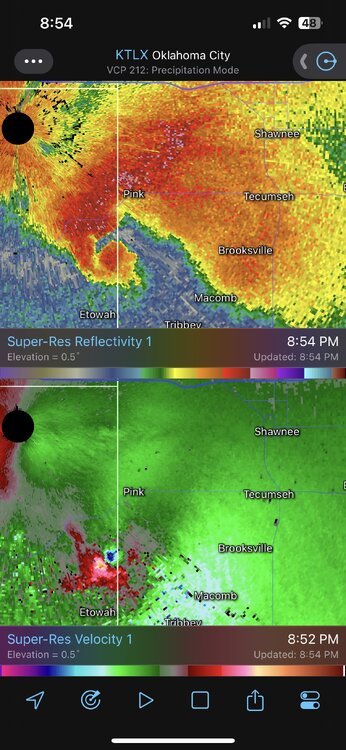
-
April 2023 General Discussion
mnchaserguy replied to PositiveEPOEnjoyer's topic in Lakes/Ohio Valley
I guess it hailed a little bit in OKC tonight. .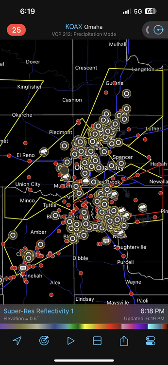
-
April 2023 General Discussion
mnchaserguy replied to PositiveEPOEnjoyer's topic in Lakes/Ohio Valley
It was almost 90 on Friday… .
- 512 replies
-
- 10
-

-

-
April 2023 General Discussion
mnchaserguy replied to PositiveEPOEnjoyer's topic in Lakes/Ohio Valley
If that trend keeps happening maybe we’ll end up in that 25” bullseye by tomorrow. . -
April 2023 General Discussion
mnchaserguy replied to PositiveEPOEnjoyer's topic in Lakes/Ohio Valley
It’d be one thing if it was just one or two models but everything I’ve seen seems to be trending upwards. A lot still has to come together just right this time of year but it sure seems like we still have a shot at breaking the season record. . -
April 2023 General Discussion
mnchaserguy replied to PositiveEPOEnjoyer's topic in Lakes/Ohio Valley
Seems like models are trending towards more snow for us. Nam is especially bullish. . -
April 2023 General Discussion
mnchaserguy replied to PositiveEPOEnjoyer's topic in Lakes/Ohio Valley
Going from multiple days near 90 to models showing a foot of snow is rude. Going from 88 yesterday to 45 today is bad enough. Should be interesting to see if the snow pans out tomorrow. -
April 2023 General Discussion
mnchaserguy replied to PositiveEPOEnjoyer's topic in Lakes/Ohio Valley
It’s a bummer the higher snow totals here for MSP are still so questionable. Would have been great to have a WSW while we were in the mid to upper 80s today. . -
Spring 2023 Medium/Long Range Discussion
mnchaserguy replied to Chicago Storm's topic in Lakes/Ohio Valley
It’s going to be 80 on Wednesday. We may still have a shot at breaking our snow record a few days later. . -
April 2023 General Discussion
mnchaserguy replied to PositiveEPOEnjoyer's topic in Lakes/Ohio Valley
We had blizzard warnings last Friday here in MSP. Looks like we have a real shot at hitting 80 degrees next Wednesday. Gotta love spring in Minnesota. . -
April 2023 General Discussion
mnchaserguy replied to PositiveEPOEnjoyer's topic in Lakes/Ohio Valley
MSP finally hit 50 degrees today, officially breaking our streak of 126 days without hitting 50 degrees or warmer. Man it’s been a long winter. Finally feels like spring out there. . -
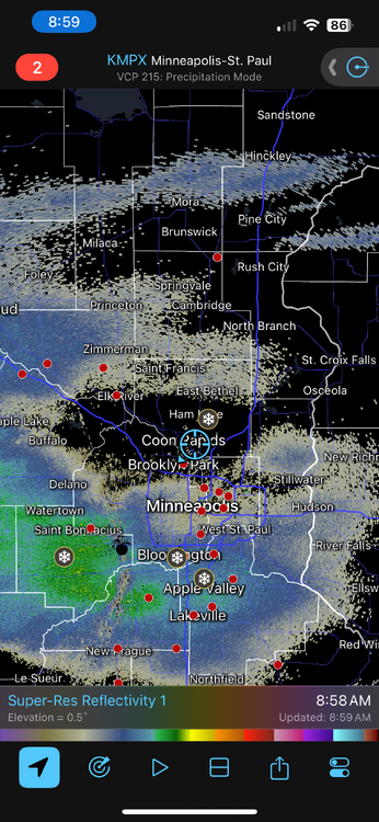
The main focus is obviously on the severe threat but I want to point out the cold side up here in MSP is no joke either. Blizzard warnings for the MSP metro which is really rare. 6-10” of snow, 50 mph gusts, thundersnow, and 1-2” per hour rates. Gonna be a bad night to be on the road and that’s one reason I chose not to chase down in Iowa today. Getting home would have been tough. Back to the severe weather discussion. .
-
The Twin Cities have been upgraded to a blizzard warning which is quite rare for the metro. 6-10” of snow and wind gusts to 50 mph. 1-2” per hour rates tonight. The cold side of this storm is no joke either. .
-
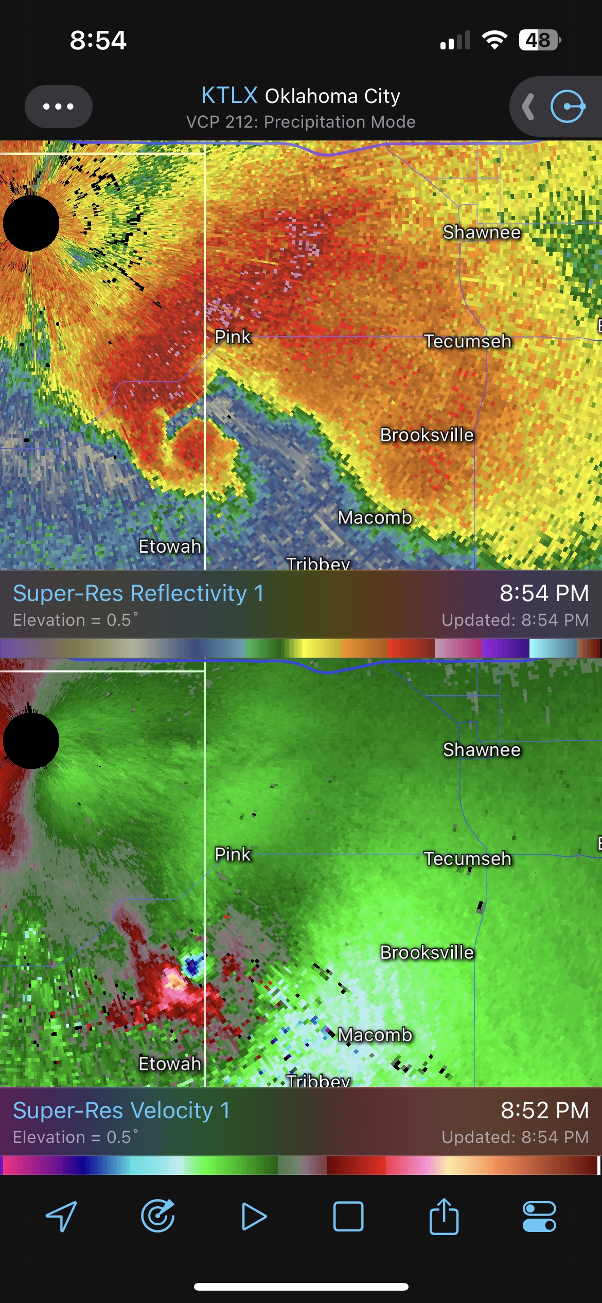
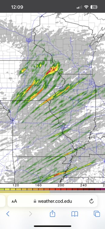
One of the more ridiculous UH maps I’ve seen. .
-
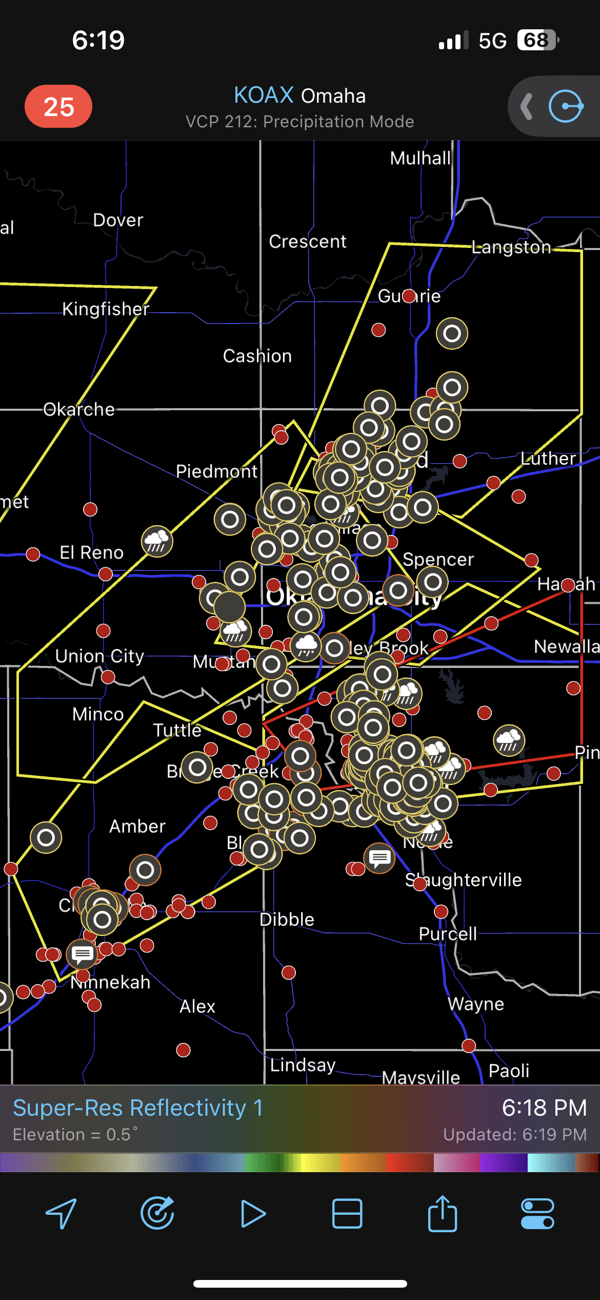
Indeed. And these kinds of speeds are how you get long track tornadoes. A tornado can cover a lot of ground in 15-20+ minutes if it's moving 50-60 mph. In my experience, 50 mph is about the upper end of being able to chase. Once you get past that, it becomes extremely hard to keep up with the storm, especially if the storm isn't moving due east. It looks like storm speeds on Tuesday could be in the 55-70 mph range across a lot of the warm sector. A powerful jet streak is great until it starts cranking up the storm speeds.
-
This is a hell of a set up. From a chasing perspective, the storm motions will once again be a problem with storm speeds forecast in the 50-60 knot range on the forecast soundings. They look better along the warm front in Iowa, which is where I may end up if this setup holds together like the models currently show. .
-
I want to give it a shot tomorrow but I'm having a tough time with storm motions in the 50-60 knot range. Driving 3-4 hours each way to hopefully watch a storm fly by just doesn't sound all that appealing. Throw in a snowstorm on the drive home and it really doesn't sound like it's worth it coming from MSP.
-
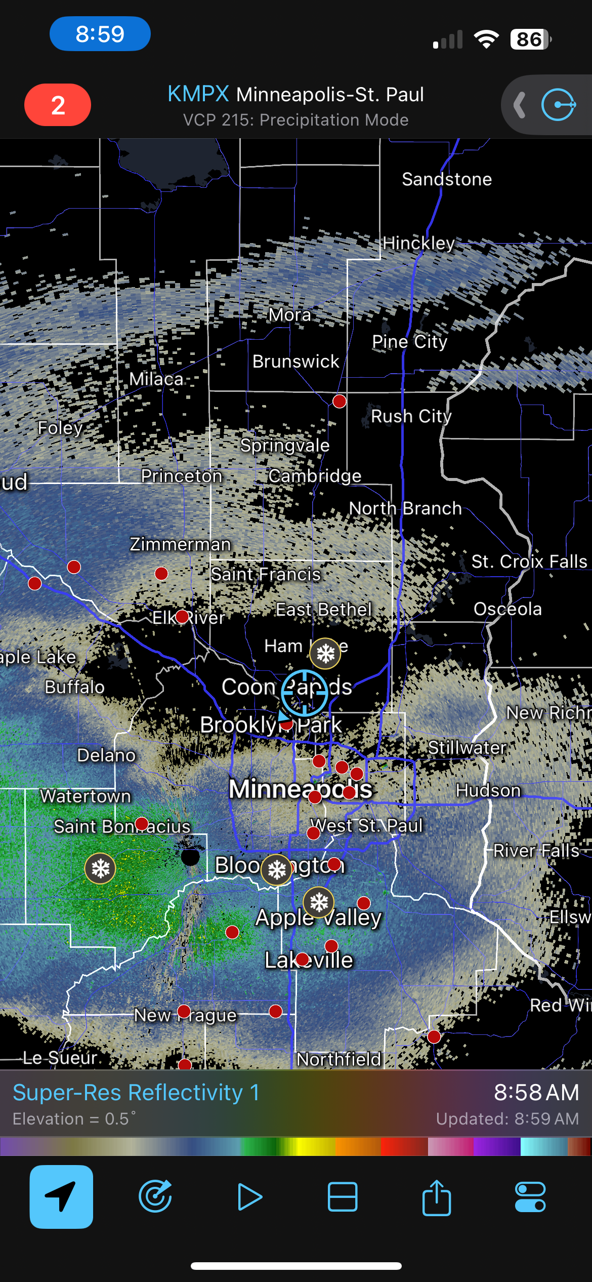
I’m not quite sure how to wrap my head around our snow potential tomorrow here in MSP. It will be a very fine line between a dumping of snow and cold rain but the picture the models are painting right now is a convective band lifting north into MSP tomorrow night right as we start getting below freezing. If that happens, we could get absolutely buried. The nam and nest have been showing this scenario for a while and the HRRR, Gfs, and Euro are all on board with only spatial differences. The 12z HRRR has a 5” per hour rate in the south metro tomorrow night. It accumulates 22” in 12 hours. That is insane. I’m not sure how to process something like that happening around here. .