mnchaserguy
-
Posts
247 -
Joined
-
Last visited
Content Type
Profiles
Blogs
Forums
American Weather
Media Demo
Store
Gallery
Everything posted by mnchaserguy
-
Measured 6”. What a complete joke after what the models showed for so long. I swear the north metro has a weather curse. .
-
This new band should help the totals a bit. All depends on how long it sticks around. Really coming down right now. .

-
Well that was a swing and a miss for MSP. Idk what it’ll take to get a storm to live up to the hype around here. .
-
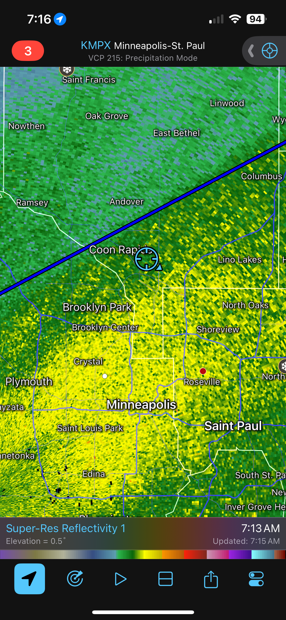
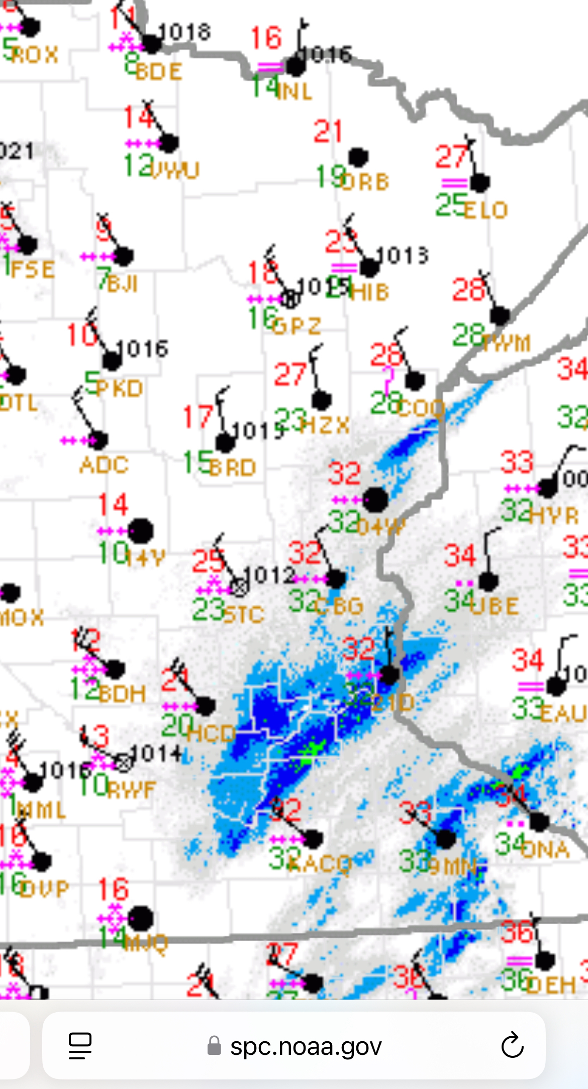
2.5” of snow here so far in Blaine. Solid 0.5” per hour rate since 6:00 pm. Heaviest band has set up just north of the dry slot on the south side of the metro. We’ll see if that band makes it up to me much the rest of the night. .
-
I don’t have the data to support but I’m pretty sure our upper echelon storms start to cluster around 12-13”. Anything over that is pretty good for us. .
-
I’m not sure I quite buy it. They’ve held steady all day on the band over the metro. Seems odd that there is such a dramatic shift in one run as things are starting. .
-
Snowing pretty good despite relatively mundane reflectivity. .

-
I really love that they went through that explanation. They didn’t pull any punches about it either. .
-
Ground and roads covered here in Blaine. Blizzard warning doesn’t start for another 3 hours. This is all bonus snow. .
-
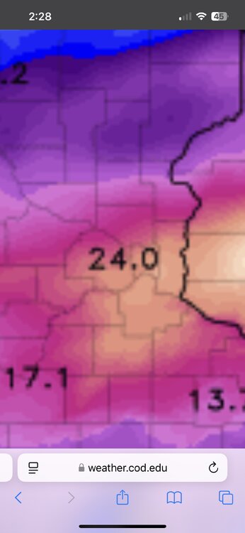
The interesting thing is some of the cams were spitting out big numbers but it wasn’t using crazy high ratios to do it. Some of them had ratios of 11 or 12:1 which isn’t that high, and it was still giving us over 20” totals. Just imagine if we actually got 15:1 ratios for this entire storm lol .
-
Hrrr has the bullseye over the heart of MSP. .
-
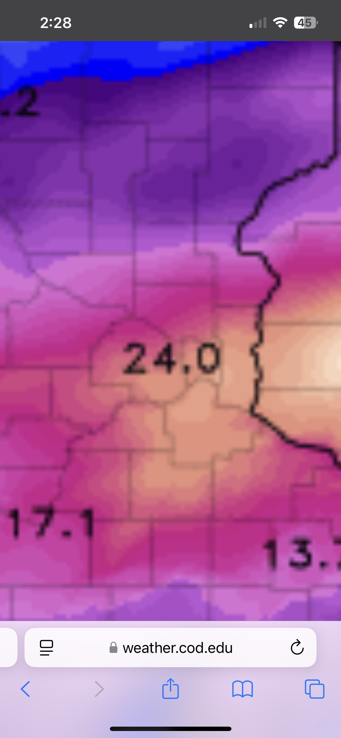
18z hrrr is one of the craziest things I’ve ever seen for us. Several hours of 2”+ rates, even pushing 3” for a while. The one thing that could really hamper our totals are the ratios. I wouldn’t be surprised if some of the ratios are under 10:1, maybe getting a bit better as the rates ease up but at that point the winds will ramp up and compact things too. .
-
I think I might actually end up in or close to the bullseye for the metro here in Blaine. Models keep bouncing back and forth a few miles and that’s enough to make a difference in the heaviest band. .
-
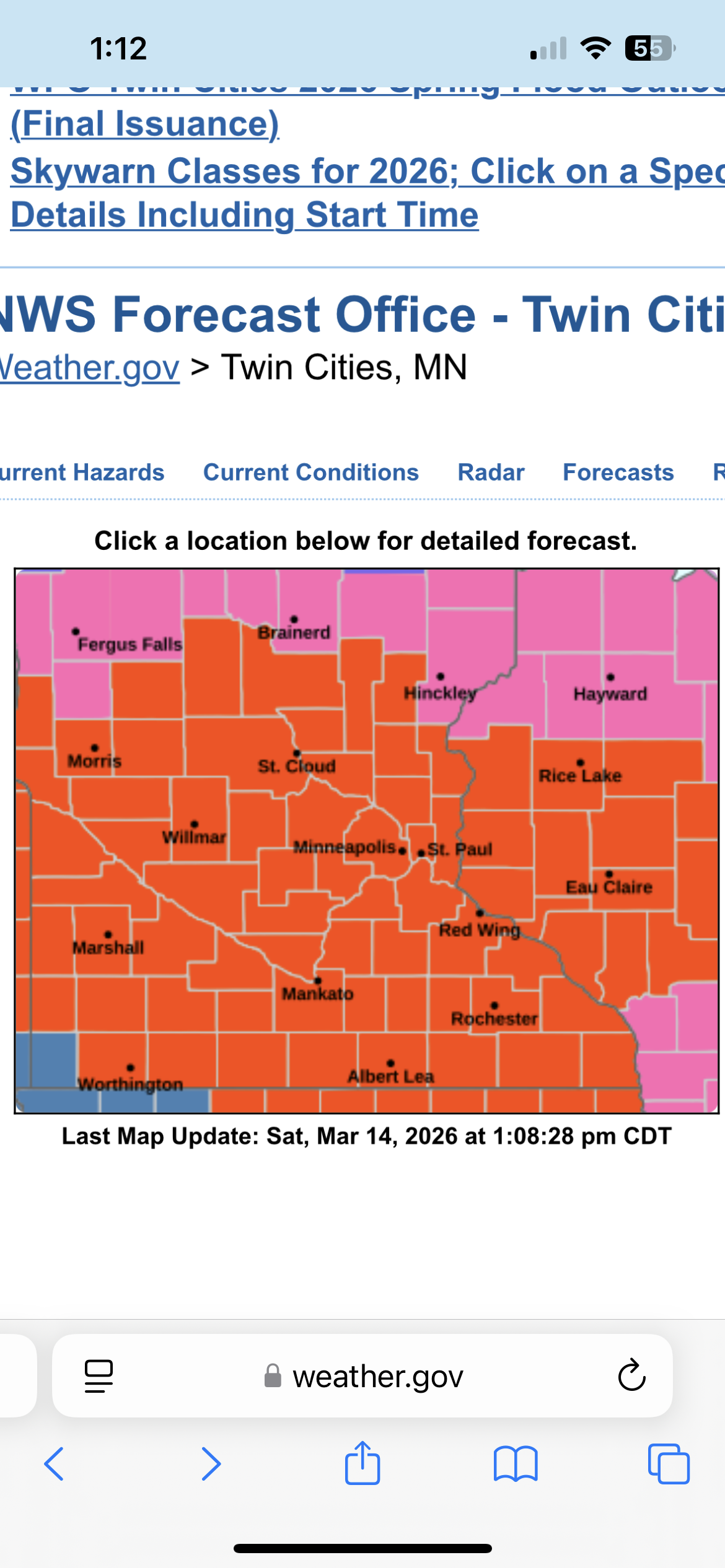
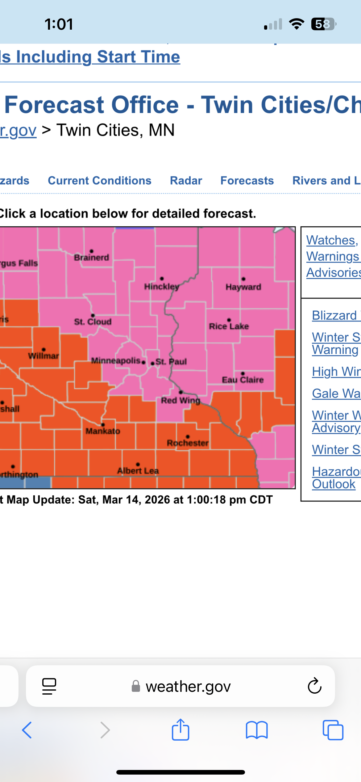
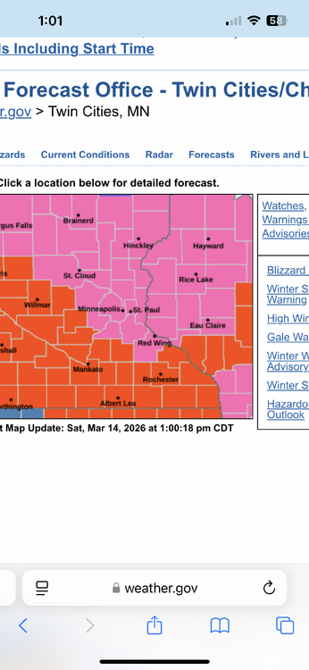
There it is. The entire MPX CWA is under a blizzard warning. That might be a first. .

-
Gotta imagine we have a blizzard warning incoming here in MSP .
-
Hrrr coming back south a bit. Making me cautiously optimistic that I might actually end up in the bullseye for MSP on this one. .
-
Nam and HRRR shifted way north. Wonder if it’s an outlier or a trend. They tend to do this so I’m not gonna believe them until the globals start to show it. .
-
People reporting 6-7” nearby. Hard to know exactly with all the blowing and drifting. Didn’t quite live up to the hype but still a decent storm. .
-
Yeah looks like we will be lucky to get to 5-6” at this rate. .
-
It’ll be interesting to see how this plays out. It’s snowing pretty hard despite what the radar is showing. Models always showed a less intense but consistent and prolonged moderate snowband pivoting over central Minnesota which is where the majority of our accumulation is supposed to come from. The initial heavy band was never supposed to last long or add up to much. Radar looks about what I would expect. .
-
Winds picking up quick. Should continue to increase from here over the next few hours. .
-
Wouldn’t let me attach the screenshot for some reason. .

-
Those crashing temps are right on our doorstep.
-
Models did a pretty good job of picking that up. They showed a heavy snow band for us but not much accumulation until closer to noon. .
-
Snowing hard now. Not much has stuck yet but it’s starting to turn white in the street. If this band can stick around for a while, this will start adding up quick. .