mnchaserguy
-
Posts
247 -
Joined
-
Last visited
Content Type
Profiles
Blogs
Forums
American Weather
Media Demo
Store
Gallery
Everything posted by mnchaserguy
-
Not sure. I’d have to go back and look at the surface obs. I know they fired close to a warm front. If I had to guess they fired off the cold front or dryline (can’t remember which, probably a DL) and then moved north and anchored on the warm front where there was better low level shear. An open warm sector to their south with plenty of unimpeded instability and the shear and helicity of the warm front was a perfect set up for what played out last night. Glad it was over mostly open grassland but that also meant road network was terrible and prevented some better footage of what could end up being a 2 mile wide tornado. .
-
Radar loop of the Nebraska supercells last night for anyone interested. One of the crazier velocity loops you’ll ever see. Wouldn’t be surprised if that tornado was on the ground for 2-3 hours. https://x.com/peterc428/status/1916728473755828285?s=42 .
-
Seems like the issue is a lack a forcing. Looks like weak convergence on the dryline and the cold front is way out west. .
-
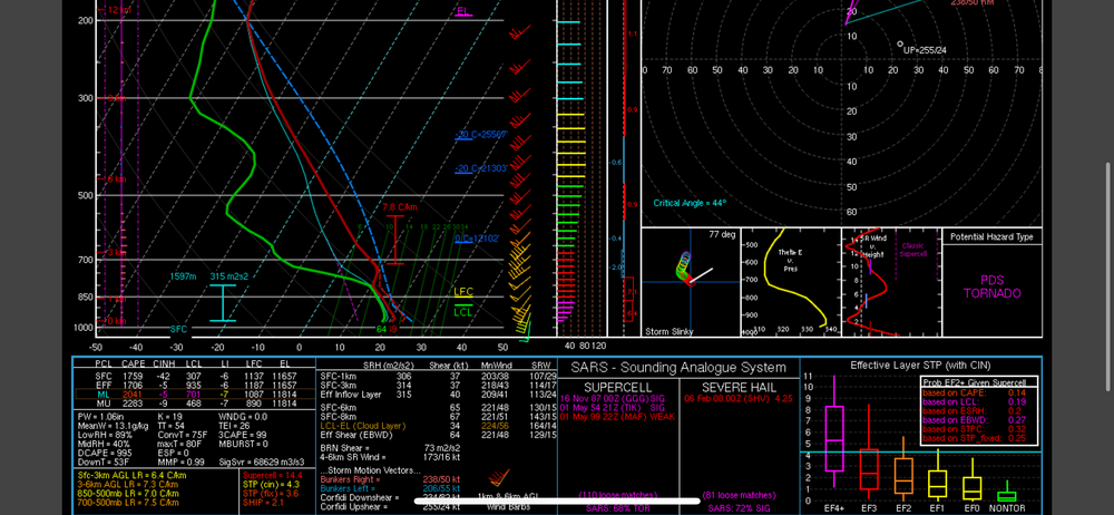
9z rap sig tor is maxed out over MSP tomorrow. Never seen it this high here before and may never see it again. .
-
This is the 21z RAP sounding over my house at 23z on Monday. .
-
18z hrrr is similar at 18z on Monday to what the 15z RAP showed. May get some waa storms here in MSP and north towards Duluth in the morning. Could be some hail with those. If we can actual get that clearing after the waa convection we should be in business. .
-
Whoops. Mislabeled. It is 18z on Monday. .
-
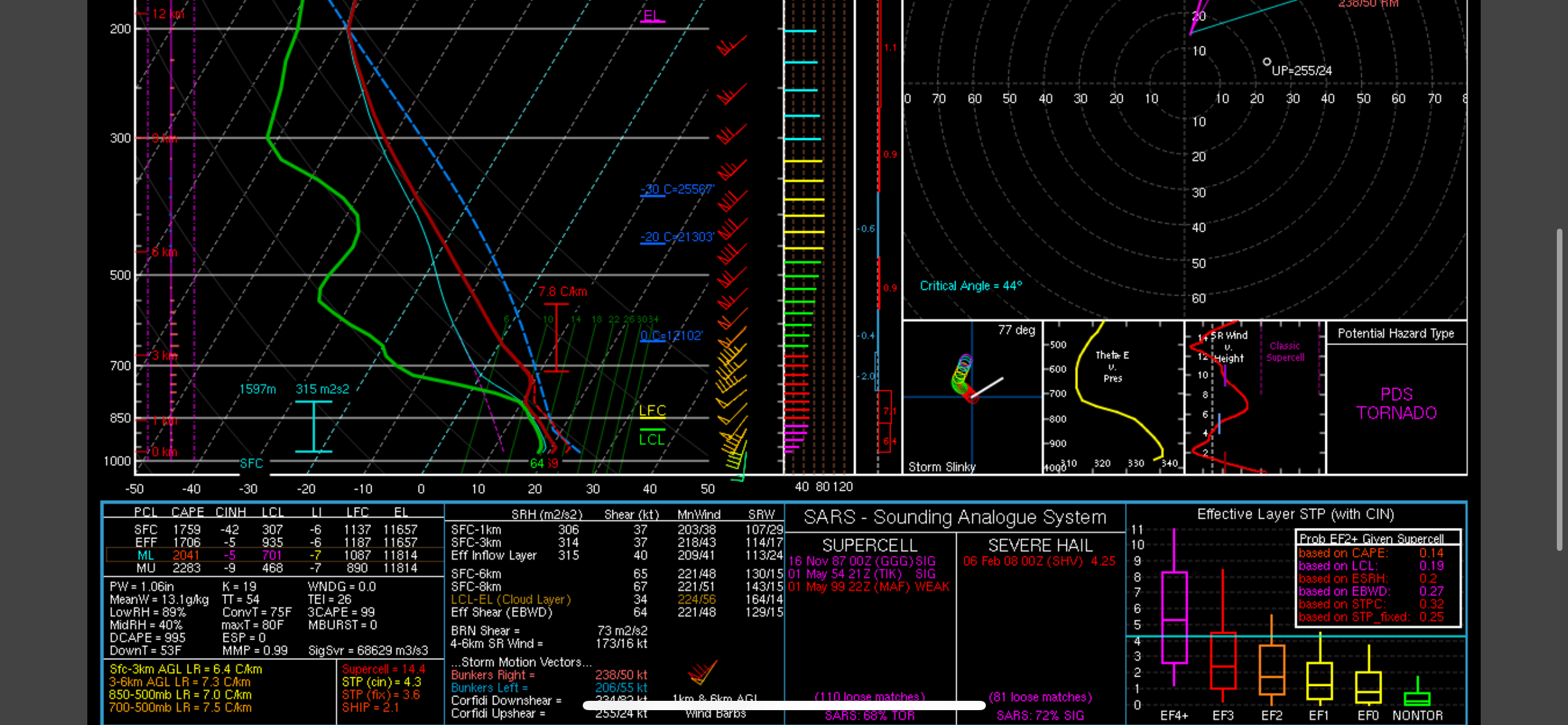
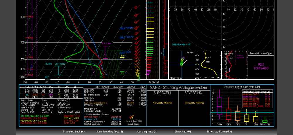
I haven’t been a believer because something has just seemed off. Probably mostly the lack of better heating and narrow cape ribbons. However the RAP is screaming outbreak. If it’s correct or even somewhat close then we could be in real trouble. This is the RAP at 21z in western MN on Monday. .
-
Day 3 Moderate risk for MSP. Pretty rare, especially around here. .
-
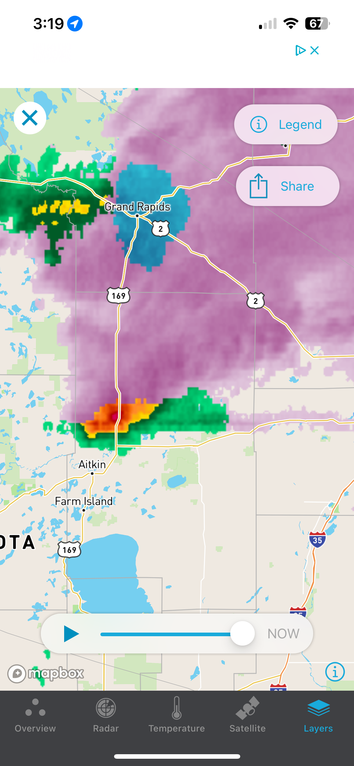
Nice surprise storm in northern MSP right now. Had a surprisingly strong gust front with it. .
-
Transition from rain to snow in northern MSP. White rain coming down right now. Just to my west is getting nailed by a very heavy band. .
-
Grass has quickly gotten covered in snow. Roads should remain mostly ok. Big band moving in to my backyard soon. Edit. After looking at DOT cameras in the south metro it looks like the roads are getting bad quick under that heavy band moving my way.
-
Just rain here too. Little bit of snow and sleet today. .
-
It’s 31 degrees just to my north. Might be cold enough to freeze at my house but it’s probably coming down too hard to freeze much right now. .
-
I’ll be right on the edge it looks like. Crazy how different the models have been from each other for this storm. These spring ones are so tough to forecast. .
-
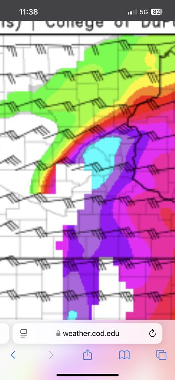
This was the radar signature with precip type taken into account .

-
Pretty crazy temp difference across the MSP metro right now. Mid 50s in the far north metro and low 80s across the southern metro. .

-
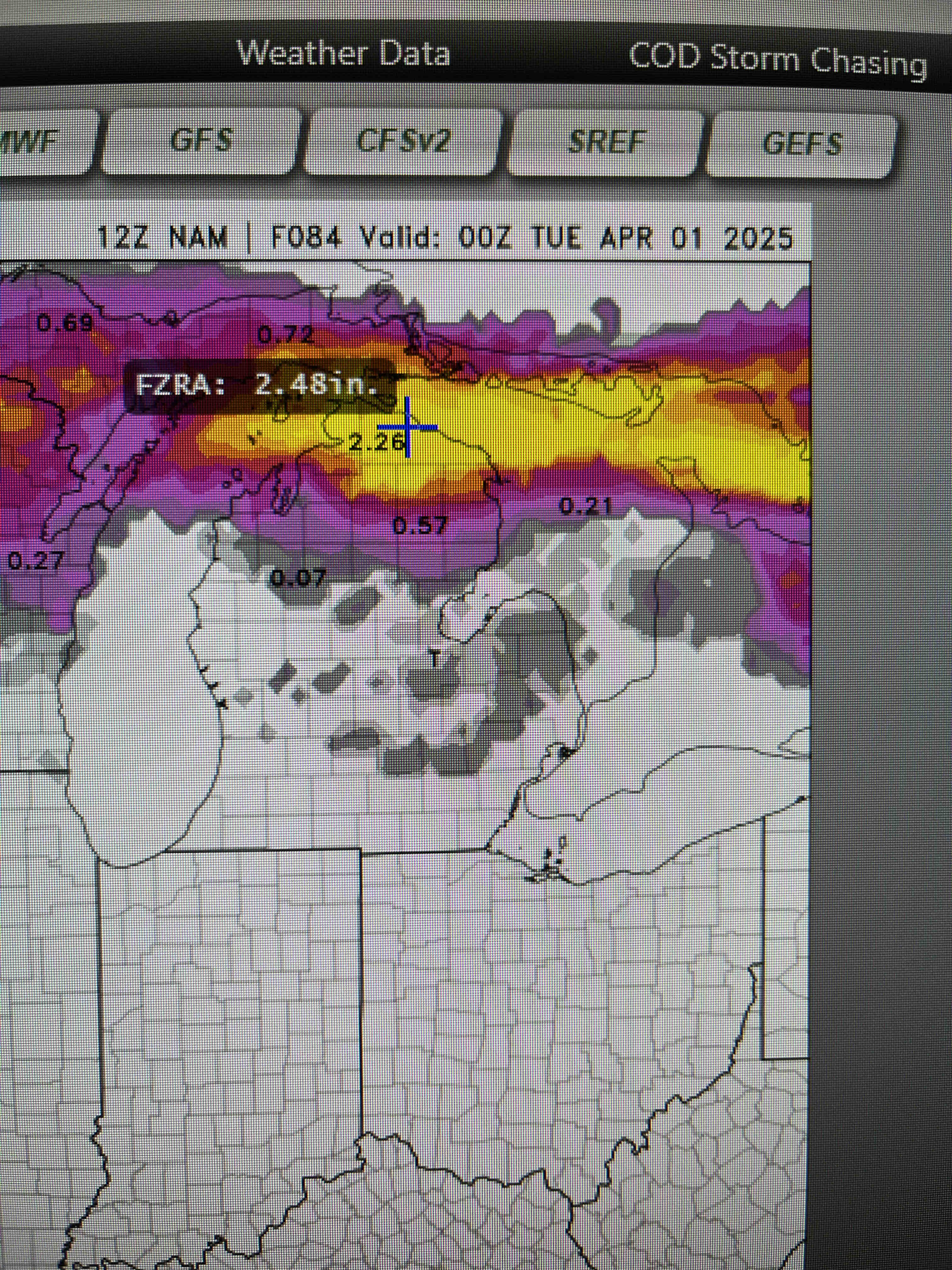
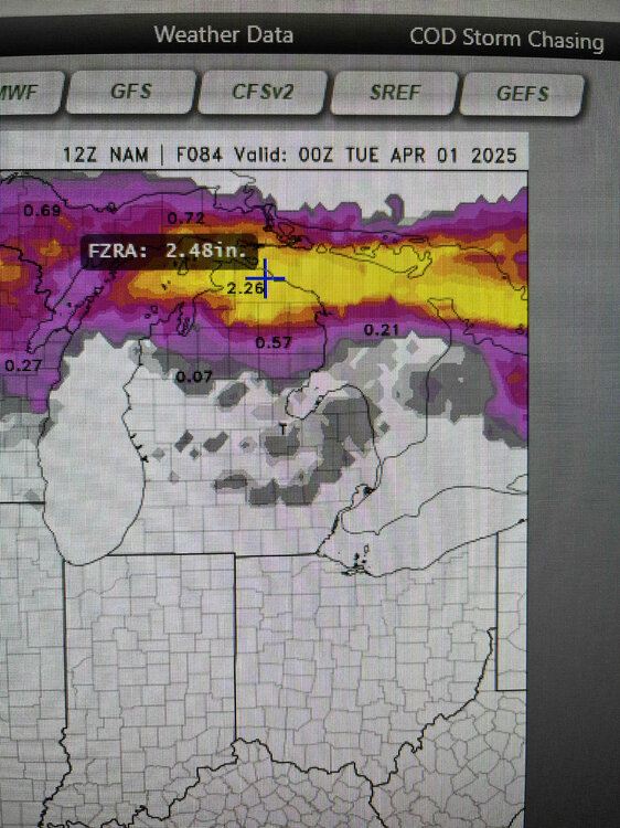
Northern LP of Michigan looks like it’s gonna get hammered by freezing rain. .
-
Southwest MN will be in the low 80s tomorrow while the arrowhead will be in the 20s. Minnesota is wild in the spring. .
-
With another system right behind it mid week. .
-
Models flip flopping over a snowstorm here in MSP this weekend. Should be interesting to see how that plays out. .
-
It’s been pretty funny to watch the trend the last couple model runs. Even southern MN is at risk of missing the worst of it if this trend continues. .
-
That’s how last year was for us in MSP. Almost no snow all winter but we had a good amount at the very end of winter/early spring they made it look like an almost average year. .
-
Snow total maps are almost a carbon copy IMO. .
-
Models showing potential for a narrow band of double digit totals. It’s probably overdoing amounts and not taking into account melting a at the beginning after ground temps warmed up the last several days. .