mnchaserguy
-
Posts
247 -
Joined
-
Last visited
Content Type
Profiles
Blogs
Forums
American Weather
Media Demo
Store
Gallery
Everything posted by mnchaserguy
-
Crazy that western MN is going to hit 70 this afternoon and is under the gun for 6” of snow or more tomorrow. .
-
Depending on what Cocorahs ob you want to believe, I got between 5-7”. Not bad. Just to my west got about half that. .
-
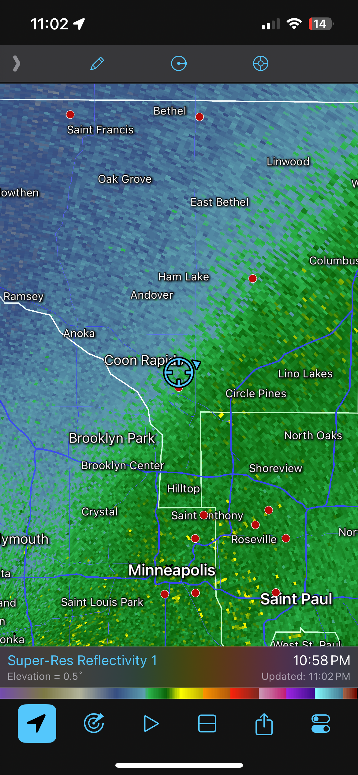
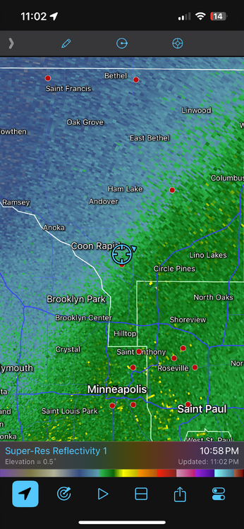
It has been a very frustrating night watching the band of heavy snow hang *just* to my south and east almost all night so far. Really hoping I can cash in on it soon. .
-
Ground is white and it’s really coming down, although the real heavy stuff is still to my south and east. .
-
Little layer of sleet on the grass. Looks like it’s switched to snow now. Might be a little ahead of schedule for the change to snow. Probably won’t add much to our forecast amount. .
-
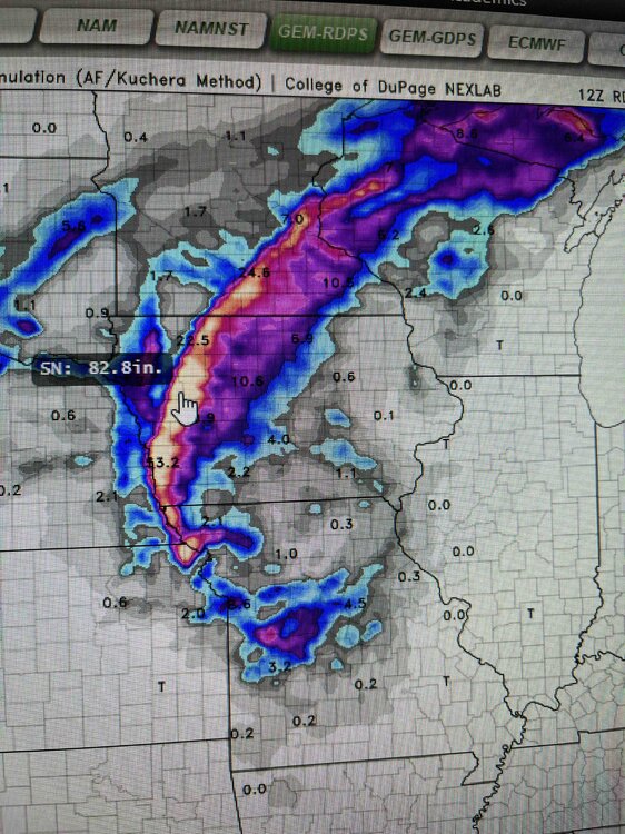
If anyone wants a laugh, check out the Canadian output for this storm. .
-
12z continues the trend. Don’t want to jinx it though by getting my hopes up. Not sure what the 12z hrrr is doing. It takes a weird deviant track with the low. .
-
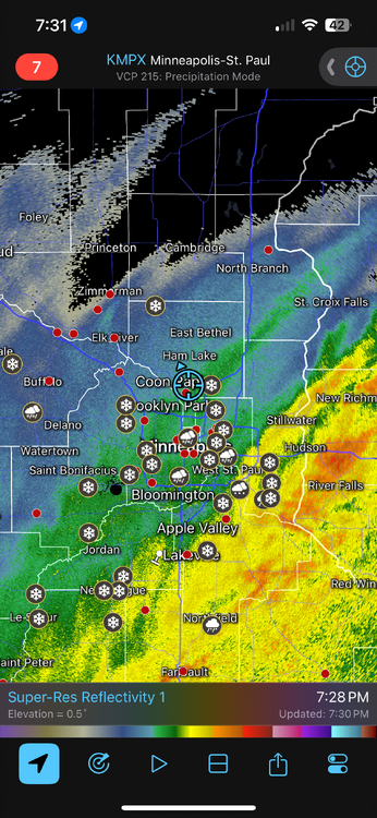
Late shift northwest with the snow. Now looks like MSP will get some decent snow with the heaviest falling just southeast of the metro. I still don’t quite believe it but MPX does and issued a winter storm warning for the entire metro. .
-
Looks like winter isn’t ready to leave us alone here in Minnesota yet. The Wednesday system could be interesting. .
-
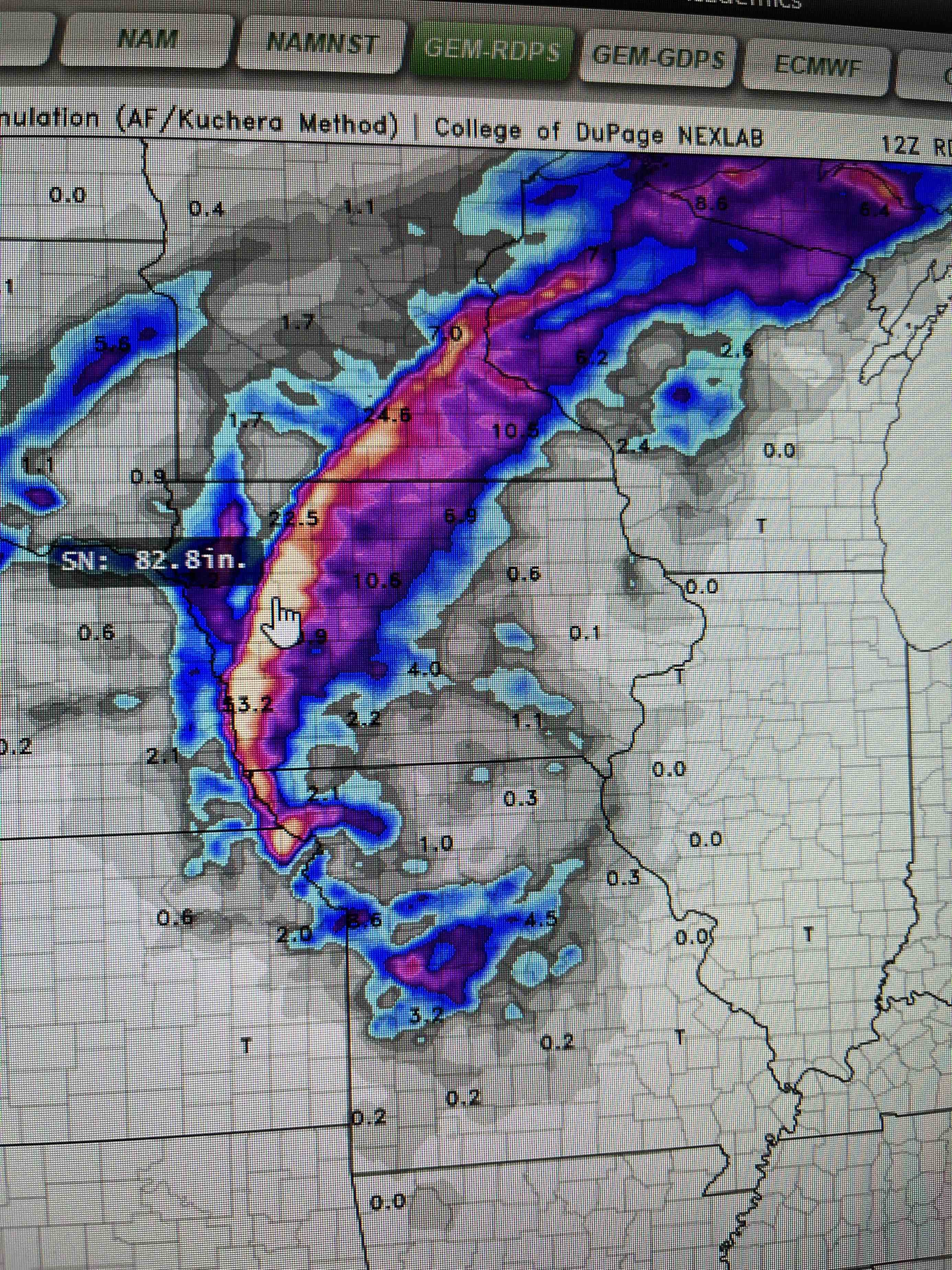
The forecast was much different when the winter storm watches for 5-8” was originally issued and forecast. A lot changed in the models after that. Edited to add the weather story graphic from a couple days ago from MPX that highlighted the south metro being in the bullseye. .
-
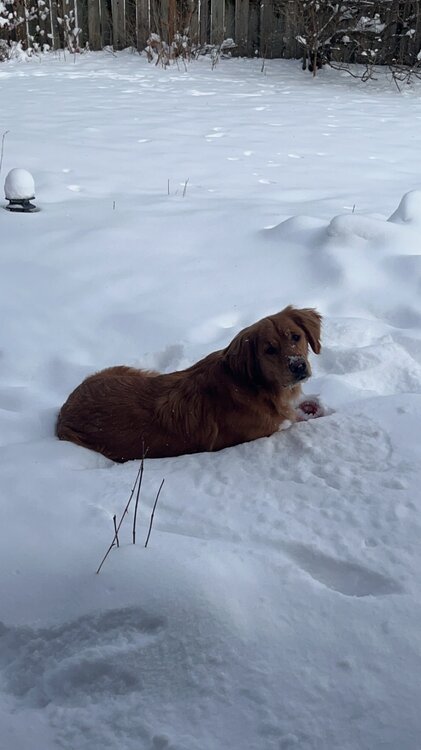
Ended up with about 5” here in the northern MSP suburbs. Dog was happy about it. Edit: Snow report just to my west just came in at 7”. Not bad at all. .
-
Looks like next weekend could be interesting here in MN too. Gfs has been pretty consistent with a big storm. .
-
I think I got a solid 4-5” so far. Big band of snow just to my south should help make up a bit for most of the metro. .
-

Winter 2024-25 Medium/Long Range Discussion
mnchaserguy replied to michsnowfreak's topic in Lakes/Ohio Valley
You’re complaining about things that no one can control. Saying “how can you be content” is dumb because there is nothing anyone can do to change that. It’s understandable to be frustrated but to be incessantly complaining about it is annoying. It’s almost like you’re taking it personally. . -
We’ve seen plenty of winter storm fails over the years around here but it has been truly so to watch this one go from potential 12” to possibly less than 2” in just a couple days. That dry slot is really going to mess things up for southern MN. .
-
Euro has almost completely dried up for us in MSP. Hrrr still says we will have a decent storm. Who knows which one is right. Would lean towards the high res but the models are a crap shoot these days. .
-
At this rate it seems like it’s going to end up being about half that. That dry slot could really mess things up too. .
-
Got a solid 4” here in my backyard. I was on the northern end of the heavier band this morning. I bet places just to my north got half of that, and we were in the bullseye on everything leading up to this event. Might add another inch this afternoon, but it looks like the main band will stay south of me. .
-
Faribault reporting 4.3” at 7:00. That is where the heaviest band set up and sat this morning. Guessing I have about 3” at my house. Dry slot looks to be working in from the south. We’ll see how far north it goes and how much havoc it wrecks on the snow. .
-
Looks like this thing came in well south of where the models showed it would. Wonder where the bullseye ends up now. .
-
I don’t think I’ve ever seen it either. Especially not for this large of an area. North side of the cities is definitely in the better spot, but the 18z models say it might not matter. 18z hrrr actually buries the south metro more. I think both of us will enjoy a solid storm out of this. Could have some 1”/hour rates in the morning. .
-
I went from nothing to Winter Storm Warning. Just gotta hope that dry slot doesn’t screw me over tomorrow. 10-20 miles could make a big difference in what I get vs what @Ordlowpitmsp gets tomorrow. .
-
Clipper systems are annoyingly finicky. Looks like we’ll miss out on the snow today in Minneapolis. Still on track to get a decent amount from a more potent clipper on Thursday. .
-
Models have trended a decent ways south for tomorrow. Maybe a half inch for us. Not sure what that means for the track for Thursday if it’ll follow a similar southern trend. The good news is that Thursday’s system looks to have a pretty wide band so even if we don’t end up in the sweet spot we should still get a decent amount. .
-
Looks like a couple of chances for snow here in Minneapolis this week. An inch or two tomorrow night then a bigger clipper system on Thursday. Still a bit of spread in the models for both systems but either way we should pick up some snow this week. .