

Lightning
-
Posts
1,182 -
Joined
Content Type
Profiles
Blogs
Forums
American Weather
Media Demo
Store
Gallery
Everything posted by Lightning
-

Winter 2022/23 Short/Medium Range Discussion
Lightning replied to Chicago Storm's topic in Lakes/Ohio Valley
What you don't think this is accurate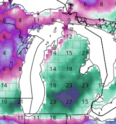
-
Winter 2022/23 Short/Medium Range Discussion
Lightning replied to Chicago Storm's topic in Lakes/Ohio Valley
My area gets a good amount of LES. Coming from Macomb county and moving to Livingston County it is night and day with LES!! It has a lot to do with the hills from Ann Arbor to Lapeer as there are many times we do better than Lansing were it is flat. Flint doesn't do as well either as it flat around there too but the it does better than Detroit. -
Actually did rather well for March and lake effect. We had a 30 minute squall go through just before lunch that put a 1.5-2". Ground was completely white again. March Sun came out for a bit and started doing its dirty work even though it is only 21F. Now getting a bunch of intense snow showers which a couple have put down a quick 1/4"-1/2". It is cold out there.
-
Fun times. It makes me happy to see Superior snow!!!
-
Kind of funny, as this year could challenge 13-14. That year was basically opposite with temperatures.
-
No worries here. I got a big 'L' right on top of MBY.

-
What are the current numbers?
-
I have seen many April winter weather events (Quick 3 of the top of my head ... Major Ice followed by 7" of snow April 2003, 15" April 2005 and 9" April 2009). It is common to see flakes fly into early May in MBY. I always warn people who get excited about an early April warm up and tell them: "Do not to forget they live in MI. Let's get to May 10th and then we should be safe from snow until October. If we are lucky we will be done with snow well before May 10th."
-
I am not looking forward to this weekend being cold and snowless
-
Cherry picking data.
-
Wow some area's got 40'+!! ... try 40"+ This area is just too far disconnected from the Oceans to get those type of totals outside LES belts.
-
I don't see this coming far enough south to be any help for us other than a mild 50F rain(with possible Thunder) to a cold 35F rain (miserable). I prefer the possibility of thunder at this point But yes I agree there has been a very noticeable south trends (with slight north bump right at the endgame).
-
We have a pretty solid snow look here. 4-8" on the ground (a bit less in the blowing and more in drift areas of course). We still have a few inches from the big dog (never lost it all) in many areas. In fact there is still some sleet from the sleet fest storm in shaded areas. If you got ride of all the melting I would have a good 20" on the ground since the second ice storm.
-
Throwback. I was cleaning up some old links. Who remembers this one.
-
Past couple days have exceeded my expectations. Looks like mid-Winter (should have looked) outside!!
-
I would love to have a fun Severe Weather season; we'll see!
-
Very interesting situation for you coming up for March as Superior is WIDE open. Big storm and followed by lots of LES. Could be good times!!
-
It will be interesting to see how this sets up. I would not be surprised if there is a 4-6" narrow path. Mostly 1-2" otherwise.
-
I agree with 86% so far the biggest knock on this the warmth. Ski conditions were miserable on the local hills. It's pretty amazing how many positives this winter has had considered how above normal the temps have been.
-
Wow. Beautiful morning here good 2" of snow that I wasn't expecting
-
That's the spirit
-
Agreed as I just love lightning streaks, thunder and heavy rain. Damaging winds and hail (unless pea sized or less) are not necessary for me!!
-
Awesome. You definitely did better then MBY We got about 4" but the March sun angle has done it's damage quickly. All I had to do is walk on my asphalt slightly exposing the blacktop and within 2-3 hours the driveway snow turned into water . I did have to shovel other areas with concrete though.
-
Wouldn't mind repeating 2021 as it was one of my best thunderstorm filled summer.
-
Well at least we don't have to shovel


