

Lightning
-
Posts
1,182 -
Joined
Content Type
Profiles
Blogs
Forums
American Weather
Media Demo
Store
Gallery
Everything posted by Lightning
-
I have really learned to enjoy the Sept and Oct warmth more now and now get bummed when we get a cool October. I don't mind the our normal delayed springs anymore (I used to hate them). I have found most of MI just doesn't typically get great t-storms in March and Aprils (can happen with major outbreaks but typically not so much). I have observed that May begins true spring and the beginning of decent t-storms season (Mid-May into Sept) for my area.
-
For some reason many people in MI have a month ahead mindset with the weather (i.e. they feel like April weather is supposed to be like May actual climo) ... especially spring and fall months.
-
Oh my. I just got informed from my family at home (I am at work unfortunately). They got a good 1/2" or so from the snow band in NE Livingston county!!
-
I was thinking the same thing
-
May 10th I found was a key date. Things would start greening up regardless of the weather around May 10th when I was in the Keweenaw for 5 years.
-
I'll take stormy but the cold I can do without.
-
Feeling the area charge up, hair standing up and then the strike with instant thunder. I recall it sounded way cool. But exact sound details are a bit more fussy now that it was over 25 years ago for me. I have been close many times since but that event was just above all else (not looking to repeat unless I am in my 90s and ready to go ). I didn't have any health impacts thankfully too.
-

Spring 2023 Medium/Long Range Discussion
Lightning replied to Chicago Storm's topic in Lakes/Ohio Valley
I'll be honest. If we get a foot+ then it would be hard not to enjoy. If it is going to be a 1-2" slop fest like last nights 1" of snow then no thanks. They snow cover would help to protect some of the plants at least -
Today's 12Z Euro looks very interesting for sure. Had a couple bands that gave 2 separate 1/2" coatings on everything that quickly melted after they moved out.
-
Hello!! It was definitely a hair raising event . One thing that amazed me was how different the thunder sound was. I have now heard thunder like that now a few times in my life. The other events I had enough shelter not to feel the lightning.
-
1995 was the first time I recall dew points in the 80s in my area with HI if I recall correctly 120F+. It was crazy hot. I went rollerblading those days and there was no one at park on the trials. I loved it Plus the Derecho that hit most of MI July 13th was incredible! Lastly I was on top of Pikes Peak I believe it was July 31st. It was snowing on top the mountain and my sister and I got struck by lighting. Most crazy experience thankfully neither of us had any side effects!! 1988 in June (?) I was in Smoky National Park (Chimney Tops) hiking. While all you heard about was drought and heat we made national news because a thunderstorm hammered during the hike. We had lightning striking all around us, heave rain and pea sized hail. The hiking trail turned into a stream. Thankfully we were on the decent down so the lightning (though close) was not a problem (just . Of course the storm ended right when we got to the vehicle!! The national news reported about our location as the very area we were hiking record about ~2.5" of rain. I had a blast!!
-
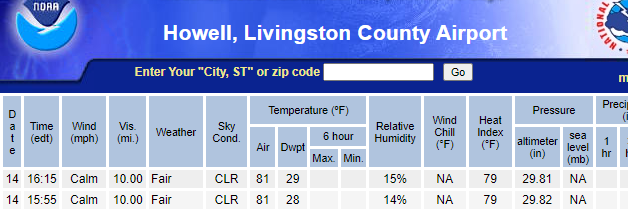
That is pretty crazy. Here at the surface it amazingly desert dry. I am not sure I have personally witnessed 81 with a dew point of 28 in this area before. Note: I am not saying it hasn't happened but rather personally witnessing it.
-
So typical for our area. Beautiful sunny morning. Head home from work and it is filter/milky cloud crap. At least it was still warm out!
-
I am so glad there are city folks. It is so annoying when city people move out to the country but bring the city mentality with them. Like you say different strokes.
-
Simple. I hate crowds and cities!! Weatherbo's location to me is heaven on earth
-
Yeah my plan was to be in the farm fields to the SW of Indy (note I am saying Indy because it looks like I might have family moving there in a few months).
-
I am going to be monitoring the forecast too and then definitely make a drive to see it My first plan will be Indy; then SW from there depending on the forecast.
-
Model changes ... CHECK
-
Spring 2023 Medium/Long Range Discussion
Lightning replied to Chicago Storm's topic in Lakes/Ohio Valley
I can vouch for that one little spot in SE Michigan. We had 15 month in a row of below normal precipitation (no event near or >1") There where multiple events which the counties around us were getting hit but we got next to nothin. It finally broke in February and much more so in March. The lake I live on did not get back to normal levels until end of March. I am actually surprised the drought index is so accurate for just one small area like this being southern Michigan is so wet right now. -
I am going with B. My snowfall was a bit above average. MBY only lacked extended cold and snow cover which led to poor local ski conditions.
-
I know lightning doesn't always do what you think it will. I have chased many storms. Sometimes there are great lightning filled storms but you never see a single CG. Other storms which have occasional lightning with everyone being an awesome CG.
-
At least you did better then me overall (just disappointing). Once I knew the lightning was out I would have just taken the heavy rain you all got and called it a day. It rather stalled for a bit in your area to Lansing but then just cruised on through around here (which of course is nothing new ).
-
It's not about wanting your house destroyed as I am sure most don't mind missing damaging hail (golf ball +) and tornado's ITBY. I think many love getting strong to even severe storms IMBY with vivid lightning, pea/marble sized hail, torrential rains and some 45-50 MPH gusts. I say bring it. With this line of storms I didn't even see a flash of lightning (just heard some rumbles), heavy rain and maybe a 35 MPH gust. Sorry but it was just lame!! I know other may have had more but I can only comment on what I got.
-
Bingo ... Looks like some quick moving heavy rain with embedded thunder. That is all we got. Red on radar (heavy rain) yet only heard couple rumbles and the largest stick that fell from a tree was 10" long.
-
To be honest my excitement is low for this one. Looks like some quick moving heavy rain with embedded thunder. The very SE counties might do better.


