Hurricane Agnes
-
Posts
9,336 -
Joined
Content Type
Profiles
Blogs
Forums
American Weather
Media Demo
Store
Gallery
Everything posted by Hurricane Agnes
-
1/19/25 Eagles Playoff Winter Storm obs
Hurricane Agnes replied to Ralph Wiggum's topic in Philadelphia Region
We have definitely seen the huge and "curious" (and territorial but not too aggressively so) Carpenter bees, so know where their holes were (which were bigger). These holes were definitely downy woodpecker pecks! The downies are much smaller than the pilated that she has in the area too that pop up every once in awhile. -
Blizzard of 2026 Storm Thread/OBS
Hurricane Agnes replied to Mikeymac5306's topic in Philadelphia Region
The storm has about wrapped up here now as of ~11 am with some flurries and snow blowing off of roofs (although I won't count out any sudden back-building bursts). The sun was briefly trying to shine through the clouds too. I measured another 1.5" on the cleared board so that plus the 8 am 13.5" would make it 15" here in what is visible of MBY. We're talking knee-height snow to wade through and definitely a lot more than the last storm here. Currently a breezy, overcast (but with sun trying to shine through) 31 with dp 31, along with some occasional flurries.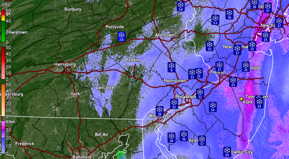
-
Blizzard of 2026 Storm Thread/OBS
Hurricane Agnes replied to Mikeymac5306's topic in Philadelphia Region
I think the snow total ranges were spot on but the only thing that perhaps "under performed" were the winds west of the Delaware River. I am about 5 miles east of KLOM (Wings Field) and the strongest gusts have so far been around 22 mph throughout the event so far - https://forecast.weather.gov/data/obhistory/KLOM.html ("real time" updated link). It's possible as the storm continues to bomb out and move away, the pressure differential may kick up the winds and blow a lot of this stuff around. -
Blizzard of 2026 Storm Thread/OBS
Hurricane Agnes replied to Mikeymac5306's topic in Philadelphia Region
That's right near the Visitor's Center across from Independence Mall (and that President's House exhibit). Used to work a couple blocks from there for 30+ years. I am currently at 31 w/dp 31 and the snow had briefly dropped down to SN- but there is some back-building with heavier returns nearby so am back to SN with blowing and drifting snow now. My weather station anemometer is plastered and frozen in place.
-
Blizzard of 2026 Storm Thread/OBS
Hurricane Agnes replied to Mikeymac5306's topic in Philadelphia Region
For an 8:00 am reading, currently 30 with dp 30 and persistent SN. Finally climbed through the tundra to get to the board (which is on a table) and what was there was taller than the 12" ruler, so got a 2nd one to get 13.5". The Ryan Hall Y'All look-alike snow ruler that I had adjacent to the board, had snow that drifted to almost 17" (I had sprayed it with teflon spray to at least minimize wet snow plastered against it). I did remember that 10 years ago, I bought a 4ft aluminum T-square that I had used to make some replacement dresser drawer bottoms, so dug in the basement to find that and try it. It was difficult to find an "open" place to sink it (my back patio is poured concrete with strips of ground on either side) but both my lilacs are completely bent over onto what open center patio area there was, so readings there would be skewed. Still, it ended up sinking to at least 12" - 13" in multiple spots (and I left it out there). I cleared most of the board (that I could get to) and will see what comes next. Time to buy an old-fashioned wooden yardstick. -
Blizzard of 2026 Storm Thread/OBS
Hurricane Agnes replied to Mikeymac5306's topic in Philadelphia Region
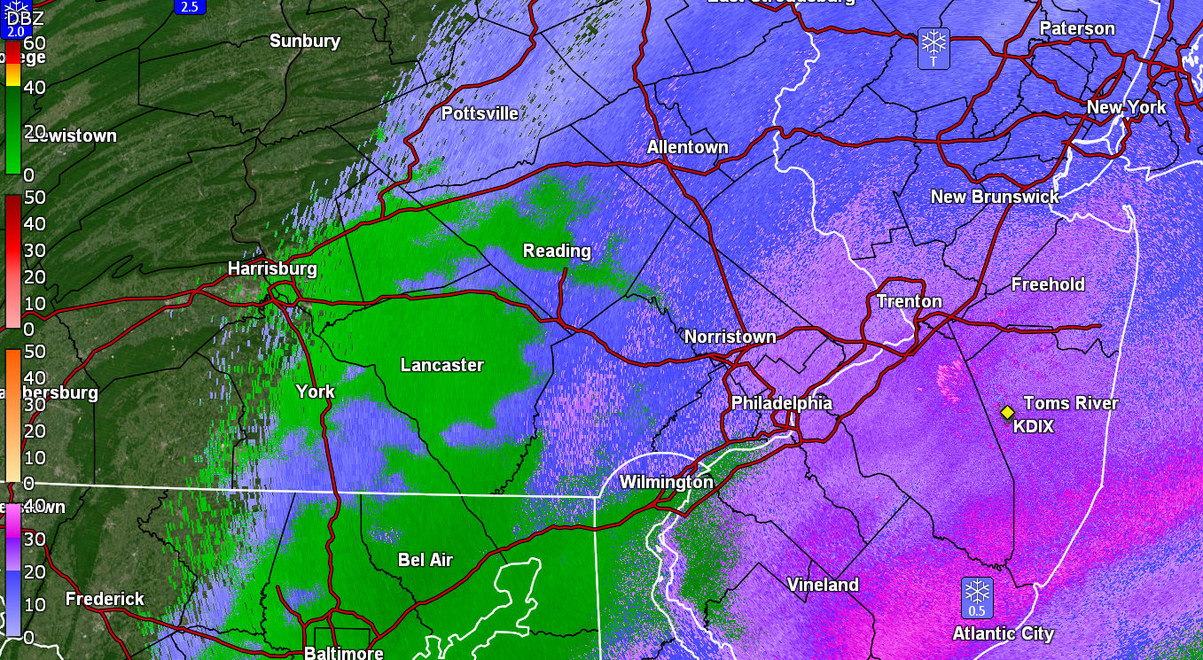
Looks like around KDIX and could be some radar clutter/noise. -
Blizzard of 2026 Storm Thread/OBS
Hurricane Agnes replied to Mikeymac5306's topic in Philadelphia Region
Still have SN with a slightly heavier band overhead here in NW Philly and the backedge on the way. Temp holding at 29 with dp 29.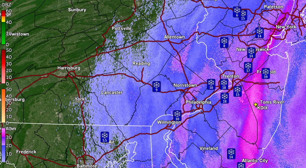

-
Blizzard of 2026 Storm Thread/OBS
Hurricane Agnes replied to Mikeymac5306's topic in Philadelphia Region
I have one of those plastic "snow sticks" propped up against my snowboard and it's at least 12" - 13". Still getting SN with temp 29 and dp 29. Looks like a band sitting right near the river that must be puking snow.
-
Blizzard of 2026 Storm Thread/OBS
Hurricane Agnes replied to Mikeymac5306's topic in Philadelphia Region
Currently 30 with dp 30 and almost up to 4" here IMBY with steady SN and fog. Haven't seen any bursts of SN+ yet but I expect that will depend on the deform band and how far it backs inland.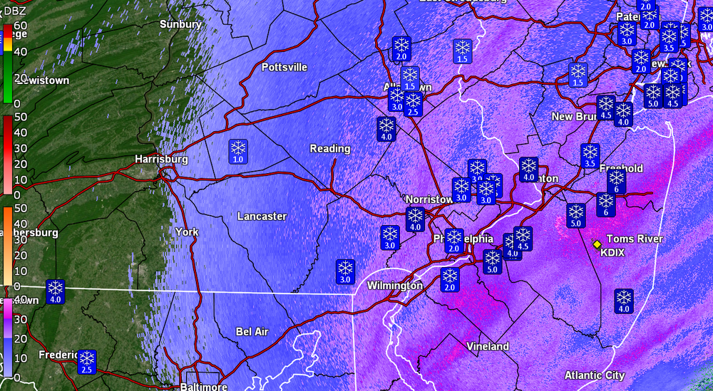
-
Blizzard of 2026 Storm Thread/OBS
Hurricane Agnes replied to Mikeymac5306's topic in Philadelphia Region
Temp here in NW Philly has now ticked below freezing and is at 31 (dp 31). This is a wet snow so the trees are plastered! -
Blizzard of 2026 Storm Thread/OBS
Hurricane Agnes replied to Mikeymac5306's topic in Philadelphia Region
Now down to 32 here with dp 32. Treated surfaces are starting to cave. Still have steady SN. -
Blizzard of 2026 Storm Thread/OBS
Hurricane Agnes replied to Mikeymac5306's topic in Philadelphia Region
Cars and grass have a coating now and currently SN, temp holding at 33 with dp 33. -
Blizzard of 2026 Storm Thread/OBS
Hurricane Agnes replied to Mikeymac5306's topic in Philadelphia Region
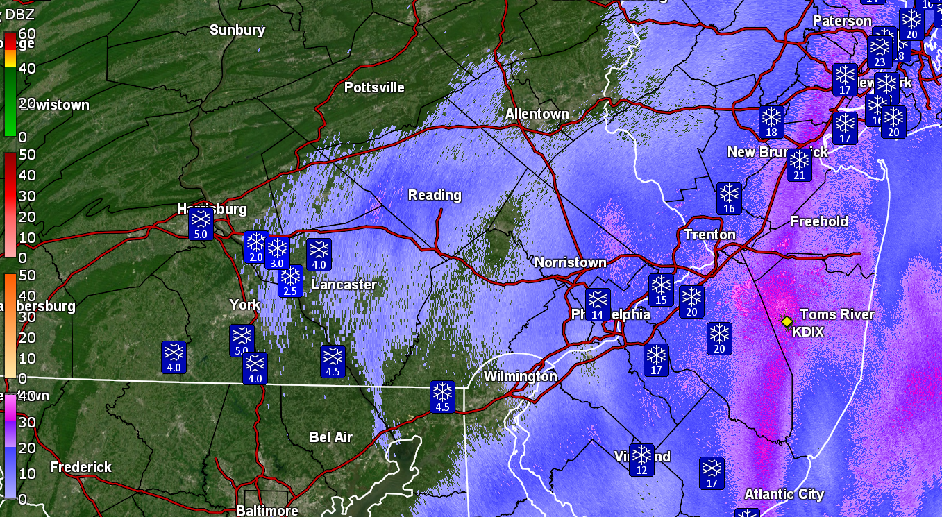
This is an instant freebie from the NWS - https://radar.weather.gov/station/KDIX/standard I use a doppler program (purchased) - GR2 Analyst.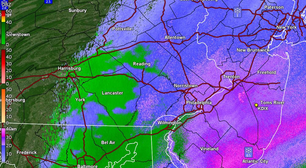
-
Blizzard of 2026 Storm Thread/OBS
Hurricane Agnes replied to Mikeymac5306's topic in Philadelphia Region
All snow here in NW Philly. Temp continues to drop and currently at 34 with dp 33. Getting some sticking on colder surfaces. Have 0.22" rain in the bucket before the changeover. -
Blizzard of 2026 Storm Thread/OBS
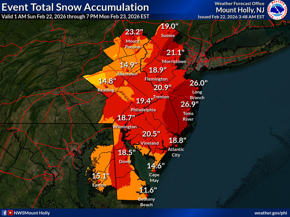
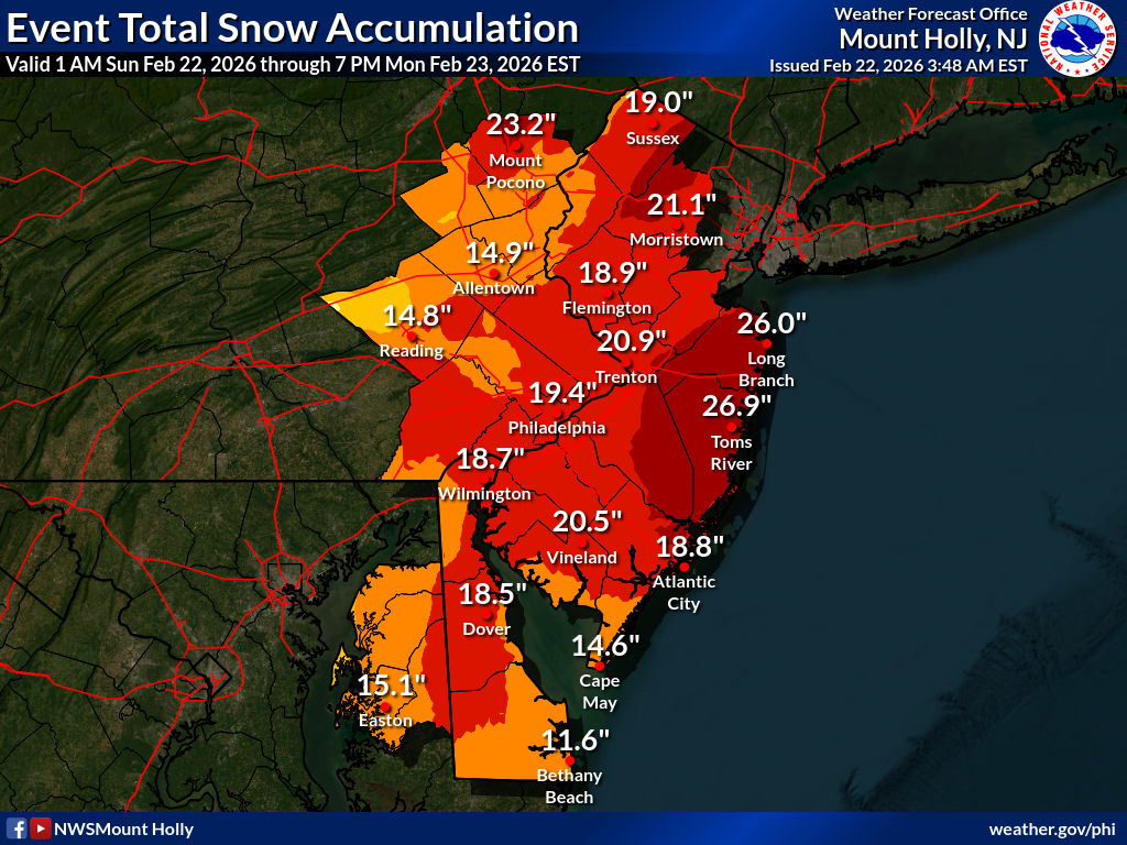
Hurricane Agnes replied to Mikeymac5306's topic in Philadelphia Region
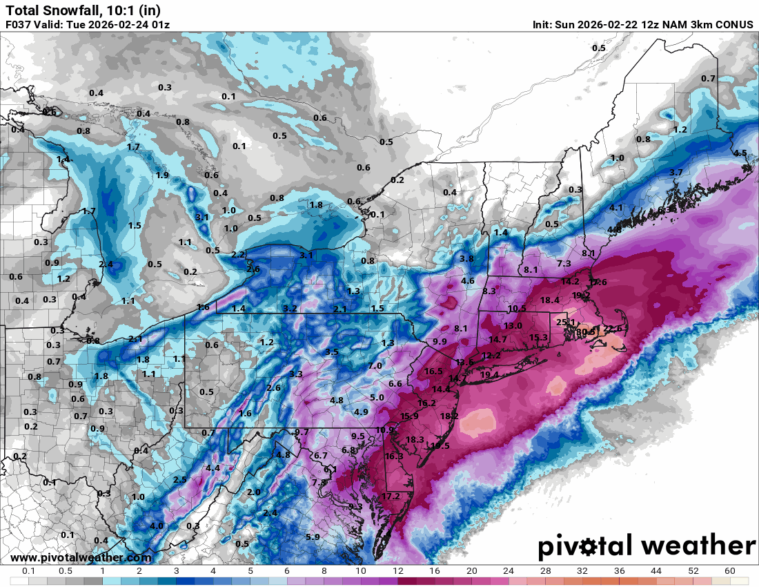
Latest Mt. Holly forecast totals -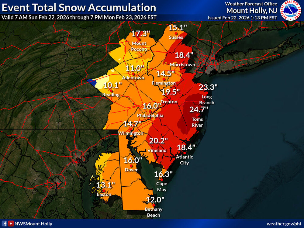
-
Blizzard of 2026 Storm Thread/OBS
Hurricane Agnes replied to Mikeymac5306's topic in Philadelphia Region
Rain/snow mix here in NW Philly. My high got up to 39 about 2 hours ago and is now down to 36, with dp 35. -
Blizzard of 2026 Storm Thread/OBS
Hurricane Agnes replied to Mikeymac5306's topic in Philadelphia Region
Finally getting some measurable from the precip and have 0.01" in the bucket. Currently light rain and 37 with dp 35. -
Blizzard of 2026 Storm Thread/OBS
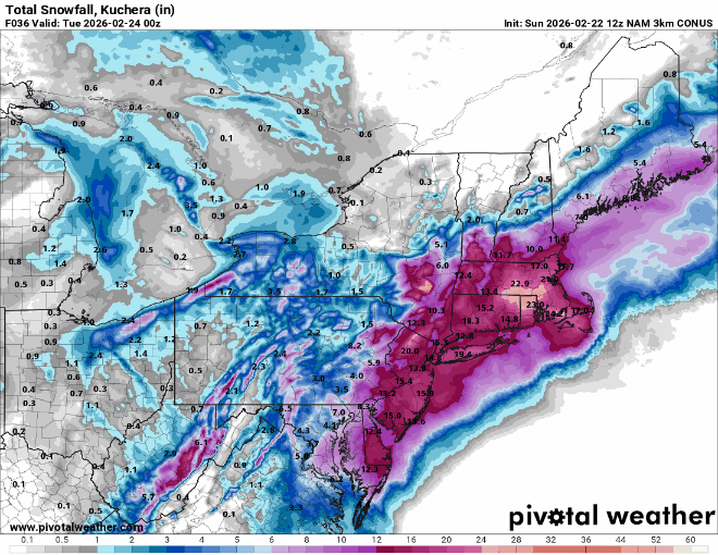
Hurricane Agnes replied to Mikeymac5306's topic in Philadelphia Region
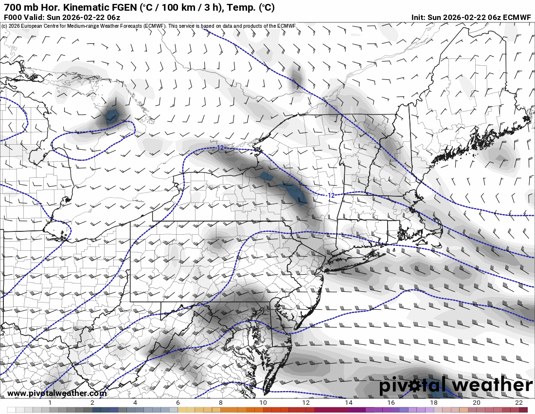
12z 3k NAM is putting a bullseye on Cape Cod!
-
Blizzard of 2026 Storm Thread/OBS
Hurricane Agnes replied to Mikeymac5306's topic in Philadelphia Region
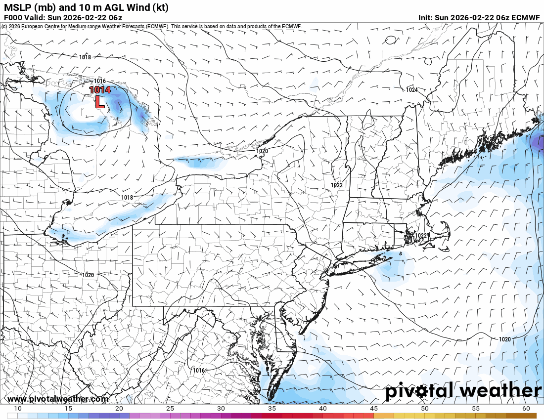
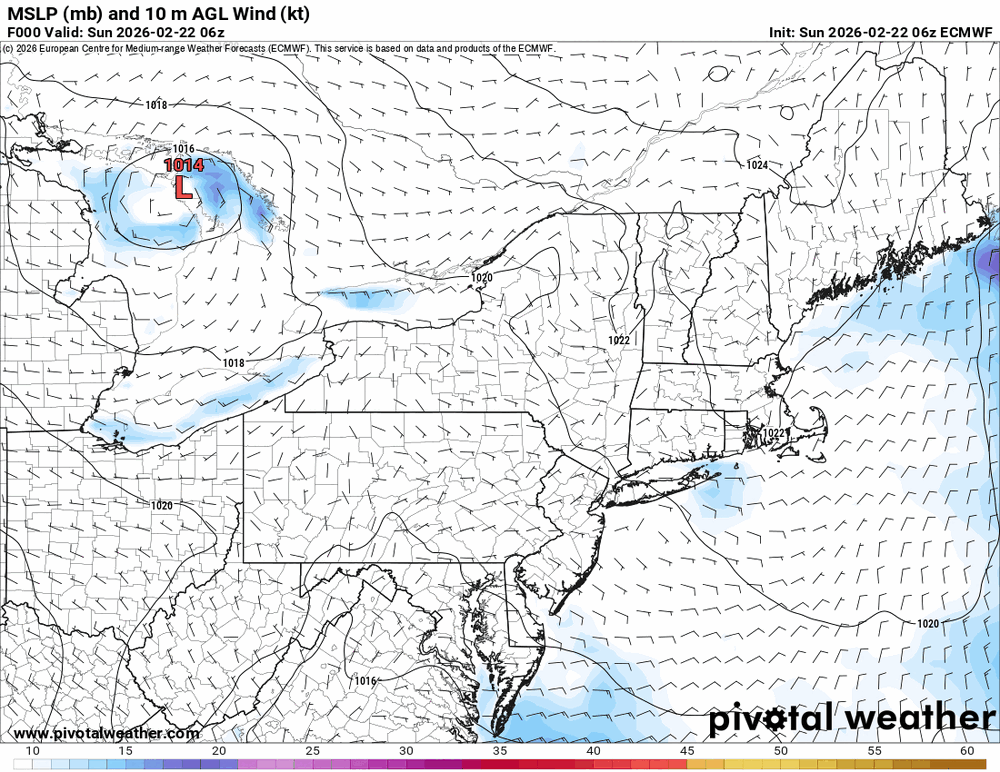
6z Euro is sort of showing the same with something setting up along the Jersey coast.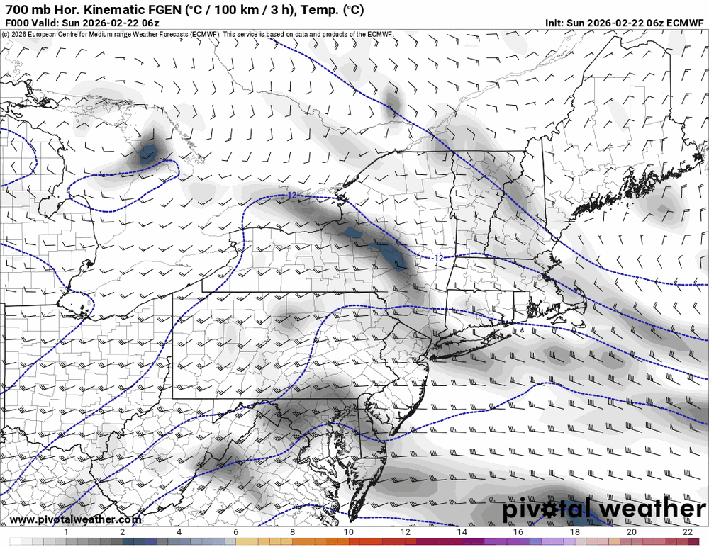
-
Blizzard of 2026 Storm Thread/OBS
Hurricane Agnes replied to Mikeymac5306's topic in Philadelphia Region
-
Blizzard of 2026 Storm Thread/OBS
Hurricane Agnes replied to Mikeymac5306's topic in Philadelphia Region
6z EC running and continues that trend...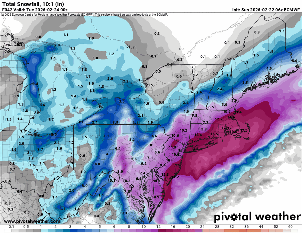
-
E PA/NJ/DE Spring 2026 Obs/Discussion
Hurricane Agnes replied to PhiEaglesfan712's topic in Philadelphia Region
I ended up with 0.60" of beneficial rain from that last event. That took out almost all of the remaining snow/ice cover IMBY from the colder NE-facing areas. The glacial plowed/shoveled mounds still survive however! -
Blizzard of 2026 Storm Thread/OBS
Hurricane Agnes replied to Mikeymac5306's topic in Philadelphia Region
Wanted to start adding some obs since there has been some light liquid precip this morning IMBY. Currently some intermittent light drizzle (not enough to tip the bucket but walks and streets are wet) and 37, with dp 34. -
Blizzard of 2026 Storm Thread/OBS
Hurricane Agnes replied to Mikeymac5306's topic in Philadelphia Region
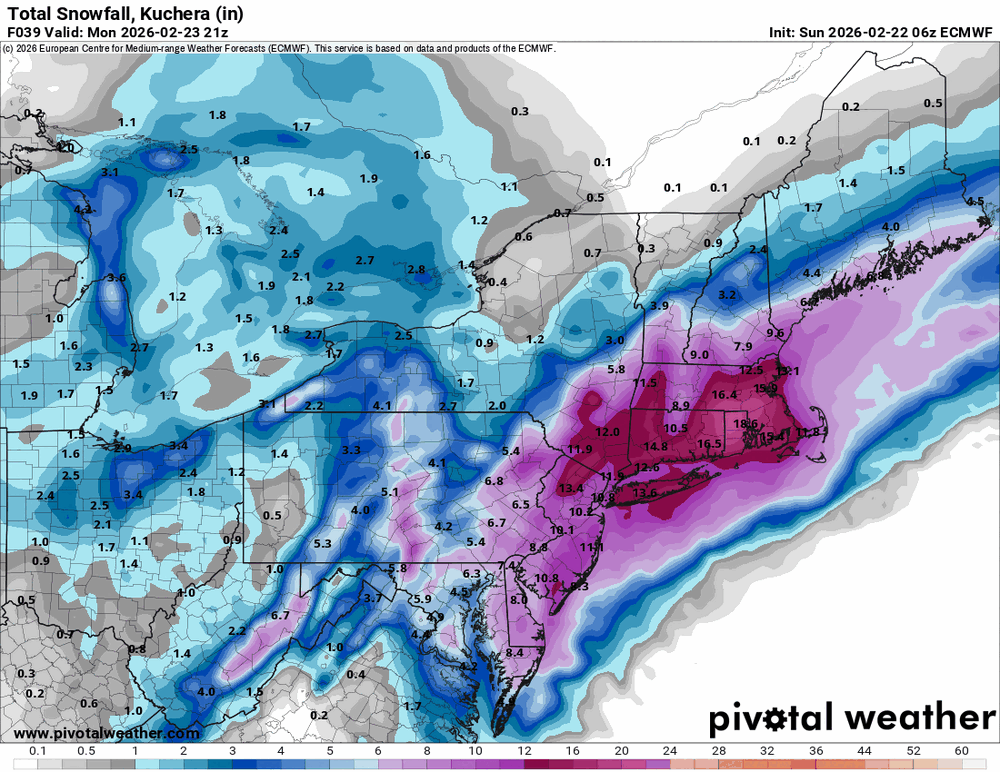
Mt. Holly's latest just before 4 am -