Hurricane Agnes
-
Posts
9,336 -
Joined
Content Type
Profiles
Blogs
Forums
American Weather
Media Demo
Store
Gallery
Everything posted by Hurricane Agnes
-
Blizzard of 2026 Storm Thread/OBS
Hurricane Agnes replied to Mikeymac5306's topic in Philadelphia Region
Soon as I sat down and go onto the computer, NOAA Weather Radio went off on a "Blizzard Warning" for Philly and Philly metro!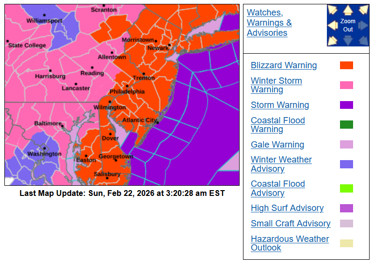
-
Blizzard of 2026 Storm Thread/OBS
Hurricane Agnes replied to Mikeymac5306's topic in Philadelphia Region
I had subbed to weathermodels and haven't had time to fool around with it much but did find this for the hourly 18z hourly GFS, which was cool (I am a "surface" woman! I like surface level maps).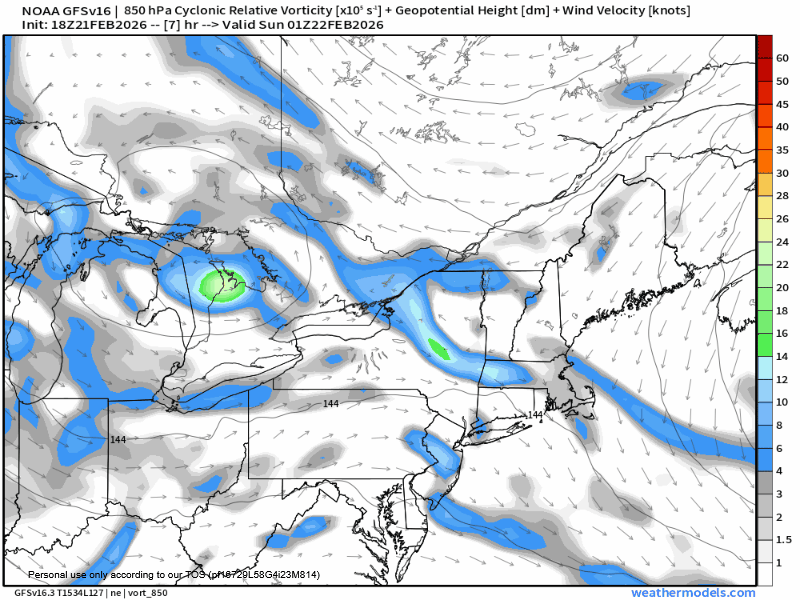
-
Blizzard of 2026 Storm Thread/OBS
Hurricane Agnes replied to Mikeymac5306's topic in Philadelphia Region
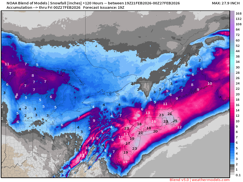
Yours might actually have another storm accumulation in there since it is going out to March 4! I did a couple - a 66 hour earlier and just did a 120...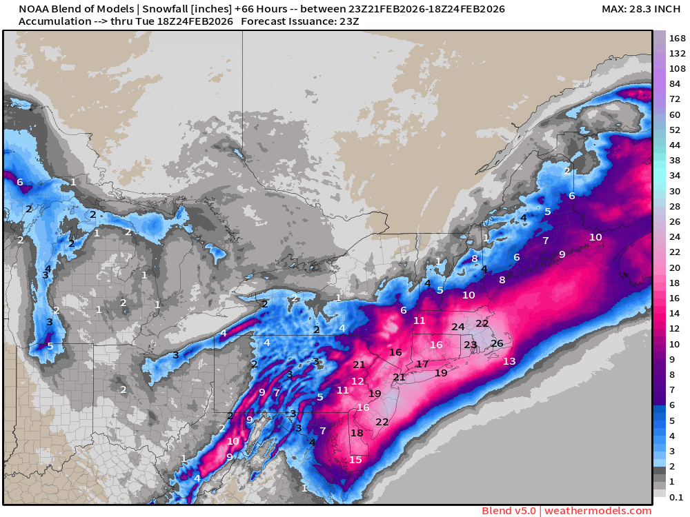
-
Blizzard of 2026 Storm Thread/OBS
Hurricane Agnes replied to Mikeymac5306's topic in Philadelphia Region
I'm an early bird and checked in here this morning around 3 am and saw there had been 73 messages posted since last night. -
Blizzard of 2026 Storm Thread/OBS
Hurricane Agnes replied to Mikeymac5306's topic in Philadelphia Region
Even though the New Moon was done a bit ago, it's still just 4 days past, so I expect higher tides than usual anyway, on top of what that is gonna do. -
Blizzard of 2026 Storm Thread/OBS
Hurricane Agnes replied to Mikeymac5306's topic in Philadelphia Region
Blizzard Warnings for most NJ counties (and southern Delaware) -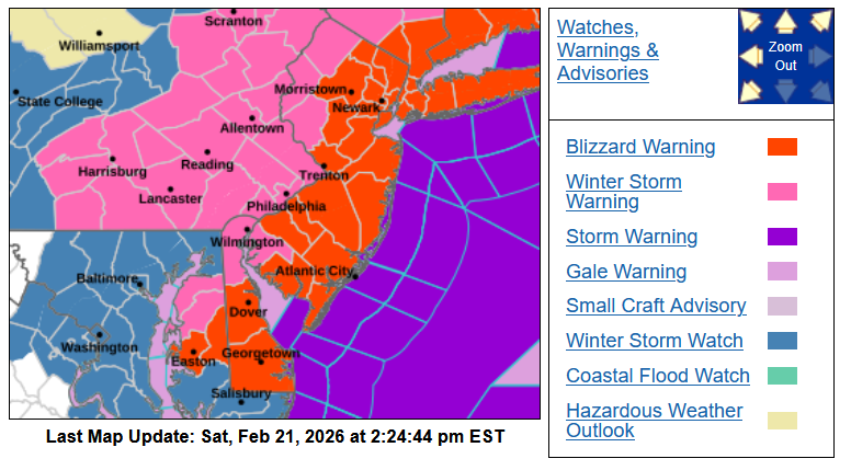
-
Blizzard of 2026 Storm Thread/OBS
Hurricane Agnes replied to Mikeymac5306's topic in Philadelphia Region
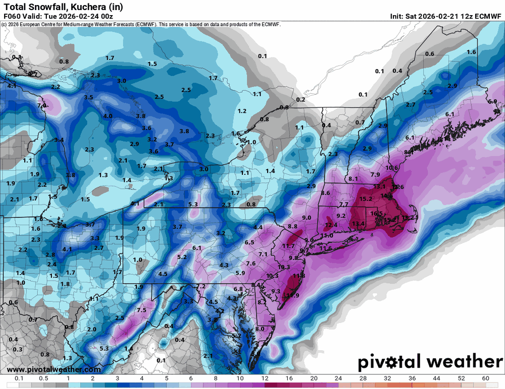
12z ECs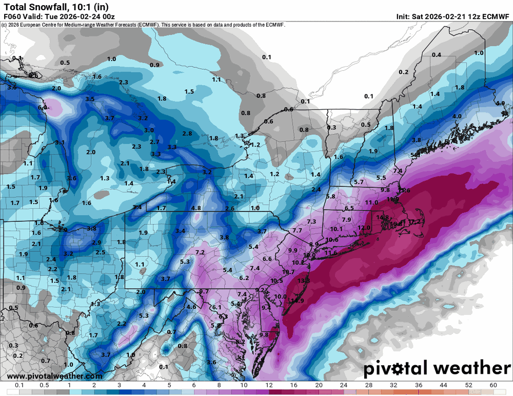
-
Blizzard of 2026 Storm Thread/OBS
Hurricane Agnes replied to Mikeymac5306's topic in Philadelphia Region
46 here in NW Philly too and am staring at a car cover (and the instructions) that I just pulled out of a box, that I was gonna try to put on my SUV. -
Blizzard of 2026 Storm Thread/OBS
Hurricane Agnes replied to Mikeymac5306's topic in Philadelphia Region
Cot time. -
Blizzard of 2026 Storm Thread/OBS
Hurricane Agnes replied to Mikeymac5306's topic in Philadelphia Region
I guess we are so used to "Miller Bs" being visible in our region but it looks like it is happening further south. I generated a map for the MA region (the other was the Northeast one) and you can see the funky things going on (like it wanted to be a "Miller A" but ran aground instead).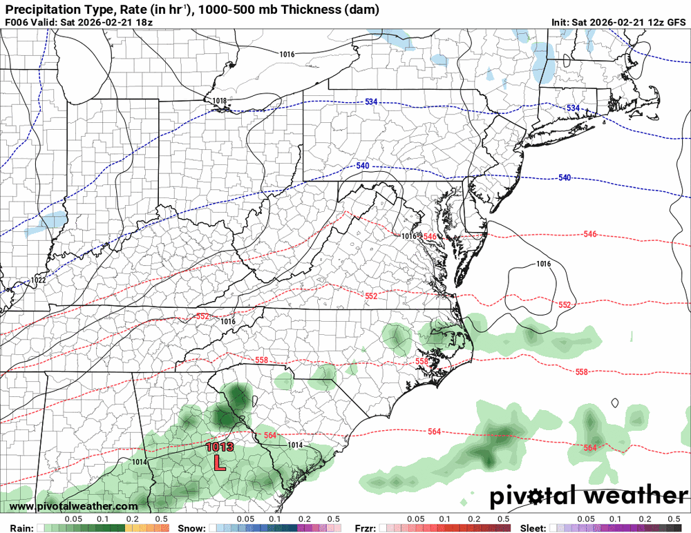
-
Blizzard of 2026 Storm Thread/OBS
Hurricane Agnes replied to Mikeymac5306's topic in Philadelphia Region
And you are "closer" to it then some of us. -
Blizzard of 2026 Storm Thread/OBS
Hurricane Agnes replied to Mikeymac5306's topic in Philadelphia Region
12z GFS to see the low behavior (which is maybe why Hurricane Schwartz was Miller B-ing this). I know that this is really not the GFS's range and forte though.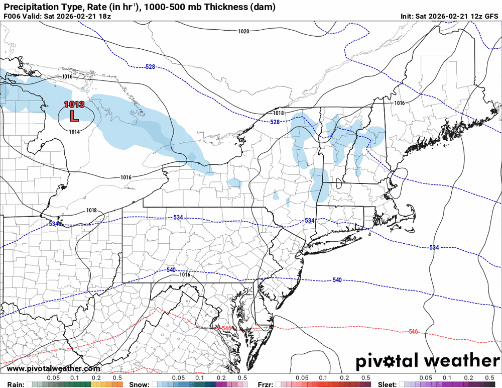
-
Blizzard of 2026 Storm Thread/OBS
Hurricane Agnes replied to Mikeymac5306's topic in Philadelphia Region
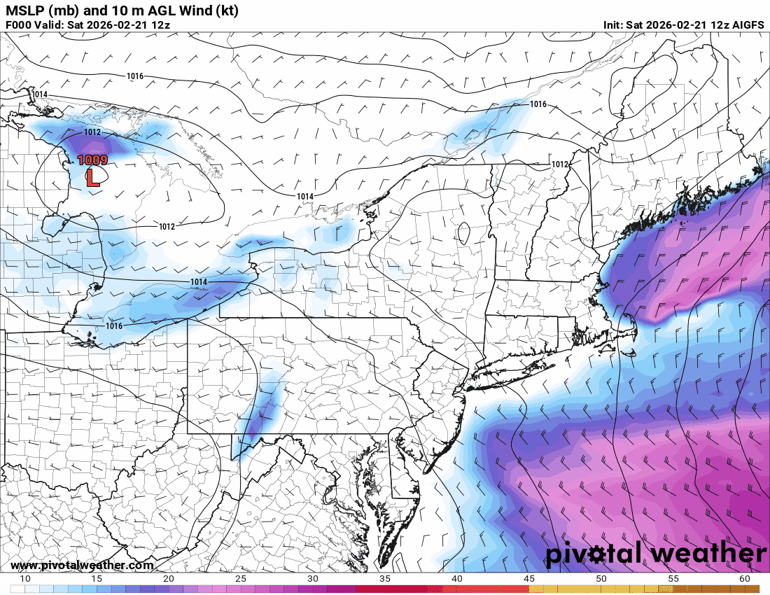
12z AIGFS
-
Blizzard of 2026 Storm Thread/OBS
Hurricane Agnes replied to Mikeymac5306's topic in Philadelphia Region
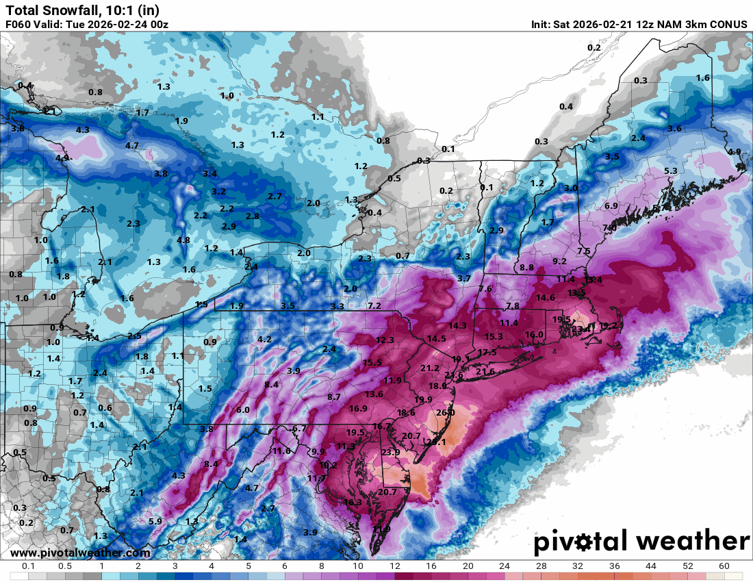
3k NAM out to its last panel.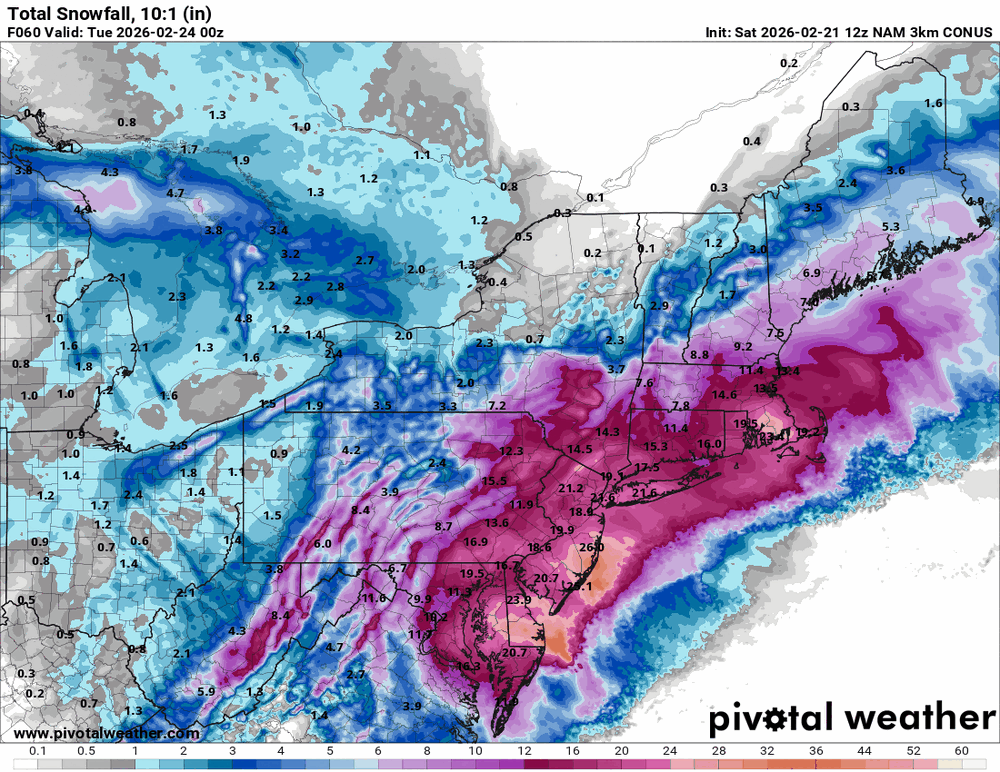
-
Blizzard of 2026 Storm Thread/OBS
Hurricane Agnes replied to Mikeymac5306's topic in Philadelphia Region
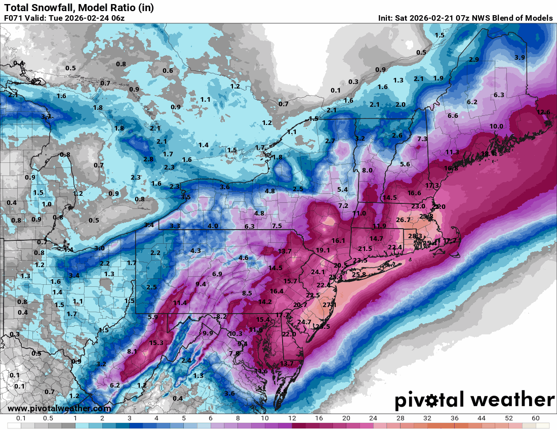
I think this was the latest NBM.
-
Blizzard of 2026 Storm Thread/OBS
Hurricane Agnes replied to Mikeymac5306's topic in Philadelphia Region
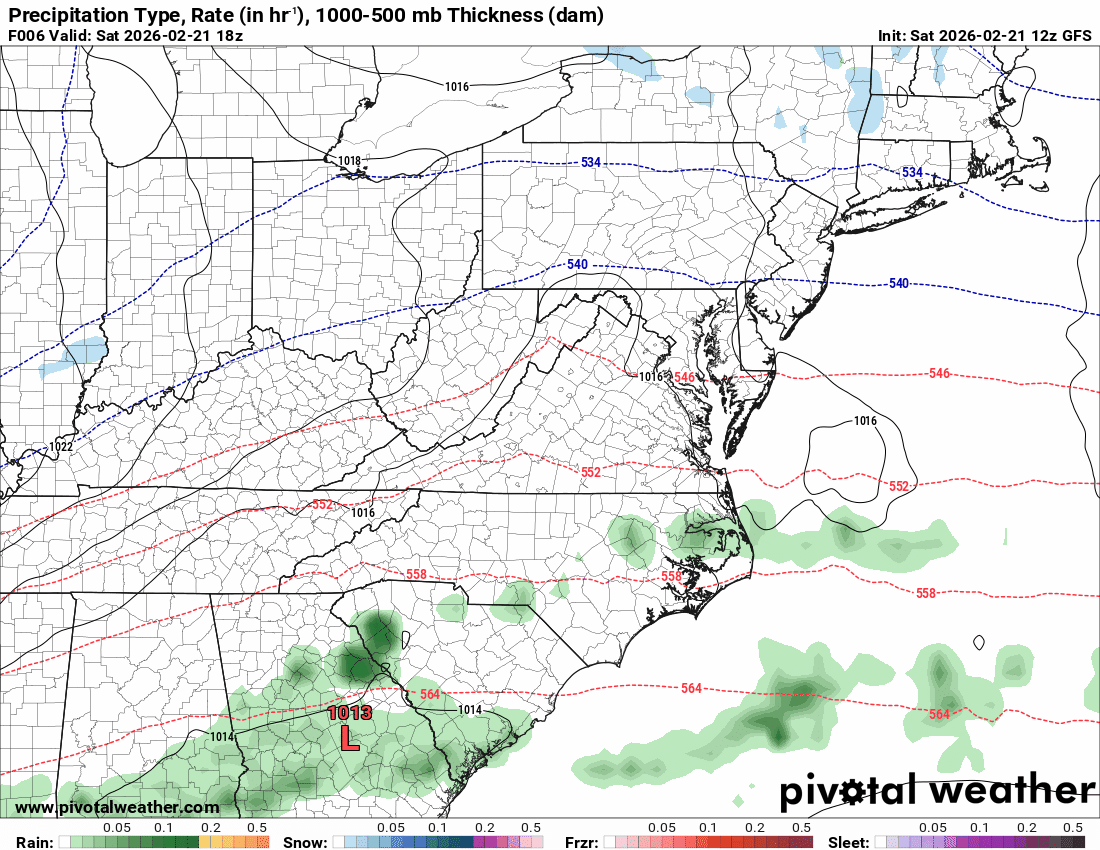
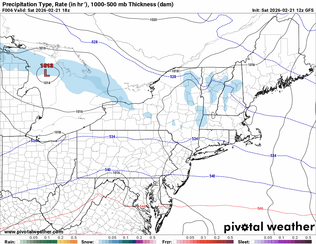
Mt. Holly AFD said something along the lines of starting Saturday evening with rain/snow mix and then things kick into high gear on Sunday, and it finishes up Monday afternoon. -
Blizzard of 2026 Storm Thread/OBS
Hurricane Agnes replied to Mikeymac5306's topic in Philadelphia Region
18z EC doesn't scrape the coast like the 18z NAM but interestingly enough, IIRC, when I have seen lows do that weird jump from the coast to inland and back out, it eventually ended up being some kind of double/non-stacked low off the coast, at least briefly.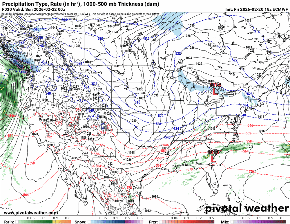
-
Blizzard of 2026 Storm Thread/OBS
Hurricane Agnes replied to Mikeymac5306's topic in Philadelphia Region
On the 18z GFS, the low looks really tucked during the early part of its run and then it jumps closer to the benchmark.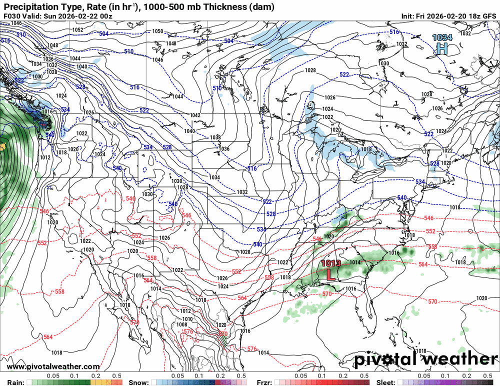
-
Blizzard of 2026 Storm Thread/OBS
Hurricane Agnes replied to Mikeymac5306's topic in Philadelphia Region
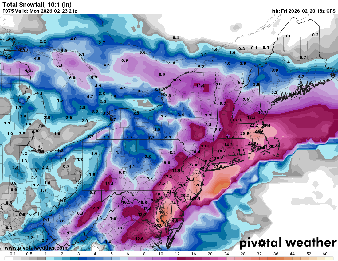
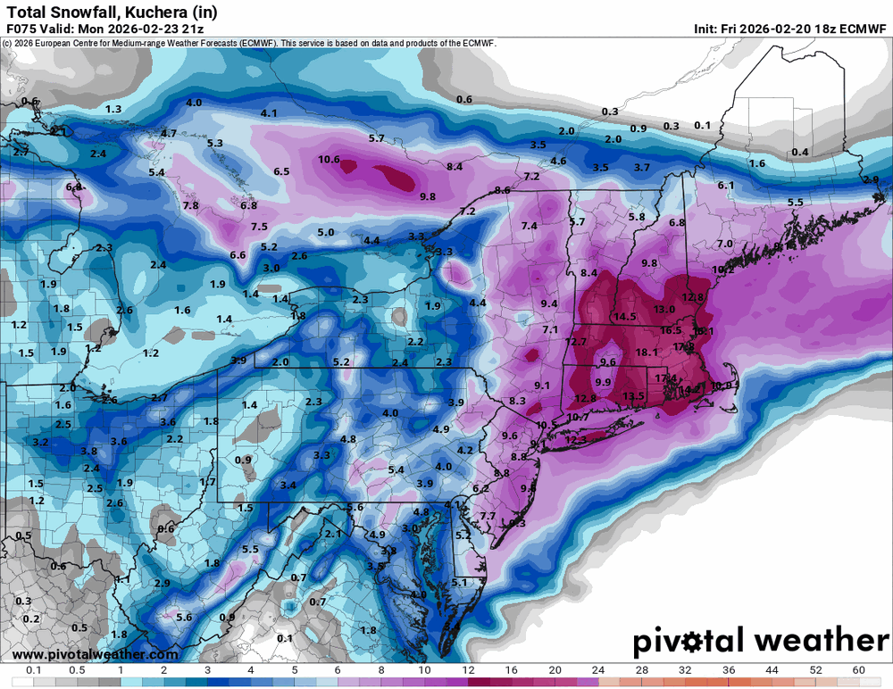
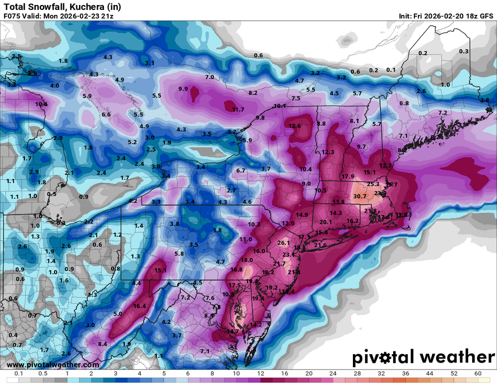
18z GFS (the AI one doesn't do "winter" stuff... at least yet) -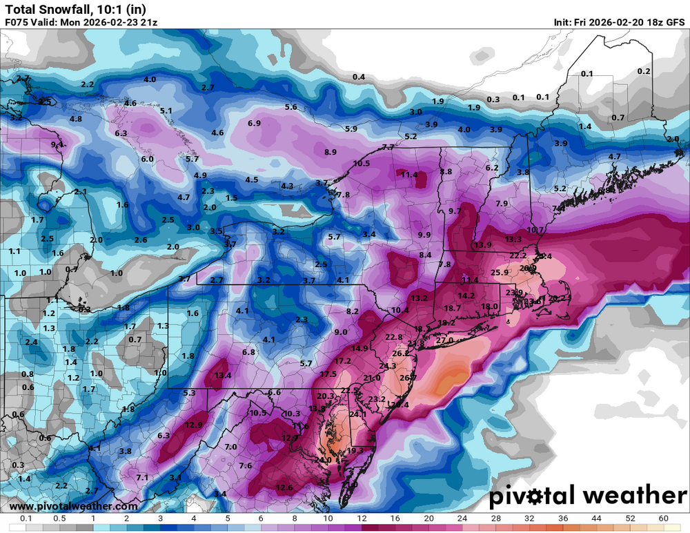
-
Blizzard of 2026 Storm Thread/OBS
Hurricane Agnes replied to Mikeymac5306's topic in Philadelphia Region
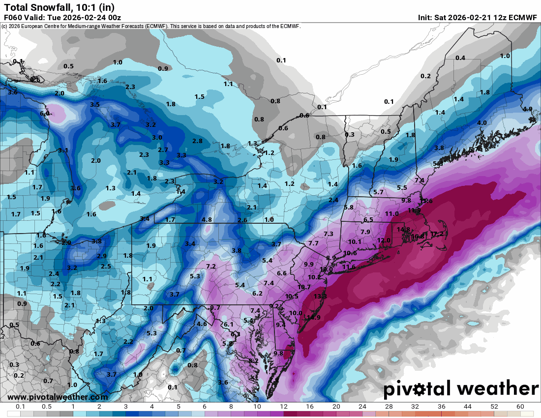
To me, "HECS" = 1996 levels! -
Blizzard of 2026 Storm Thread/OBS
Hurricane Agnes replied to Mikeymac5306's topic in Philadelphia Region
I have a sub with them so if you're not subbed, it could be they limit which runs are available. -
Blizzard of 2026 Storm Thread/OBS
Hurricane Agnes replied to Mikeymac5306's topic in Philadelphia Region
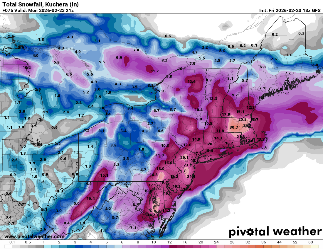
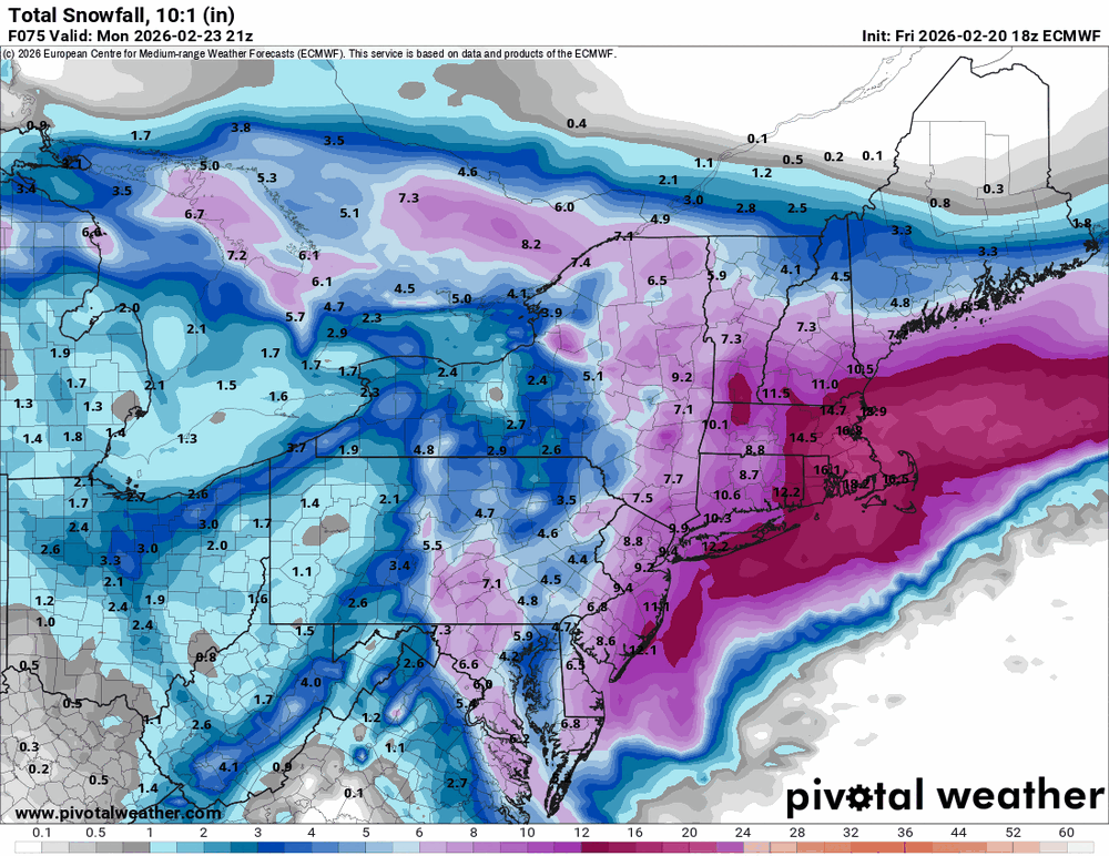
HECS along the Jersey shore.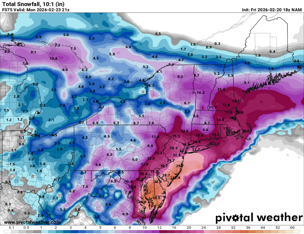
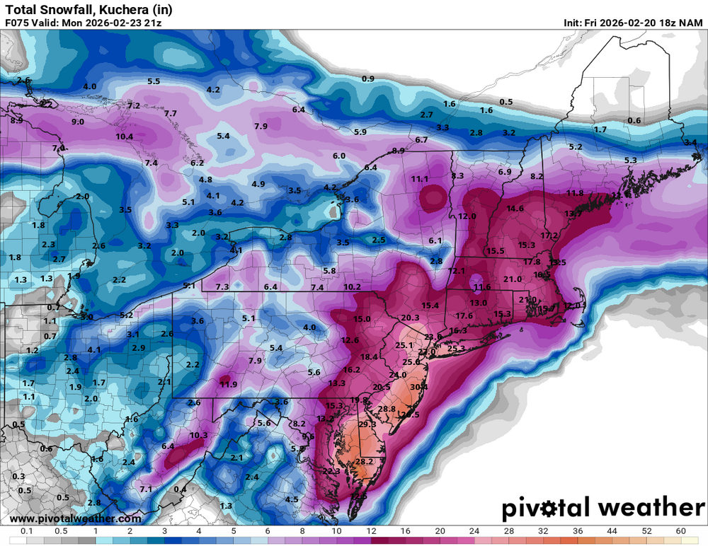
-
Blizzard of 2026 Storm Thread/OBS
Hurricane Agnes replied to Mikeymac5306's topic in Philadelphia Region
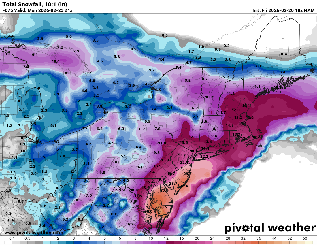
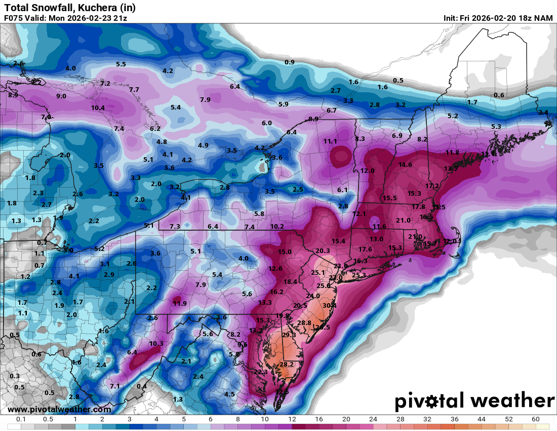
18z 12k NAM out to 66 -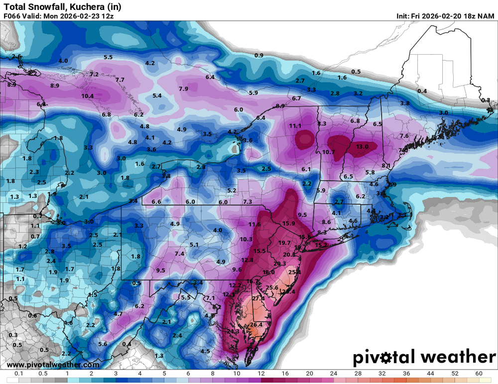
-
Blizzard of 2026 Storm Thread/OBS
Hurricane Agnes replied to Mikeymac5306's topic in Philadelphia Region
Just heard on KYW (for Birds~69) that North Wales just declared a Snow Emergency.