Hurricane Agnes
-
Posts
9,261 -
Joined
Content Type
Profiles
Blogs
Forums
American Weather
Media Demo
Store
Gallery
Everything posted by Hurricane Agnes
-
E PA/NJ/DE Winter 2023-2024 OBS/Discussion
Hurricane Agnes replied to The Iceman's topic in Philadelphia Region
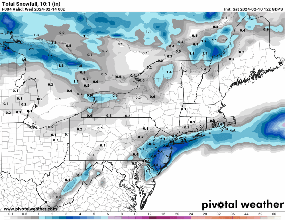
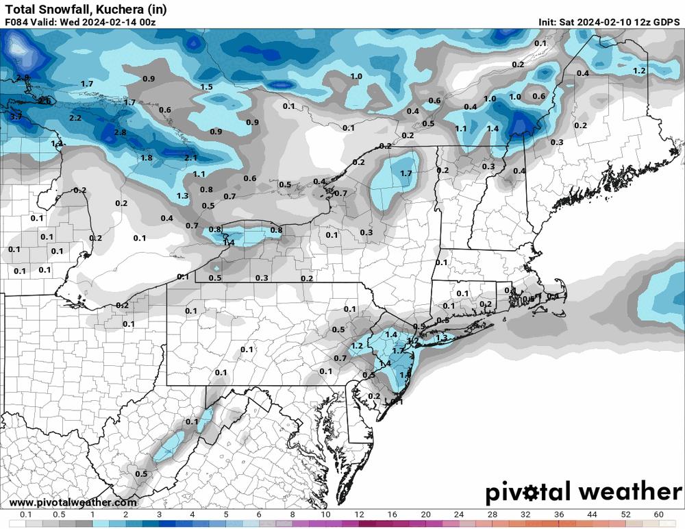
7z NBM not buying it. I almost want to say it could be convective feedback but I suppose the 12z will be instructive.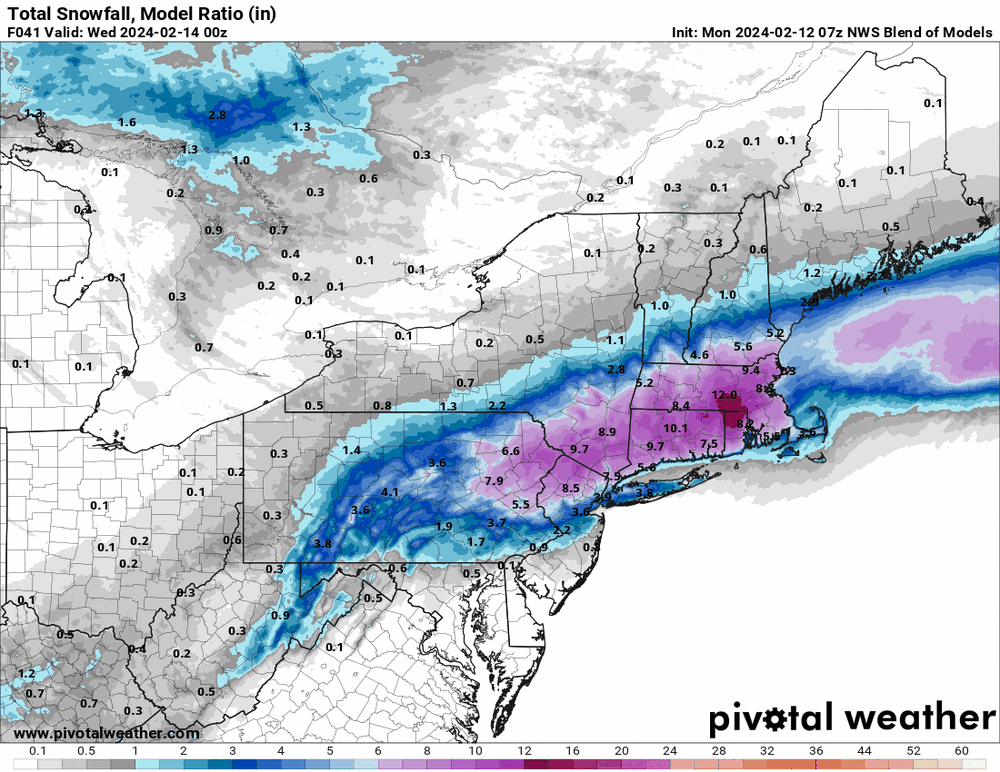
-
E PA/NJ/DE Winter 2023-2024 OBS/Discussion
Hurricane Agnes replied to The Iceman's topic in Philadelphia Region
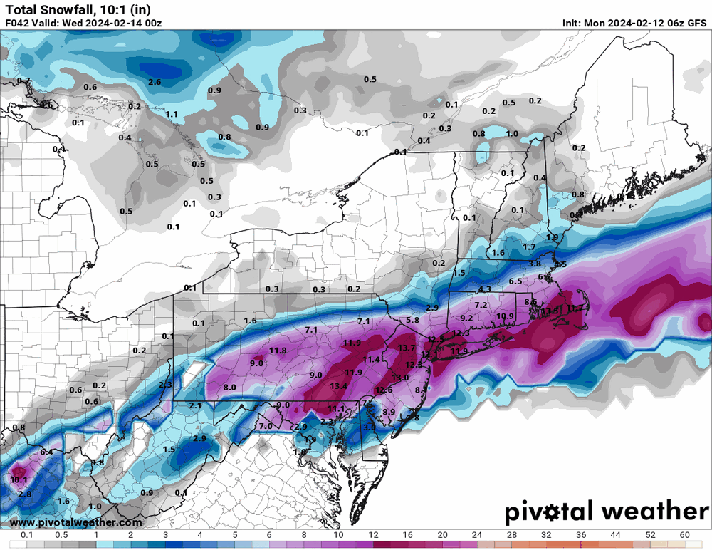
Was trying to see what the GFS was trying to do and I guess it wants to start bombing out the low when it gets out into the ocean.
-
E PA/NJ/DE Winter 2023-2024 OBS/Discussion
Hurricane Agnes replied to The Iceman's topic in Philadelphia Region
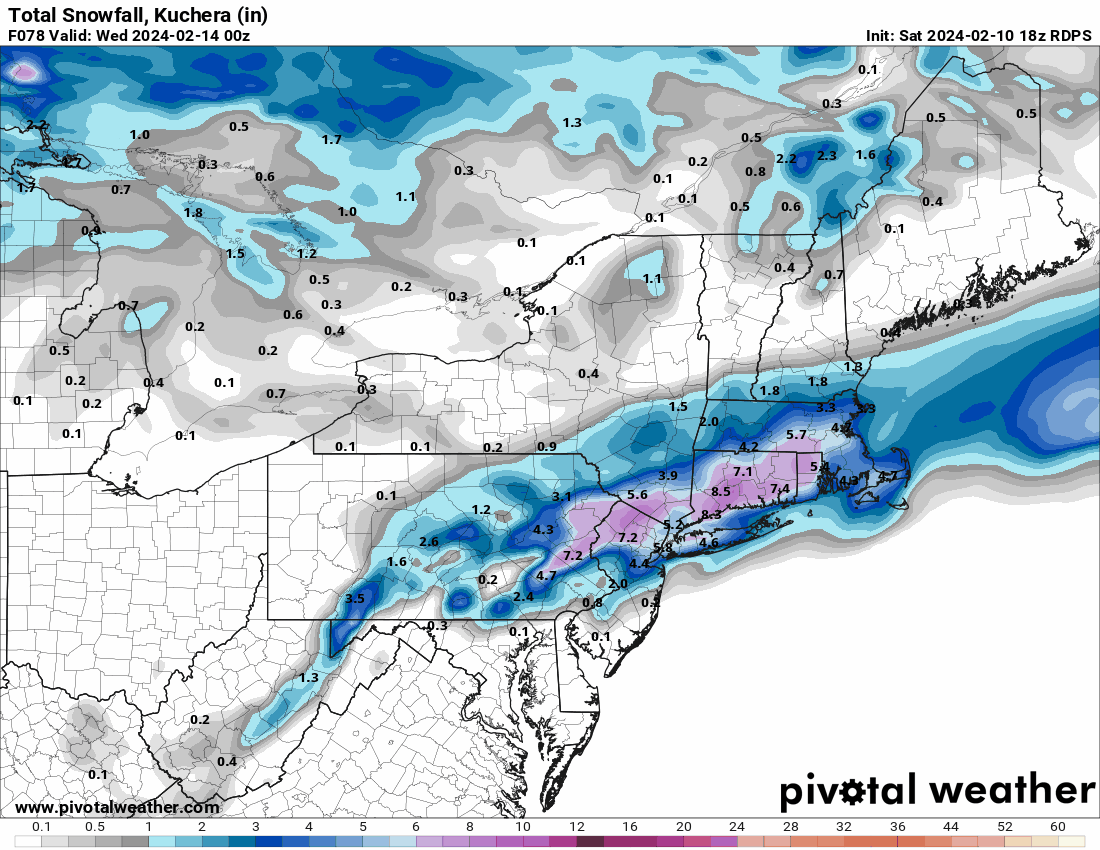
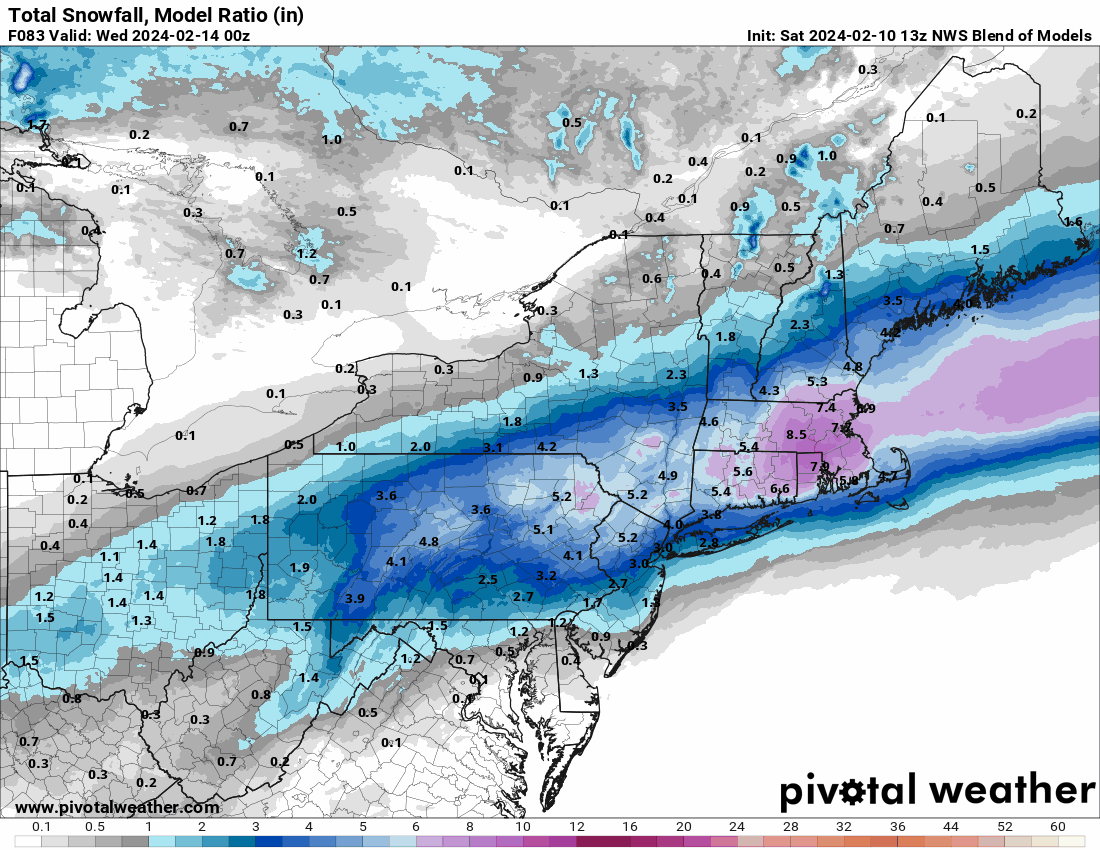
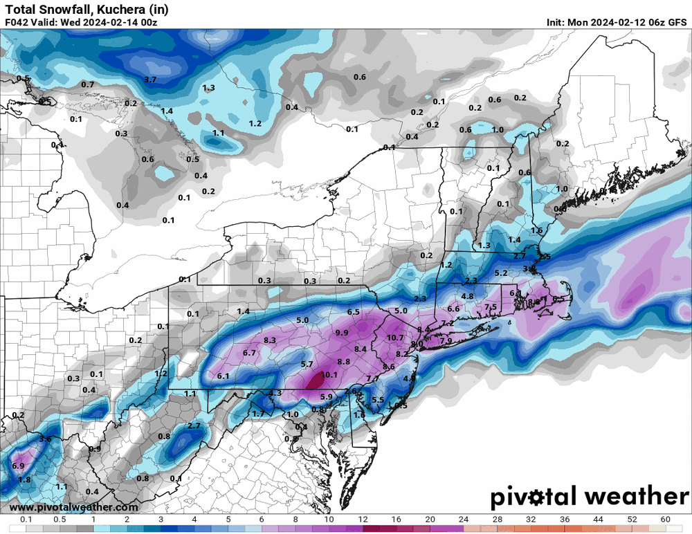
Latest Mt. Holly map -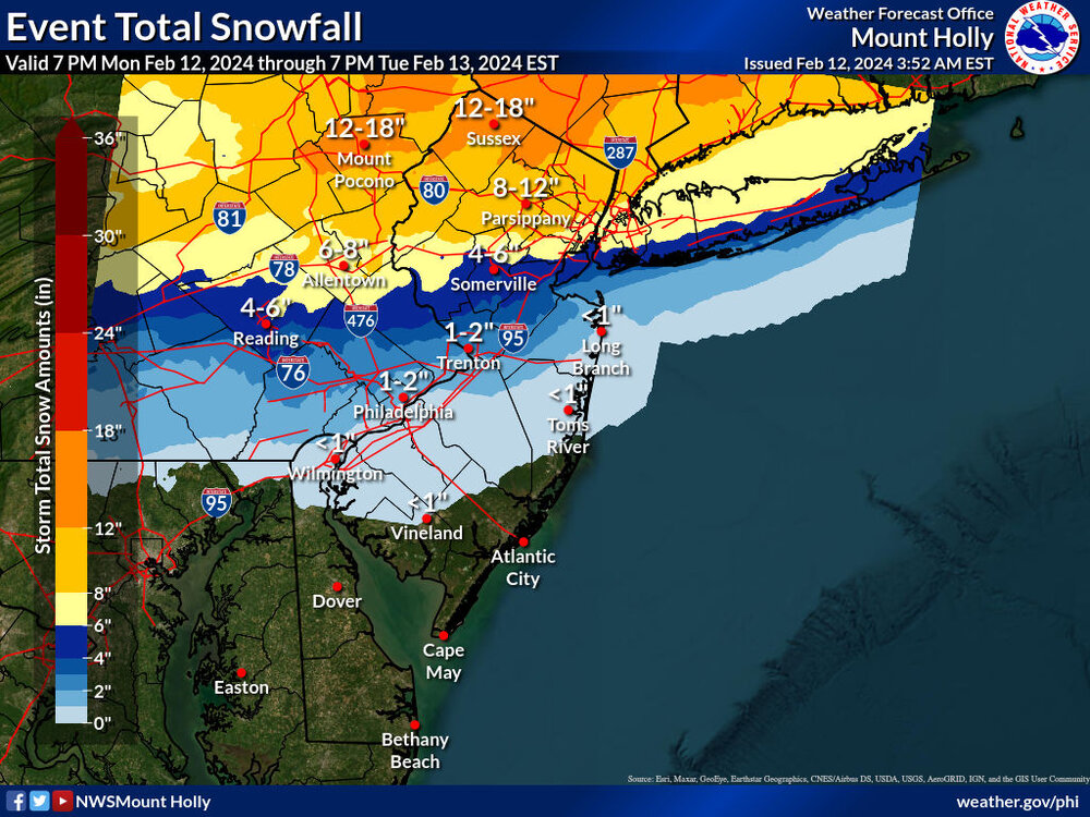
-
E PA/NJ/DE Winter 2023-2024 OBS/Discussion
Hurricane Agnes replied to The Iceman's topic in Philadelphia Region
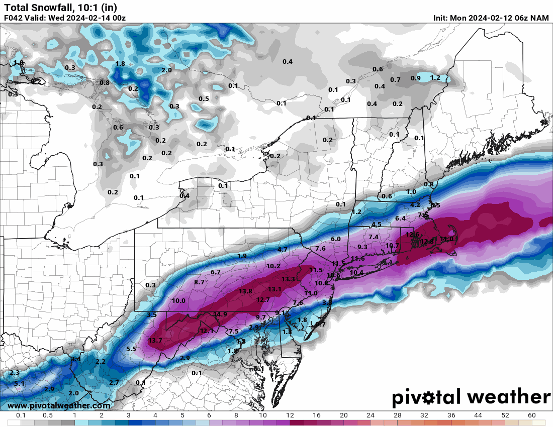
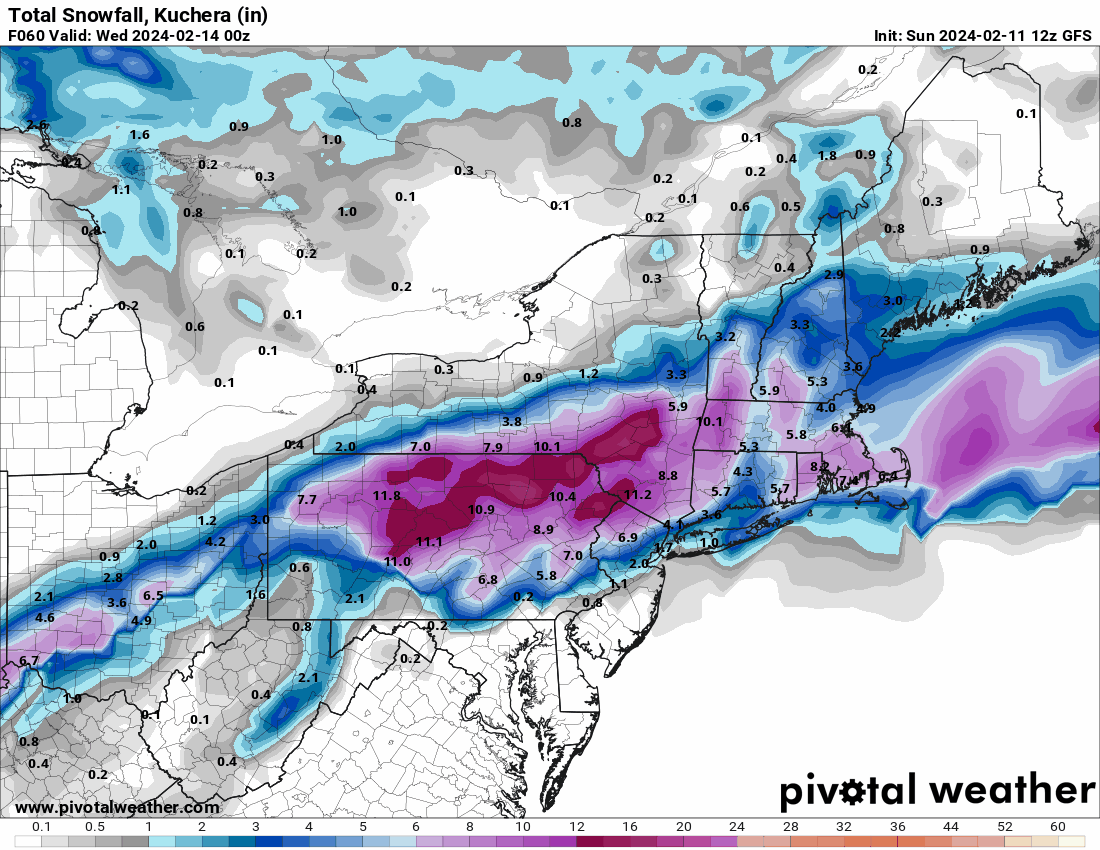
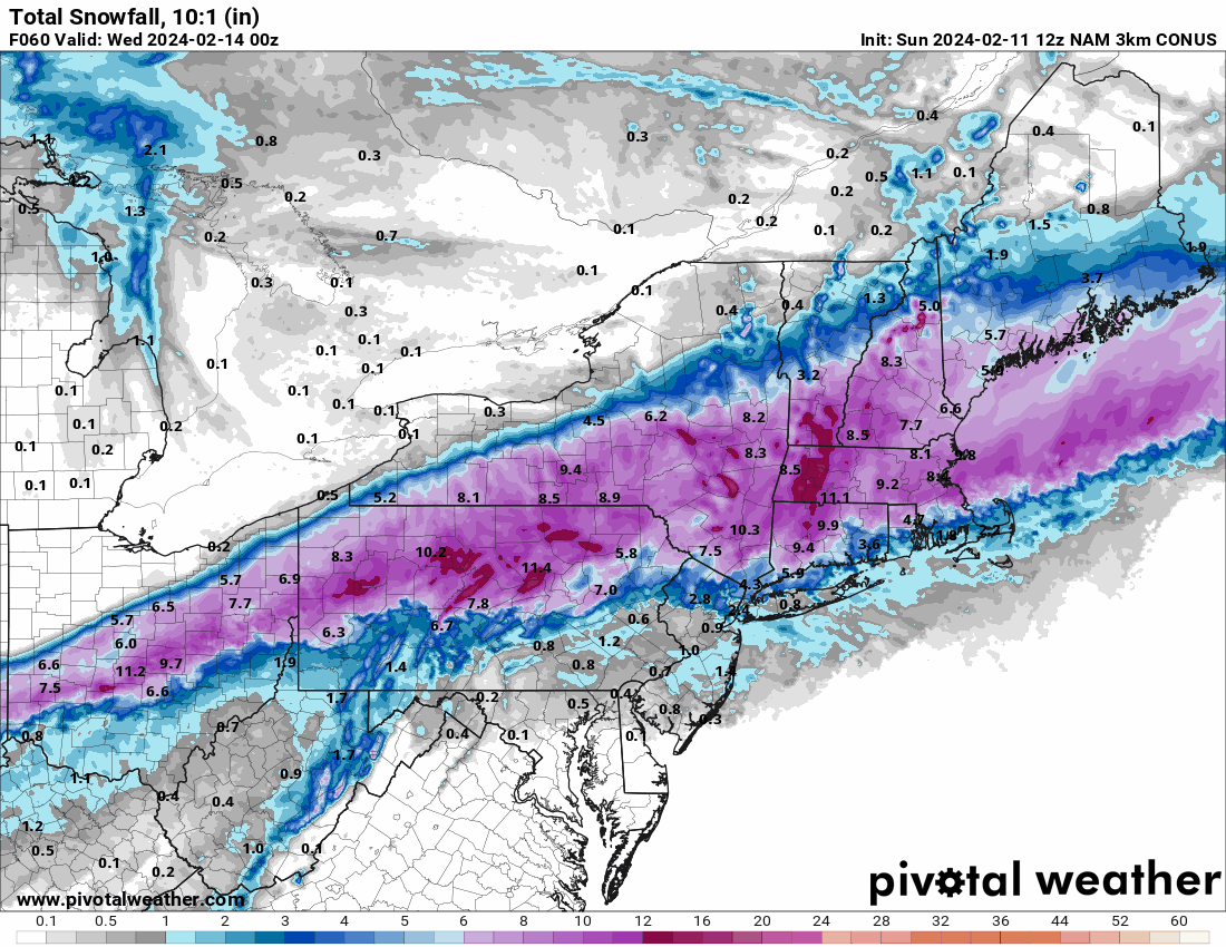
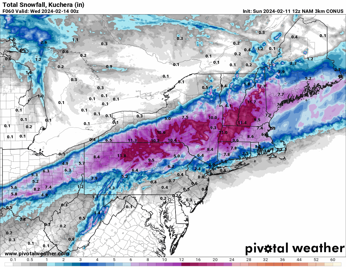
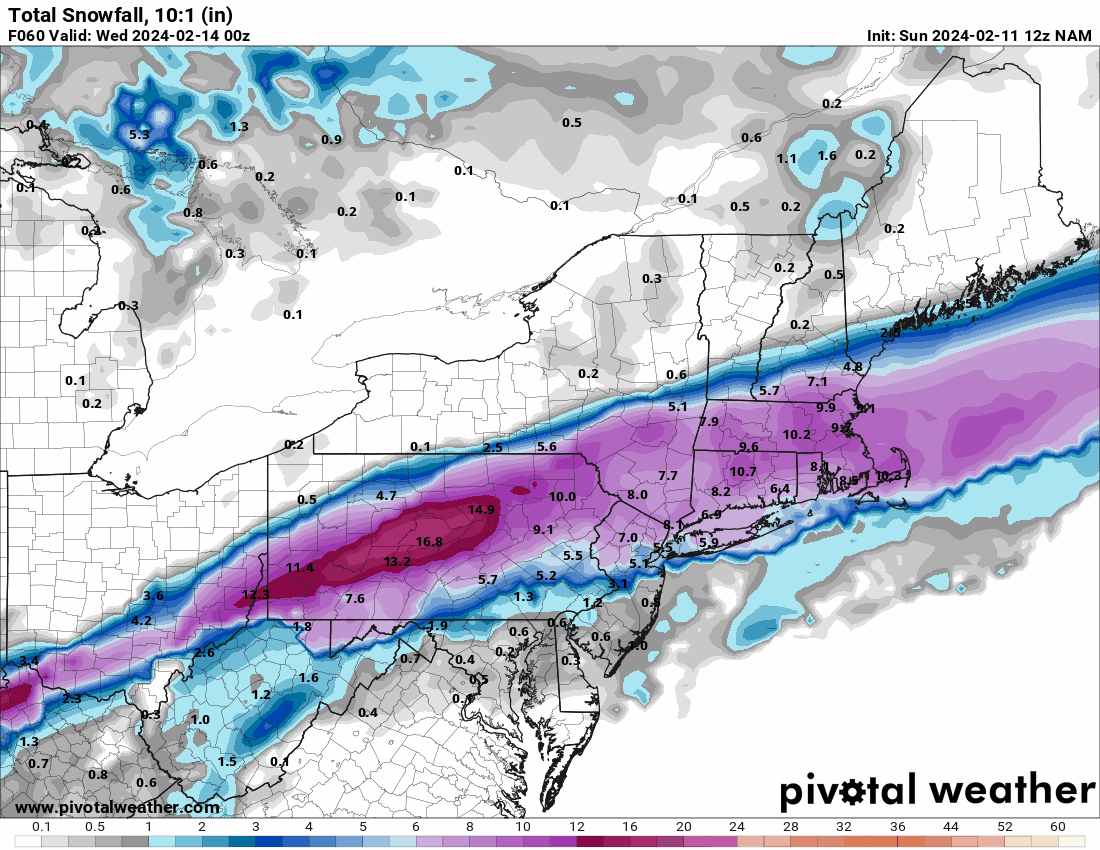
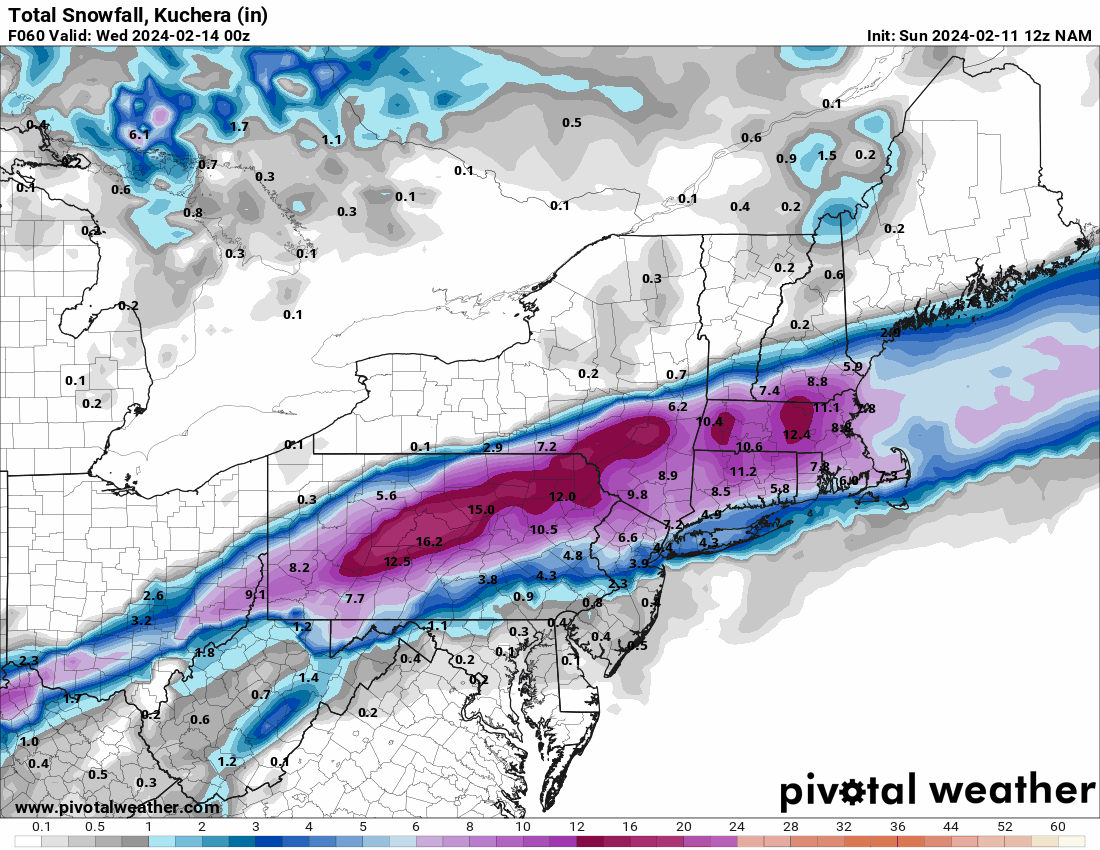
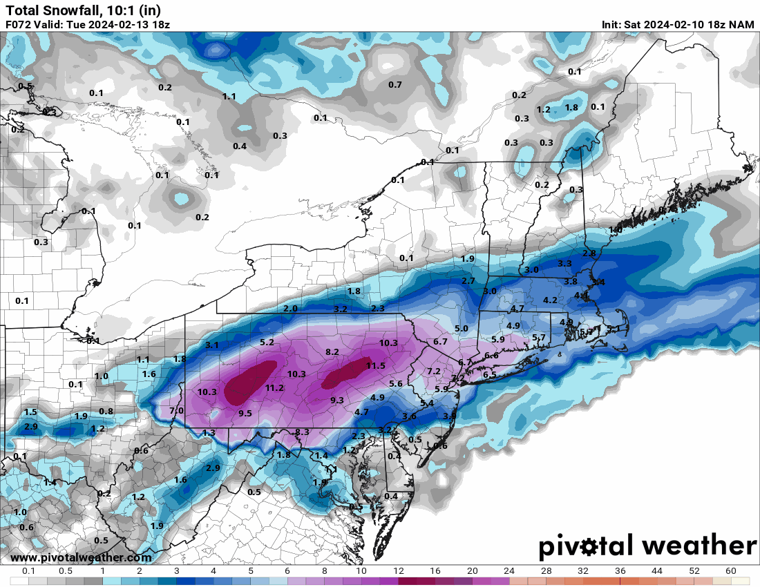
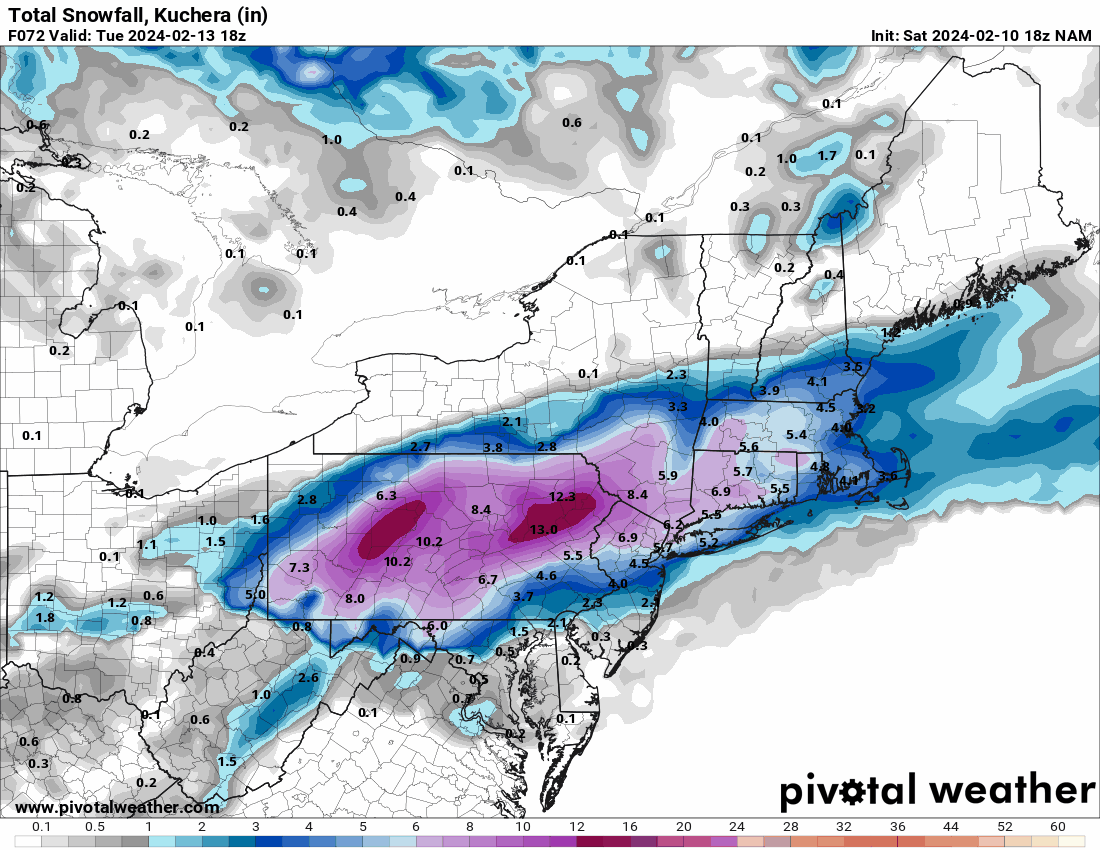
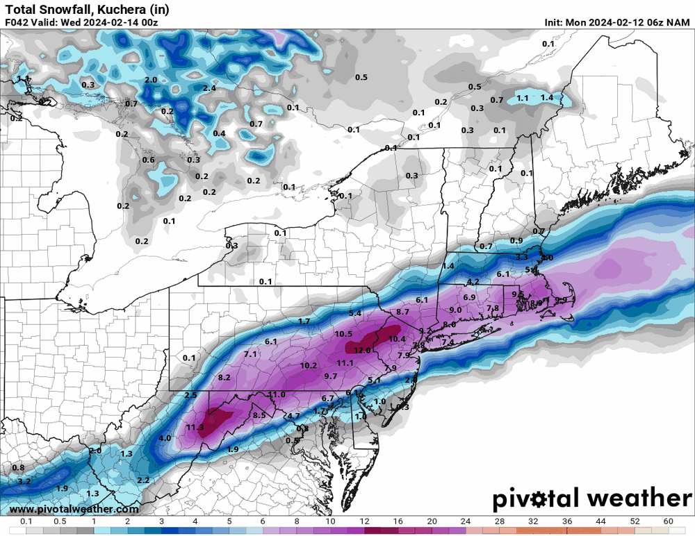
6z 12K NAM
-
E PA/NJ/DE Winter 2023-2024 OBS/Discussion
Hurricane Agnes replied to The Iceman's topic in Philadelphia Region
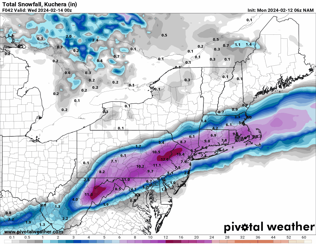
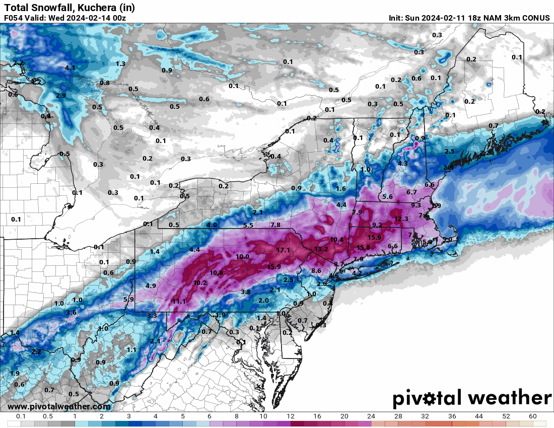
6z 3k NAM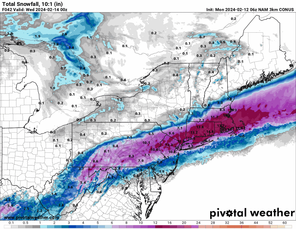
-
E PA/NJ/DE Winter 2023-2024 OBS/Discussion
Hurricane Agnes replied to The Iceman's topic in Philadelphia Region
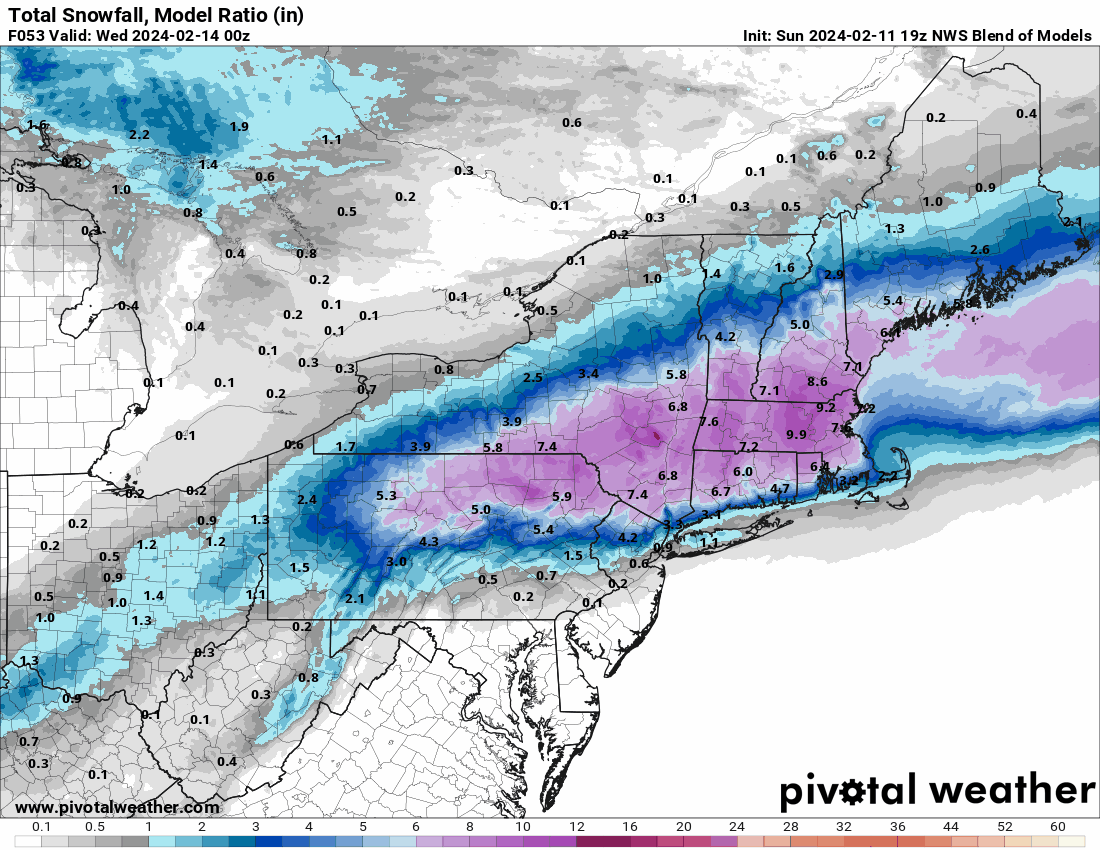
19z NBM.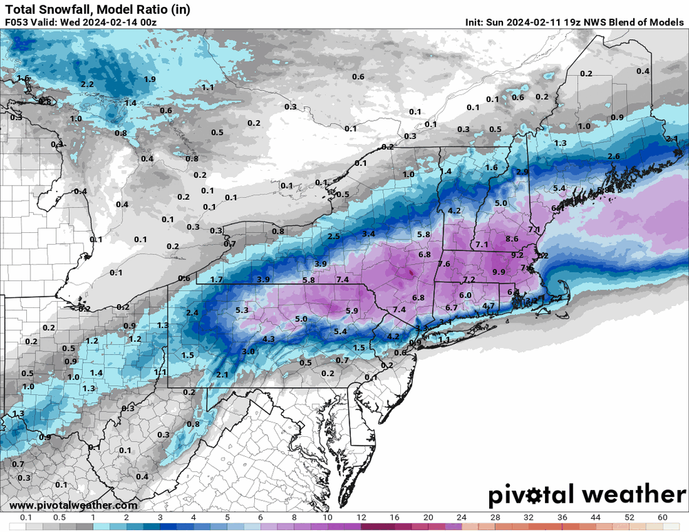
-
E PA/NJ/DE Winter 2023-2024 OBS/Discussion
Hurricane Agnes replied to The Iceman's topic in Philadelphia Region
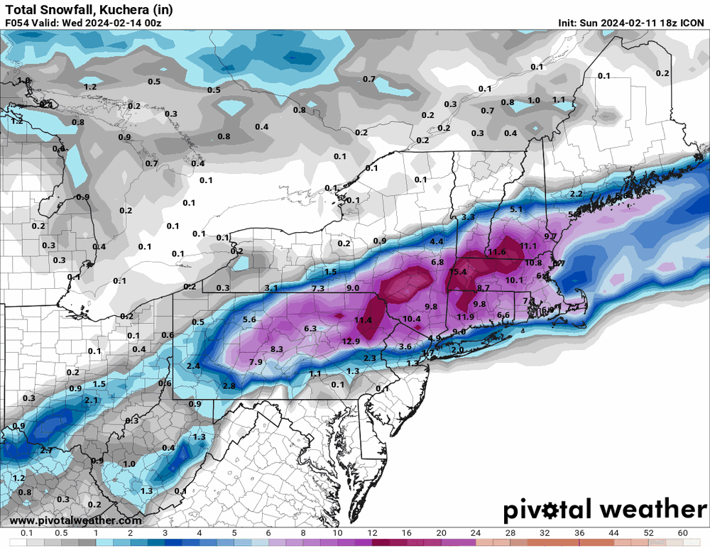
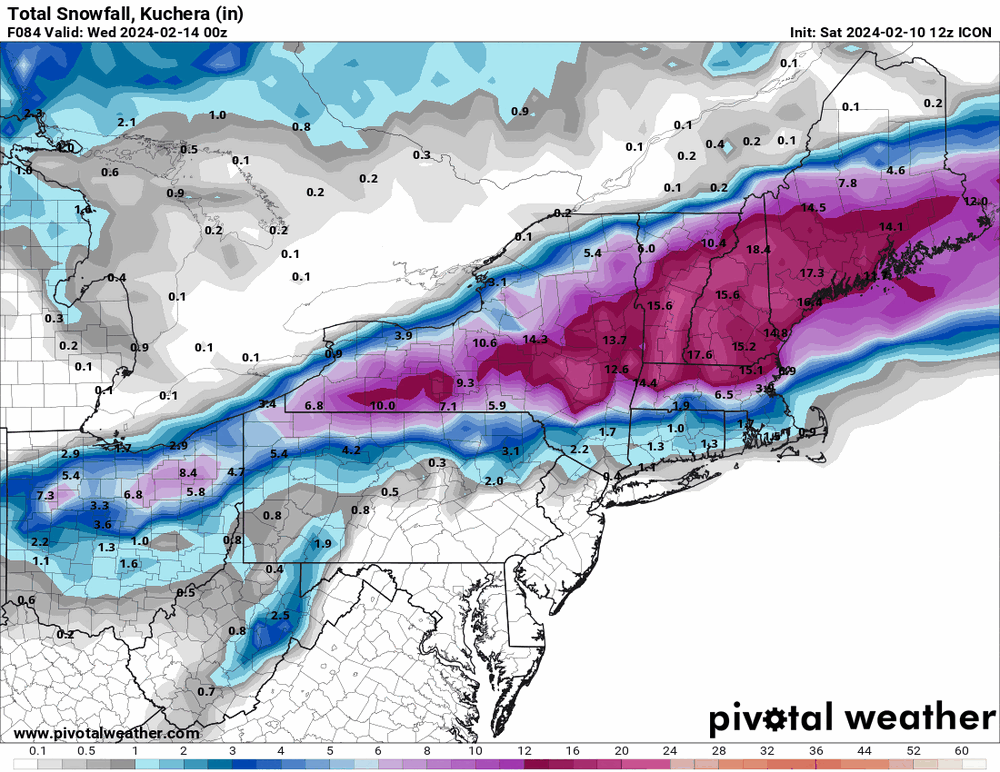
18z ICON kept the same theme as others.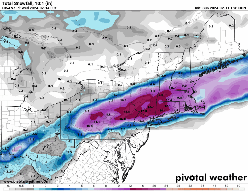
-
E PA/NJ/DE Winter 2023-2024 OBS/Discussion
Hurricane Agnes replied to The Iceman's topic in Philadelphia Region
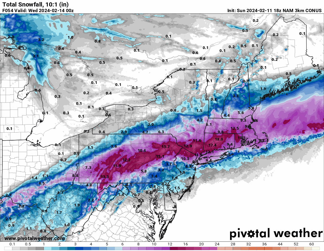
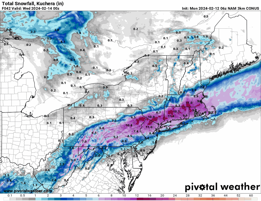
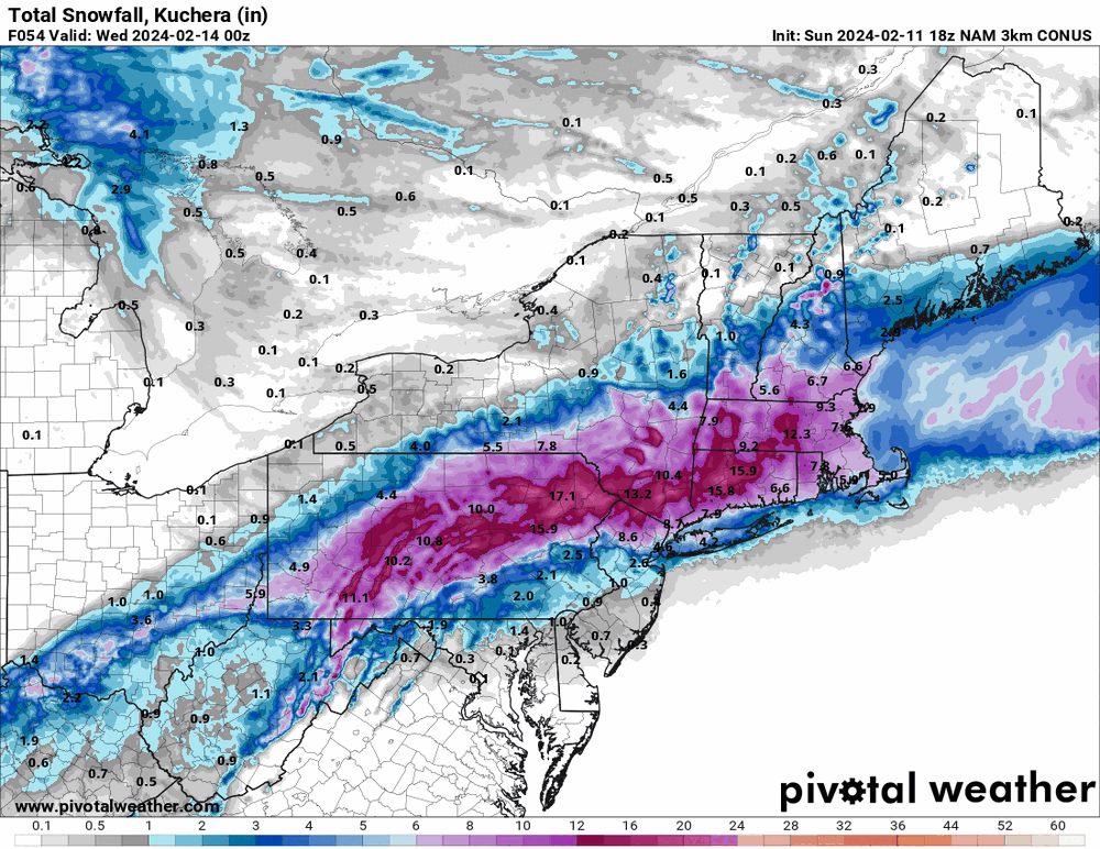
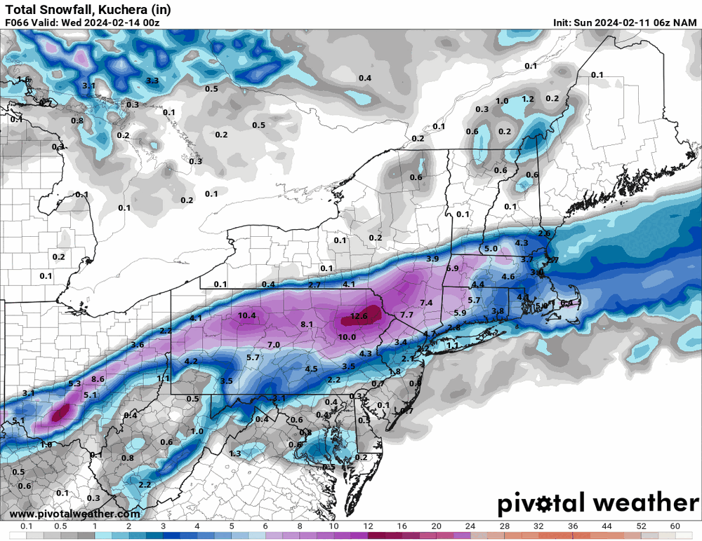
18z 3k NAMs...
-
E PA/NJ/DE Winter 2023-2024 OBS/Discussion
Hurricane Agnes replied to The Iceman's topic in Philadelphia Region
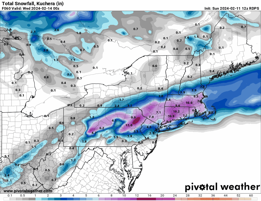
Well the 12z Canadian gave you a little... I think, at least as of today, it's near 100% I-78 -> I-80 and north jackpot.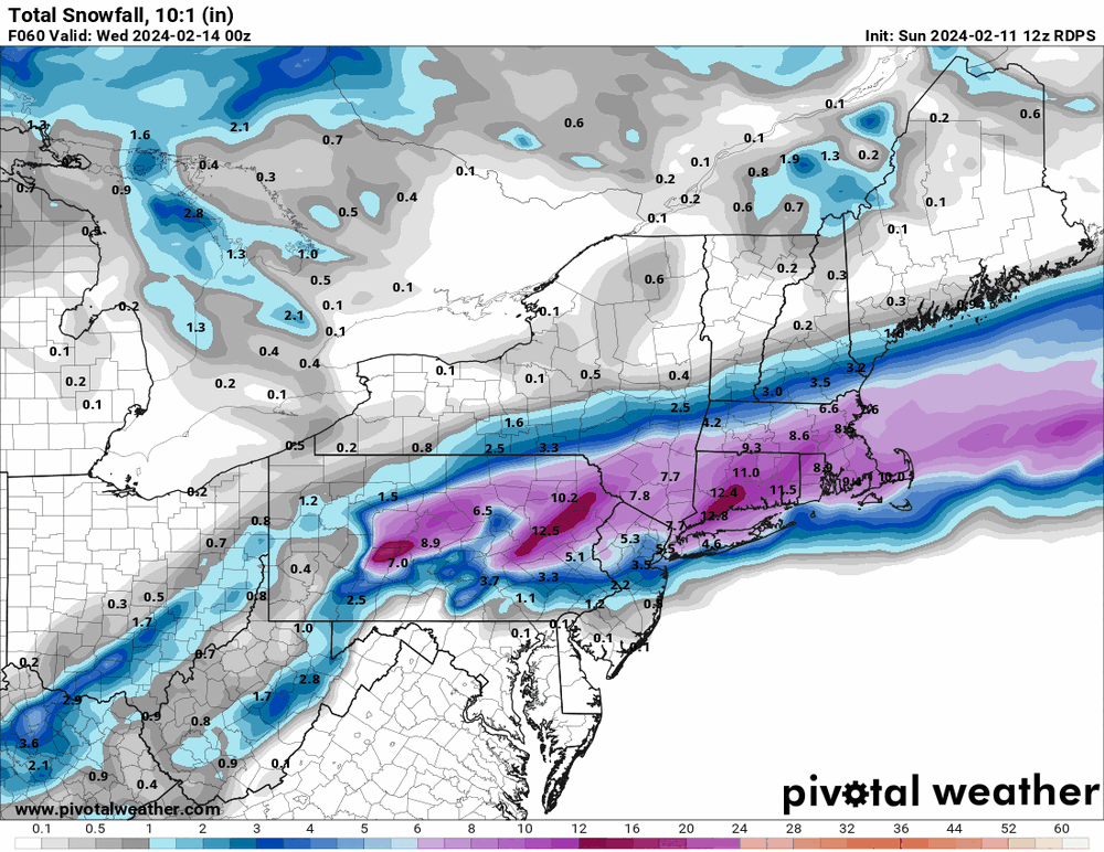
-
E PA/NJ/DE Winter 2023-2024 OBS/Discussion
Hurricane Agnes replied to The Iceman's topic in Philadelphia Region
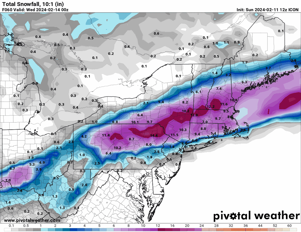
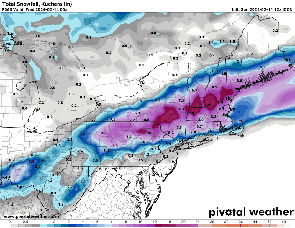
I'll give you the Ukie (that came west) + a couple ICONs (where the ICON finally put the crack pipe down and caved).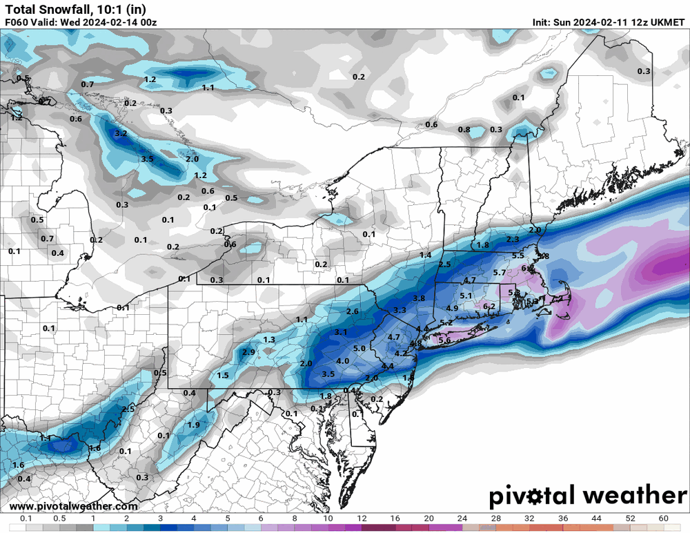
-
E PA/NJ/DE Winter 2023-2024 OBS/Discussion
Hurricane Agnes replied to The Iceman's topic in Philadelphia Region
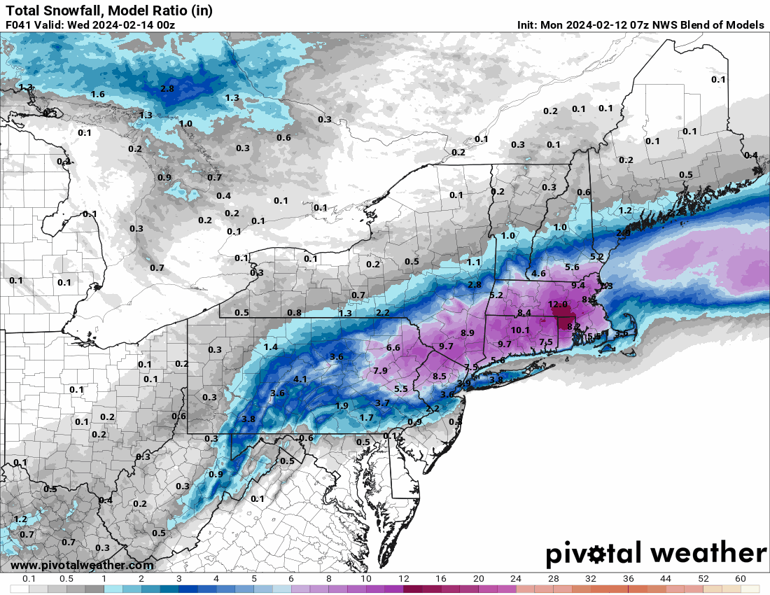
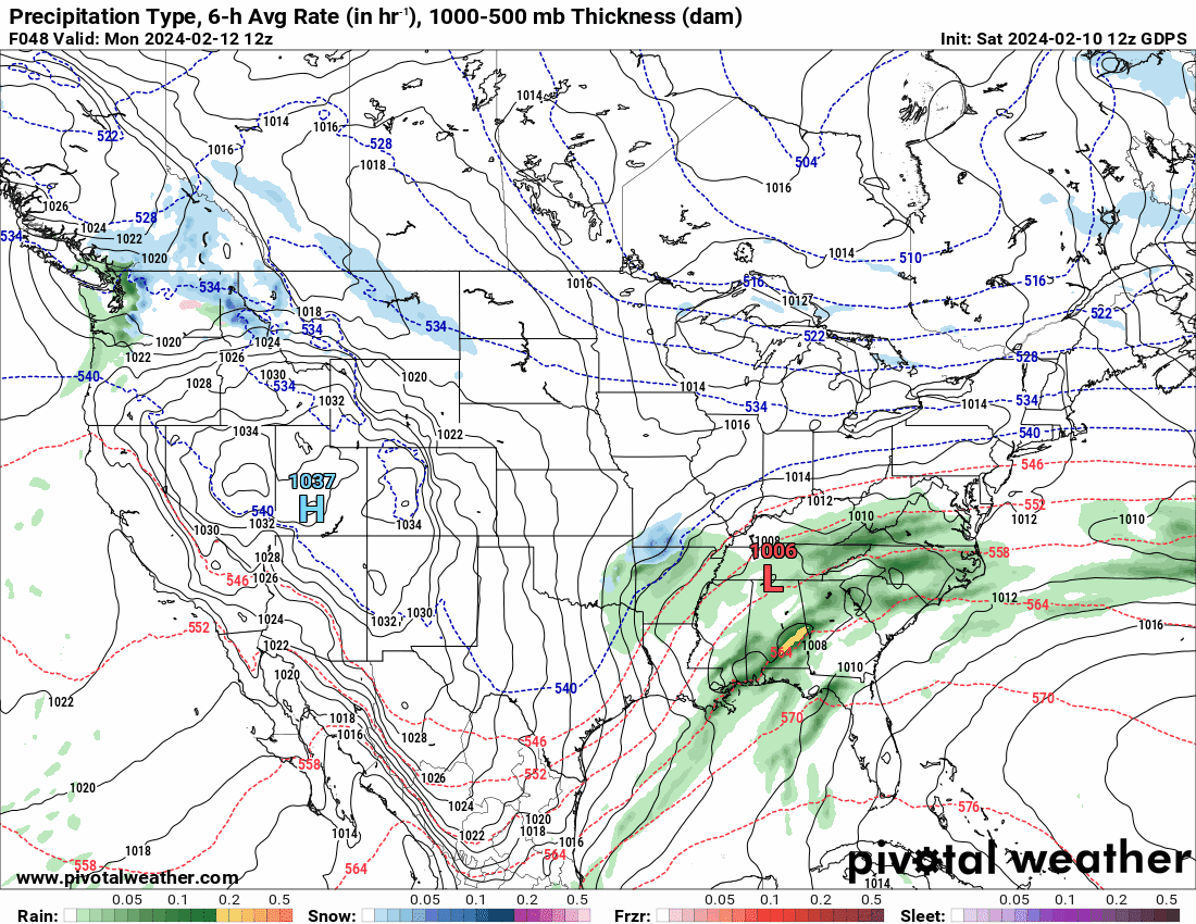
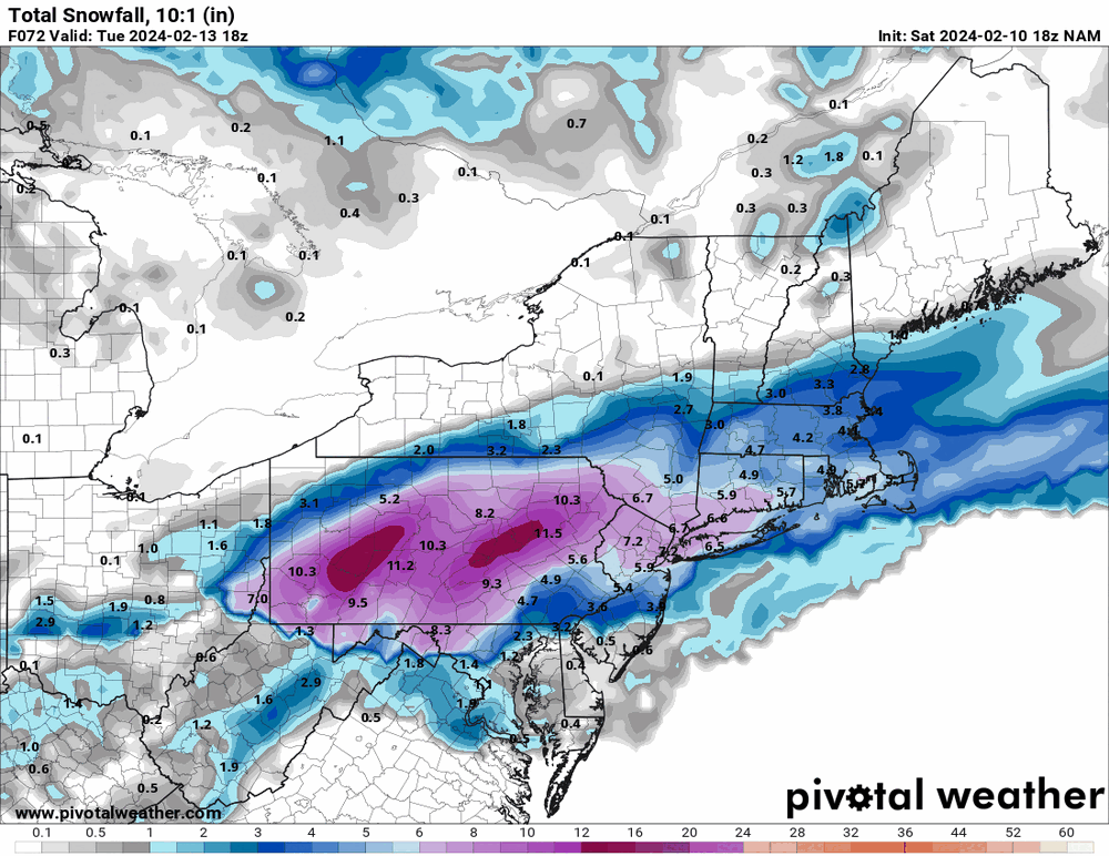
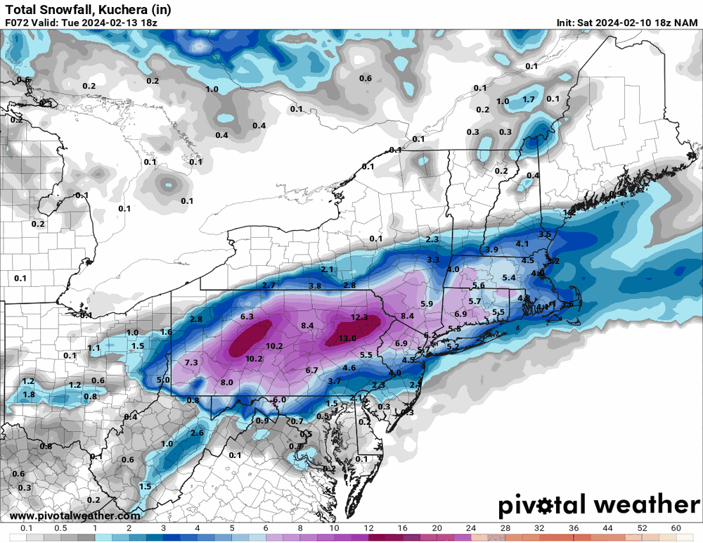
The 10:1 looks better but is a non-starter given that low is pulling all kinds of warm moisture out of a warm GOM.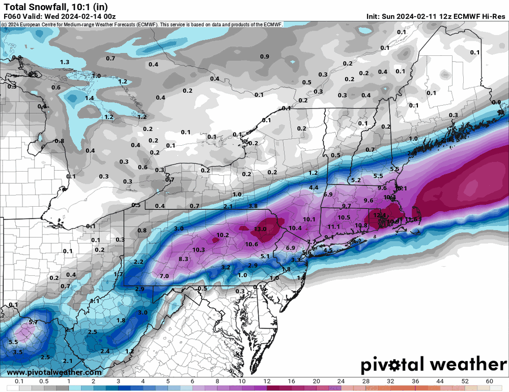

-
E PA/NJ/DE Winter 2023-2024 OBS/Discussion
Hurricane Agnes replied to The Iceman's topic in Philadelphia Region
12Z GFS similar although still hanging with some for most inland (pretty much nothing for coastal plain/I-95 south and east).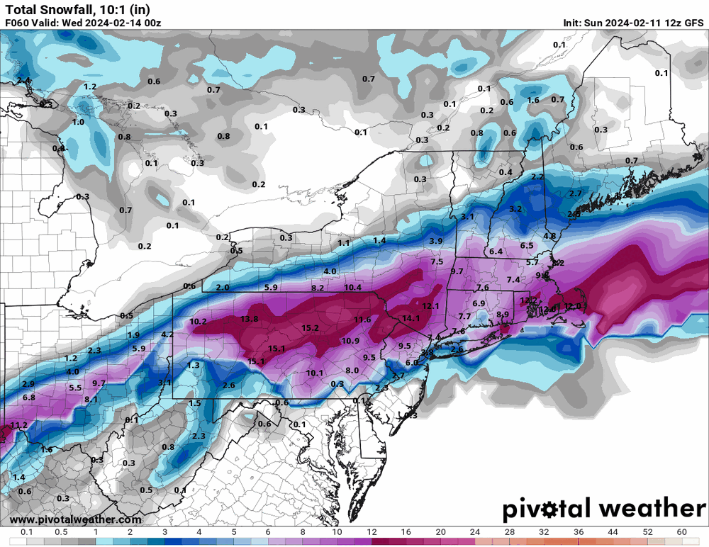
-
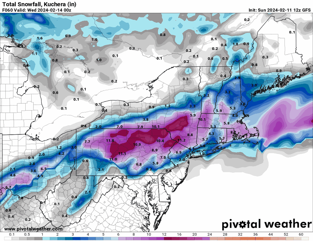
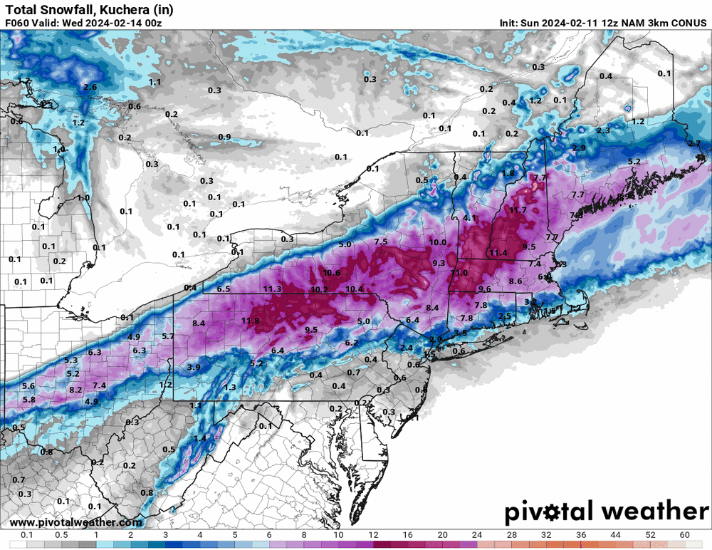
E PA/NJ/DE Winter 2023-2024 OBS/Discussion
Hurricane Agnes replied to The Iceman's topic in Philadelphia Region
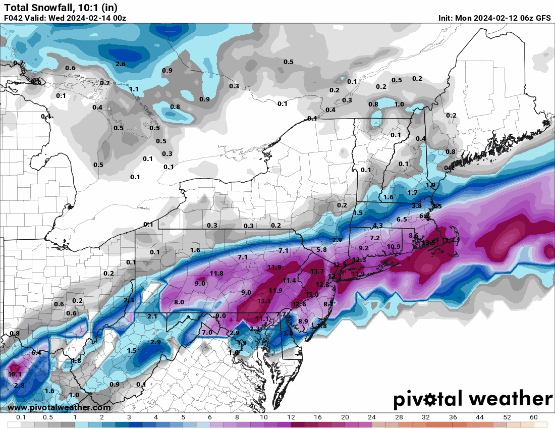
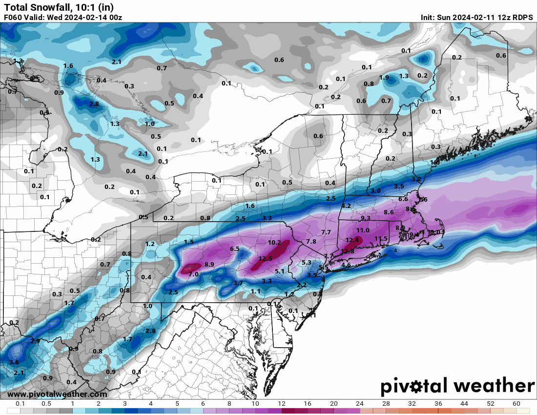
The 12z 3k NAM really came in north in terms of drying up the south (more than the 12k).
-
E PA/NJ/DE Winter 2023-2024 OBS/Discussion
Hurricane Agnes replied to The Iceman's topic in Philadelphia Region
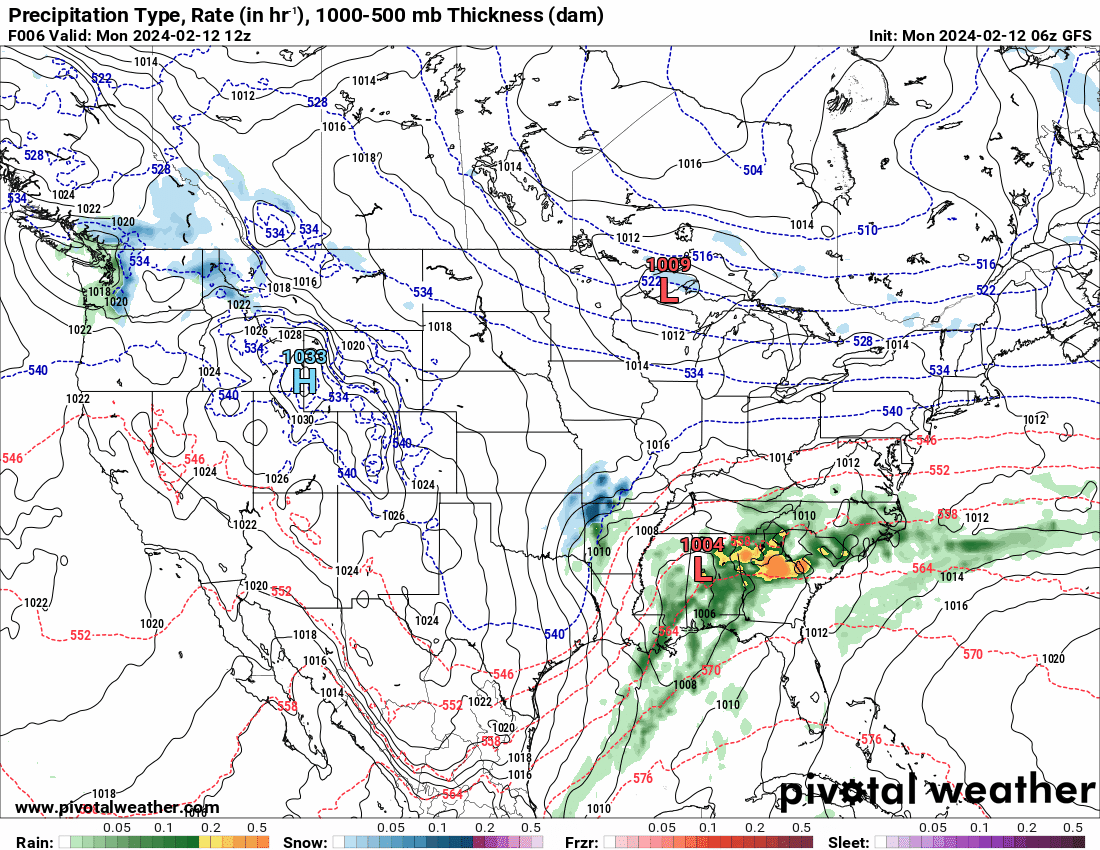
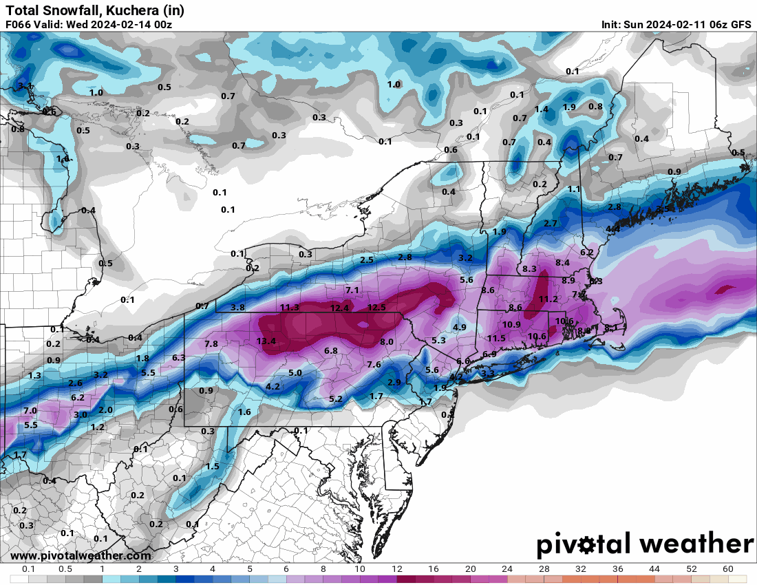
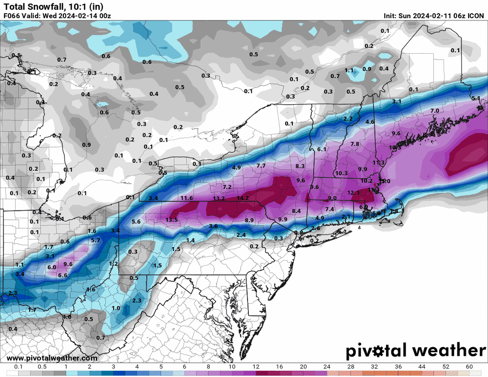
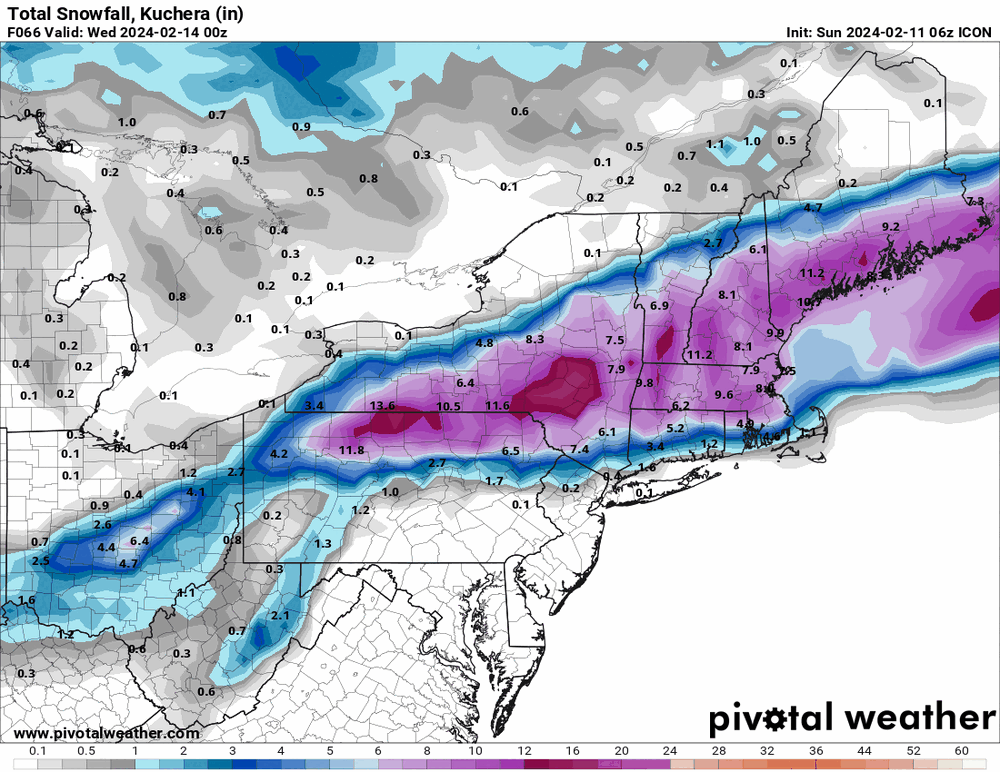
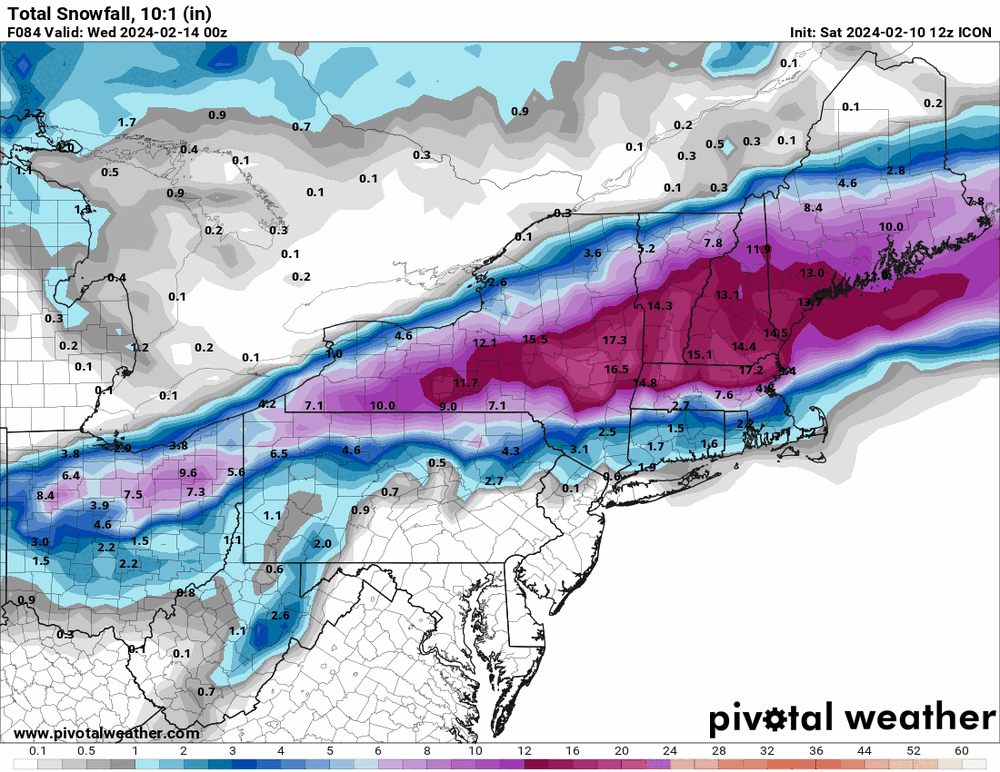
For completeness - 6z GFS & 6z ICON.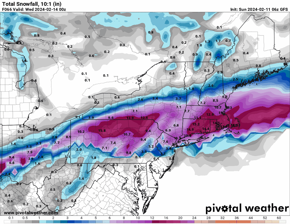
-
E PA/NJ/DE Winter 2023-2024 OBS/Discussion
Hurricane Agnes replied to The Iceman's topic in Philadelphia Region
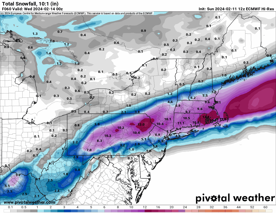
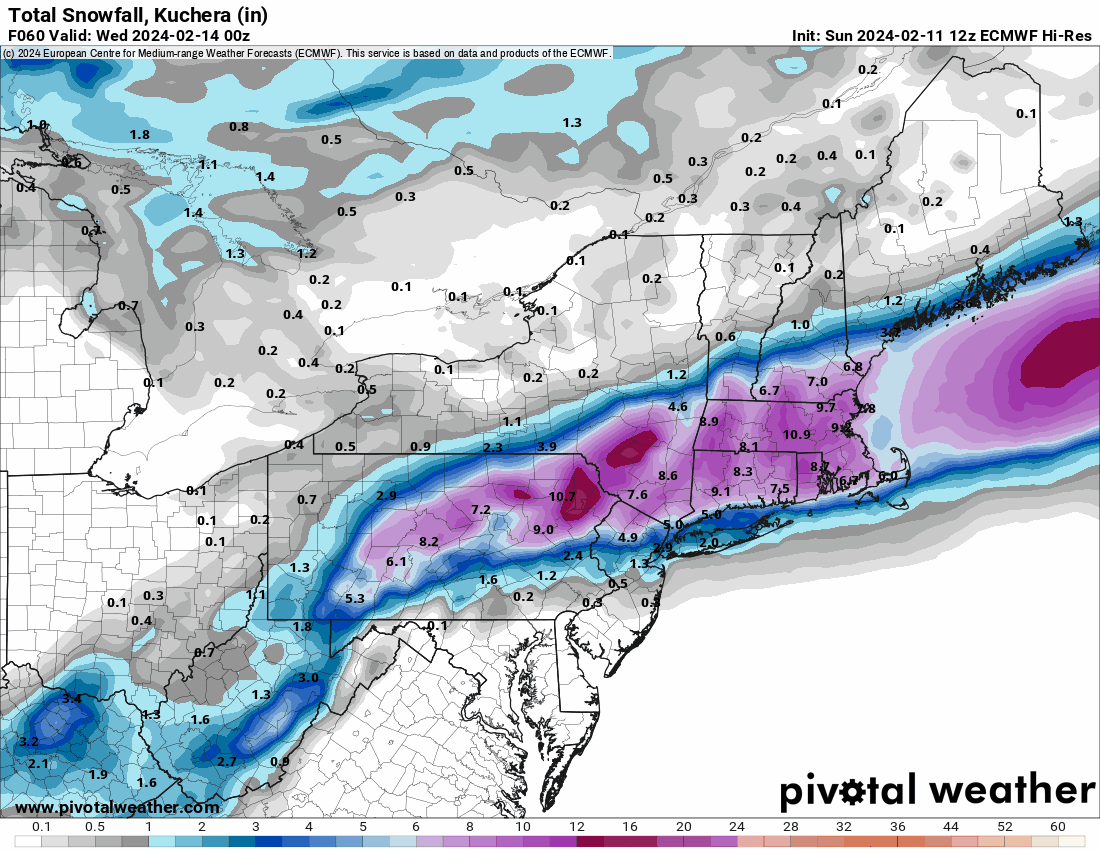
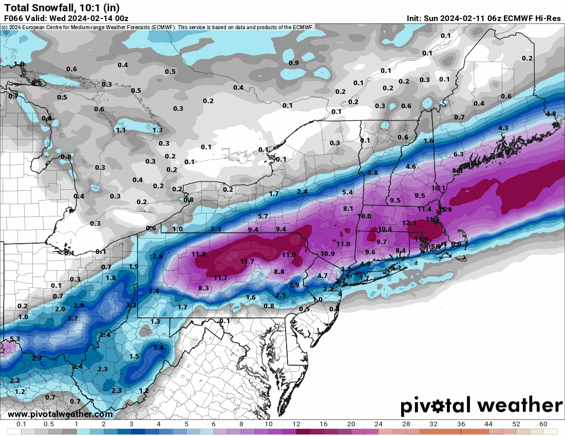
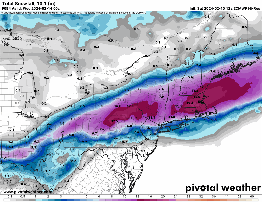
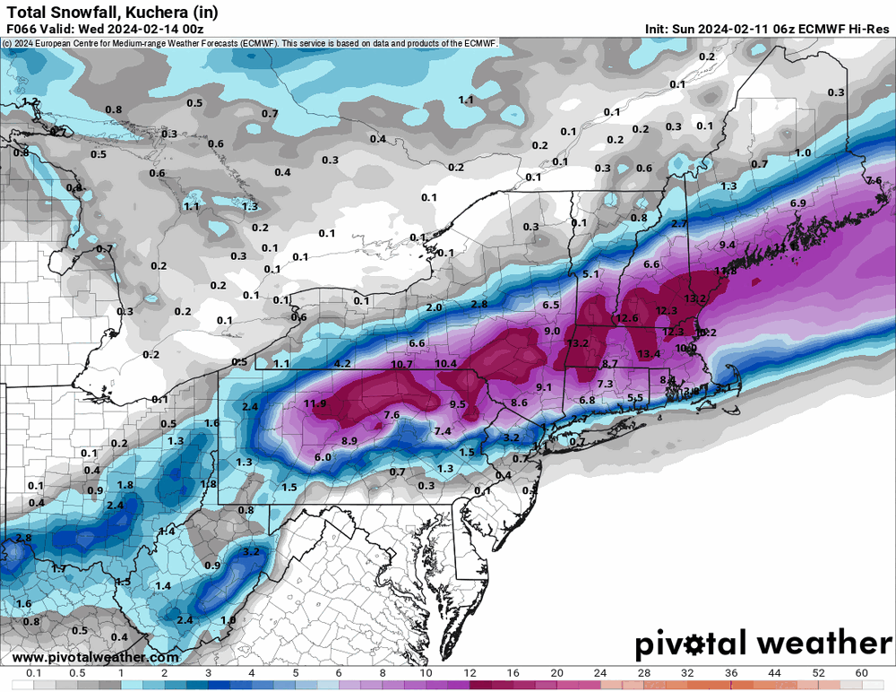
6z hi-res Euro.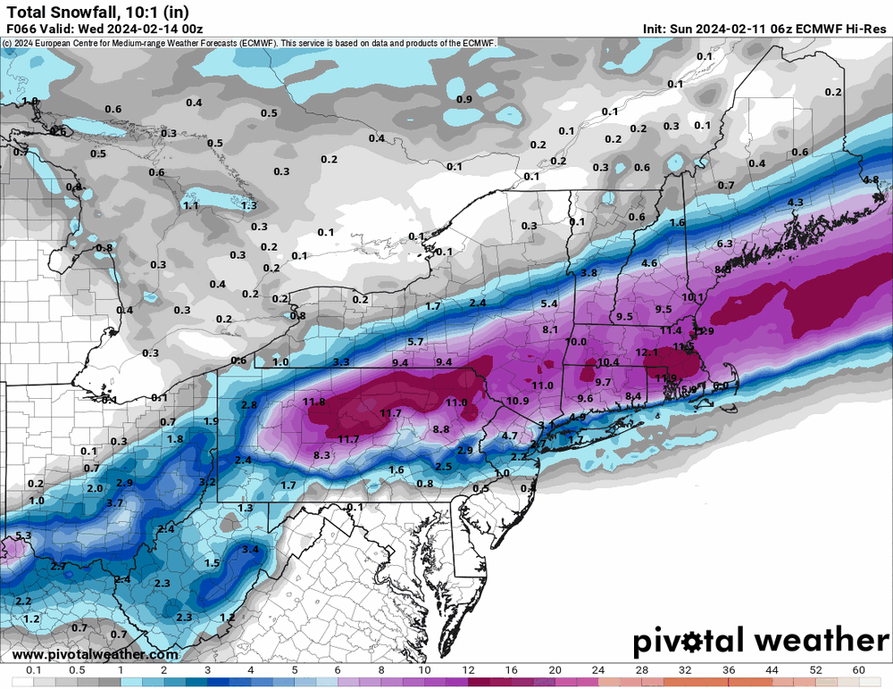
-
E PA/NJ/DE Winter 2023-2024 OBS/Discussion
Hurricane Agnes replied to The Iceman's topic in Philadelphia Region
6z NAM was more north than it had been before (it was a southern outlier). 6z EC is running.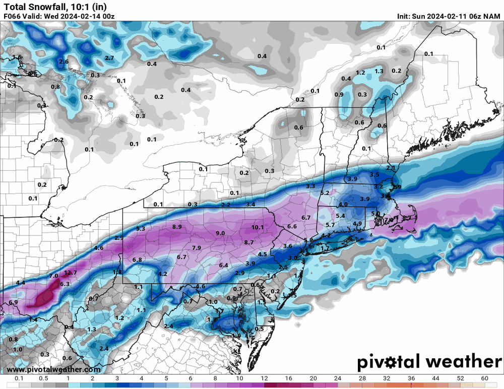
-
E PA/NJ/DE Winter 2023-2024 OBS/Discussion
Hurricane Agnes replied to The Iceman's topic in Philadelphia Region
18z Canadian seems to keep the same more-north theme. And as an obs - I bottomed out at 40 this morning and made it up to 55 as a high. Currently 51 with dp 46.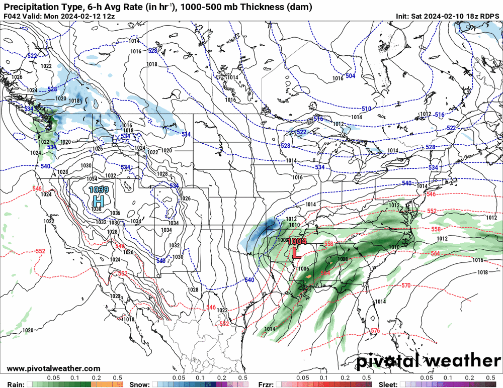


-
E PA/NJ/DE Winter 2023-2024 OBS/Discussion
Hurricane Agnes replied to The Iceman's topic in Philadelphia Region
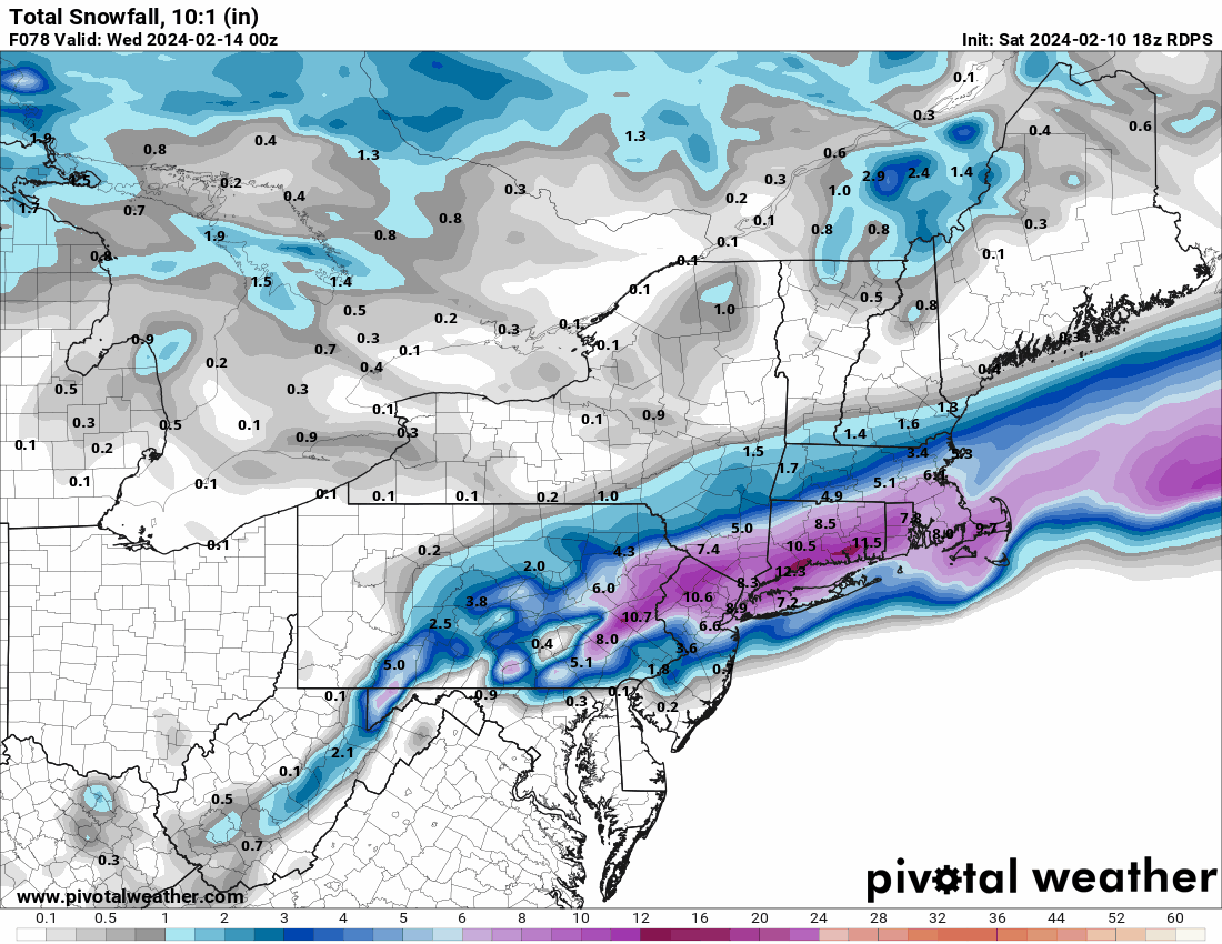
Mt. Holly's first call -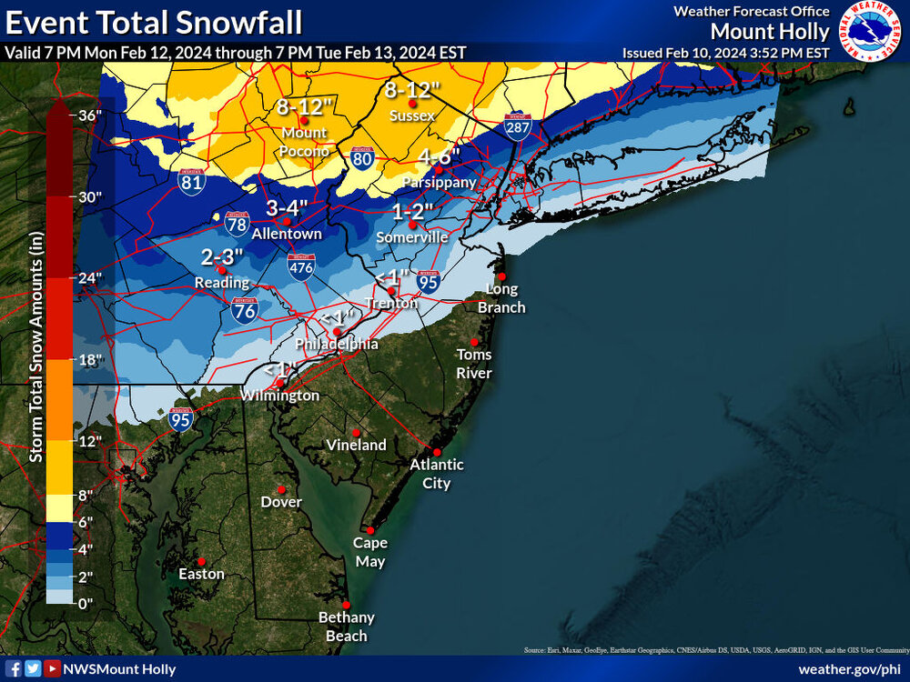
-
Philadelphia Historical Snowfall Data:
Hurricane Agnes replied to ncforecaster89's topic in Philadelphia Region
Thanks for posting! I was here for 7 of the 10 (missed #6 by a couple weeks because I was 2 weeks late being born according to my mom ). I still laugh with one of my sisters about the '66 blizzard when we had our snowsuits and Yogi Bear snow boots, with shovels ready to dig out the area in front of the garage at our first house. The summer of '66 was a hot one as a note (at least for back then - hit 104 at one point which I think still stands as the 2nd highest ever recorded in Philly to date). My mom was pregnant with my little sister at the time. -
E PA/NJ/DE Winter 2023-2024 OBS/Discussion
Hurricane Agnes replied to The Iceman's topic in Philadelphia Region
18z NAM came a little further north and east than the 12z (closer to the EC & GFS).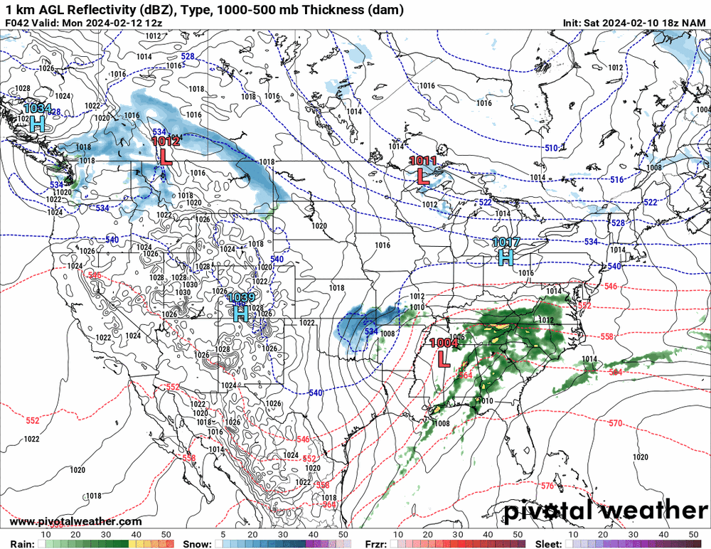
-
E PA/NJ/DE Winter 2023-2024 OBS/Discussion
Hurricane Agnes replied to The Iceman's topic in Philadelphia Region
I'm waiting for the 12z of that (for today) to run. But here's the 12z CMC (only a tad bit better than the ICON ).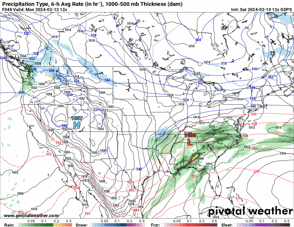
-
E PA/NJ/DE Winter 2023-2024 OBS/Discussion
Hurricane Agnes replied to The Iceman's topic in Philadelphia Region
The whole Philly board would be like -->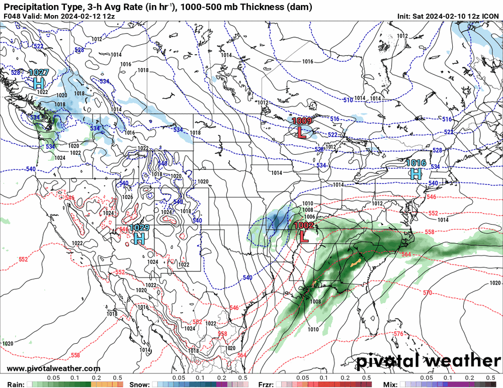
-
E PA/NJ/DE Winter 2023-2024 OBS/Discussion
Hurricane Agnes replied to The Iceman's topic in Philadelphia Region
13z NBM sortof ignores the massive precip. and cuts it all in half. lol
-
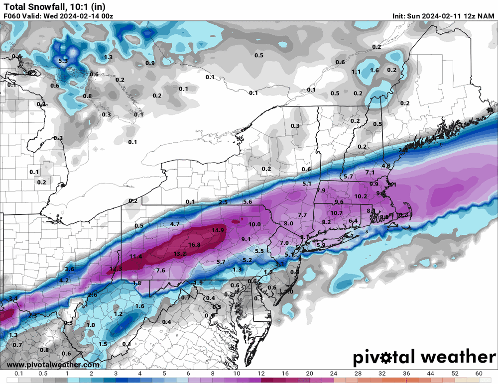
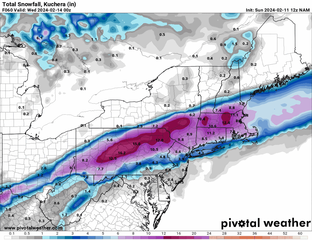
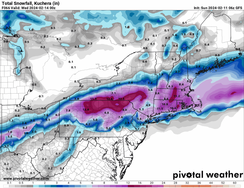
E PA/NJ/DE Winter 2023-2024 OBS/Discussion
Hurricane Agnes replied to The Iceman's topic in Philadelphia Region


-
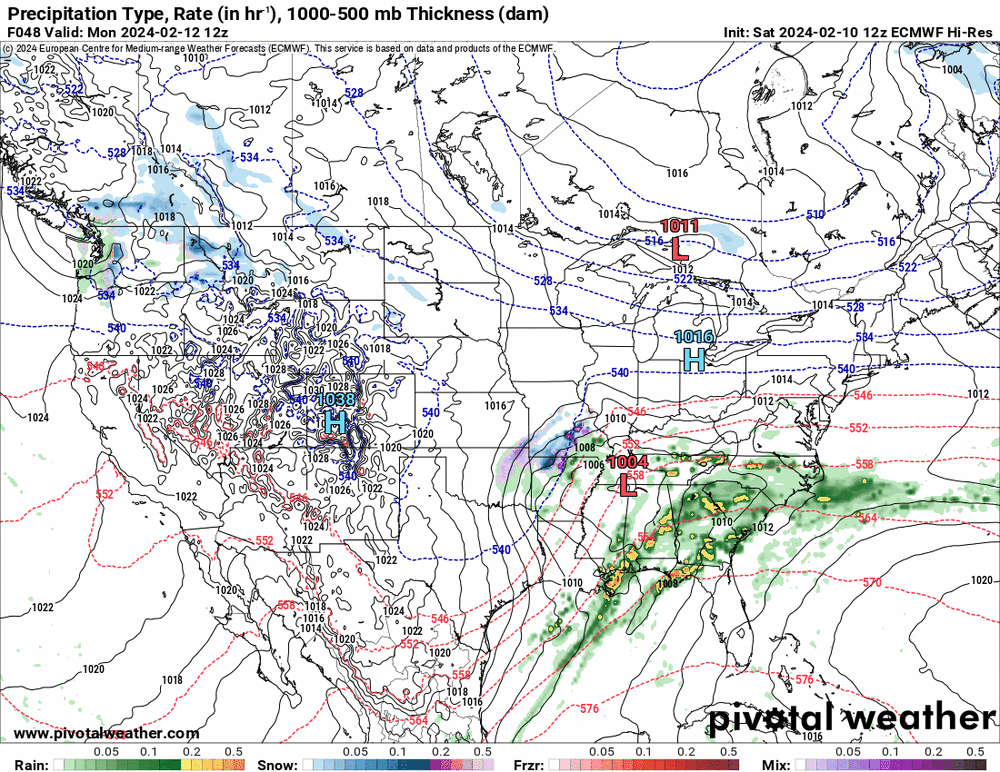
E PA/NJ/DE Winter 2023-2024 OBS/Discussion
Hurricane Agnes replied to The Iceman's topic in Philadelphia Region
12z hi-res EC looks to be following the northerly trend of the GFS.