Hurricane Agnes
-
Posts
9,261 -
Joined
Content Type
Profiles
Blogs
Forums
American Weather
Media Demo
Store
Gallery
Everything posted by Hurricane Agnes
-
Have been getting very light rain the past hour or so - enough to wet the walks but not enough to tip the bucket. Temp is 45 with dp 38. Had made it up to 49 for a high with a 36 low. Am concerned with icing over tomorrow night if it drops just below freezing here.
-
WWA just got extended down to the next tier of counties to including Philly & Delco.
-
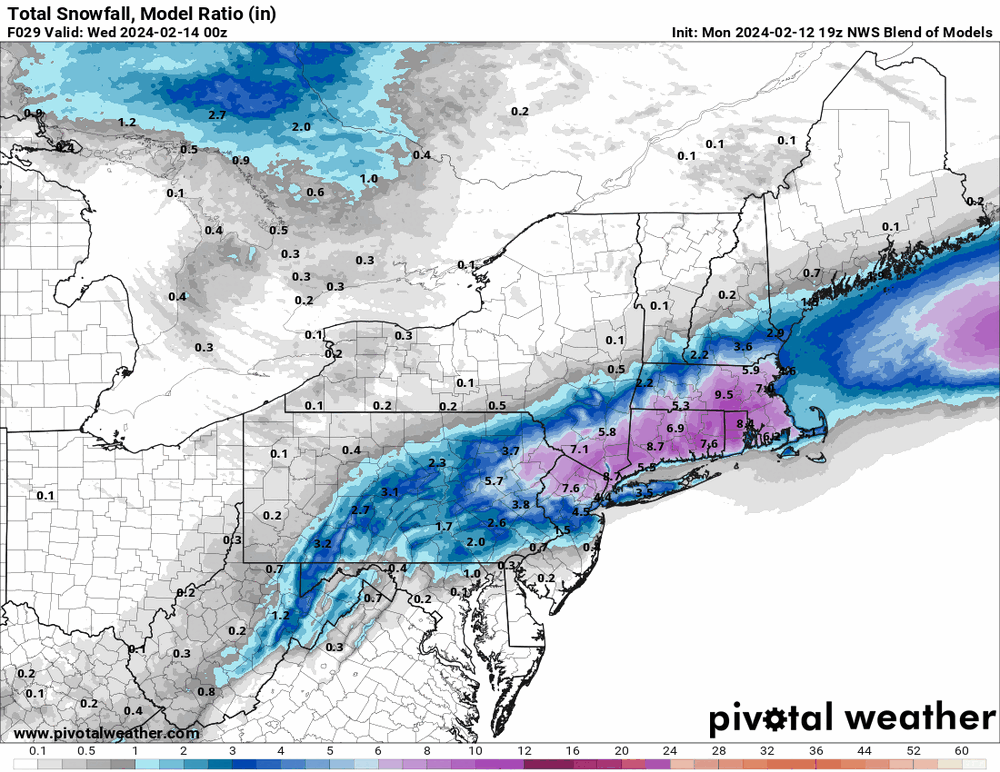
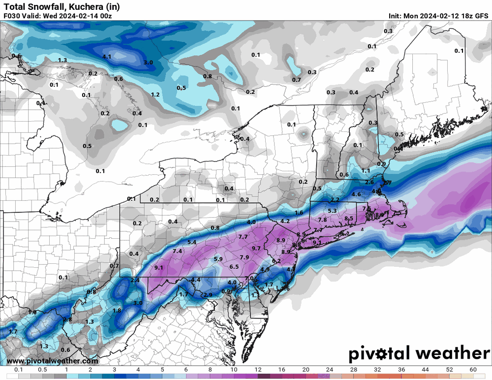
19z NBM (sort of dismisses the globals possibly overdoing it). An issue here is that we don't have that antecedent cold air and are relying on something to churn into oblivion to manufacture and/or pull cold air down from the north.
-
-
Exactly what my Wydmoor sis said to me about an hour ago when I gave her a warning... It's 48 here right now with dp 36 so it would be hard to justify a paste job.
-
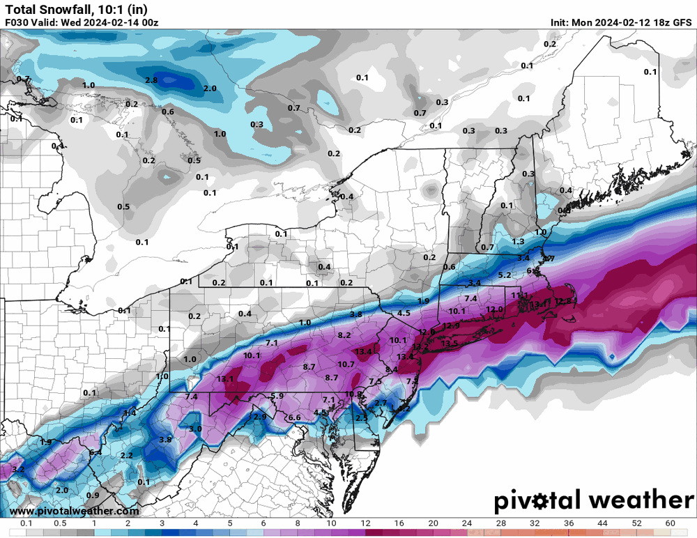
Put this in the other thread. Seems all the models have shifted the low a touch east over the past day or so.

-
E PA/NJ/DE Winter 2023-2024 OBS/Discussion
Hurricane Agnes replied to The Iceman's topic in Philadelphia Region
-
E PA/NJ/DE Winter 2023-2024 OBS/Discussion
Hurricane Agnes replied to The Iceman's topic in Philadelphia Region
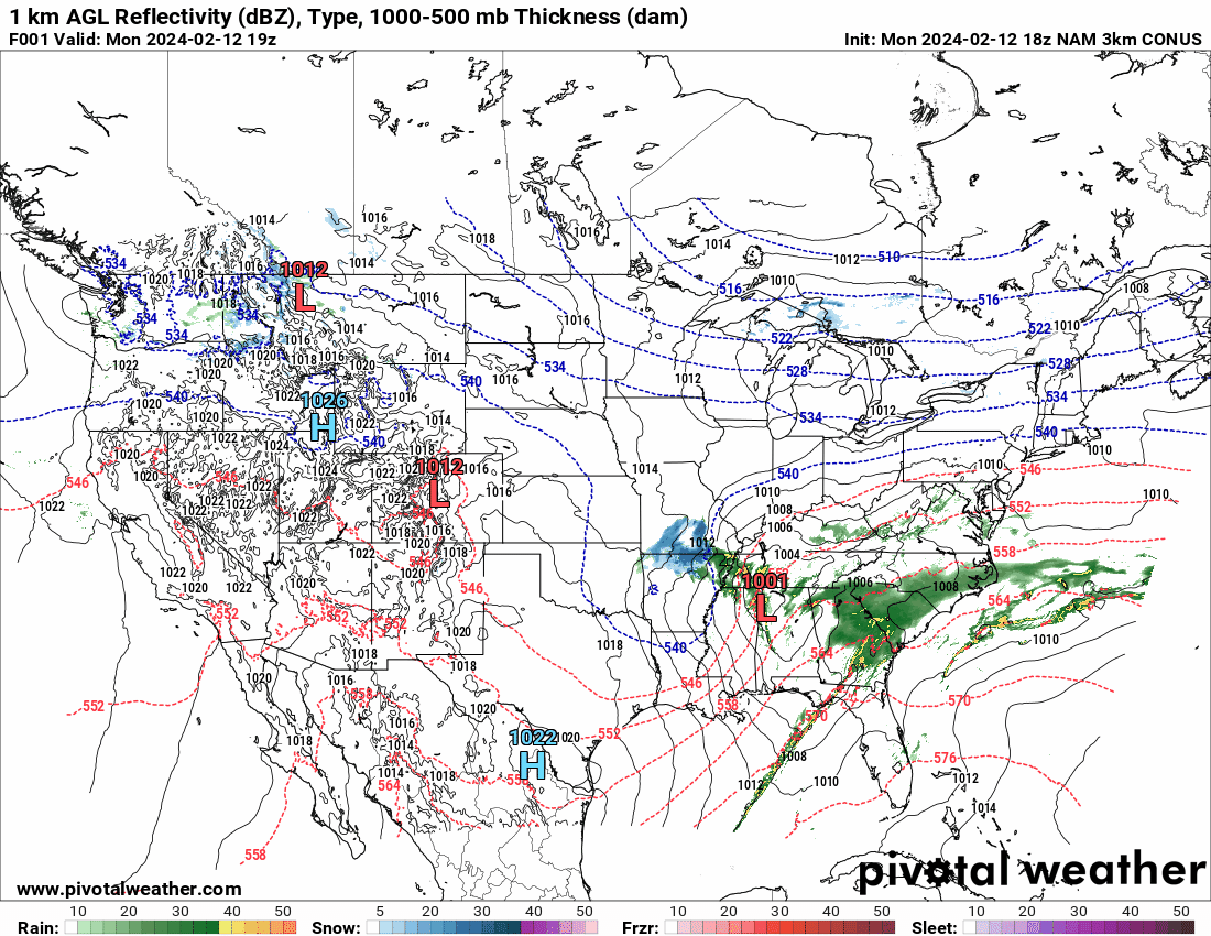
18z 3k NAM's s too!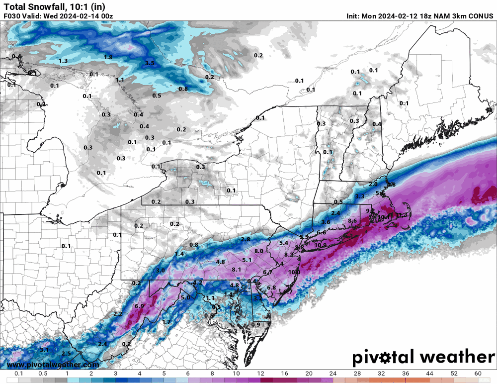
-
E PA/NJ/DE Winter 2023-2024 OBS/Discussion
Hurricane Agnes replied to The Iceman's topic in Philadelphia Region
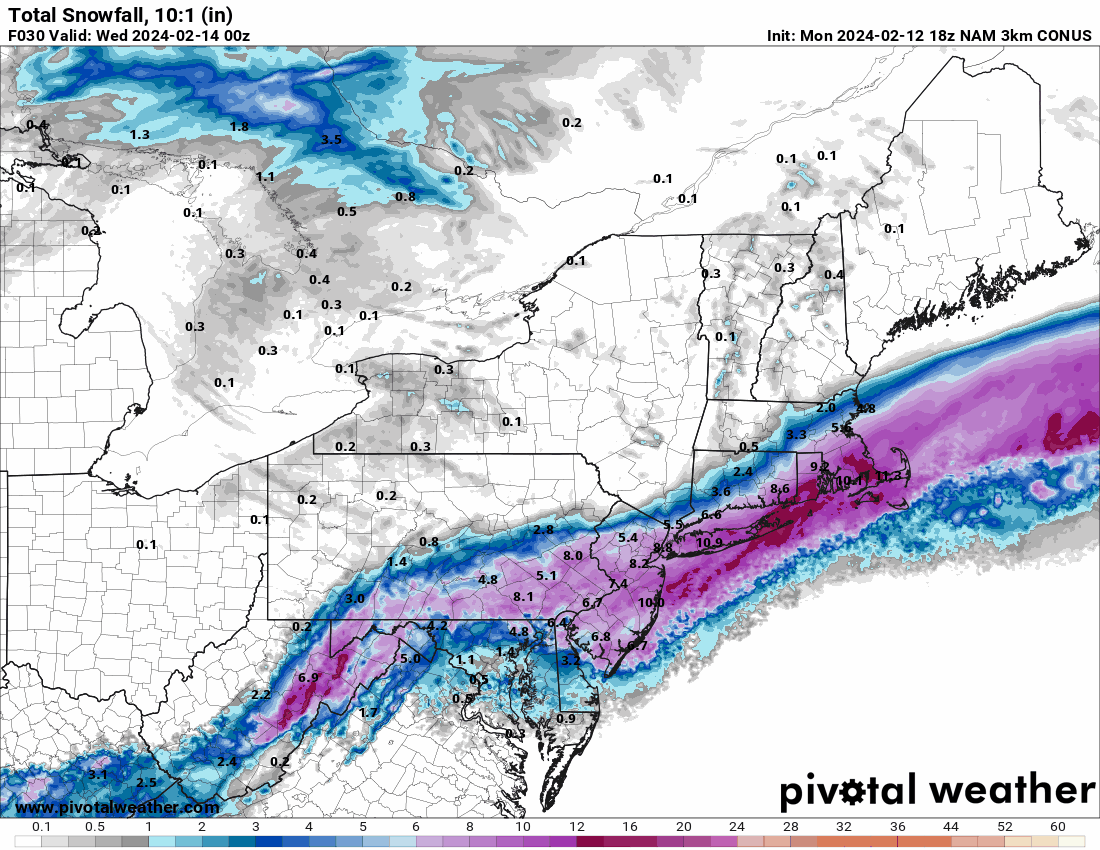
18z 12K NAM just NAM'd SE PA.

-
E PA/NJ/DE Winter 2023-2024 OBS/Discussion
Hurricane Agnes replied to The Iceman's topic in Philadelphia Region
13z NBM is reasonable.
-
E PA/NJ/DE Winter 2023-2024 OBS/Discussion
Hurricane Agnes replied to The Iceman's topic in Philadelphia Region
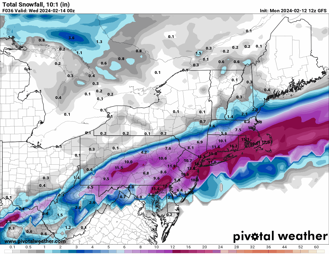
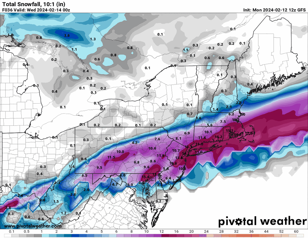
12z GFS seems to have that same idea of blowing up just off the coast although it looks a wee bit west from the 6z. I know the globals aren't really the best for the short range in any case.
-
E PA/NJ/DE Winter 2023-2024 OBS/Discussion
Hurricane Agnes replied to The Iceman's topic in Philadelphia Region
Just checking that out. Far western areas along the Appalachians. That positive tilt of moisture flow may become a fire hose. -
I know no one wanted to make a thread lest they jinx it but I think you guys up there have a better chance of avoiding the jinx! The sun was trying to pop out here earlier but am currently clouded over and 44, with dp 34. Don't expect to see anything until much later this evening but we shall see.
-
E PA/NJ/DE Winter 2023-2024 OBS/Discussion
Hurricane Agnes replied to The Iceman's topic in Philadelphia Region
I hate that imgur changed how they did that. I don't use imgur here but do use it at another site and you can still click on your image to get the bigger view and then right click that image and (depending on how the browser drop down menu words it) "open image in new tab" (if you use tabs), and it will display the image full size and will use the image's URL with the graphic's extension (".gif" or ".png" or ".jpg", etc). Then copy and past that link. -
E PA/NJ/DE Winter 2023-2024 OBS/Discussion
Hurricane Agnes replied to The Iceman's topic in Philadelphia Region
Since they may be using the same name for each iteration, you may have pulled up an older one. The current one has this - -
E PA/NJ/DE Winter 2023-2024 OBS/Discussion
Hurricane Agnes replied to The Iceman's topic in Philadelphia Region
Up in that northern tier of counties in the CWA, they can definitely brine and salt ahead of time as it has been progged (at least at the higher elevations and furthest north) to pretty much be all snow for the event. The next couple tiers down would be the mess. -
E PA/NJ/DE Winter 2023-2024 OBS/Discussion
Hurricane Agnes replied to The Iceman's topic in Philadelphia Region
I haven't bothered to even look at the NE forum but I expect they are celebrating. As a quick obs - I bottomed out above freezing at 39 this morning and am currently at 42 with dp 33. -
E PA/NJ/DE Winter 2023-2024 OBS/Discussion
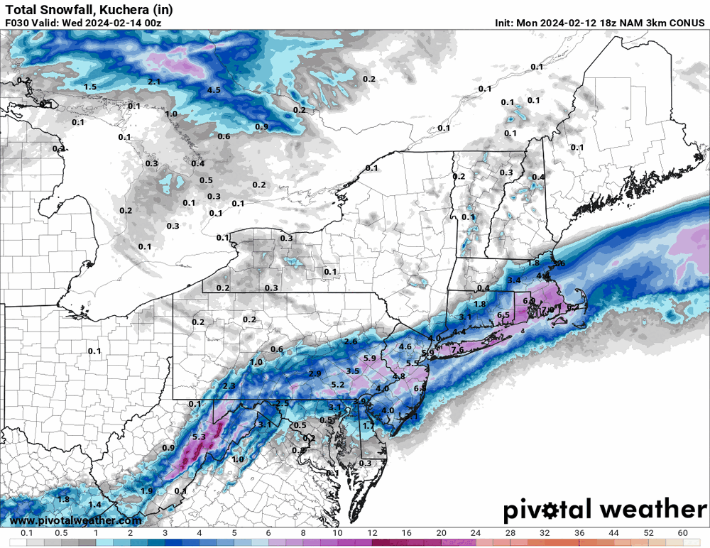
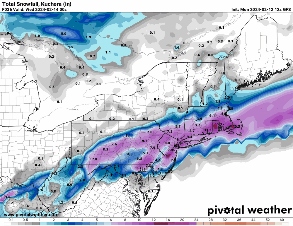
Hurricane Agnes replied to The Iceman's topic in Philadelphia Region
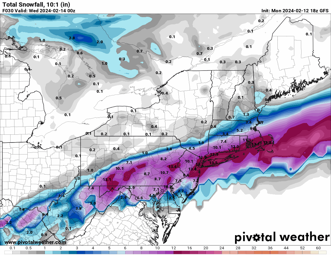
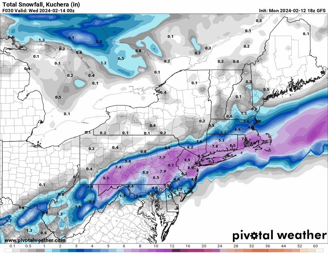
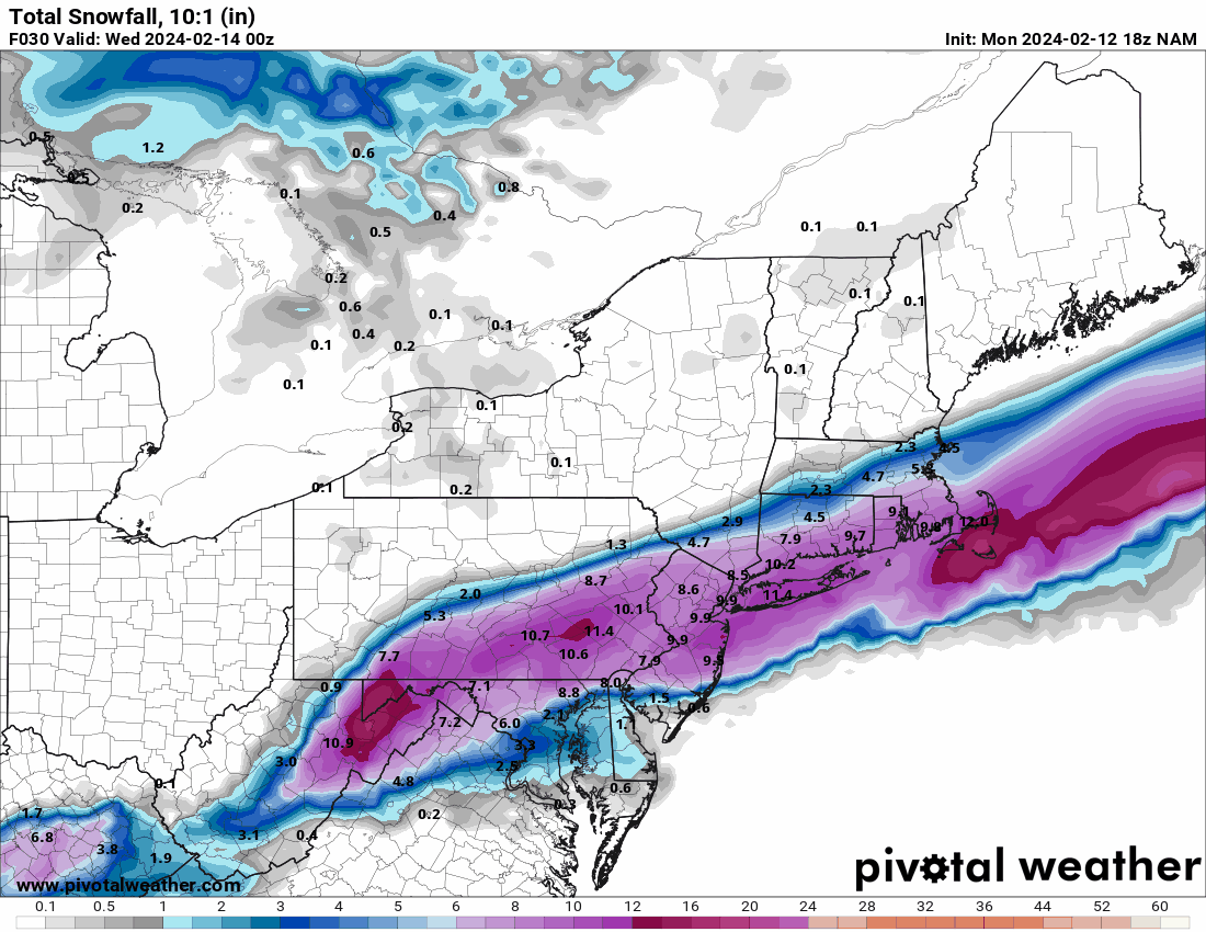
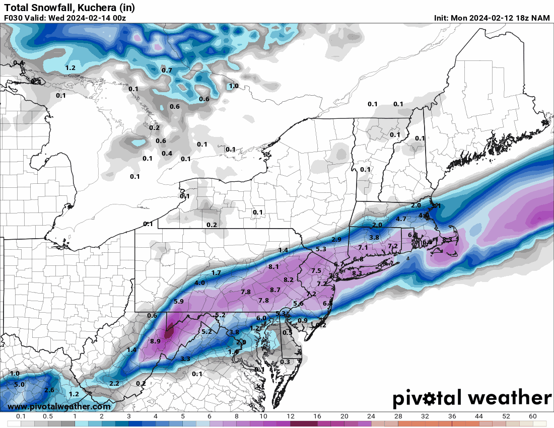
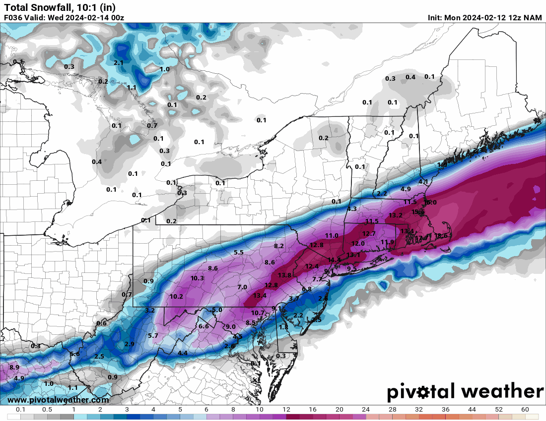
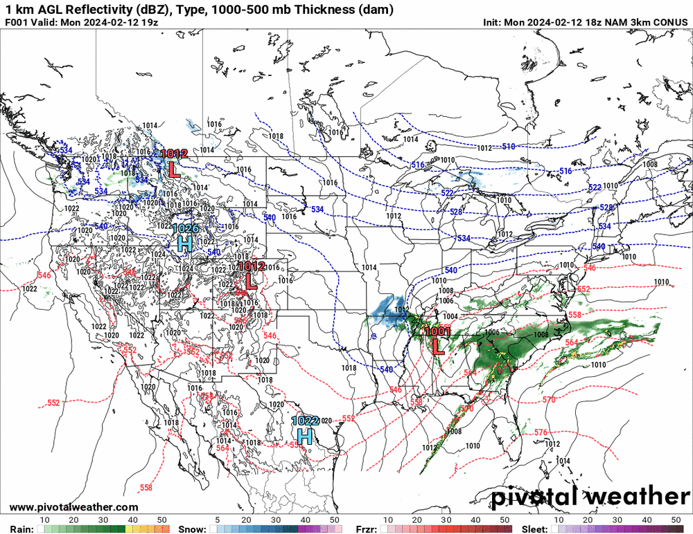
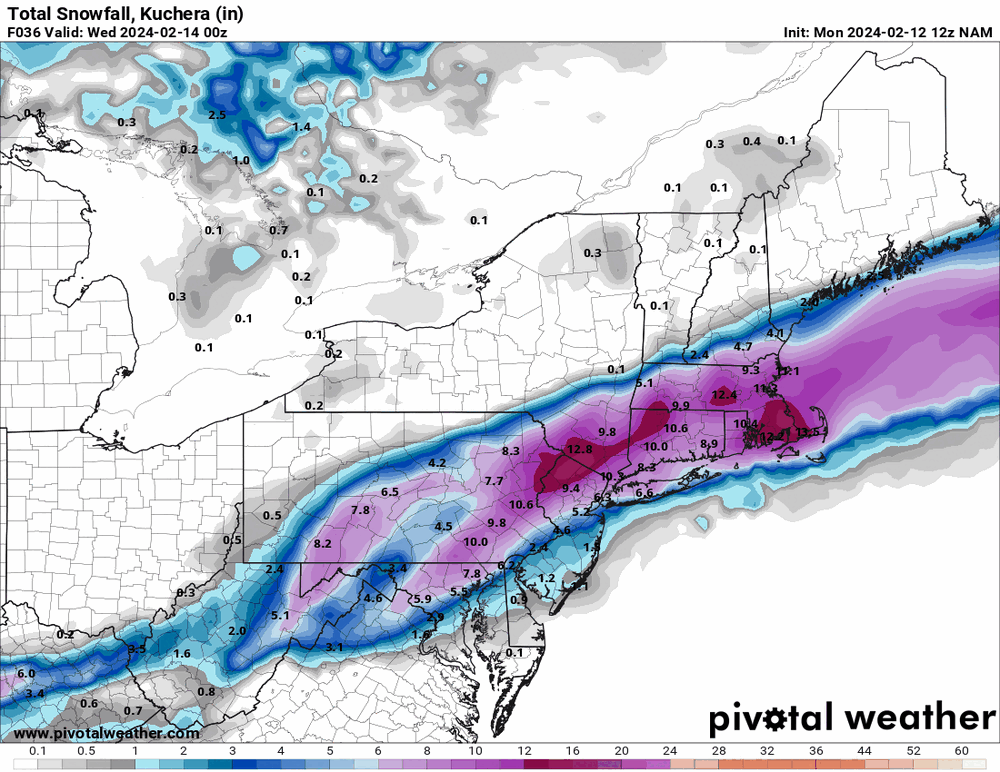
12z 3k NAM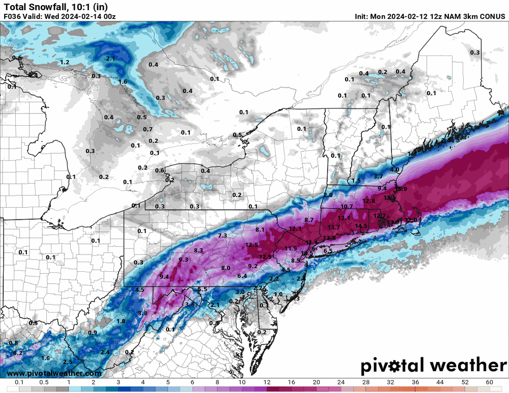
-
E PA/NJ/DE Winter 2023-2024 OBS/Discussion
Hurricane Agnes replied to The Iceman's topic in Philadelphia Region
-
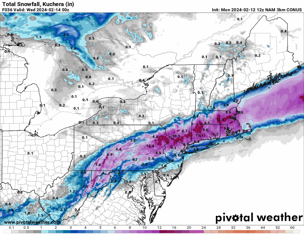
E PA/NJ/DE Winter 2023-2024 OBS/Discussion
Hurricane Agnes replied to The Iceman's topic in Philadelphia Region
It (at least the 12k) still brings more further south. But the LV / I-78 and north has always been persistent with all of the models. ETA - RedSky would like this...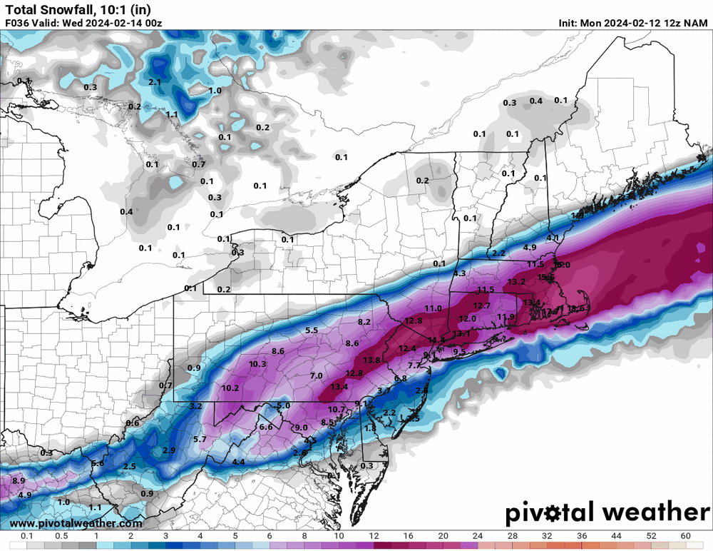
-
E PA/NJ/DE Winter 2023-2024 OBS/Discussion
Hurricane Agnes replied to The Iceman's topic in Philadelphia Region
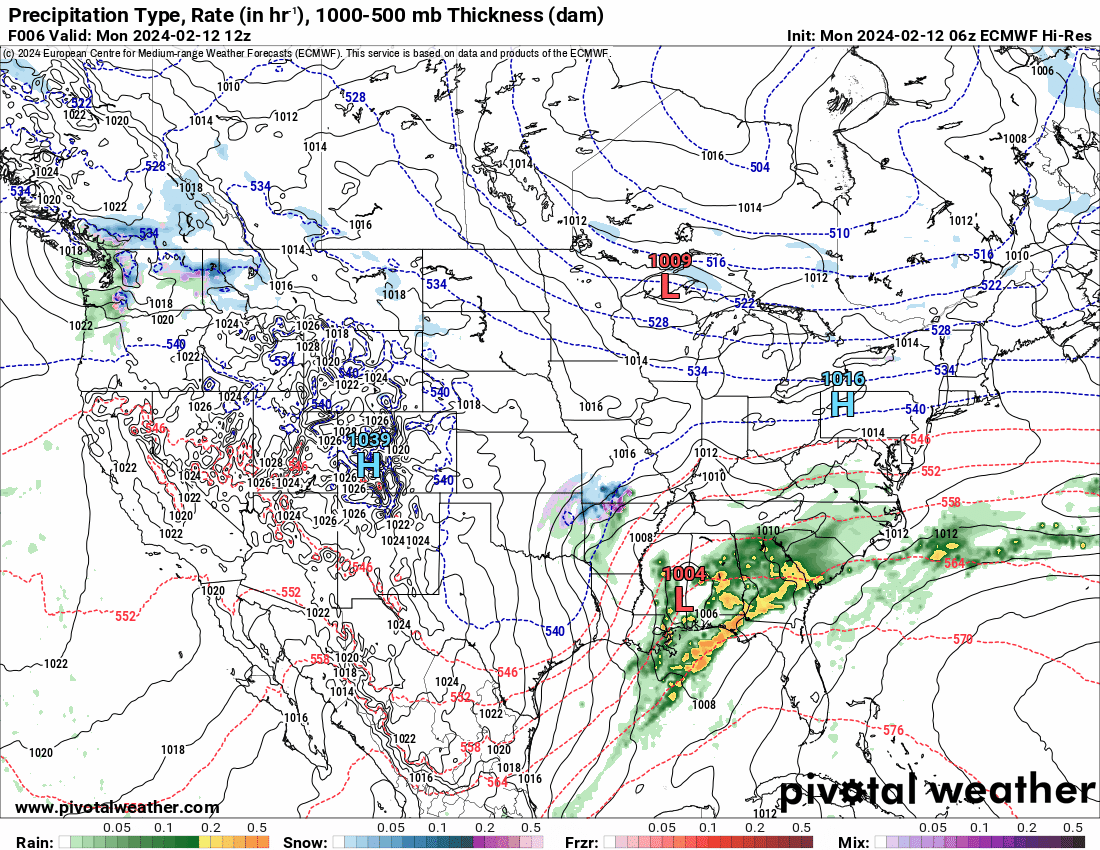
12z NAM is running so will see how that goes. -
LOL I just saw this trailer this morning - The trailer scenes almost look like a remake of the original "Twister" but I think this is supposed to be a sequel. Hard to believe it's been almost 30 years. I have the original on laserdisc and used to use it as one of my "demo" films for my early Dolby Digital 5.1 home theater back then (complete with subwoofer).
-
E PA/NJ/DE Winter 2023-2024 OBS/Discussion
Hurricane Agnes replied to The Iceman's topic in Philadelphia Region
6z EC seems to be matching the 6z GFS, ticking the low a bit to the east off the coast.
-
E PA/NJ/DE Winter 2023-2024 OBS/Discussion
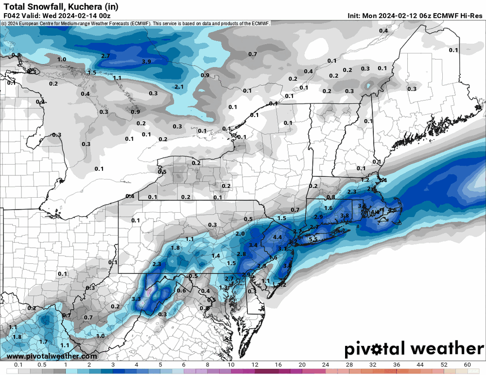
Hurricane Agnes replied to The Iceman's topic in Philadelphia Region
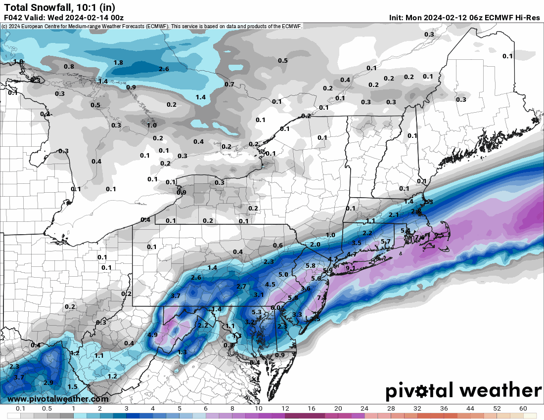
6z hi-res EC has moved south.
-
E PA/NJ/DE Winter 2023-2024 OBS/Discussion
Hurricane Agnes replied to The Iceman's topic in Philadelphia Region
Up your way has definitely been in the target zone for days now. It's a matter of how much.