Hurricane Agnes
-
Posts
9,263 -
Joined
Content Type
Profiles
Blogs
Forums
American Weather
Media Demo
Store
Gallery
Everything posted by Hurricane Agnes
-
I got into them thanks to a book that I ordered with the monthly book order thing they did while I was in middle school! My mom was 9 when that came out and she said her generation was enamored by the fact that half the film was "in color". Hell many of us grew up with TV shows that had the opening of "in color" on the screen to let you know that the show was actually "in color" (if you even had a color TV).
-
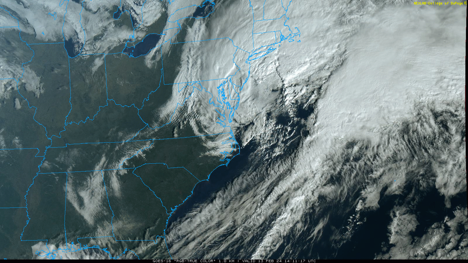
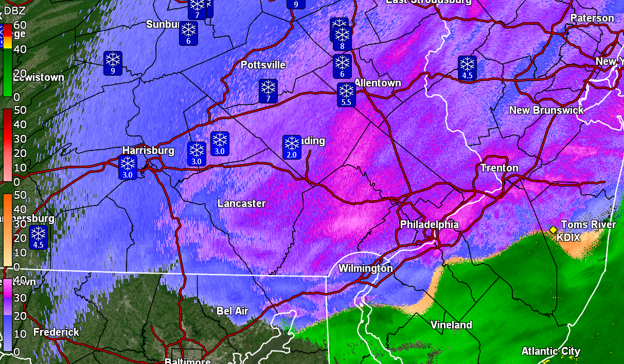
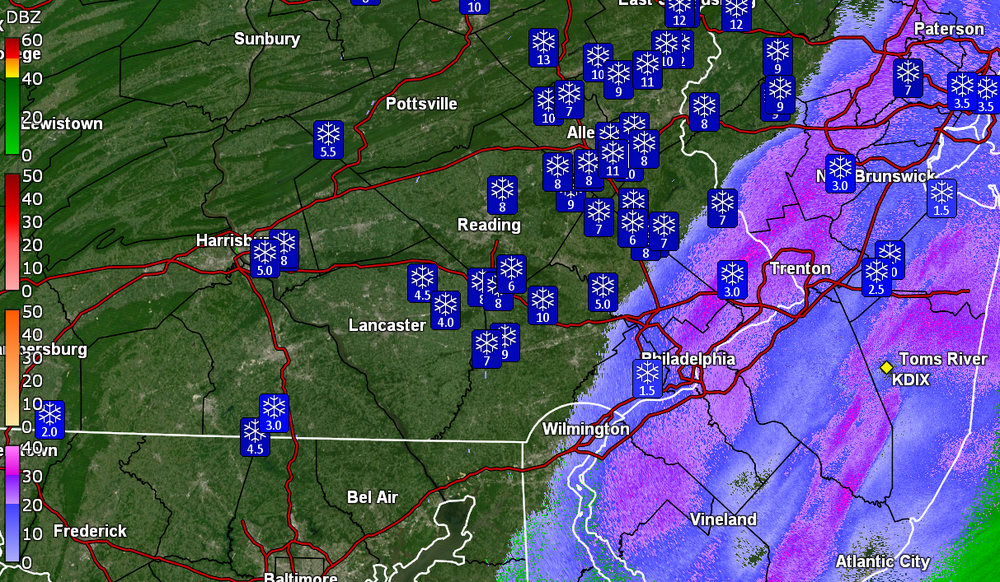
Have been under one of the stronger pivot bands with some SN+ and pancake flakes. Back edge is approaching though. Temp 33 with dp 32. That sucker wants to bomb out!
-
You can see how/where it will pivot.
-
Still getting moderate snow here although not at the 1"/hr rate (probably closer to 1/3rd - 1/2" per hr). Temp is up to 33 with dp 32.
-
Yeti has awoken! I still think you are in the pivot area.
-
Looks like Central Montco & Bucks up into Hunterdon county, NJ and NE, are are in the pivot zone. My cousin up in West Orange, NJ (Essex County) just texted pics of the snow up her way.
-
Still have SN but smaller flakes/lighter intensity. Did measure the board about 8:45 am and have 2.5". The transition started about 6:30 with pingers mixing with rain, then white rain, and by 6:50, it was full on snow. So this averaged a bit over 1"/hr rates. Temp has been holding right at 32 with dp 32.
-
Was briefly under a heavier streak and getting fatties mixed in. It's wet stuff too that has plastered the trees and shrubs and although it looks pretty, it could cause some concerns with power lines if the winds really pick up. Am watching the pivot. Currently SN (vis is up now) and 32 with dp 32.
-
KYW's Jim Melwert reported that he was on Rt. 29 (and a notorious hill), near 422 and traffic is stuck.
-
KYW's Tim Jimenez has been in Doylestown (including along 202) and noting the streets were all snow-covered with a couple inches that have fallen already. It's also apparently snowing heavily downtown Philly.
-
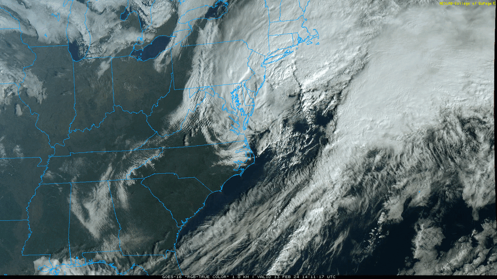
Latest Mt. Holly tweet/X -
-
I'm at the eastern fringe of that but the rates have picked up here with vis < 1/4 mile with snow and fog.
-
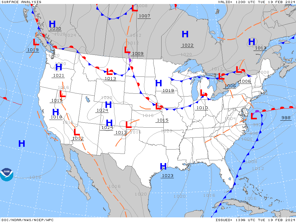
Had to see where the lows were. Already 993s. Am closing in on an inch now. Still 32 with dp 32.
-
My Upper Darby sis says she's under a heavier band. Still have SN and probably close to 1/2" here.

-
That's exactly what happened! The temp was already dropping near but still above freezing so surfaces had cooled and that thin sleet layer took it the rest of the way. Temp now at 32 IMBY with dp 32 and SN & fog.
-
KaPOW! Went from white rain/mix to SN, near SN+ here in NW Philly. Ended up with 0.48" in the bucket (0.53" 2-day total) and the accumulation is building quickly everywhere. Already have 1/4" coating on surfaces warm and cold! Temp still 33 with dp 32.
-
Getting white rain here in NW Philly now. There was enough pingers in the earlier rain to actually "dust" the cars with a layer of sleet. Temp is still holding at 33 with dp 32.
-
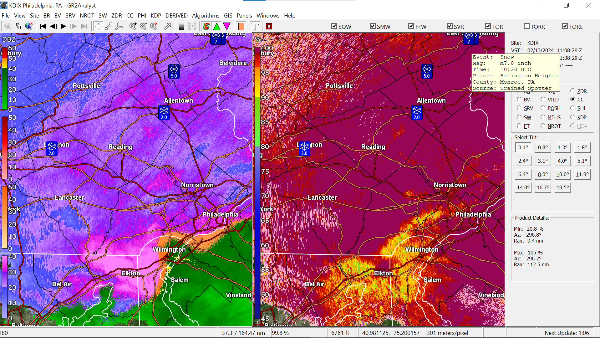
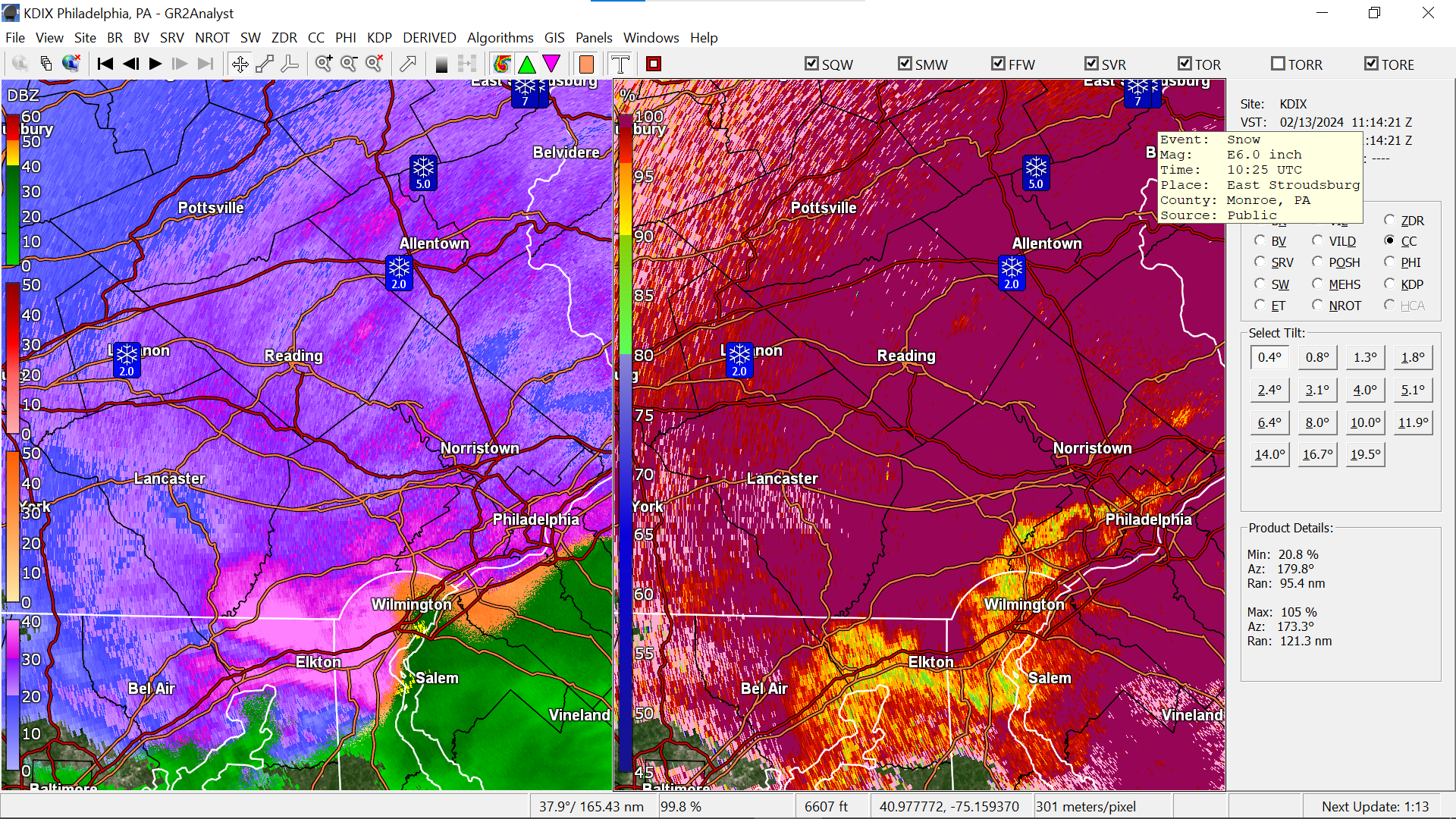
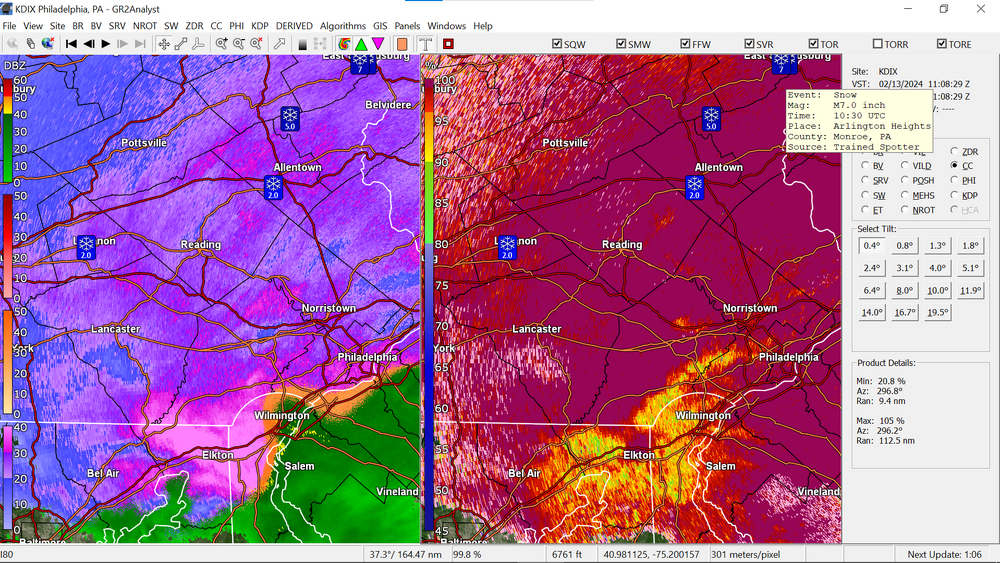
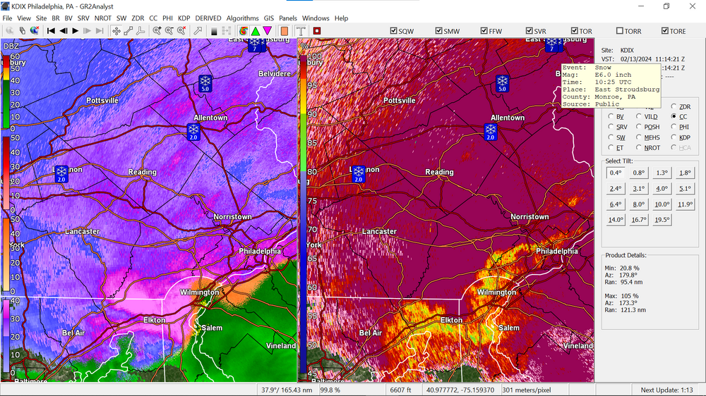
A spotter up that way reported 7". ETA and a closeby report from East Stroudsburg proper had 6".
-
My Upper Darby sis texted to say it is transitioning there and they closed the schools (was a delay but they decided to call it a day). She said they are getting sleet/ZR. The light rain had restarted here with a couple more hundredths and I can now barely hear the sound of some pingers mixed in. Now up to 0.47" (0.52" 2-day).
-
Bucket-tippable precip has ceased here in NW Philly at the moment. Last reaading was 0.44" (0.49" 2-day total so far). Am not seeing any flakes or getting any ip yet but the winds have picked up and are pretty persistent. Temp is 33 with dp 33.
-
Well at post time, I have 0.05" rain yesterday and 0.41" (total 0.46) this morning so far with light rain continuing but the R/S line getting close. Temp has fallen to 33. As a note that KYW has Tim Jimenz on the road who earlier reported a coating up in Quakertown and he has been working his way south and is near Souderton and seeing the snow.
-
Finally tipped the bucket with 0.01". Temp is 43 and dp 40 with light rain.
-
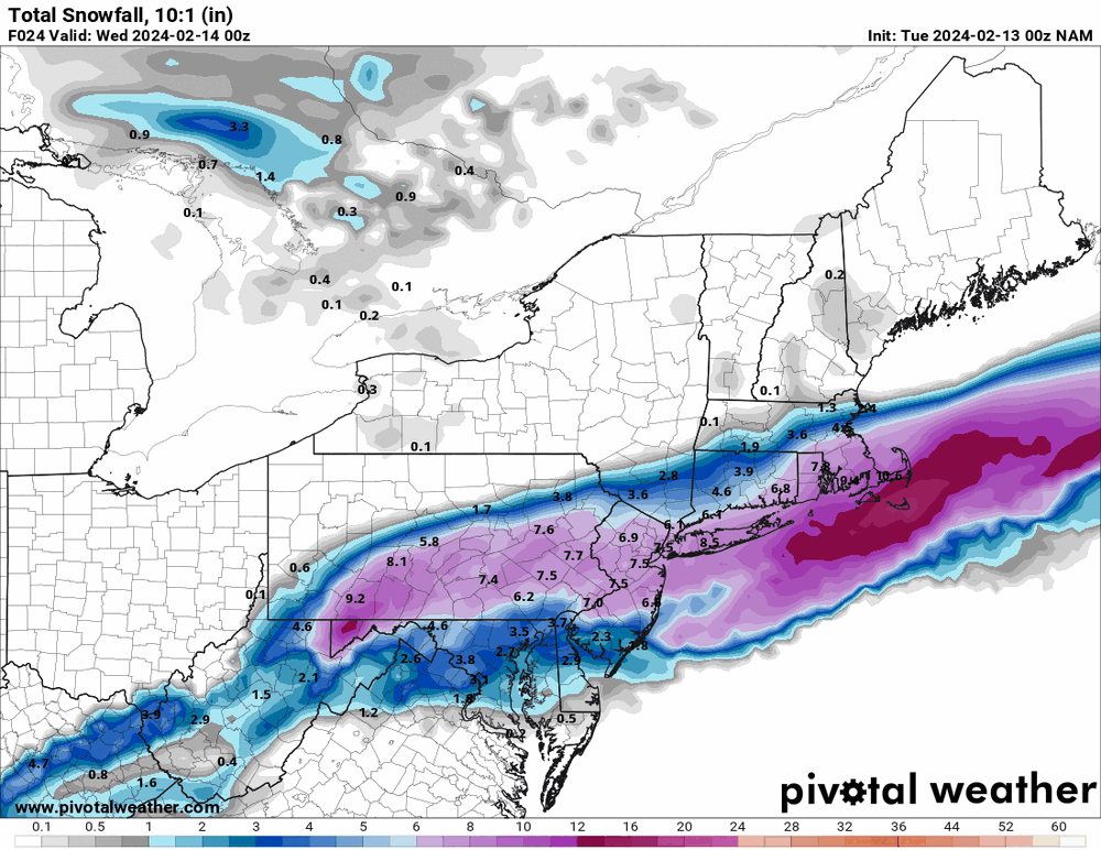
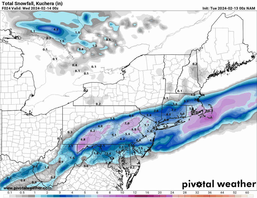
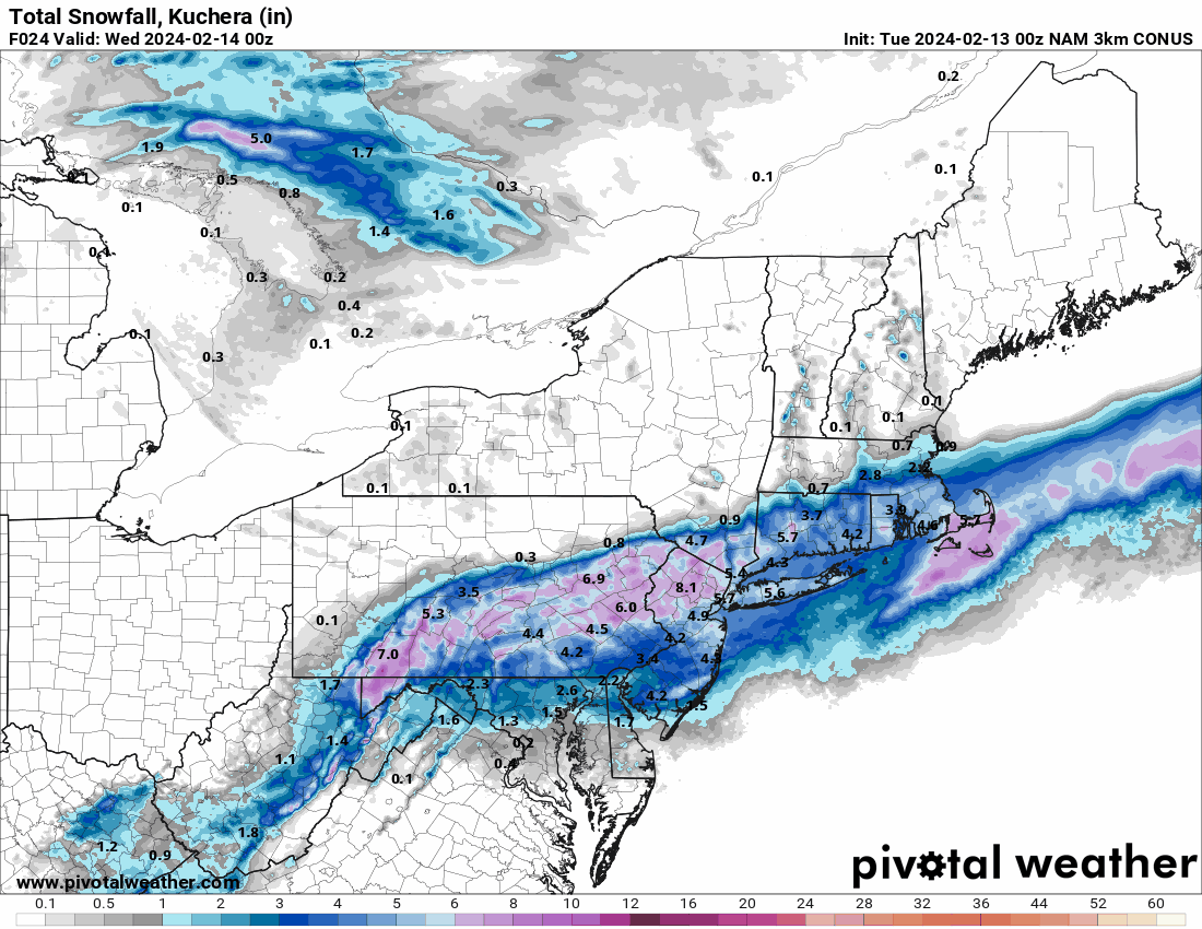
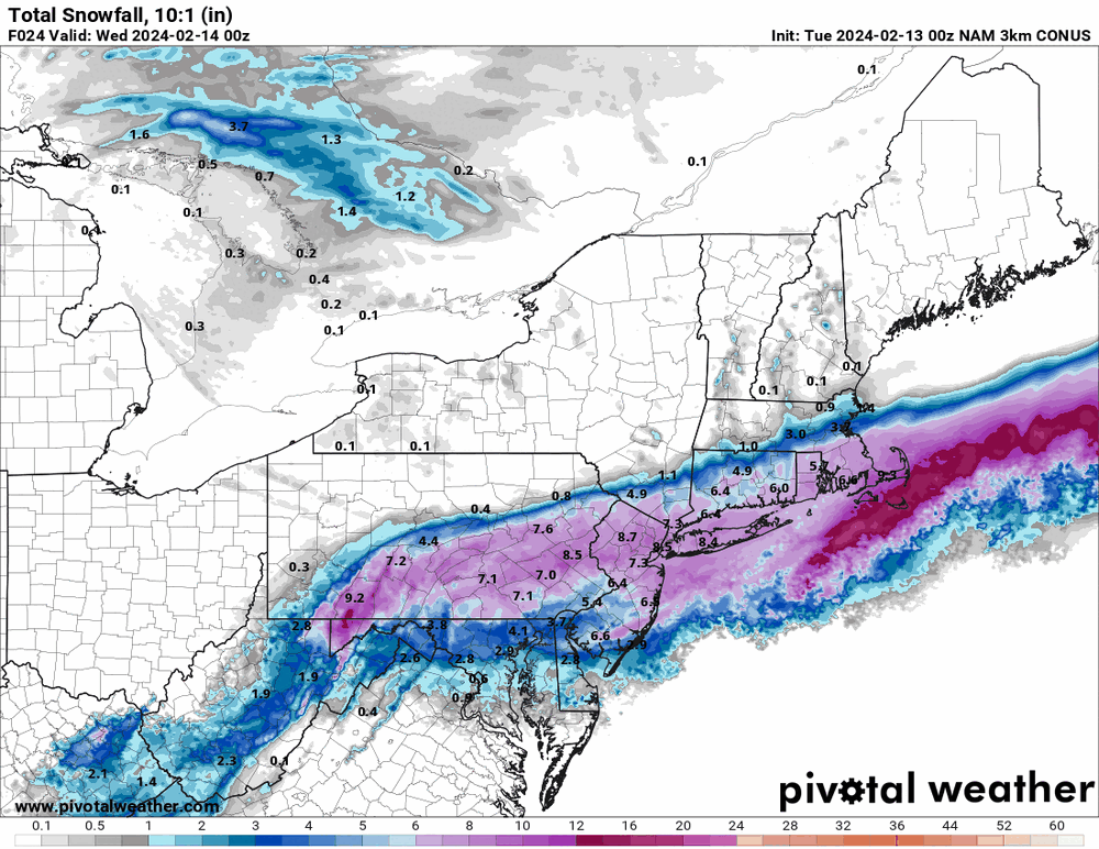
3k NAM still has the higher totals in the city.

-
But the 12k NAM verbatim is at (10:1 which won't be happening) or almost (Kuchera) getting to WSW criteria for the city.
-
0z 12k NAM is still NAMing south.