Hurricane Agnes
-
Posts
9,336 -
Joined
Content Type
Profiles
Blogs
Forums
American Weather
Media Demo
Store
Gallery
Everything posted by Hurricane Agnes
-
E PA/NJ/DE Summer 2024 Obs/Discussion
Hurricane Agnes replied to JTA66's topic in Philadelphia Region
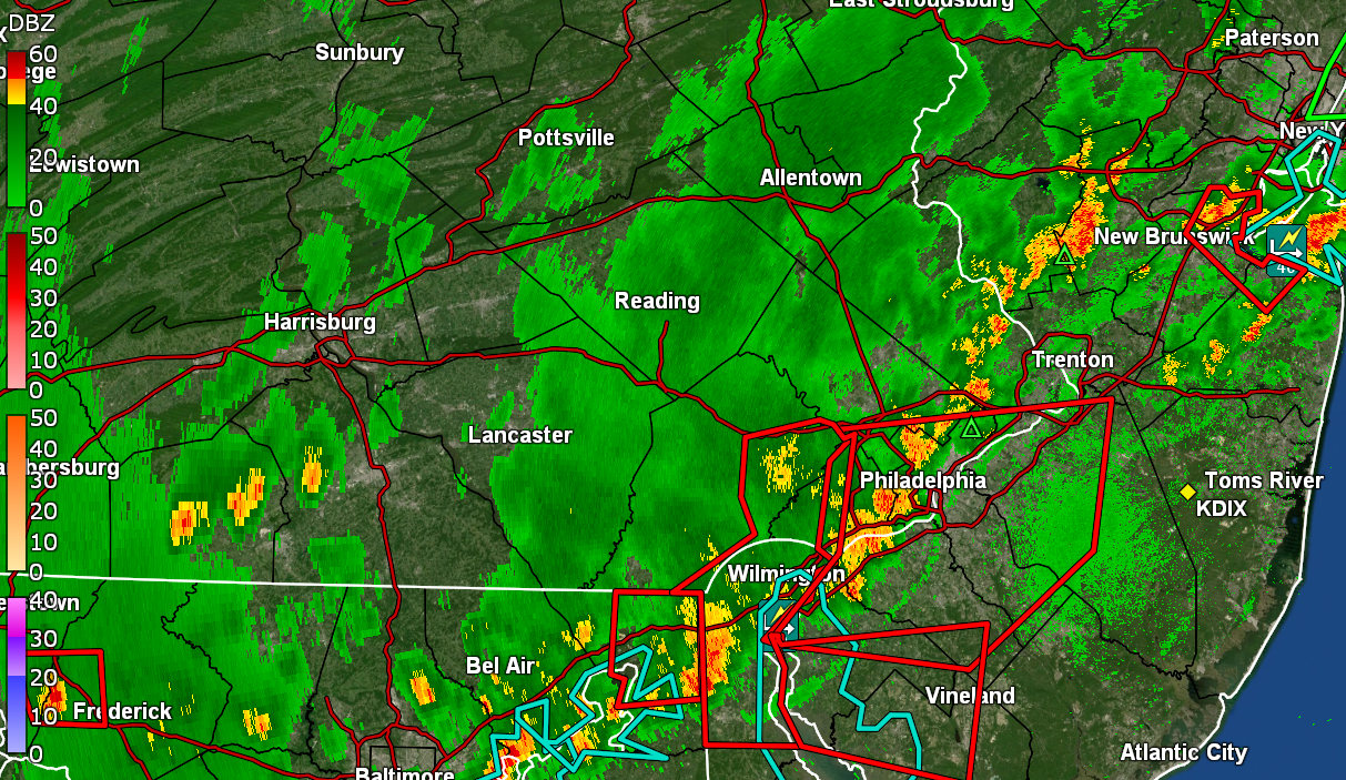
Ended up with an additional 0.14" for a 3-round 0.65" for Saturday, and a 2-day total of 0.72". The high yesterday topped off at 91 before the rains dropped the temp significantly. Currently 72 with dp 71. -
E PA/NJ/DE Summer 2024 Obs/Discussion
Hurricane Agnes replied to JTA66's topic in Philadelphia Region
Getting another round of light rain now and picked up a couple hundreds so far from that (0.51" total for the day). Temp 72 and dp 71. -
E PA/NJ/DE Summer 2024 Obs/Discussion
Hurricane Agnes replied to JTA66's topic in Philadelphia Region
Doesn't look like much measurable in the immediate future so finished up wtih 0.41" on top of 0..07" from midnight for 0.48" so far today. Did have some thunder finally a couple minutes ago. Looks like there is some more stuff back around Harrisburg but I don't know how much of that will survive its way east. Currently 72 and misty with dp 71. -
E PA/NJ/DE Summer 2024 Obs/Discussion
Hurricane Agnes replied to JTA66's topic in Philadelphia Region
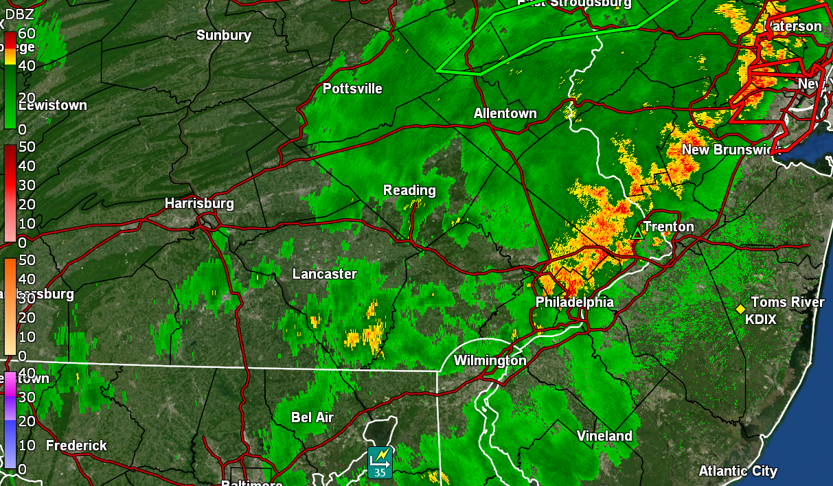
1.80"/hr rates with the back-build and 0.47" in the bucket (0.40" from round 2). Temp 74 and dp 72.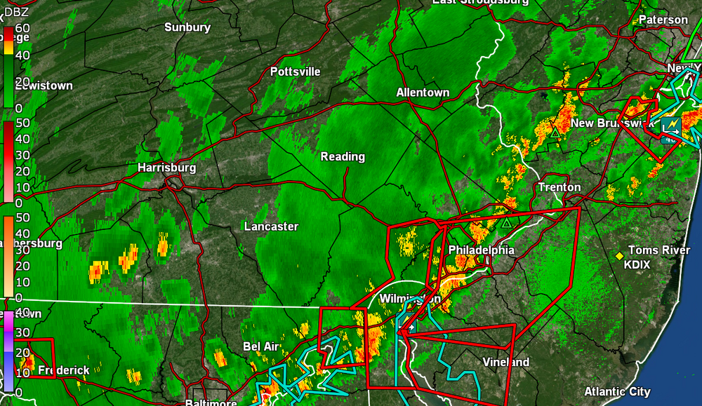
-
E PA/NJ/DE Summer 2024 Obs/Discussion
Hurricane Agnes replied to JTA66's topic in Philadelphia Region
Ooo... a blob just did a back-build over me. Getting some rain again.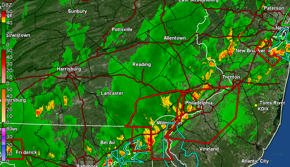
-
E PA/NJ/DE Summer 2024 Obs/Discussion
Hurricane Agnes replied to JTA66's topic in Philadelphia Region
It's fast moving and cools the air rapidly so the atmosphere seems to stabilize. Am down to 76 with dp 72 and still only 0.16" (total 2 rounds) in the bucket. -
E PA/NJ/DE Summer 2024 Obs/Discussion
Hurricane Agnes replied to JTA66's topic in Philadelphia Region
Getting warned now. Have about 1/2" per hour rates and 0.16" in the bucket (0.09" on top of the 0.07" from midnight). -
E PA/NJ/DE Summer 2024 Obs/Discussion
Hurricane Agnes replied to JTA66's topic in Philadelphia Region
A blob coalesced over me and am getting rain. Temp dropped down to 81 with dp 72 and getting convection (no audible thunder though).
-
E PA/NJ/DE Summer 2024 Obs/Discussion
Hurricane Agnes replied to JTA66's topic in Philadelphia Region
Line wants to fall apart down this way but hoping a couple blobs come over. It got real dark out with some nasty looking storm clouds! Current temp is 87 with dp 73 and breezy.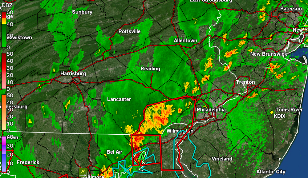
-
E PA/NJ/DE Summer 2024 Obs/Discussion
Hurricane Agnes replied to JTA66's topic in Philadelphia Region
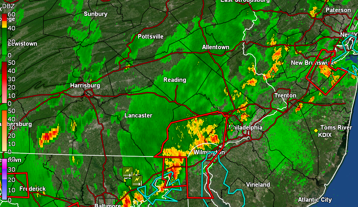
More Watches up (in addition to the Flood Watch) - I ended up getting a little more rain after midnight this morning - 0.07". I actually finished yesterday with 0.86" so have 0.93" over 2 days with more possibly on the way with that line that is out west. Low this morning was 74 and am currently at my high of 91 (day 4 of my current heatwave and I believe day 26 for 90+), with dp an awful 80.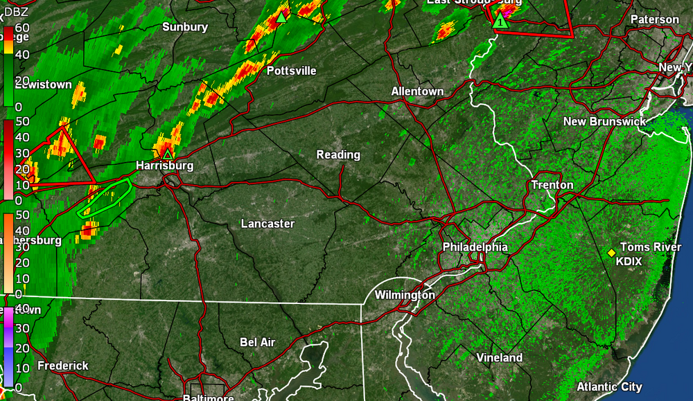
-
E PA/NJ/DE Summer 2024 Obs/Discussion
Hurricane Agnes replied to JTA66's topic in Philadelphia Region
Yeah looks like it's about done here and sky is brightening. Am seeing some epic outflow from that blob down by Wilmington. Unless something else bubbles up, looks like I finished with 0.85" and am glad. Supposed to possibly be more this weekend (I guess with a front) although it'll heat up before that gets close. Currently clearing, misty, and 75 with dp 75, -
E PA/NJ/DE Summer 2024 Obs/Discussion
Hurricane Agnes replied to JTA66's topic in Philadelphia Region
Getting over 2"/hr rates and now have 0.85" in the bucket at post time and am grateful! Temp down to 74 with dp 74. -
E PA/NJ/DE Summer 2024 Obs/Discussion
Hurricane Agnes replied to JTA66's topic in Philadelphia Region
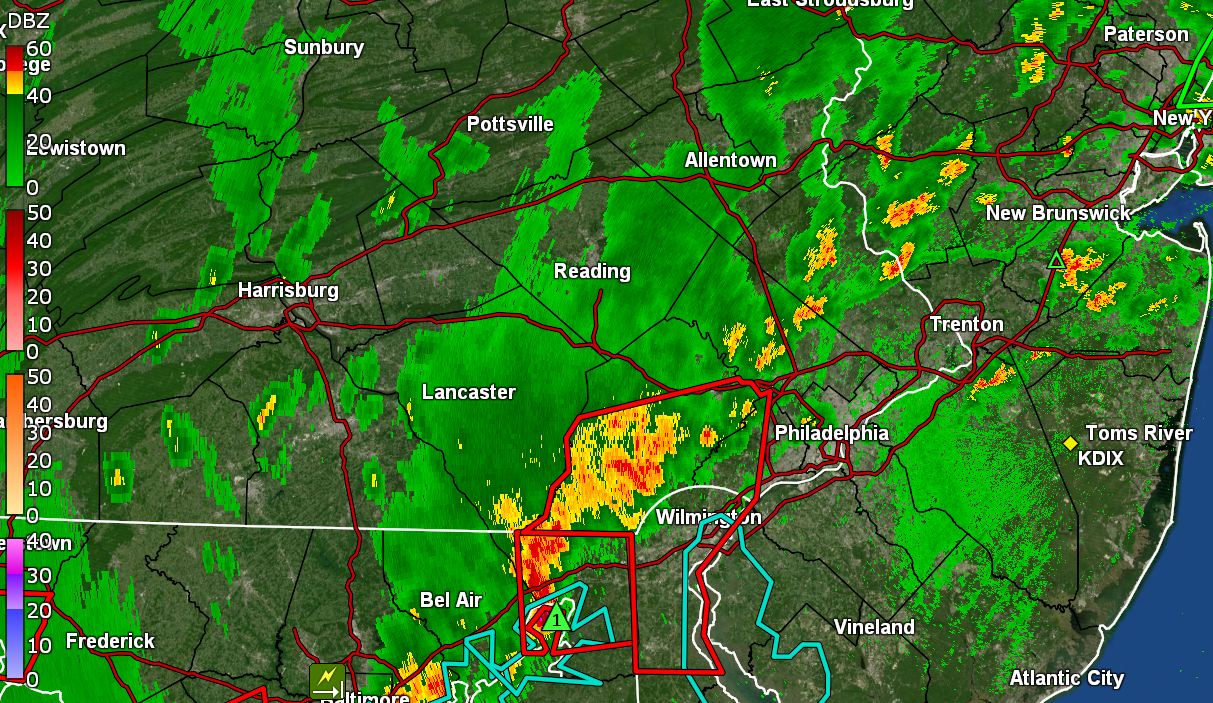
Finally under a little heavier returns. Rain is steady but was so "quiet" I had to go check to see if it was actually raining. Currently3/4" per hour rates and have 0.27" in the bucket. Temp still 77 with dp 75. -
E PA/NJ/DE Summer 2024 Obs/Discussion
Hurricane Agnes replied to JTA66's topic in Philadelphia Region
Getting some thunder and rain and have 0.14" in the bucket. Temp down to 77 with dp 74.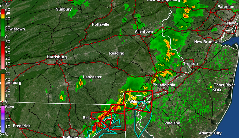
-
E PA/NJ/DE Summer 2024 Obs/Discussion
Hurricane Agnes replied to JTA66's topic in Philadelphia Region
Watches are up - Currently overcast and 90 with dp 78. Hoping the line holds together to give me something!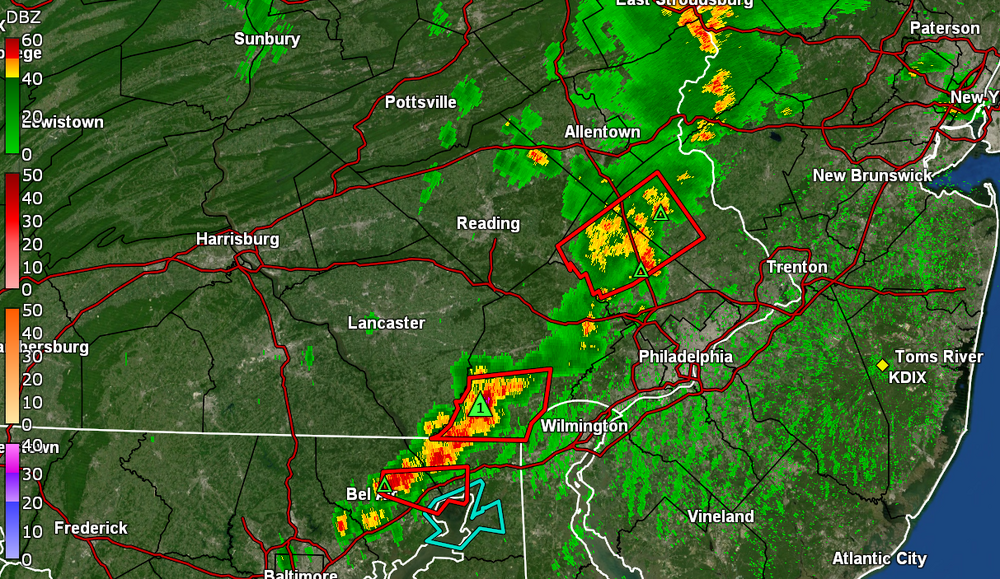
-
E PA/NJ/DE Summer 2024 Obs/Discussion
Hurricane Agnes replied to JTA66's topic in Philadelphia Region
Day 3 to start yet another heatwave IMBY, with the last day of July having a 90/75 split and yesterday with a 97/74 split. This morning's low was 77 and had hit 90 by 9:30 this morning. High so far today was 95 which is my current with dp 77. Tally of 90+ days is now 25 IMBY for JJA. When I had briefly popped outside (foolish) earlier this morning, i saw an interesting combo of cirrus and cumulus - just all kinds of cloud types but still plenty of sun. I need rain! Last rain here was 9 days ago (thankfully a soaking but that as worn off). Hoping I can cash in on some of that incoming stuff! EC seems to have problems with tropical systems. The Ukie seems to do better!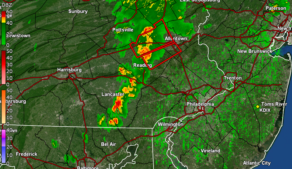
-
E PA/NJ/DE Summer 2024 Obs/Discussion
Hurricane Agnes replied to JTA66's topic in Philadelphia Region
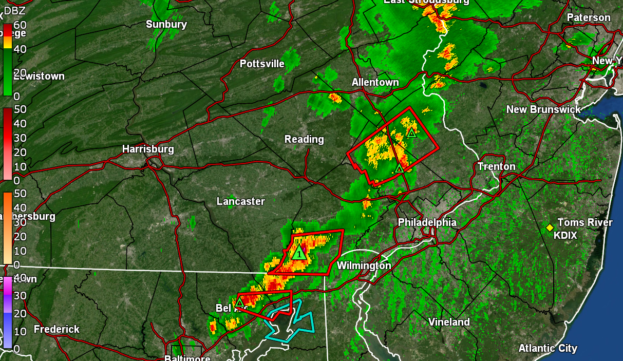
Down to very light rain where the sun has popped out a few times and currently have 1.41" of beneficial rain at post time. Temp is rising again and at 75 with dp 75. -
E PA/NJ/DE Summer 2024 Obs/Discussion
Hurricane Agnes replied to JTA66's topic in Philadelphia Region
The heaviest of the blob has moved out although still have just over 1/2" hour rates. Currently have 1.38" in the bucket at post time since noon. Current temp is 72 with dp 72. -
E PA/NJ/DE Summer 2024 Obs/Discussion
Hurricane Agnes replied to JTA66's topic in Philadelphia Region
Yeah it was because I wasn't sure if the storm motion would move it up from the SW over me vs fizzling or moving more to the east. Don't have to pull the hose out!!! -
E PA/NJ/DE Summer 2024 Obs/Discussion
Hurricane Agnes replied to JTA66's topic in Philadelphia Region
Now at 1.07" since 12:00pm (I had opened the back door to check for any hail). 3.40"/hr rate. -
E PA/NJ/DE Summer 2024 Obs/Discussion
Hurricane Agnes replied to JTA66's topic in Philadelphia Region
Now at 3"/hr rates, 0.85" in the bucket, temp 73 with dp 72.
-
E PA/NJ/DE Summer 2024 Obs/Discussion
Hurricane Agnes replied to JTA66's topic in Philadelphia Region
Now under the blob with just over 2"/hr rates. Have 0.41" in the bucket at post time.
-
E PA/NJ/DE Summer 2024 Obs/Discussion
Hurricane Agnes replied to JTA66's topic in Philadelphia Region
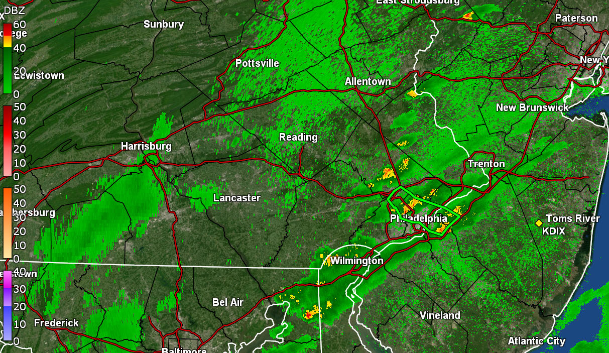
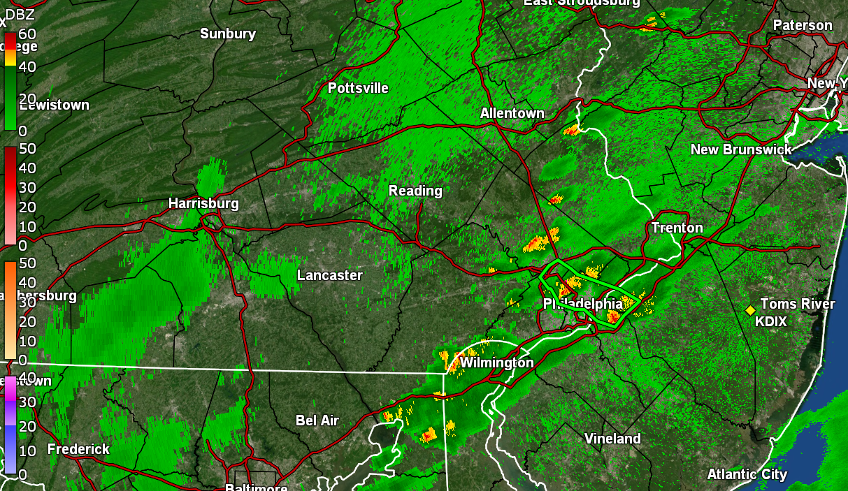
Getting warned for a little blob that is fringing me to the south. Made it up to 84 yesterday after a low of 76 and had 0.14" Monday evening and 0.41" early yesterday morning. Low this morning was 74. Currently getting some light rain and it's soup with a temp of 77, a dp of 75 and 0.03" in the bucket at post time.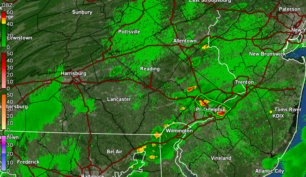
-
E PA/NJ/DE Summer 2024 Obs/Discussion
Hurricane Agnes replied to JTA66's topic in Philadelphia Region
Finished up with 0.87" (total from 2 rounds - 0.05" + 0.82"). There appears to be a light band ahead of the actual cold front moving this way but not sure how much of that survives the trip. Currently an overcast and misty 71 (my low so far for the day), with dp 71. -
E PA/NJ/DE Summer 2024 Obs/Discussion
Hurricane Agnes replied to JTA66's topic in Philadelphia Region
Under the band now and getting a gully washer with 1.75"/hr. Temp down to 74 with dp 73. Have 0.42" in the bucket (0.37" from round 2).