Hurricane Agnes
-
Posts
9,336 -
Joined
Content Type
Profiles
Blogs
Forums
American Weather
Media Demo
Store
Gallery
Everything posted by Hurricane Agnes
-
Sunday 1/19 Eagles Game Snow and Stuff
Hurricane Agnes replied to Ralph Wiggum's topic in Philadelphia Region
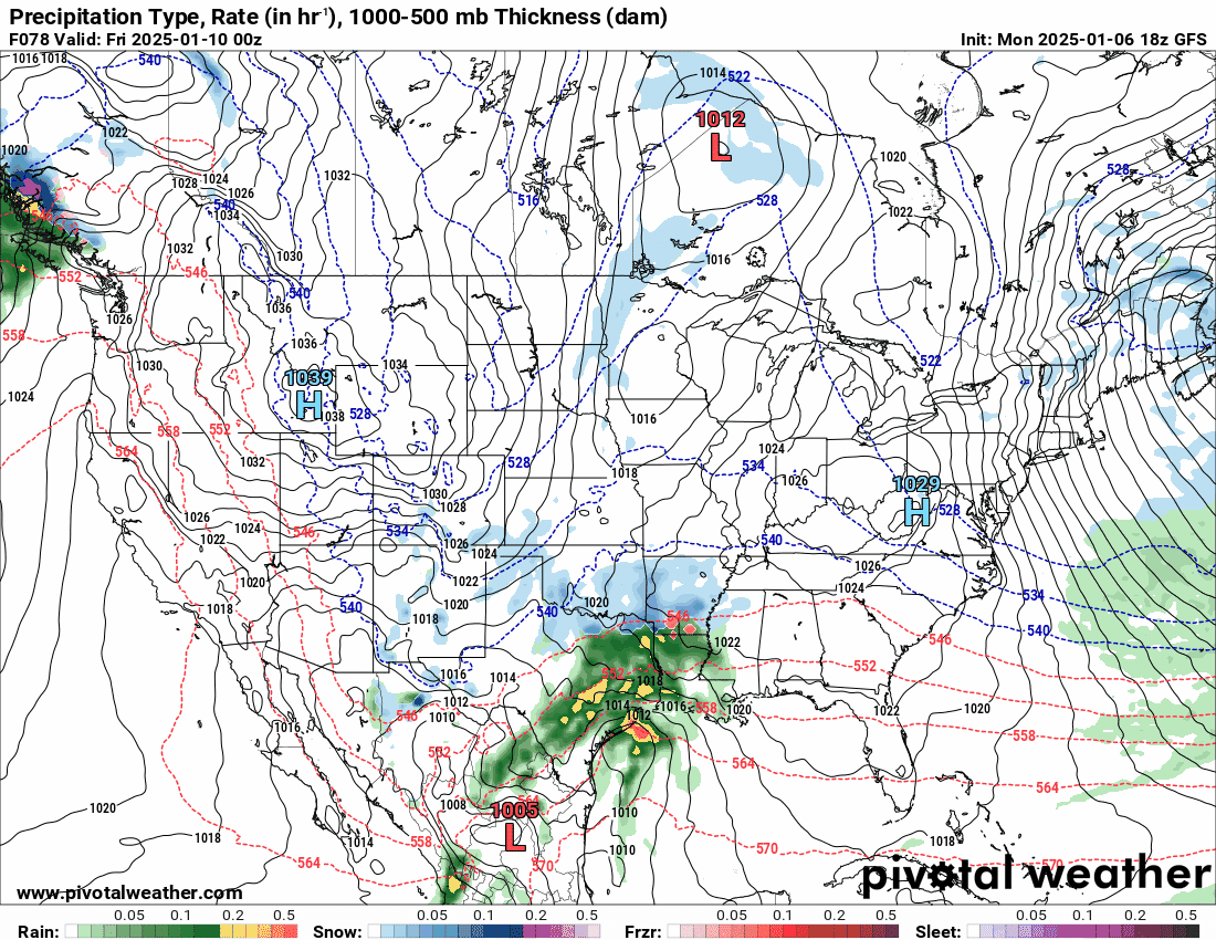
The NAM doesn't want to "NAM" anyone.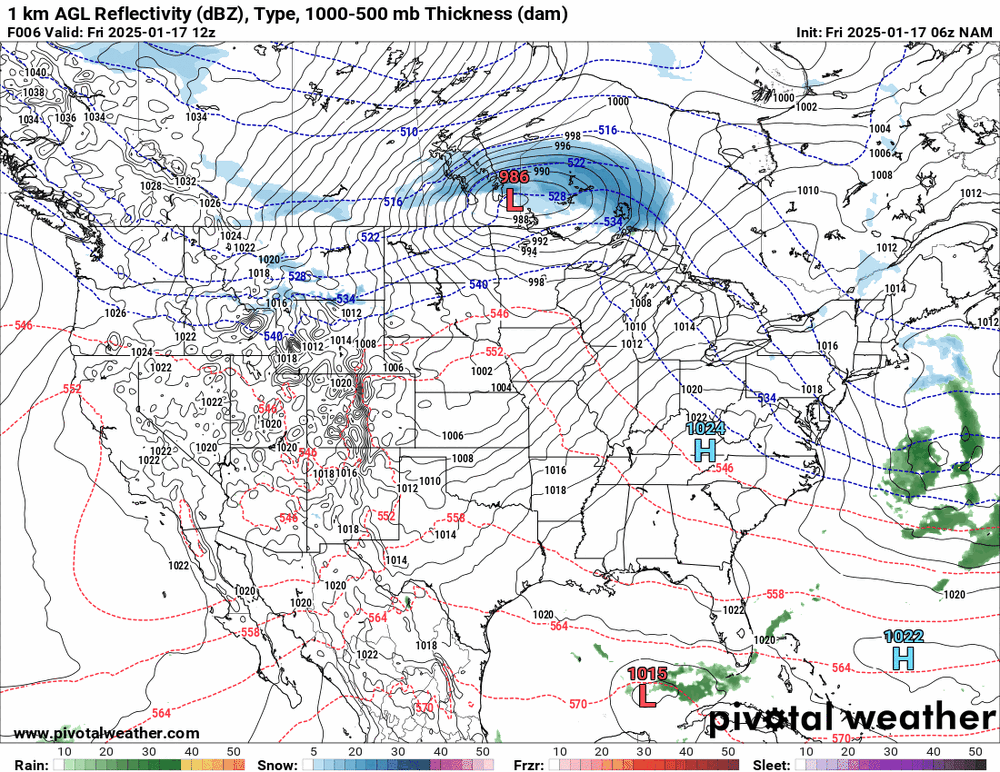
-
Sunday 1/19 Eagles Game Snow and Stuff
Hurricane Agnes replied to Ralph Wiggum's topic in Philadelphia Region
The "big 2" 6zs.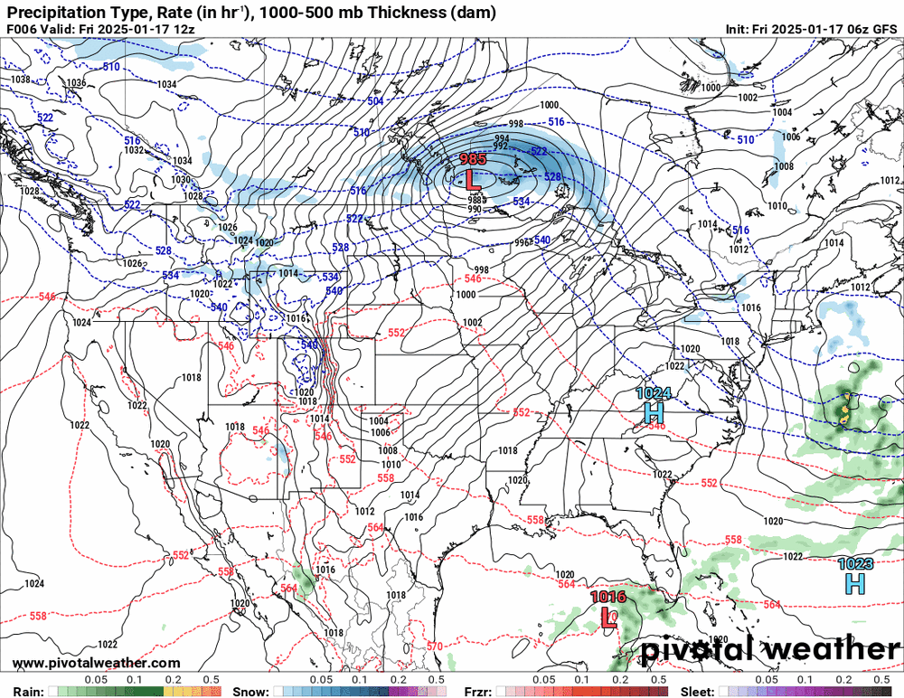
-
E PA/NJ/DE Winter 2024/25 Obs/Discussion
Hurricane Agnes replied to JTA66's topic in Philadelphia Region
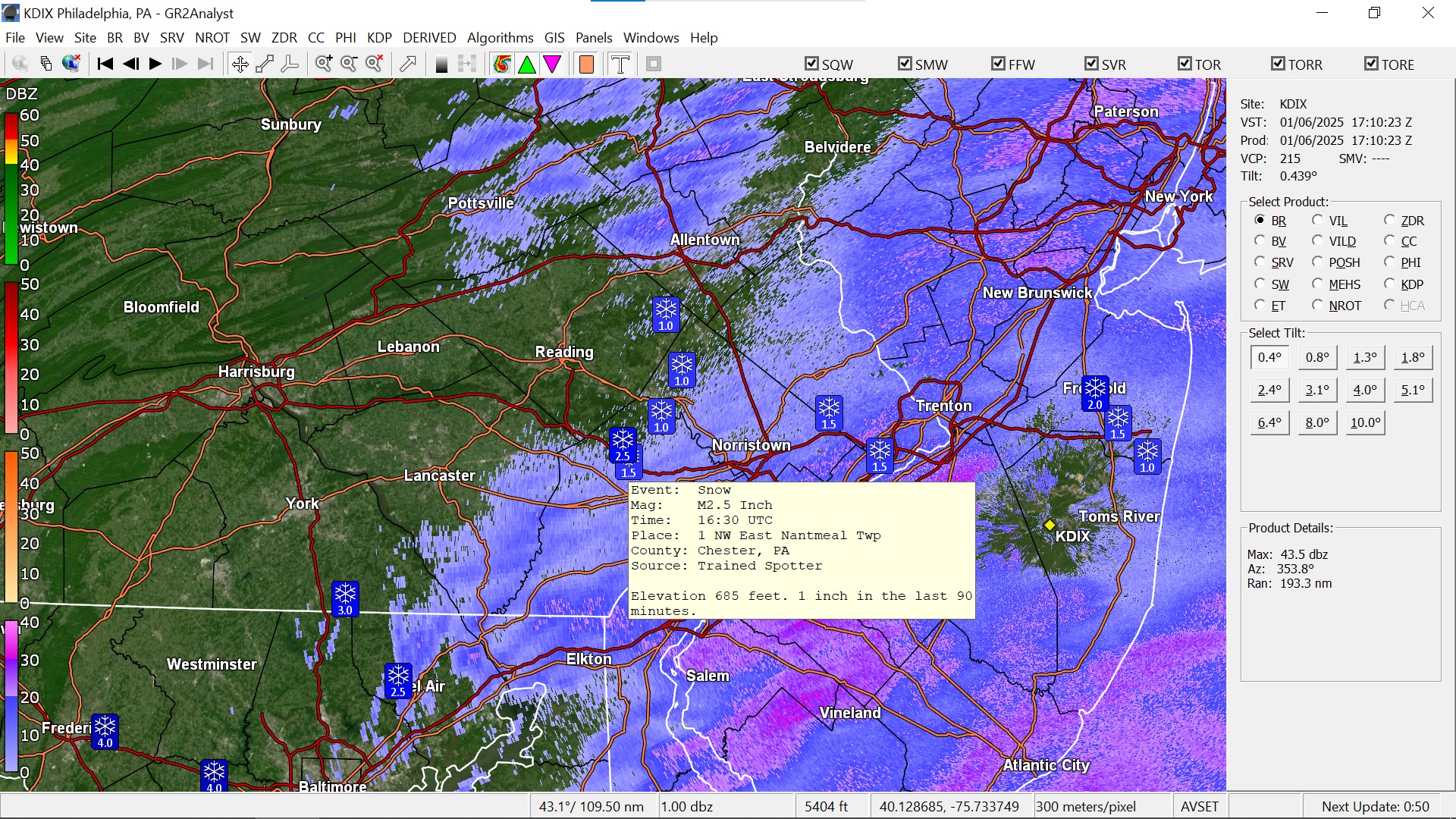
Did a 7 pm measure and have 0.75" and am down to some stray flurries. Radar is showing a dry slot over me at the moment but that may fill in later. Currently 26 with dp 24. -
Sunday 1/19 Eagles Game Snow and Stuff
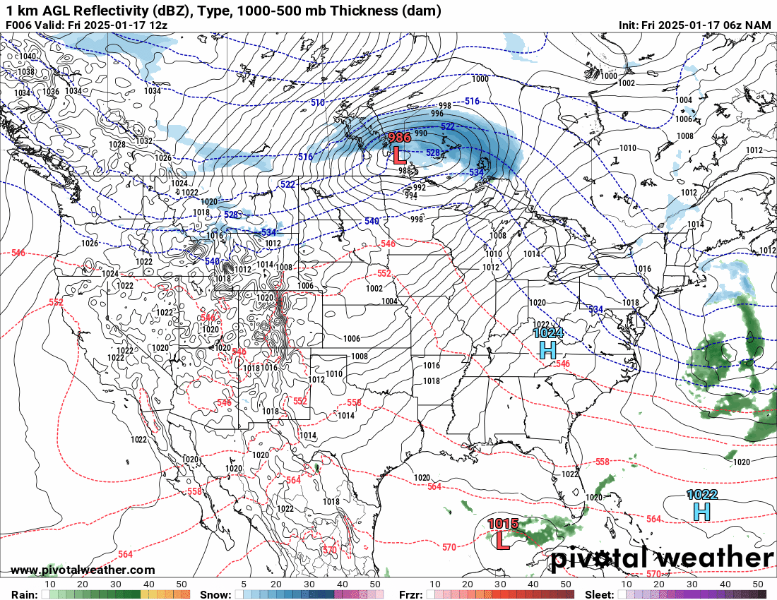
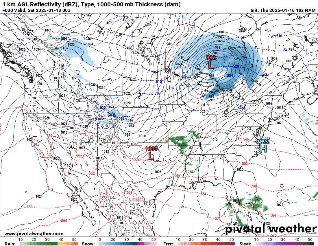
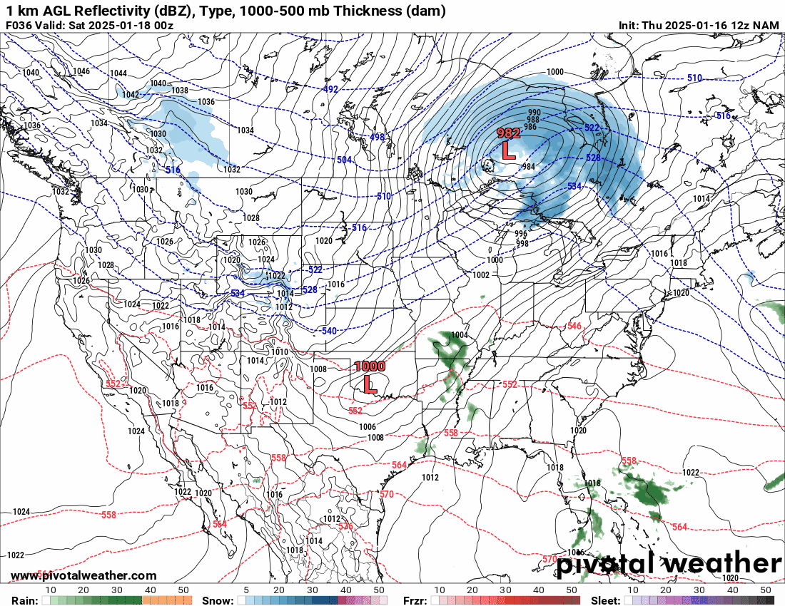
Hurricane Agnes replied to Ralph Wiggum's topic in Philadelphia Region
As noted - the 18z NAM found the other low (although it still does a whiff)...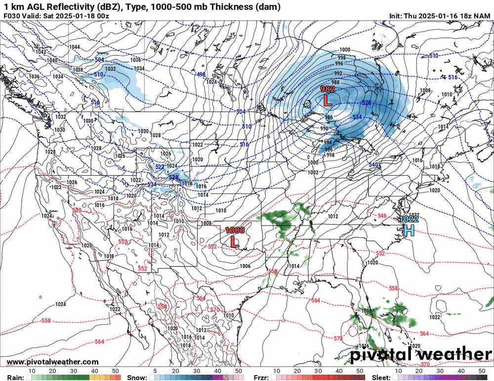
-
E PA/NJ/DE Winter 2024/25 Obs/Discussion
Hurricane Agnes replied to JTA66's topic in Philadelphia Region
Finally started getting some kind of coating out there with the fine flakes and did a 4:30 pm measurement to get 0.30" (so far). Currently have some very light pixie flakes and temp is 25 with dp 23. My high ended up being 29 earlier this afternoon. -
Sunday 1/19 Eagles Game Snow and Stuff
Hurricane Agnes replied to Ralph Wiggum's topic in Philadelphia Region
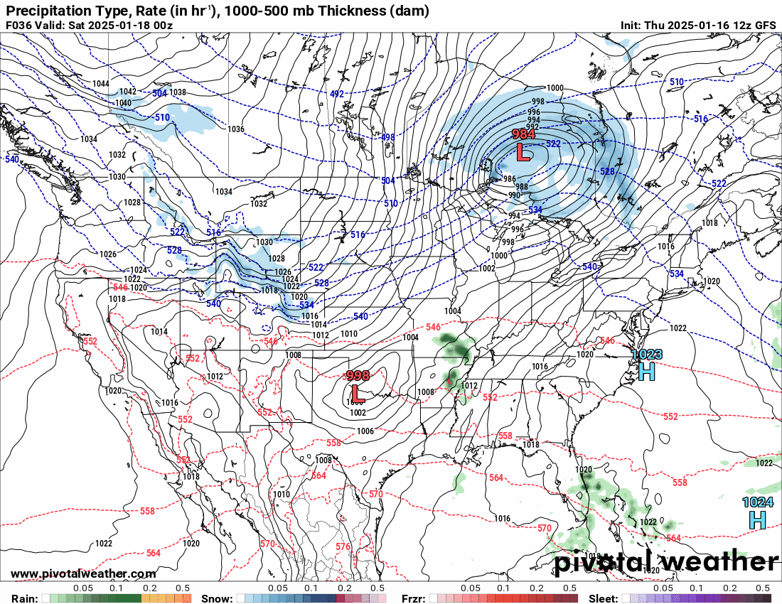
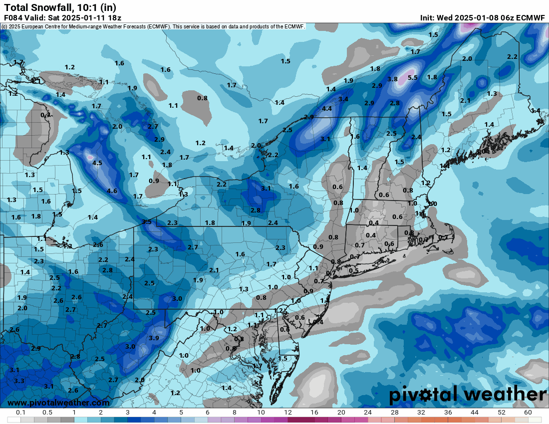
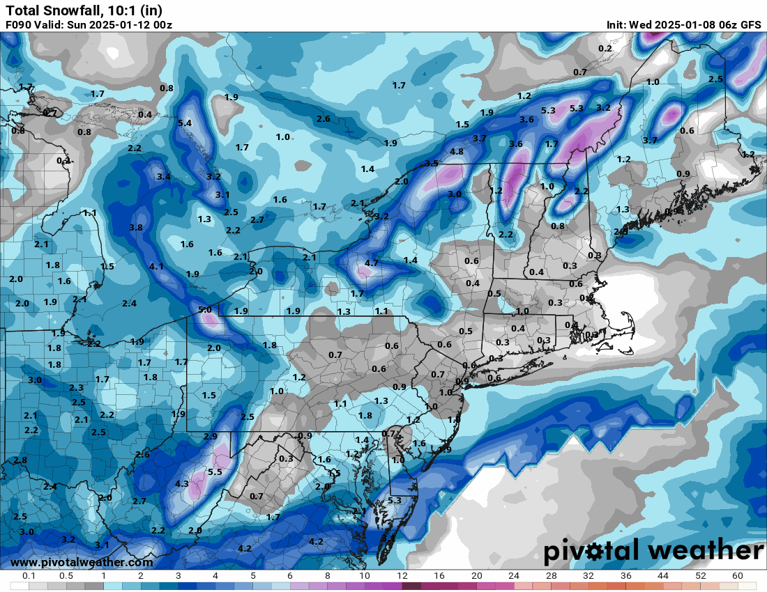
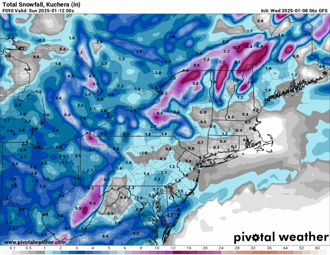
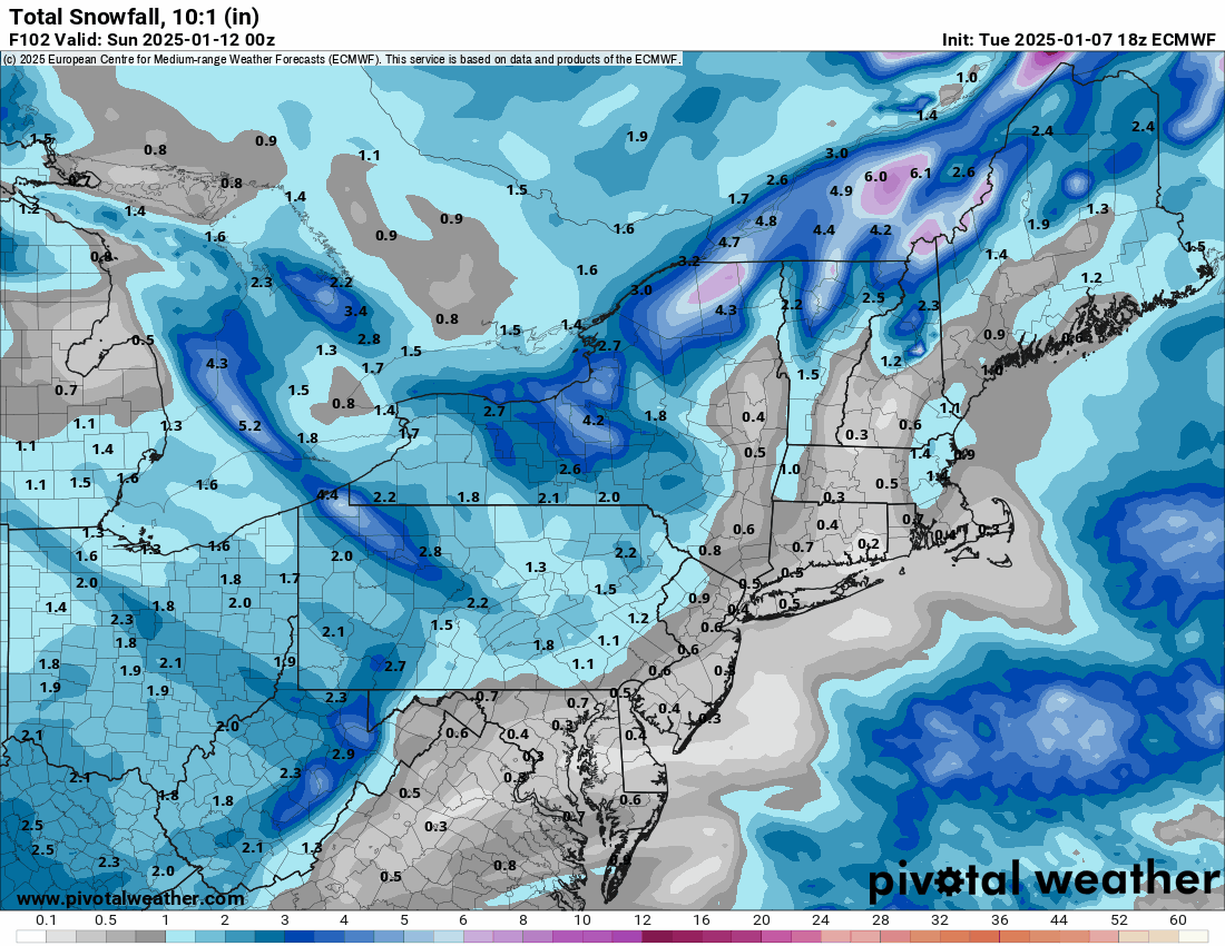
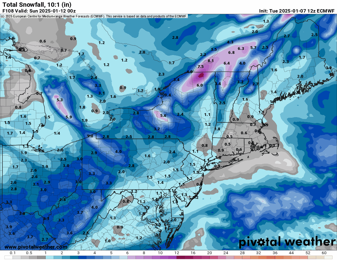
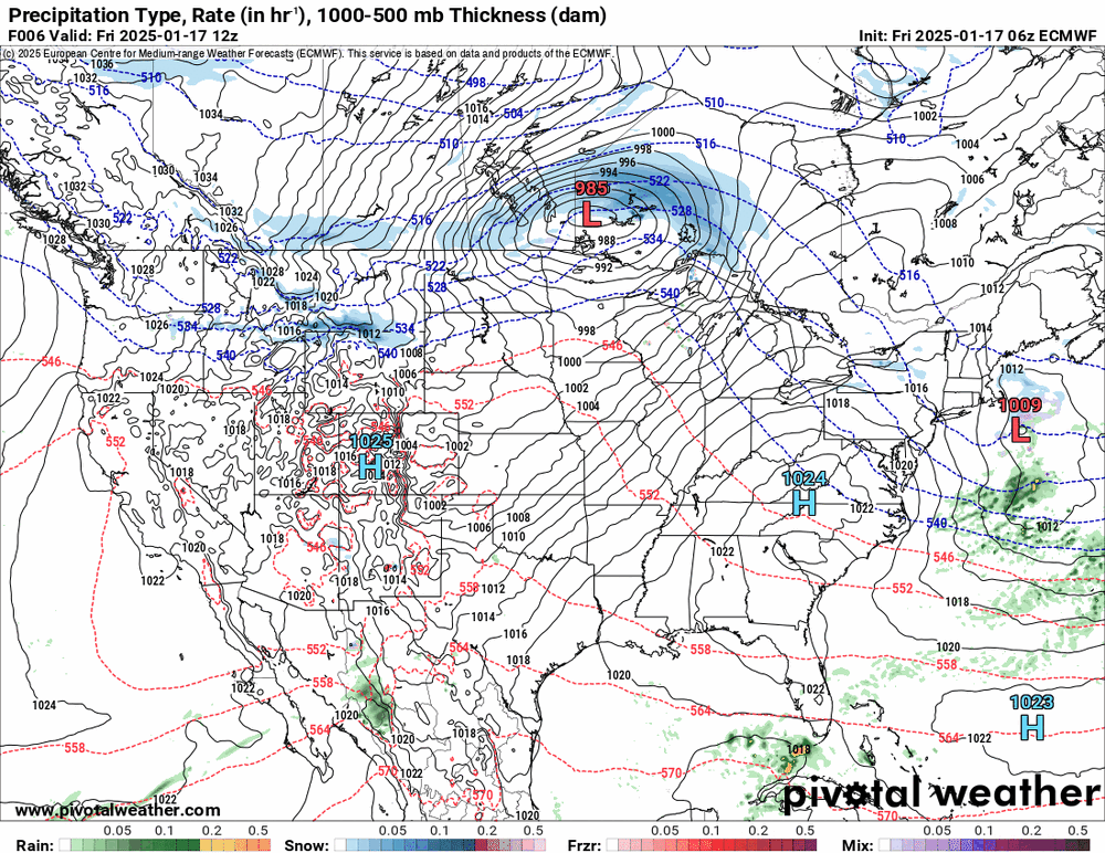
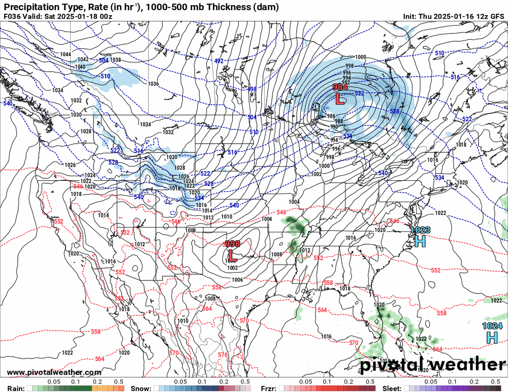
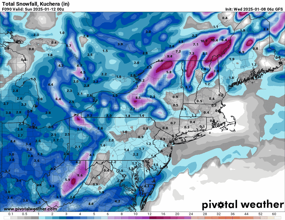
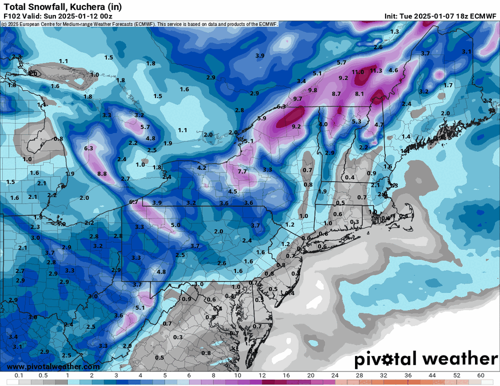
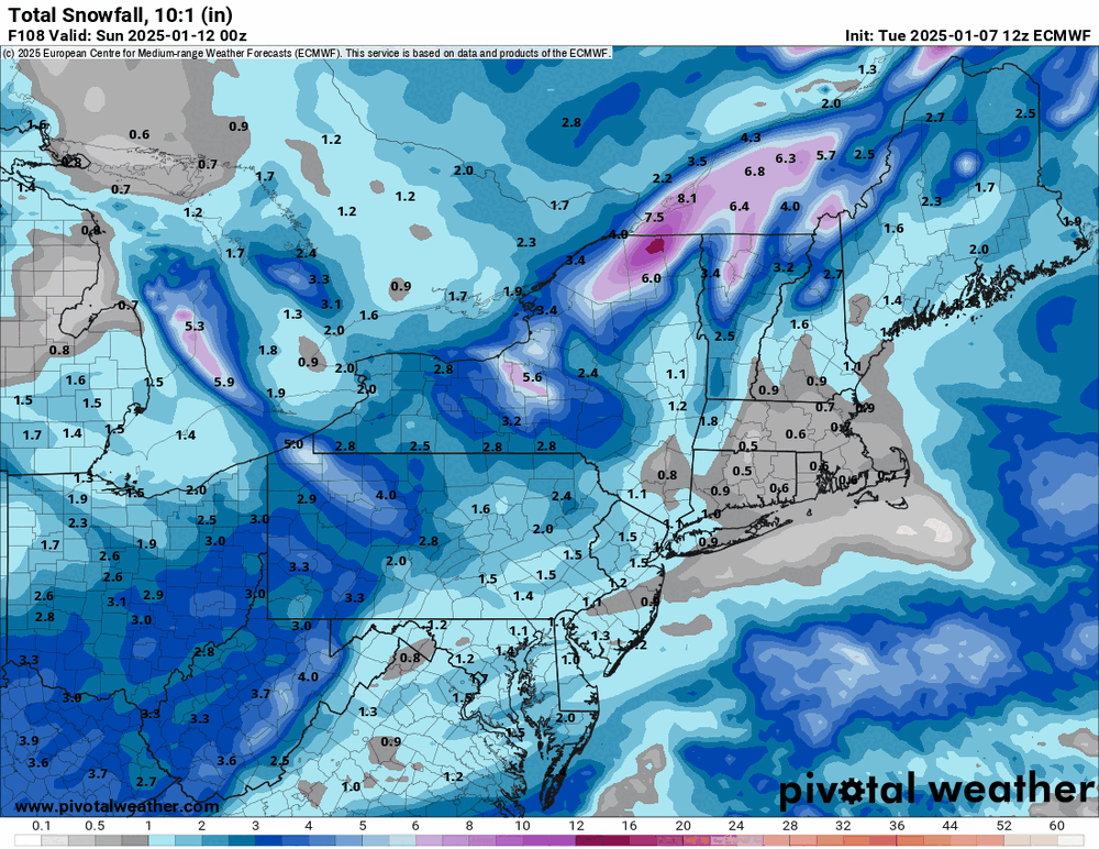
Since it's supposed to be bitter cold next week, it looks to me like it has the arctic front suppressing the thing to the south and then having it ride on up the eastern side of it. ETA - adding the 12z EC & GFS (the NAM only has the one low whereas the EC & GFS have an antecedent low that seems to keep the arctic high from digging as deep).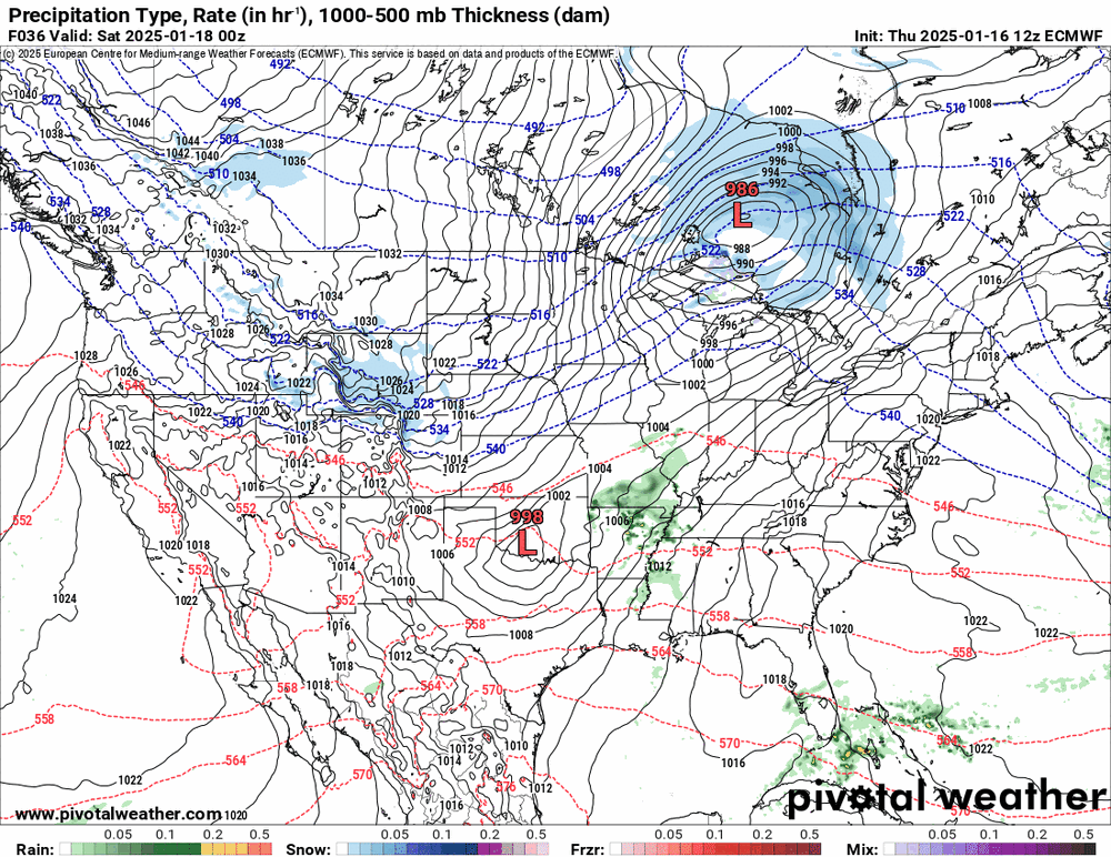
-
Sunday 1/19 Eagles Game Snow and Stuff
Hurricane Agnes replied to Ralph Wiggum's topic in Philadelphia Region
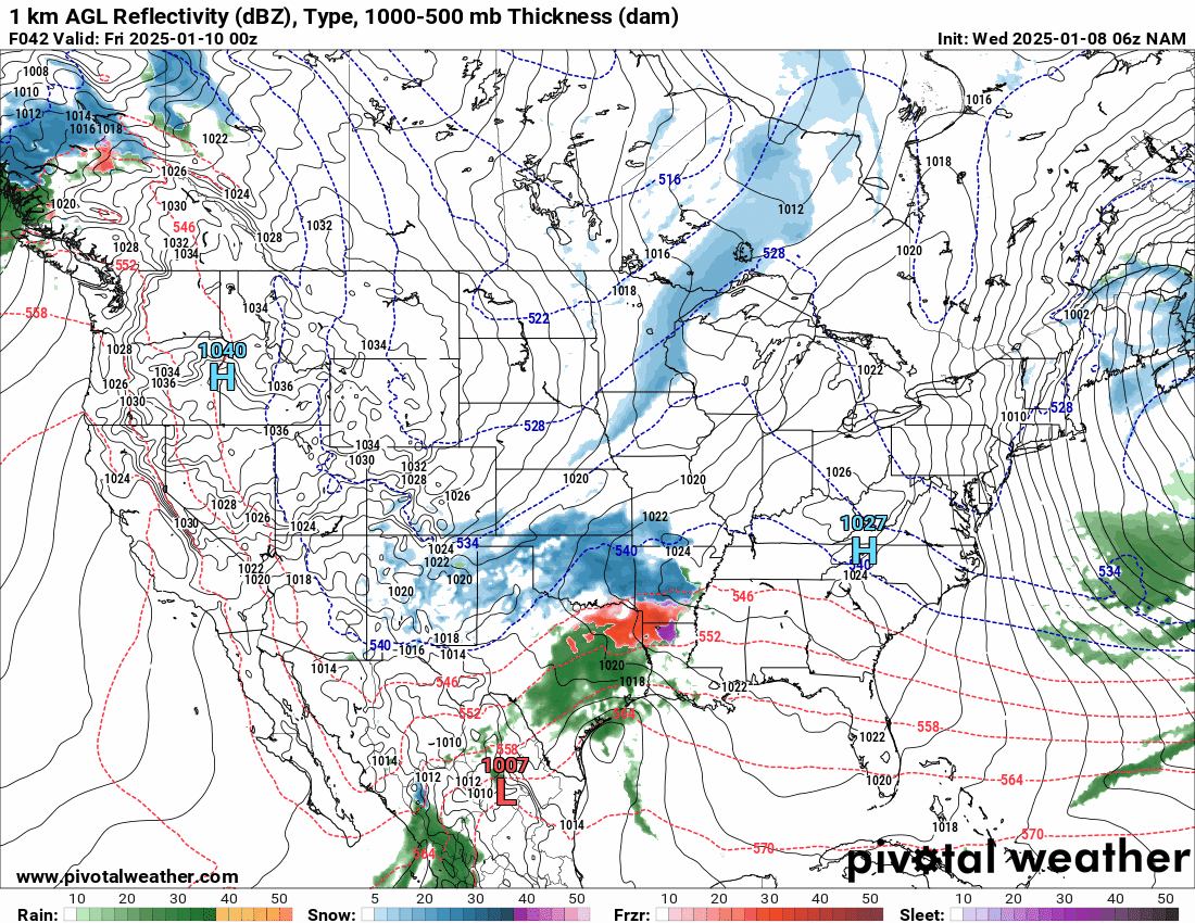
12z NAM is sliding the low sort of OTS from the Carolinas, so it swings and misses.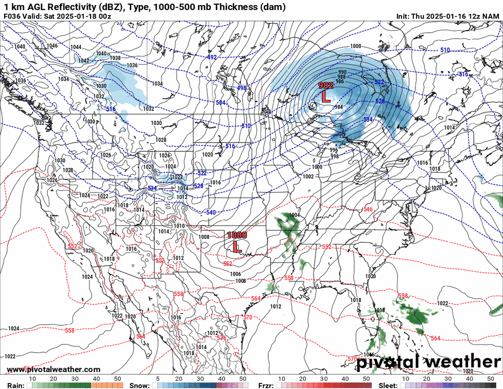
-
E PA/NJ/DE Winter 2024/25 Obs/Discussion
Hurricane Agnes replied to JTA66's topic in Philadelphia Region
Had some flurries earlier but just checked and it's so dry that it's mostly virga at the moment with the sun visible behind the clouds. Had bottomed out at 16 this morning and it's currently overcast and 27 with dp 17. -
E PA/NJ/DE Winter 2024/25 Obs/Discussion
Hurricane Agnes replied to JTA66's topic in Philadelphia Region
Popped out about an hour ago when it was down to flurries and measured 0.40". The back edge has pretty much cleared the city and it's currently cloudy and 26 with dp 24. -
E PA/NJ/DE Winter 2024/25 Obs/Discussion
Hurricane Agnes replied to JTA66's topic in Philadelphia Region
I think they're all in agreement at this point. lol
-
E PA/NJ/DE Winter 2024/25 Obs/Discussion
Hurricane Agnes replied to JTA66's topic in Philadelphia Region
Waiting for the 0z EC but the NAM is sortof in range and is not far off from the GFS.
-
E PA/NJ/DE Winter 2024/25 Obs/Discussion
Hurricane Agnes replied to JTA66's topic in Philadelphia Region
I think one would be looking for a blocking high over Greenland - the old "Greenland Block" (that can facillitate phasing with the southern jet stream). As an obs, am currently 24 with a crispy dp of 12. Had looked at the 6z GFS and it's still on track for an inch or so up here. 6z Euro is running right now at post time.

-
E PA/NJ/DE Winter 2024/25 Obs/Discussion
Hurricane Agnes replied to JTA66's topic in Philadelphia Region
Currently 26 with dp 14 and the 18z Euro decided to go south again and really dried it out for up here!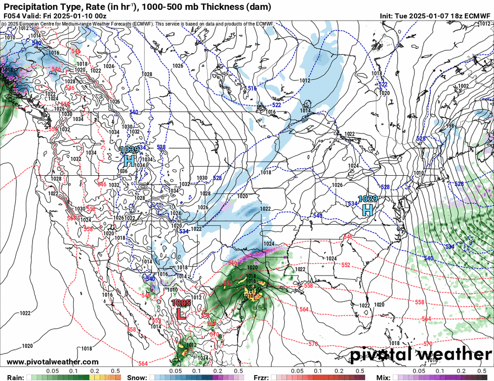

-
E PA/NJ/DE Winter 2024/25 Obs/Discussion
Hurricane Agnes replied to JTA66's topic in Philadelphia Region
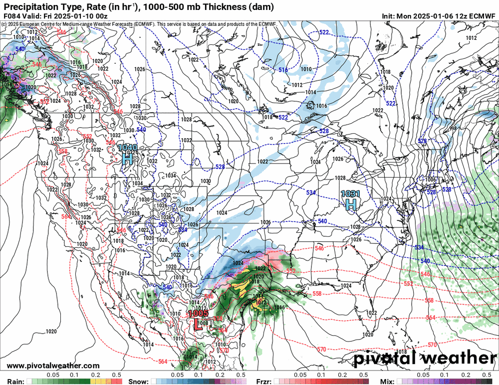
And for completeness, the Ukie is sticking with the southern slider OTS. I made it to freezing (32) as a high (so far) and it's currently partly sunny and 31 with dp 17.
-
E PA/NJ/DE Winter 2024/25 Obs/Discussion
Hurricane Agnes replied to JTA66's topic in Philadelphia Region
Bottomed out at 18 around 1:30 am and didn't expect it to warm up that much but it actually has. Currently 30 with dp 16 and stuff facing the S/SW is melting. The 12z EC seems to have moved towards the GFS up-the-coast and not completely OTS thought. Doesn't throw much snow back our way but it was an interesting shift.

-
E PA/NJ/DE Winter 2024/25 Obs/Discussion
Hurricane Agnes replied to JTA66's topic in Philadelphia Region
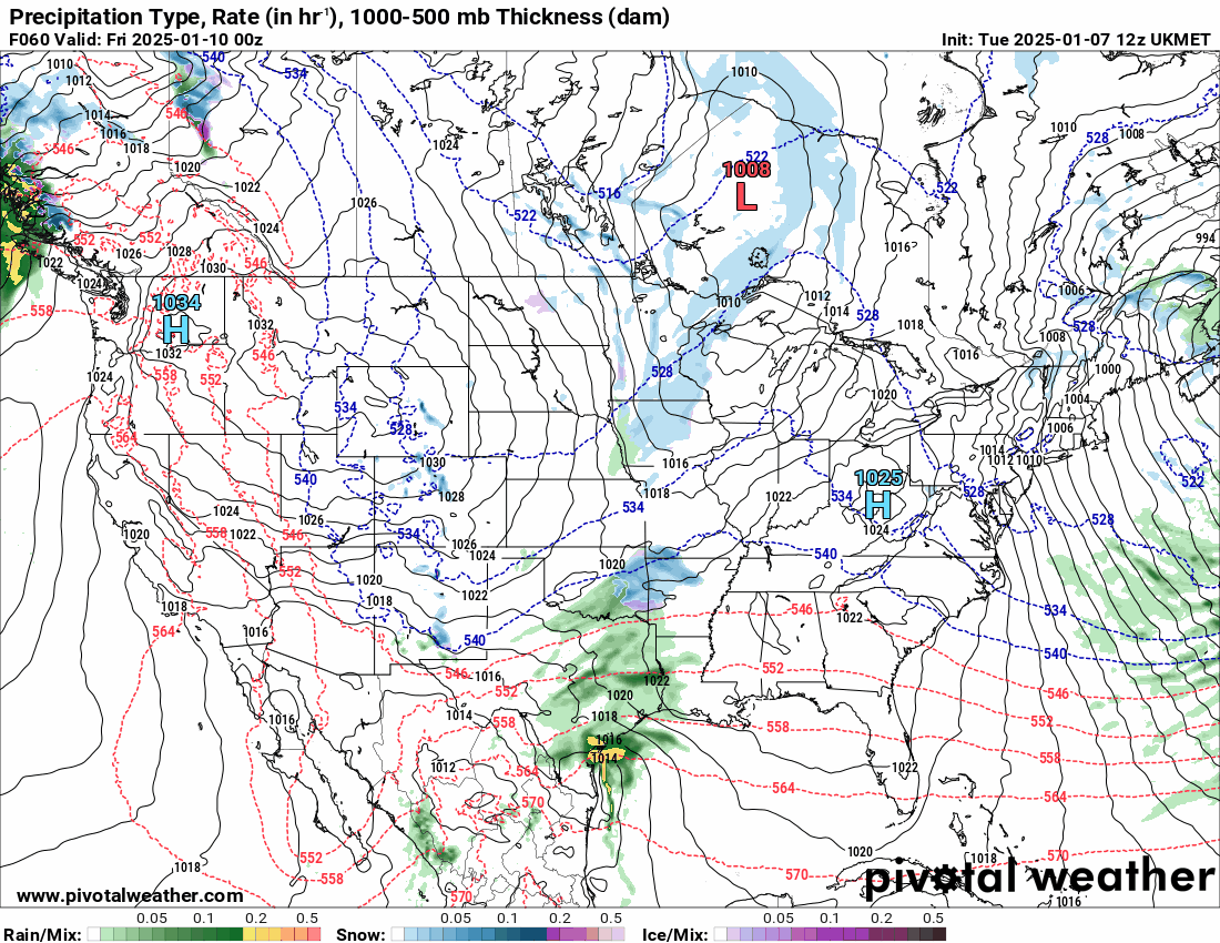
6z GFS still hanging with the Miller A-type setup. However not showing a gigantic HECS. As an obs - looks like the wind blew away whatever dusted things last night. I eventually had a high of 29 yesterday with a low of 21 and it's currently 20 and clear, with dp 12.


-
1/6 snowstorm - nuisance event or something bigger?
Hurricane Agnes replied to LVblizzard's topic in Philadelphia Region
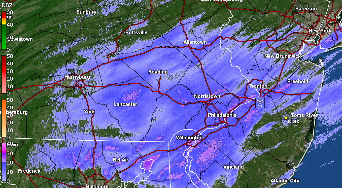
I went out to do a what-the-heck measurement at 7 pm and a new coating has appeared on places that were cleared. Actually have an additional 1/4" and am now up to 2.0" for the event so far. This is a different type of snow - more fatter flakes - than that earlier today. Currently SN- and 28 with dp 26.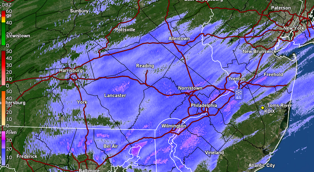
-
E PA/NJ/DE Winter 2024/25 Obs/Discussion
Hurricane Agnes replied to JTA66's topic in Philadelphia Region
The ICON doesn't go out as far as the GFS but the 18z does have the "crawl up the coast" look. Last frame below -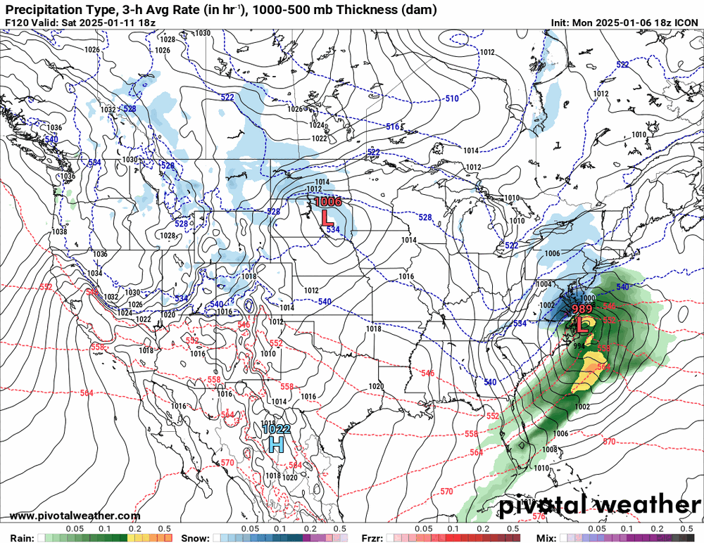
-
1/6 snowstorm - nuisance event or something bigger?
Hurricane Agnes replied to LVblizzard's topic in Philadelphia Region
That pile almost looks like the biggest that you've had in the past couple winters! And yes, something has back-built over the area and I am getting some SN-. If it all goes right, maybe I can make it to 2" overnight.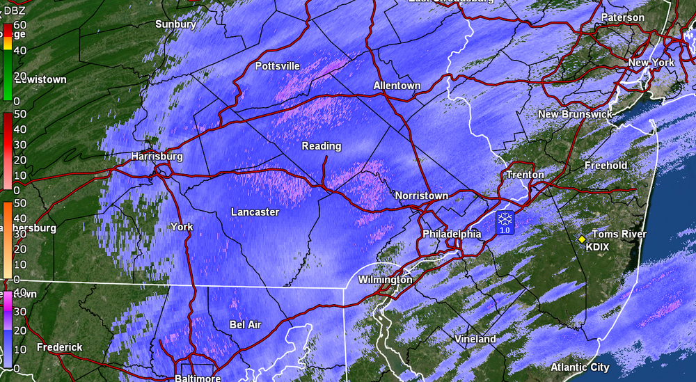
-
E PA/NJ/DE Winter 2024/25 Obs/Discussion
Hurricane Agnes replied to JTA66's topic in Philadelphia Region
LOL the 18z GFS is doubling down on a storm buzz-sawing its way up the coast. As an obs - there are some more returns coming in with a mini-round 2 and yes, something is falling from the sky - very light, just above random flurry level. Not sure how much additional accumulation I will get but we'll see. Currently 28 and SN- with dp 25.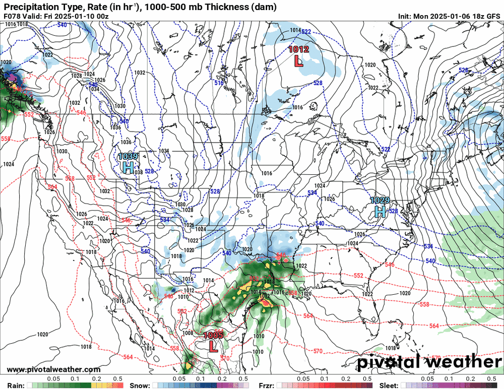
-
Welcome and soon you'll discover why the Philly forum is the best jawn on AmWx!
-
1/6 snowstorm - nuisance event or something bigger?
Hurricane Agnes replied to LVblizzard's topic in Philadelphia Region
Looks like it might be done here - nothing coming from the sky. Measured 1.75" of fine powdery stuff on the board. Currently overcast and 28 with dp 25. -
E PA/NJ/DE Winter 2024/25 Obs/Discussion
Hurricane Agnes replied to JTA66's topic in Philadelphia Region
-
1/6 snowstorm - nuisance event or something bigger?
Hurricane Agnes replied to LVblizzard's topic in Philadelphia Region
Saw your report!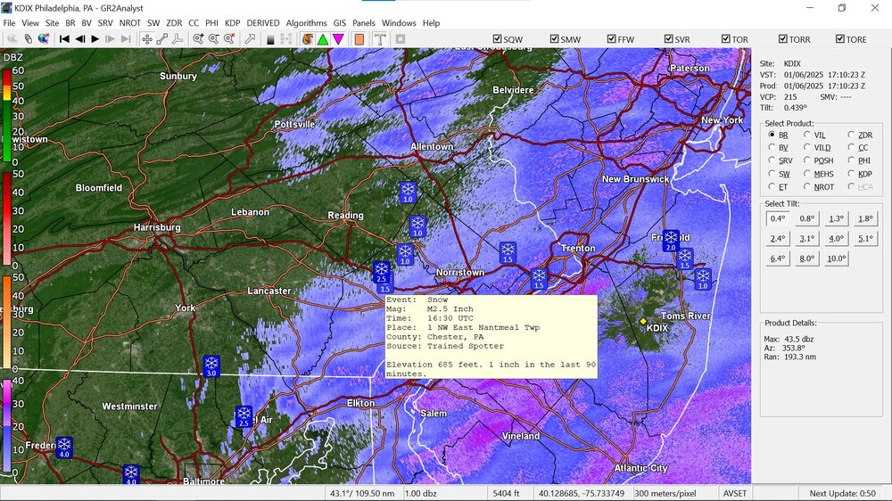
-
1/6 snowstorm - nuisance event or something bigger?
Hurricane Agnes replied to LVblizzard's topic in Philadelphia Region
Now getting the biggest flakes of the day. Not pancake-sized but much more clumped then the fine stuff from throughout the morning. Temp still holding at 26 with dp 23 so must be some warming up in the atmosphere.