Hurricane Agnes
-
Posts
9,336 -
Joined
Content Type
Profiles
Blogs
Forums
American Weather
Media Demo
Store
Gallery
Everything posted by Hurricane Agnes
-
E PA/NJ/DE Spring 2025 Obs/Discussion
Hurricane Agnes replied to PhiEaglesfan712's topic in Philadelphia Region
The scattered pop-ups mostly missed me yesterday (although my Delco sister got nailed by one but then got a cool double-rainbow at the end that she texted a pic of). But for the previous 3 days (5/21 - 23), I ended up with 1.20", which takes me to 5.82" for the month so far (vs 2.76" for April). Got up to 64 yesterday and bottomed out at 50 this morning. Currently a mostly sunny 51 and so far not as breezy as yesterday, with a dp of 45. -
E PA/NJ/DE Spring 2025 Obs/Discussion
Hurricane Agnes replied to PhiEaglesfan712's topic in Philadelphia Region
Norman, OK re-upped the Watches! I did see the cells popping way west of here. When the sun came out, the temp started shooting up and I did hit a high (so far) of 77 just before 4 pm, when it started clouding up again. Currently 75 and cloudy with dp a juicy 70. -
E PA/NJ/DE Spring 2025 Obs/Discussion
Hurricane Agnes replied to PhiEaglesfan712's topic in Philadelphia Region
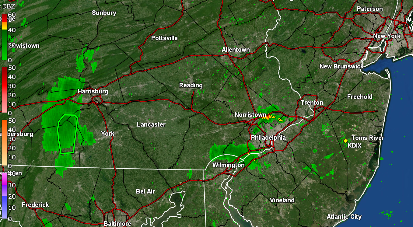
See a couple TORs up in BBasile land... I think the heaviest is done here and so far have 0.66" in the bucket. Temp is 67 with dp 67. -
E PA/NJ/DE Spring 2025 Obs/Discussion
Hurricane Agnes replied to PhiEaglesfan712's topic in Philadelphia Region
Under the heavier returns now with 2"/hr rates. Currently have 0.52" in the bucket at post time. -
E PA/NJ/DE Spring 2025 Obs/Discussion
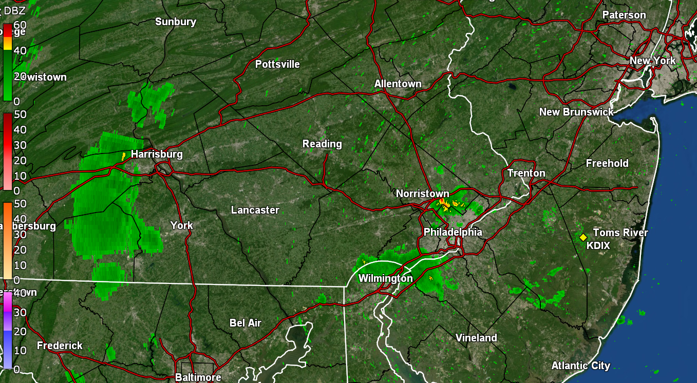
Hurricane Agnes replied to PhiEaglesfan712's topic in Philadelphia Region
FFW up for the city and surrounding counties. Still have light rain but the heavier stuff is still west in south central Montco. My Delco sis texted that she is getting walloped!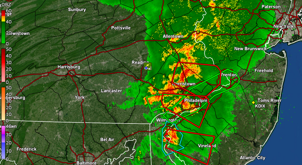
-
E PA/NJ/DE Spring 2025 Obs/Discussion
Hurricane Agnes replied to PhiEaglesfan712's topic in Philadelphia Region
Now the rest of Philly has been warned - I currently have some light rain ahead of this with temp 69 and dp 68.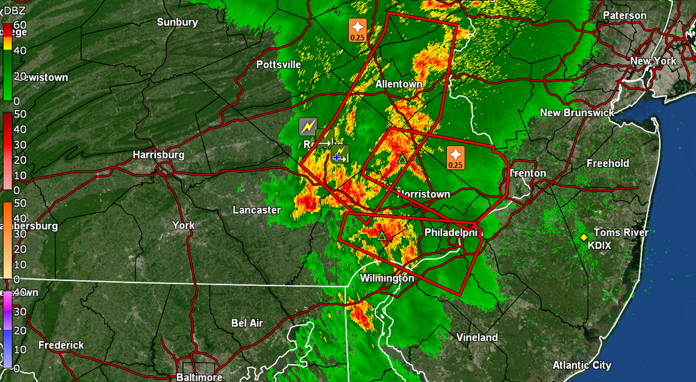
-
E PA/NJ/DE Spring 2025 Obs/Discussion
Hurricane Agnes replied to PhiEaglesfan712's topic in Philadelphia Region
They got you guys warned now! Looks pretty nasty! -
E PA/NJ/DE Spring 2025 Obs/Discussion
Hurricane Agnes replied to PhiEaglesfan712's topic in Philadelphia Region
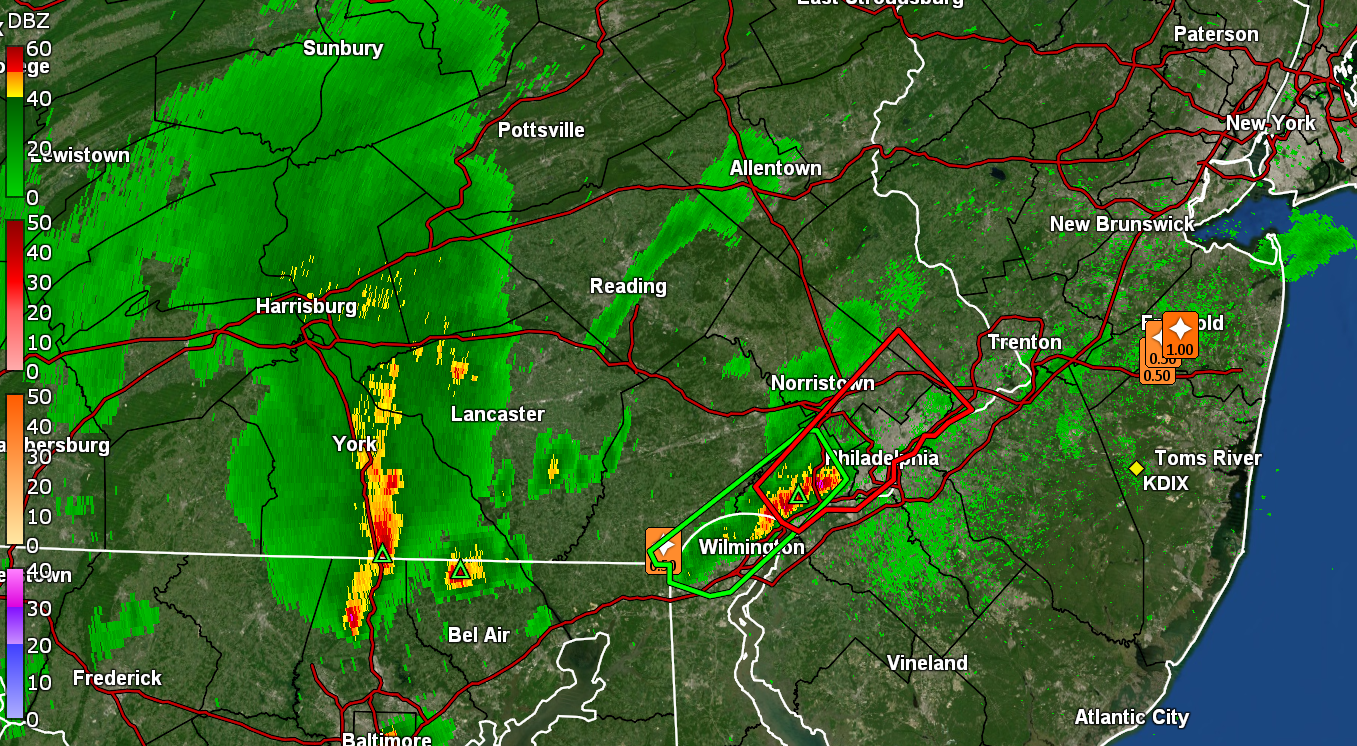
Saw that line forming and up went the watches! Bottomed out at 61 this morning and it's currently an overcast and humid 69, with dp 68. Don't know how well that line will hold together but it looks pretty rough!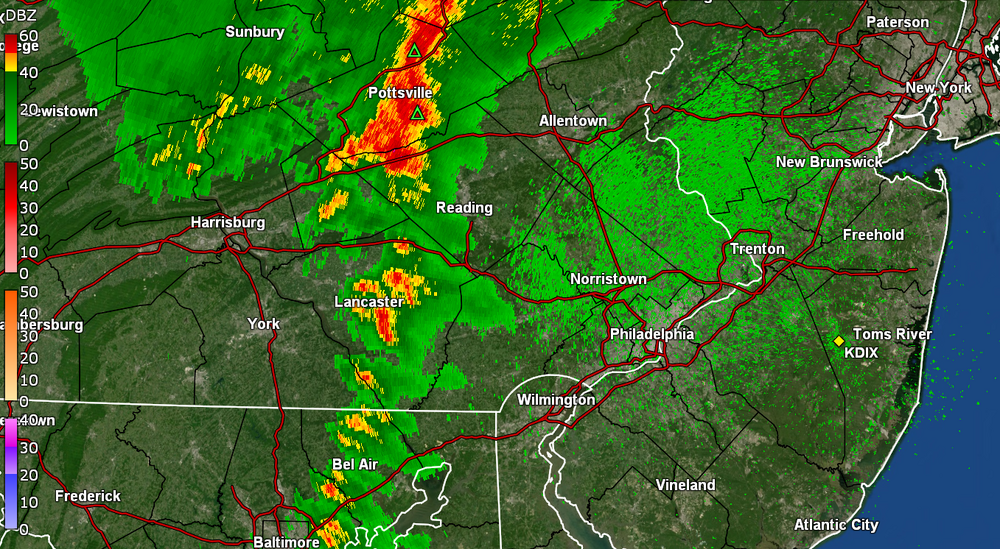
-
E PA/NJ/DE Spring 2025 Obs/Discussion
Hurricane Agnes replied to PhiEaglesfan712's topic in Philadelphia Region
Ended up with another little cell that pushed up from the SE to give me an additional 0.18" for a total of 0.48" for today and a 3-day total of 2.70". My low was 61 earlier this morning and it's currently overcast and 65 with dp 65. -
E PA/NJ/DE Spring 2025 Obs/Discussion
Hurricane Agnes replied to PhiEaglesfan712's topic in Philadelphia Region
And my lightening detector picked up a strike right after posting and about 5 minutes later, I just heard a thunder (and just heard another with a lightning. The cell was moving up from the SE and is recurving around towards the east. Currently have 0.30" in the bucket.
-
E PA/NJ/DE Spring 2025 Obs/Discussion
Hurricane Agnes replied to PhiEaglesfan712's topic in Philadelphia Region
Got one more light passing shower yesterday to finish up with 1.65" for the day and 2.22" for the 2 days. Am currently under a rogue cell that is producing over 1"/hr and have 0.28" in the bucket at post time (2.50" for 3 days). Currently 62 with dp 61, with a heavy shower and fog.
-
E PA/NJ/DE Spring 2025 Obs/Discussion
Hurricane Agnes replied to PhiEaglesfan712's topic in Philadelphia Region
So far with today's round, I ended up with 1.64" at post time for a 2-day event total of 2.21" of much needed rain! It's currently overcast and misty and am at my high for today of 64, after a low of 58, and with dp 64. -
E PA/NJ/DE Spring 2025 Obs/Discussion
Hurricane Agnes replied to PhiEaglesfan712's topic in Philadelphia Region
After some light returns much of yesterday, I did finish up with 0.57". The significant rain has happened overnight and this morning where I am sitting on an additional 1.10" at post time, with a 2-day event total of 1.67". Got up to 68 for a high yesterday after a 60 low and currently have moderate rain (~1/3" - 1/2" per hr) and 58, with dp 58.
-
E PA/NJ/DE Spring 2025 Obs/Discussion
Hurricane Agnes replied to PhiEaglesfan712's topic in Philadelphia Region
Watches are up. Have been getting on and off popcorn type little cells and streamers this morning and have 0.03" in the bucket from a couple. The sun did come out a couple hours ago so things are destabilizing. There has been a series of bands basically training, N->S, over portions of Lancaster and York Counties for hours. I know it has to be flooding there. I bottomed out at 60 this morning and have been bopping around 75/76 as a high so far. Currently 76 and partly sunny (but with some serious-looking angry cumulostratus off to the east) and a dp of 67. -
E PA/NJ/DE Spring 2025 Obs/Discussion
Hurricane Agnes replied to PhiEaglesfan712's topic in Philadelphia Region
Well another little scattered shower earlier this afternoon added 0.11" to the bucket for a total of 0.22" for the day so far and a 2-day event total of 0.89". The high so far today was 71 just before 11 am but that has dropped down since. It's currently overcast and muggy with temp 67 and dp 65. -
E PA/NJ/DE Spring 2025 Obs/Discussion
Hurricane Agnes replied to PhiEaglesfan712's topic in Philadelphia Region
And unexpectedly, the sun has popped out. Ended up with 0.11" from that isolated shower. Will have to see if it becomes "self-destruct" and the sky clouds up again. Currently partly sunny with the temp quickly rising and at 68, with dp 67. -
E PA/NJ/DE Spring 2025 Obs/Discussion
Hurricane Agnes replied to PhiEaglesfan712's topic in Philadelphia Region
I am surprised I didn't get any more overnight so did finish up with 0.67" from that round. It has started raining here again as another round comes in. Bottomed out at 63 just after midnight and it's currently raining (0.06" in the bucket at post time) and 67, with dp 65.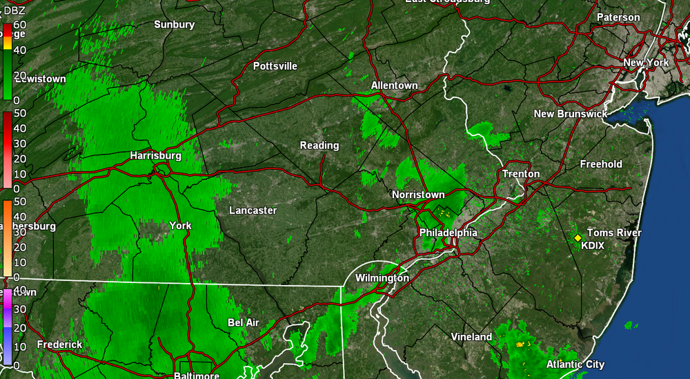
-
E PA/NJ/DE Spring 2025 Obs/Discussion
Hurricane Agnes replied to PhiEaglesfan712's topic in Philadelphia Region
Down to light rain after that round. Have 0.67" in the bucket and temp down to 62 with dp 62. -
E PA/NJ/DE Spring 2025 Obs/Discussion
Hurricane Agnes replied to PhiEaglesfan712's topic in Philadelphia Region
Gully washer. Getting almost 1.75"/hr rates. Have 0.30" in the bucket at post time. Temp down to 69 with dp 68. -
E PA/NJ/DE Spring 2025 Obs/Discussion
Hurricane Agnes replied to PhiEaglesfan712's topic in Philadelphia Region
My sis just texted again to say she is getting hail. I am getting a light show with rain (nothing measurable yet) but no thunder.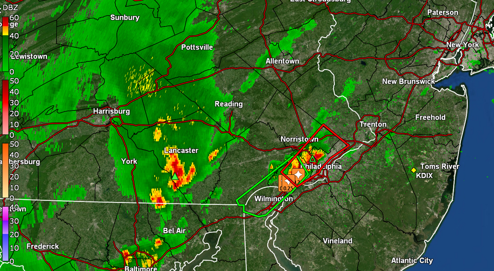
-
E PA/NJ/DE Spring 2025 Obs/Discussion
Hurricane Agnes replied to PhiEaglesfan712's topic in Philadelphia Region
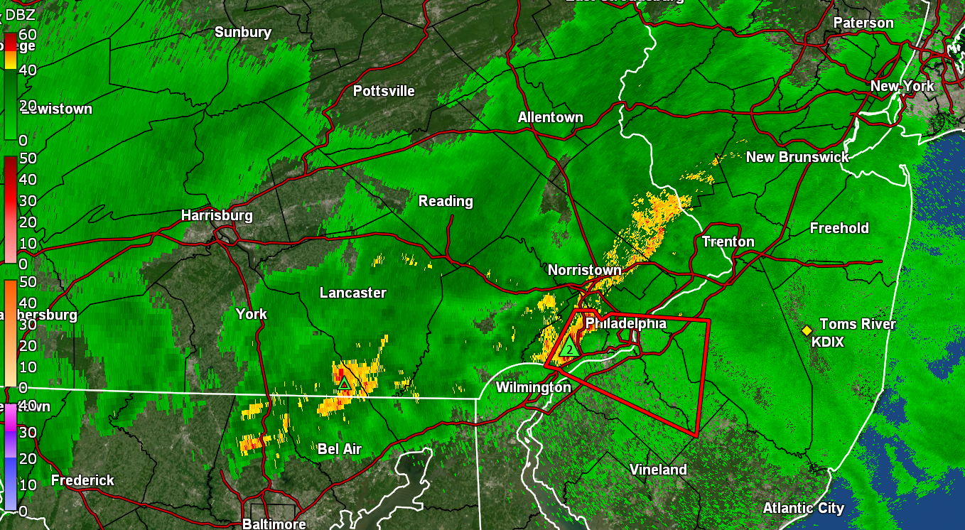
Under a Warning right now. My Delco sis just texted about it where she is in Upper Darby! Currently 77 with dp 64 .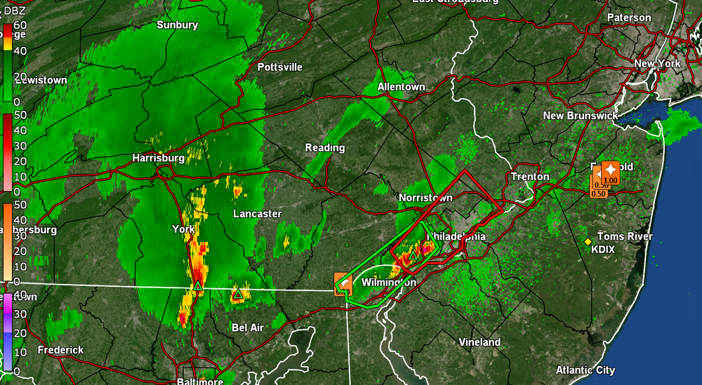
-
E PA/NJ/DE Spring 2025 Obs/Discussion
Hurricane Agnes replied to PhiEaglesfan712's topic in Philadelphia Region
And here we go! It's been pretty sticky since last night and after a low of 64, I made it up to 82, but with dews in the 60s. Currently have big puffy cumulus as the sky begins to cloud up, and temp of 80 with dp 64. -
E PA/NJ/DE Spring 2025 Obs/Discussion
Hurricane Agnes replied to PhiEaglesfan712's topic in Philadelphia Region
Didn't actually *see* any frozen falling during the weekend event but I did register 0.88" of rain Friday night and 0.50" on Saturday, for a 1.38" total for the 2-days. Saturday's high of 43 was definitely toppled by yesterday's 60, where a non-diurnal warming had commenced after midnight yesterday with my low of 40 at midnight. Whatever has been attempting to cross the area this morning has mainly been virga IMBY so far and after a low of 39 earlier this morning, It's currently overcast and 49, with dp 40. -
E PA/NJ/DE Spring 2025 Obs/Discussion
Hurricane Agnes replied to PhiEaglesfan712's topic in Philadelphia Region
Before round 2 comes through, I did pick up 0.41" from the thunder-boomers this morning. Had a low of 61 so far this evening and made it up to 71 for a non-diurnal high just after midnight. Currently 62 with dp 41. -
E PA/NJ/DE Spring 2025 Obs/Discussion
Hurricane Agnes replied to PhiEaglesfan712's topic in Philadelphia Region
And another sound and light show incoming - this time early morning. STS up for south of me - Currently getting rain (0.07" in bucket at post time) and 67 with juicy dp of 66.