Hurricane Agnes
-
Posts
9,336 -
Joined
Content Type
Profiles
Blogs
Forums
American Weather
Media Demo
Store
Gallery
Everything posted by Hurricane Agnes
-
E PA/NJ/DE Summer 2025 Obs/Discussion
Hurricane Agnes replied to Hurricane Agnes's topic in Philadelphia Region
Some of the highest cloud tops for that are up over 45k ft ASL. -
E PA/NJ/DE Summer 2025 Obs/Discussion
Hurricane Agnes replied to Hurricane Agnes's topic in Philadelphia Region
Saw a TOR is up in the area! -
E PA/NJ/DE Summer 2025 Obs/Discussion
Hurricane Agnes replied to Hurricane Agnes's topic in Philadelphia Region
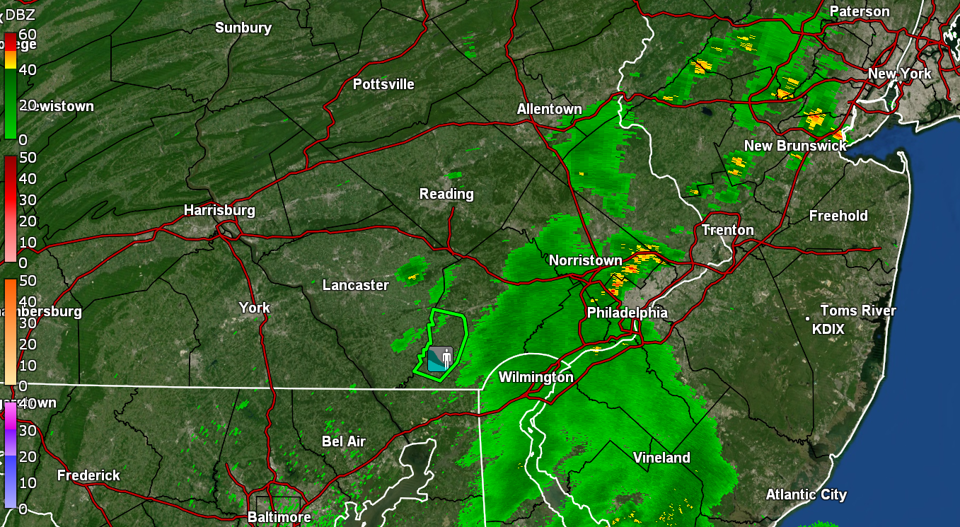
Keeps semi- fizzling here. Finally got a bit heavier rain rate but still under 1"/hr (highest was 0.9"/hr so far). Currently have 0.37" in the bucket at post time with temp 75 and dp 74. -
E PA/NJ/DE Summer 2025 Obs/Discussion
Hurricane Agnes replied to Hurricane Agnes's topic in Philadelphia Region
Severe Thunderstorm Watches are up - Made it up to 92 today after a 77 low before it clouded over. Got up to 96 yesterday and unfortunately had to go out in it to an afternoon dentist appointment in Ft. Washington. Ugh. Had 14 days of 90+ in July + 8 days of 90+ in June for 2 days so far this season. Currently down to 81 with 77 dp and the RAIN has come! However I only have 0,.08 inches in the bucket so it is just getting started. -
E PA/NJ/DE Summer 2025 Obs/Discussion
Hurricane Agnes replied to Hurricane Agnes's topic in Philadelphia Region
I finally managed to get 0.02" overnight before midnight, which was not really enough but I guess it kept me from a total miss. Still have to pull out the hose. My Upper Darby sis said they got a deluge with near an 1". After a 73 low yesterday, my high did end up being 96, making it 11, 90+ days in July so far. With the 8, 90+ days in June (with one of them being a 100), that takes me to 19 for the season at post time. Currently partly sunny and 75 with dp 73. -
E PA/NJ/DE Summer 2025 Obs/Discussion
Hurricane Agnes replied to Hurricane Agnes's topic in Philadelphia Region
DAMMIT! Got maybe 20 drops from that line. Literally nothing measurable enough to tip the bucket, let alone wet the street and walks. The heavier stuff bubbled north and south of me. It did drop the temp about 15 degrees from my 96 high to the current 82 with dp 75. Currently mostly cloudy and hope something will bubble up or I'll have to pull out the hose. -
E PA/NJ/DE Summer 2025 Obs/Discussion
Hurricane Agnes replied to Hurricane Agnes's topic in Philadelphia Region
Severe Thunderstorm Watches are up! Need the rain now - seriously! I also heard a cicada so loud that the sound was audible through the brick walls and almost sound-proof windows! Currently 95 here with dp an awful 80. Some fair weather cumulus are bubbling up too. -
E PA/NJ/DE Summer 2025 Obs/Discussion
Hurricane Agnes replied to Hurricane Agnes's topic in Philadelphia Region
Thanks to the overcast and on and off rain, I didn't hit 80 today. Bottomed out at 70 and only made it up to 78 (at least so far). Also picked up 0.30", which was welcome since a few days ago I just had a hundredth or two of rain since the 1.30" from Monday. Still, I am up to 6.5" for the month of July so far. Currently overcast and 76 with dp that has crept back up into the 70s and is at 74. -
E PA/NJ/DE Summer 2025 Obs/Discussion
Hurricane Agnes replied to Hurricane Agnes's topic in Philadelphia Region
The heaviest returns have so far moved east and am down to light rain with 1.26" in the bucket. That takes me up to 5.78" of rain for the month so far. It did knock the temp down and it's currently 74 with dp 73. -
E PA/NJ/DE Summer 2025 Obs/Discussion
Hurricane Agnes replied to Hurricane Agnes's topic in Philadelphia Region
Had a pop-up shower yesterday that gave me 0.07" but am now under a > 2.5"/hr gully washer with 0.70" in the bucket at post time, and over 5" for the month so far. Did hit 90 today for #8 of 90+ days this month. Currently heavy rain and 75 with dp 74. -
E PA/NJ/DE Summer 2025 Obs/Discussion
Hurricane Agnes replied to Hurricane Agnes's topic in Philadelphia Region
Finished up with 0.99" yesterday, 2.88" over the past 3 days, and 4.45" for the month of July so far. Bottomed out at 67 this morning and it's currently overcast and 72 with dp 69. -
E PA/NJ/DE Summer 2025 Obs/Discussion
Hurricane Agnes replied to Hurricane Agnes's topic in Philadelphia Region
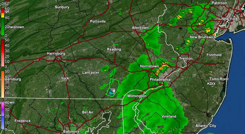
My rain rates have gradually increased to almost 1"/hr give or take, as the heaviest, and now back down to about 1/3"/hr and currently have 0.53" in the bucket at post time. Temp down to 74 with dp 73. Most of the current heavier returns have moved to my east. Looks like a TOR up in DE.
-
E PA/NJ/DE Summer 2025 Obs/Discussion
Hurricane Agnes replied to Hurricane Agnes's topic in Philadelphia Region
This is a noisier storm than yesterday (although yesterday had the winds). Rain rates have been somewhat modest - ~1/3"/hr so far. Have 0.08" in the bucket at post time. Temp knocked down to 77 with dp 75. -
E PA/NJ/DE Summer 2025 Obs/Discussion
Hurricane Agnes replied to Hurricane Agnes's topic in Philadelphia Region
It got pitch black here and rain is starting, coming up from the SW. Temp is 83 with dp 74 and getting thunder and some lightning.
-
E PA/NJ/DE Summer 2025 Obs/Discussion
Hurricane Agnes replied to Hurricane Agnes's topic in Philadelphia Region
Wash. Rinse. Repeat. Currently clouding up IMBY with a temp of 87 and dp of 72, -
E PA/NJ/DE Summer 2025 Obs/Discussion
Hurricane Agnes replied to Hurricane Agnes's topic in Philadelphia Region
Wasn't sure if I'd get there but I did tap 90 today just after 2:30 pm. That was day 4 in a row for a current heatwave and have now had 6 of 9 days in July of 90 and above. For the past 3 months (MJJ) so far, I have had 13 days of 90+ & 1 day of 100. It's currently a partly sunny and hazy 88 with dp 72. -
E PA/NJ/DE Summer 2025 Obs/Discussion
Hurricane Agnes replied to Hurricane Agnes's topic in Philadelphia Region
I finished up with 0.92" for the day (1.90" over the past 2 days and 3.47" for the month of July so far). I even got treated to a double rainbow at the end that I didn't know was out there until my Wyndmoor sis texted a pic of it from her house (she's a couple miles from me). Currently clearing and 73 with dp 73. -
E PA/NJ/DE Summer 2025 Obs/Discussion
Hurricane Agnes replied to Hurricane Agnes's topic in Philadelphia Region
Still getting some light rain from the back edge as it slowly moves through, plus come thunder. Currently have 0.71" in the bucket. Temp is 73 with dp 72. ETA - have 1.69" rain over the past 2 days (at post edit time) and 3.24" for the month of July so far. -
E PA/NJ/DE Summer 2025 Obs/Discussion
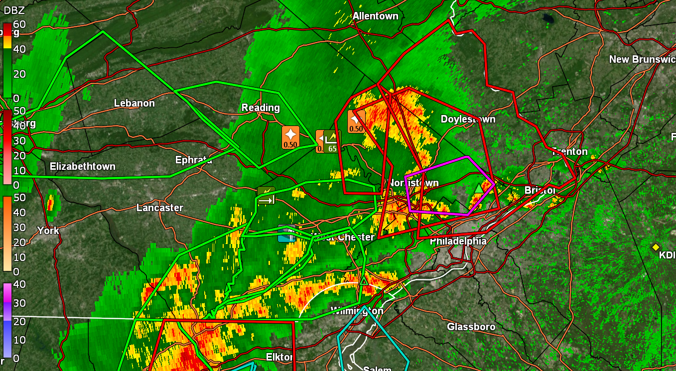
Hurricane Agnes replied to Hurricane Agnes's topic in Philadelphia Region
Now >2"/hr rates. Have 0.56" in the bucket. Temp down to 73 with dp 73. -
E PA/NJ/DE Summer 2025 Obs/Discussion
Hurricane Agnes replied to Hurricane Agnes's topic in Philadelphia Region
Getting >1.5"/hr rain rates. Have 0.28" in the bucket at post time. Temp down to 75 with dp 73. -
E PA/NJ/DE Summer 2025 Obs/Discussion
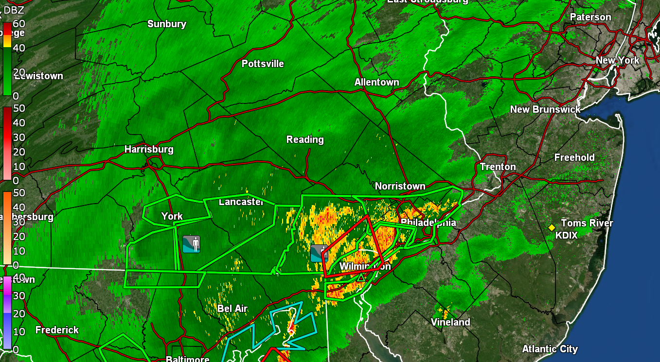
Hurricane Agnes replied to Hurricane Agnes's topic in Philadelphia Region
Getting the rains now and winds are pretty fierce. Temp dropped and down to 81 with dp 76. Sky is black.
-
E PA/NJ/DE Summer 2025 Obs/Discussion
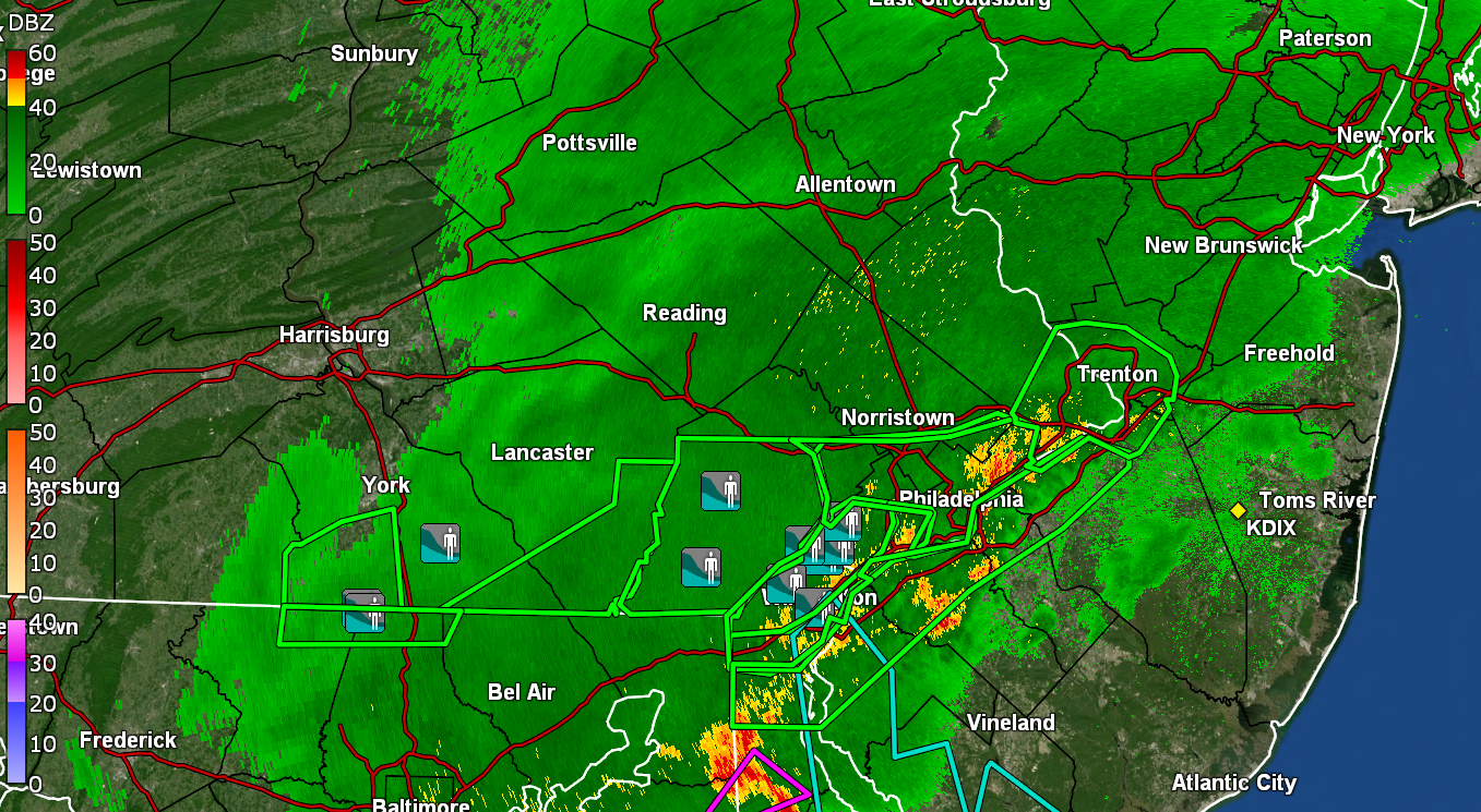
Hurricane Agnes replied to Hurricane Agnes's topic in Philadelphia Region
Getting hit with a gust front - I peeped out and the winds suddenly came. Looks like around Jenkintown (about 4 miles NE of me) may have had the rotation. -
E PA/NJ/DE Summer 2025 Obs/Discussion
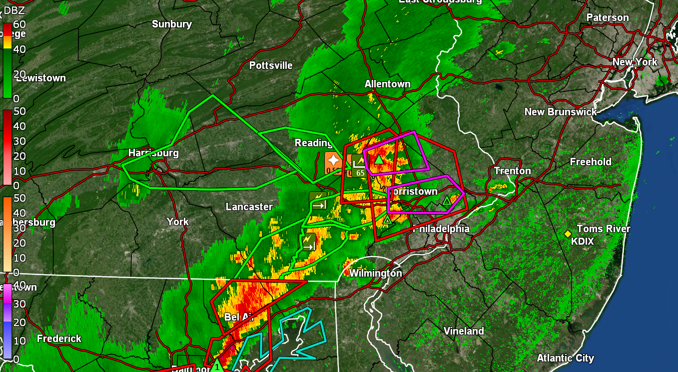
Hurricane Agnes replied to Hurricane Agnes's topic in Philadelphia Region
Am under a TOR. EAS Warned.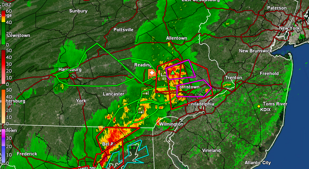
-
E PA/NJ/DE Summer 2025 Obs/Discussion
Hurricane Agnes replied to Hurricane Agnes's topic in Philadelphia Region
Here we go - So far have had a high of 93 and currently 92 with dp 78. -
E PA/NJ/DE Summer 2025 Obs/Discussion
Hurricane Agnes replied to Hurricane Agnes's topic in Philadelphia Region
After some dribs and drabs, I finished up with 0.98" from that isolated band. Currently a soupy 75 with dp 74.