Hurricane Agnes
-
Posts
9,336 -
Joined
Content Type
Profiles
Blogs
Forums
American Weather
Media Demo
Store
Gallery
Everything posted by Hurricane Agnes
-
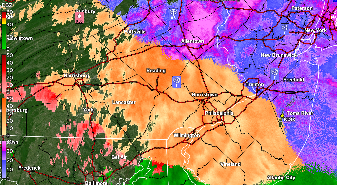
E PA/NJ/DE Winter 2025-26 Obs/Discussion
Hurricane Agnes replied to LVblizzard's topic in Philadelphia Region
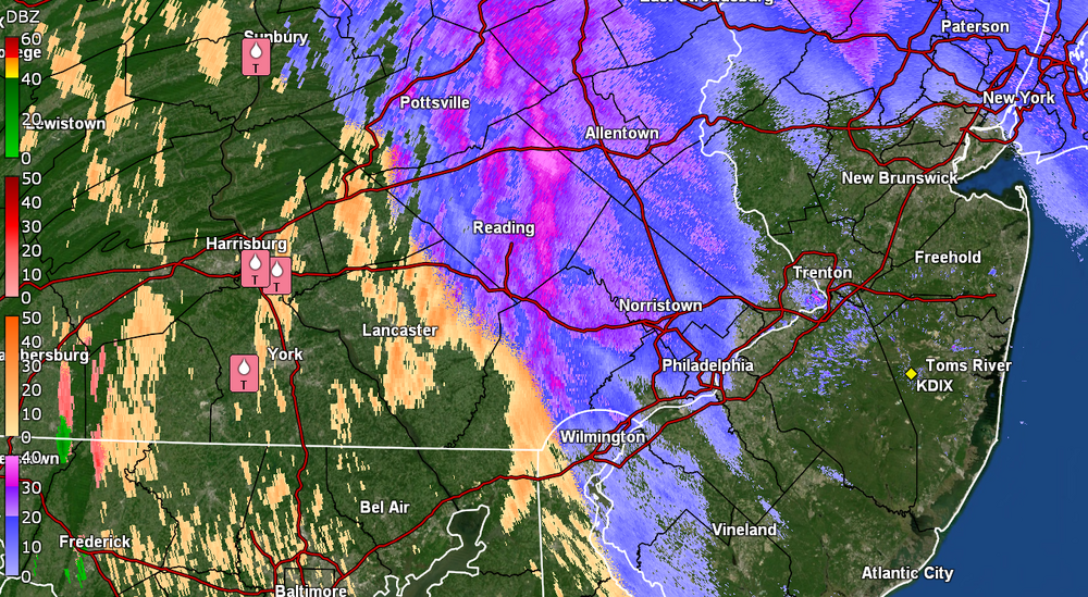
Currently getting SN but it's having a hard time sticking here in NW Philly. It refreshed the dusting from earlier that was almost gone so there's that. Might be approaching about 1/4" so far so will see if it chills the ground enough as the heavier band comes in. Temp is 34 with dp 30.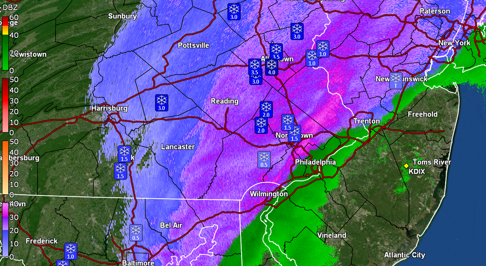
-
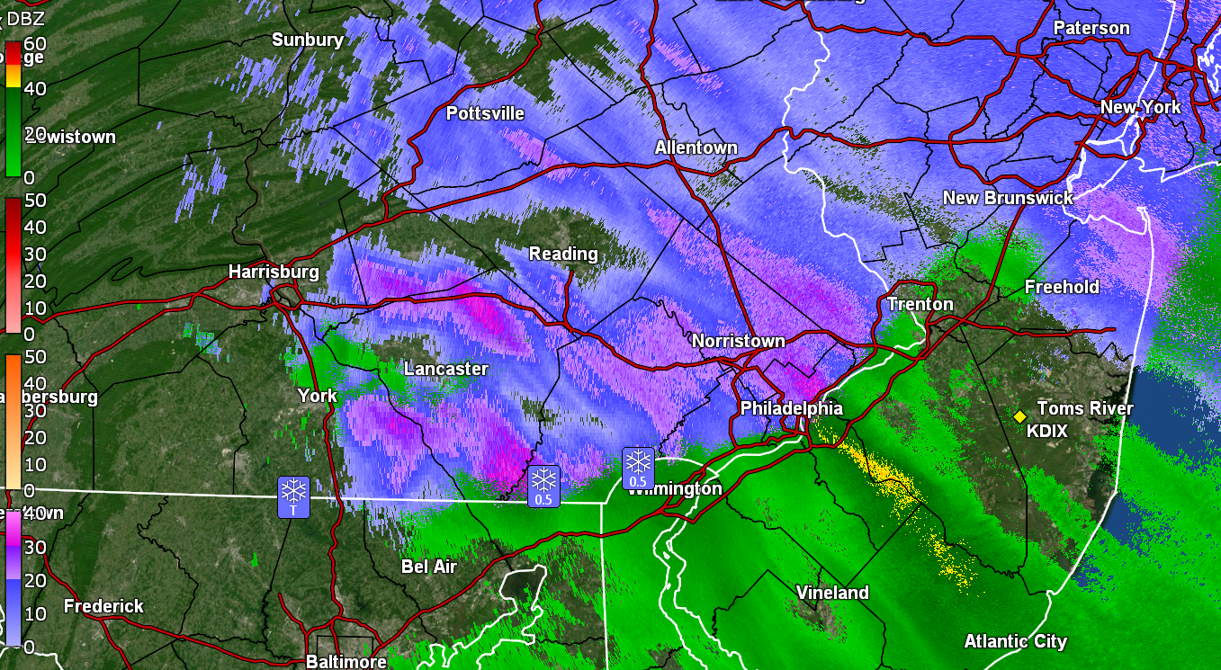
E PA/NJ/DE Winter 2025-26 Obs/Discussion
Hurricane Agnes replied to LVblizzard's topic in Philadelphia Region
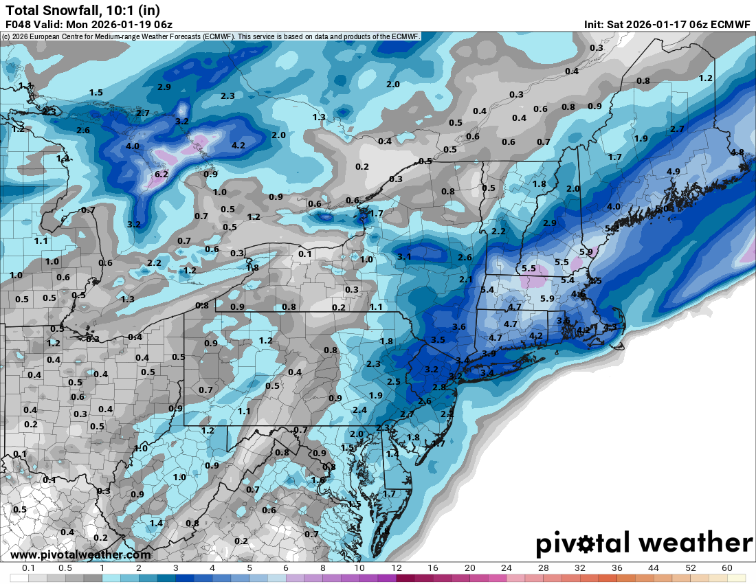
The 6z 3k NAM and EC are throwing a few inches at the Philly metro area.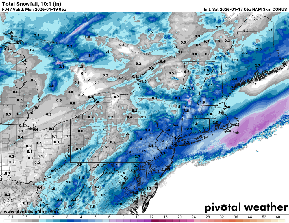

-
E PA/NJ/DE Winter 2025-26 Obs/Discussion
Hurricane Agnes replied to LVblizzard's topic in Philadelphia Region
Have a dusting of snow now, although I think there was/is a snow/rain mix out there. The temps have actually been rising here since midnight, which was my low today, of 32 and it got up to 36 before the precip started. Currently light snow and 35 with dp 26.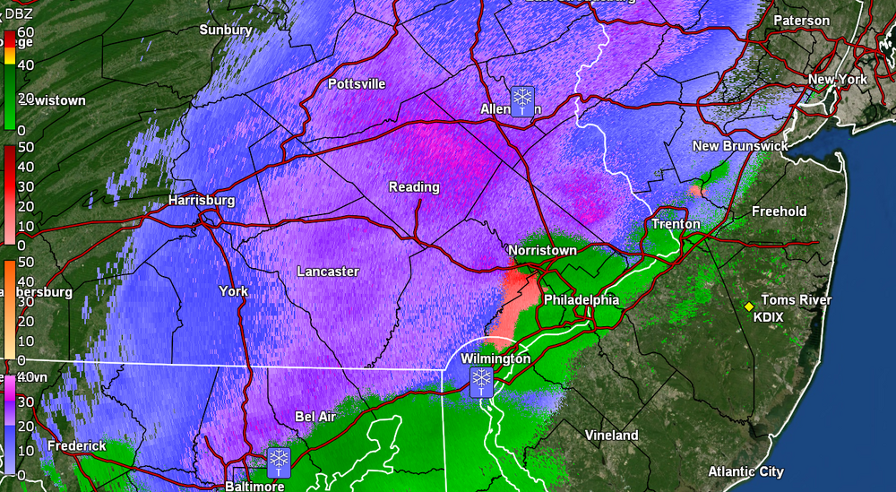
-
E PA/NJ/DE Winter 2025-26 Obs/Discussion
Hurricane Agnes replied to LVblizzard's topic in Philadelphia Region
My last below freezing low was on Tues. (1/6) with a 29. Yesterday's low 37 and this morning's low was 39 here in NW Philly. Made it up to 53 yesterday but "only" 51 today and current temp is 42 with dp 35. -
E PA/NJ/DE Winter 2025-26 Obs/Discussion
Hurricane Agnes replied to LVblizzard's topic in Philadelphia Region
Looking at where that 0C line is set up N/W of Philly metro. "Traditionally", there has been some "event" around mid-January, around MLK day, so will see which way the temps go when we get there! -
E PA/NJ/DE Winter 2025-26 Obs/Discussion
Hurricane Agnes replied to LVblizzard's topic in Philadelphia Region
It was soup out there although it has now suddenly mostly lifted IMBY within the past half hour or so. My earlier vis. had to be no more than about 100 ft several hours ago. Made it up to 42 yesterday after a 29 low, and am currently at 39, after a low so far of 37. -
E PA/NJ/DE Winter 2025-26 Obs/Discussion
Hurricane Agnes replied to LVblizzard's topic in Philadelphia Region
So far have a 1/4" coating from snow that happened between midnight and 3 am and it's currently SN- and 21 with dp 15. My temp actually bottomed out at 20 just after 1:30 am.
-
E PA/NJ/DE Winter 2025-26 Obs/Discussion
Hurricane Agnes replied to LVblizzard's topic in Philadelphia Region
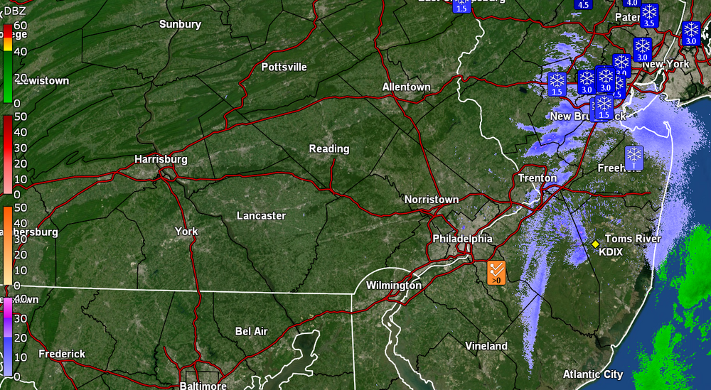
Down to SN- and flurries and measured 3/4" from that squall dump! Temp currently 28 with dp 27. The rest of Jersey and down into central Delaware under the Warning -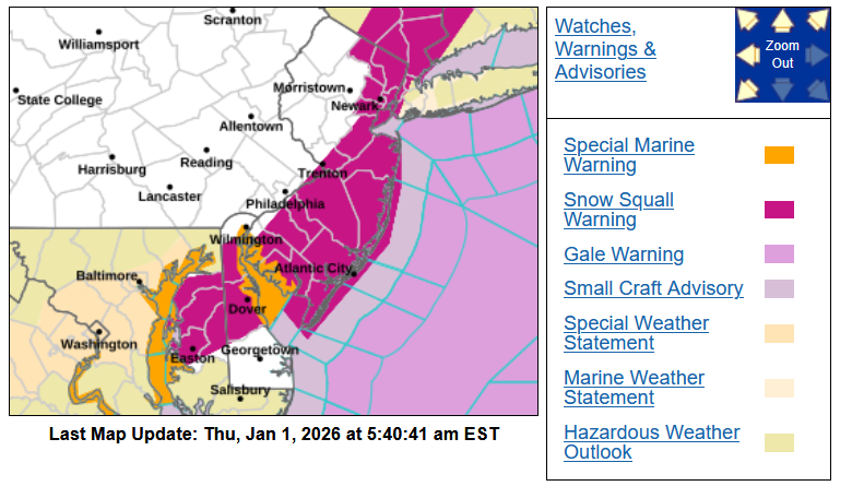
-
E PA/NJ/DE Winter 2025-26 Obs/Discussion
Hurricane Agnes replied to LVblizzard's topic in Philadelphia Region
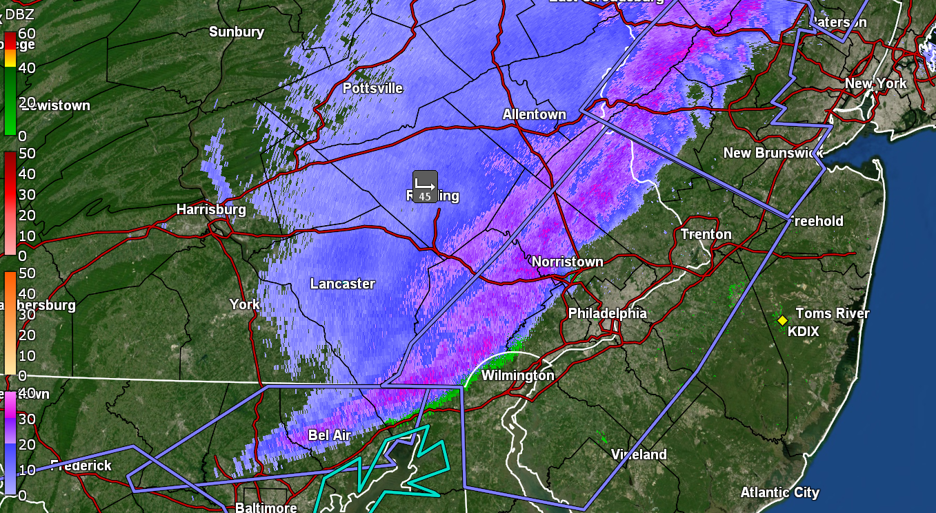
And BOOM! White out! ETA temp down to 29 and falling, dp 27. -
E PA/NJ/DE Winter 2025-26 Obs/Discussion
Hurricane Agnes replied to LVblizzard's topic in Philadelphia Region
Was getting virga but finally have big flakes. Temp 34, dp 27.
-
E PA/NJ/DE Winter 2025-26 Obs/Discussion
Hurricane Agnes replied to LVblizzard's topic in Philadelphia Region
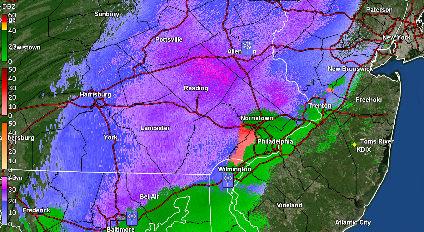
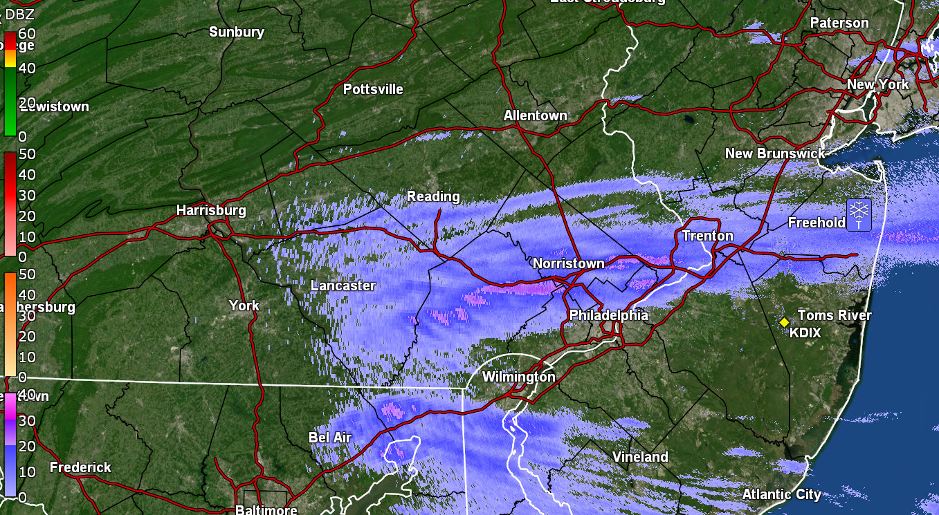
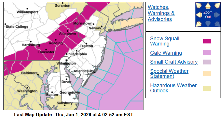
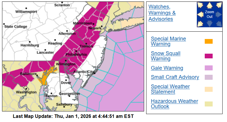
SSW lofted for Philly Metro, New Jersey, and Delaware - That band looks like it means business!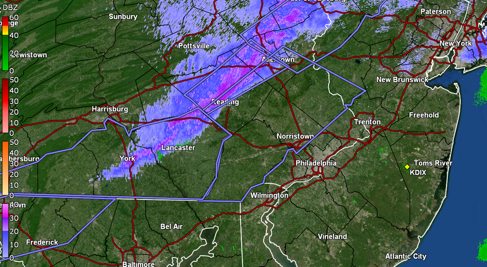

-
SSW now lofted for immediate Philly Metro, as well as in Jersey & Delaware - That band looks like it means business!
-
E PA/NJ/DE Winter 2025-26 Obs/Discussion
Hurricane Agnes replied to LVblizzard's topic in Philadelphia Region
Snow Squall Warning lofted to counties N/W of Philly - Will see if that holds together to reach Philly. Currently 33 here in NW Philly with dp 26.
-
E PA/NJ/DE Winter 2025-26 Obs/Discussion
Hurricane Agnes replied to LVblizzard's topic in Philadelphia Region
And the cold front (with the wind), is coming through now. Made it up to 51 just before 1 pm and temp is now falling rapidly and down to 44 at post time. Picked up 0.33" of rain today with the prefrontal precip. -
E PA/NJ/DE Winter 2025-26 Obs/Discussion
Hurricane Agnes replied to LVblizzard's topic in Philadelphia Region
I just went up a degree. It has been hovering around 32/33 for hours and whatever frozen was sitting on/in my weather station rain gauge spout, has begun to melt and tip the bucket (at 0.07" at post time). Had bottomed out at 23 just after 2 am and am currently at my high of 34, with changeable skies (have had sun pop in and out today). Have been watching that precip field but have had nothing but virga here when the sun wasn't out. -
Ended up with 0.30" of compacted graupel and sleet, coated with some freezing rain. Temp has been hovering around 27 for the past couple hours but finally ticked up to 28 with dp 26. Have been watching some narrow stationary band, extending from south central NJ to NE NJ, just sitting and I guess snowing.
-
Doesn't seem to be doing anything here in NW Philly except maybe some FRDZ, with about 0.3" of a crust of graupel/sleet/ice. Temp currently 27 with dp 25.
-
You missed the glacial January 1977, I think still the coldest on record here in Philly, back in the days when temps would go below zero more frequently (KPHL hasn't gone below zero for a low since 1994). I remember the walks were literal sheets of ice and the bus route that I took to high school that went up a little hill under train tracks, could not get up it so people had to get off the bus and walk up to the top and then get back on (the route has eventually modified decades later to avoid that hill). Salt truck just came through! Yay!!
-
Getting more sleet mixing in now with the ZR. Temp 26 and dp 24.
-
There were multiple ice storms that winter. It was awful because the state of PA ran out of road salt and consumer halite. I remember having to go on a work trip down to Baltimore that January (by Amtrak) but drove to 30th St. Station. I did my usual down Lincoln Drive and was ready to go up the ramp to City Line Ave to get to the Schuylkill Expressway (figuring that would be treated) and had KYW on where I heard a traffic report about the poor conditions there, so kept straight onto the Kelly Drive instead, going slow. Later found out that they had to close the Expressway due to cars and trucks stuck on the exit/entrance ramps unable to move due to the ice (and those ramps freeze before the roads). I think people were trapped for like 8 hours. Thankfully it was all rain down in Baltimore and they had plenty of halite in the stores, so I was able to buy a couple bags to bring back for my mom. That winter, her front walk ended up being the only one done to the cement because no one else had salt.
-
Gettling light ZR with some flakes mixed in. Untreated surfaces here caved to the graupel and sleet (more graupel then sleet as I didn't hear much sound as it was coming down). Looks like snow on the walks but I know it's not and is treacherous. Temp is currently 26 with dp 23 (so finally out of the teens).

-
Nowcasting now since it's here! Getting a mix of snow and graupel here in NW Philly. Temp is 28 but dp is way down in the teens at 14.
-
E PA/NJ/DE Winter 2025-26 Obs/Discussion
Hurricane Agnes replied to LVblizzard's topic in Philadelphia Region
Picked up a quick 1/4" before the mix started and currently have a light rain/snow mix with temp @33 and dp 32. -
E PA/NJ/DE Winter 2025-26 Obs/Discussion
Hurricane Agnes replied to LVblizzard's topic in Philadelphia Region
Pancakes flying here. Had virga the past couple hours but stuff has arrived! Already coating the cars, grass, and untreated surfaces. Temp is 36 with dp 31.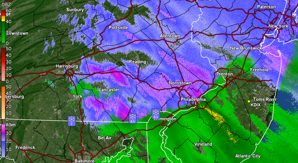
-
E PA/NJ/DE Winter 2025-26 Obs/Discussion
Hurricane Agnes replied to LVblizzard's topic in Philadelphia Region
I was listening to KYW about an hour ago and the traffic report was already talking about down trees (e.g., in Delco). But flying cows! Temp here has dropped over 15 degrees from my earlier high and I'm down to 40 with dp 28.