Hurricane Agnes
-
Posts
9,336 -
Joined
Content Type
Profiles
Blogs
Forums
American Weather
Media Demo
Store
Gallery
Everything posted by Hurricane Agnes
-
1/19/25 Eagles Playoff Winter Storm obs
Hurricane Agnes replied to Ralph Wiggum's topic in Philadelphia Region
We've actually seen them hanging on the rail pecking. The guy who originally owned the house before my sis and BIL bought it (just over 20 years ago) had built a custom deck (it's like 15 ft wide by 25 ft deep) and used "indoor" wood banister-type railing as the deck rail (and then stained/painted it). The little guys were also all over the wooden playhouse/swing set that my sis had when my niece was little. You can tell the carpenter bee holes because they are perfectly round! I remember way back having a carpenter bee make a "home" in my broomstick. As an obs, I think I may be pretty much done and aside from a few flurries, it's overcast, breezy, and the temp has been dropping. Am down to 23 with dp 21. -
1/19/25 Eagles Playoff Winter Storm obs
Hurricane Agnes replied to Ralph Wiggum's topic in Philadelphia Region
Am down to SN- with some fatties mixed in, and even have some breaks in the clouds although I expect that will close over as the back edge moves this way. Those are good-sized birds. My Montco sis gets the smaller downy woodpeckers who manage to make buckshot holes all over her deck rails. -
1/19/25 Eagles Playoff Winter Storm obs
Hurricane Agnes replied to Ralph Wiggum's topic in Philadelphia Region
Looks like a pilated woodpecker! Didn't consider if they ever went to feeders but there it is... -
1/19/25 Eagles Playoff Winter Storm obs
Hurricane Agnes replied to Ralph Wiggum's topic in Philadelphia Region
Just measured 3.5" here with SN and some bigger flakes mixing in. The snow seems wet so I expect there is definite compaction. Currently getting snow and fog with temp 26, and dp 26. -
1/19/25 Eagles Playoff Winter Storm obs
Hurricane Agnes replied to Ralph Wiggum's topic in Philadelphia Region
Have to add this - eagles-nfc-divisional-snowangels-01192025.mp4 -
1/19/25 Eagles Playoff Winter Storm obs
Hurricane Agnes replied to Ralph Wiggum's topic in Philadelphia Region
About an hour ago, someone kicked in the after-burner and the temp dropped below freezing, the graupel machine was engaged, and the winds kicked in, blowing stuff around. Did a 6:15 pm measure and have 3.25", which considering the dry slot, above-freezing temps, and white rain earlier, had kept the accumulations down for at least an hour or more before something finally started to pile up. Currently SN and 27 with dp 27. -
1/19/25 Eagles Playoff Winter Storm obs
Hurricane Agnes replied to Ralph Wiggum's topic in Philadelphia Region
And jumbo dryslot opened up over me leaving nothing but drizzle. Am still sitting at 32 and everything has been slowly melting/dripping. I did a 2:30 pm measure and barely got 0.25", which I expect is compacting. Currently misty and 32 with dp 31.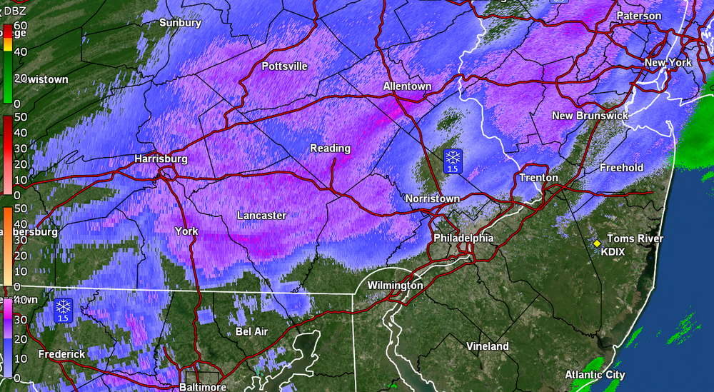
-
1/19/25 Eagles Playoff Winter Storm obs
Hurricane Agnes replied to Ralph Wiggum's topic in Philadelphia Region
Once the temp dropped to 32 and I got under a heavier return, some of the treated surfaces (that were done for the last storm) caved. Getting back and forth snizzle and then SN. ETA - dry slot looks like it wants to fill the gap but will see.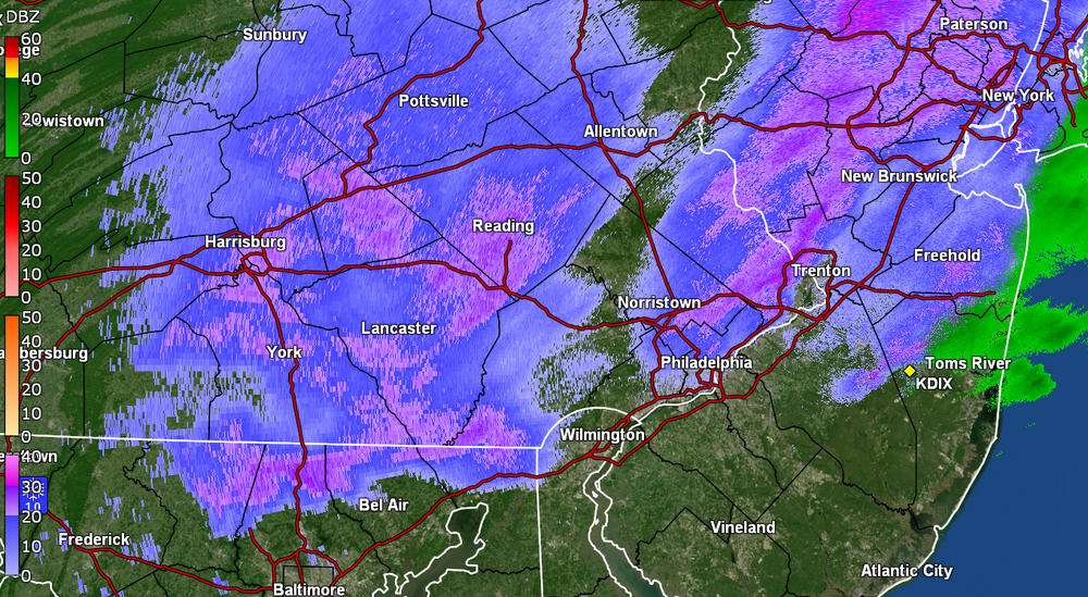
-
1/19/25 Eagles Playoff Winter Storm obs
Hurricane Agnes replied to Ralph Wiggum's topic in Philadelphia Region
The previous hour or so of precipitation resulted in no stickage whatsoever. Once the temp eased down to 33, I'm finally seeing some of the grassy areas cave as well as some untreated cold surfaces. Have been getting intermittent white rain. My Delco sis texted that she was getting sleet down in the Upper Darby area. Currently SN- and 33 with dp 31.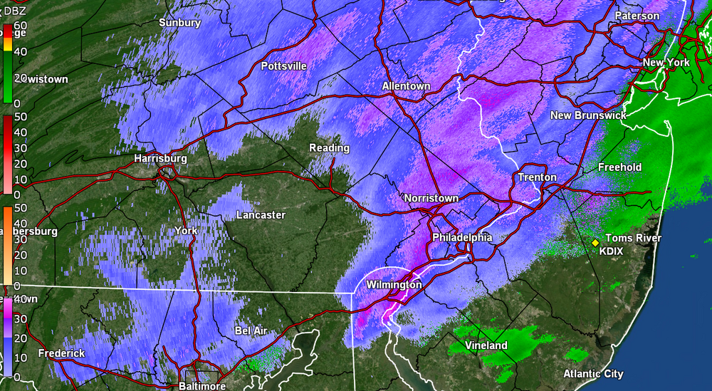
-
1/19/25 Eagles Playoff Winter Storm obs
Hurricane Agnes replied to Ralph Wiggum's topic in Philadelphia Region
Flurries began here within the past 45 minutes but am now up to SN. Temp is still above freezing at 35 & dp 31 but slowly creeping down as everything cools. They have been tailgating ahead of the game so they can eventually become snow cones. -
1/19/25 Eagles Playoff Winter Storm obs
Hurricane Agnes replied to Ralph Wiggum's topic in Philadelphia Region
Above from the other thread but I was wondering if any of that was making it to the ground as I watched that whole area suddenly blossom into existence. At post time, it's well above freezing here IMBY in NW Philly and is overcast and 36, with dp 33. There are just a few patches of snow left on protected grassy areas. -
Sunday 1/19 Eagles Game Snow and Stuff
Hurricane Agnes replied to Ralph Wiggum's topic in Philadelphia Region
WSW has now been ticked to the east to include Philly metro - Currently 34 with dp 33 and misty.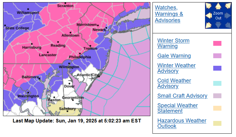
-
Sunday 1/19 Eagles Game Snow and Stuff
Hurricane Agnes replied to Ralph Wiggum's topic in Philadelphia Region
-
Sunday 1/19 Eagles Game Snow and Stuff
Hurricane Agnes replied to Ralph Wiggum's topic in Philadelphia Region
Blend is keeping it conservative (might be seeing the west shift).
-
Sunday 1/19 Eagles Game Snow and Stuff
Hurricane Agnes replied to Ralph Wiggum's topic in Philadelphia Region
Throwing in the Canadian which is aligned with the others...
-
Sunday 1/19 Eagles Game Snow and Stuff
Hurricane Agnes replied to Ralph Wiggum's topic in Philadelphia Region
This forum's threads go back to late 2010 when we migrated over from EasternWx to AmericanWx, so you could go hunting for any threads in the period. -
Sunday 1/19 Eagles Game Snow and Stuff
Hurricane Agnes replied to Ralph Wiggum's topic in Philadelphia Region
Flags up... -
Sunday 1/19 Eagles Game Snow and Stuff
Hurricane Agnes replied to Ralph Wiggum's topic in Philadelphia Region
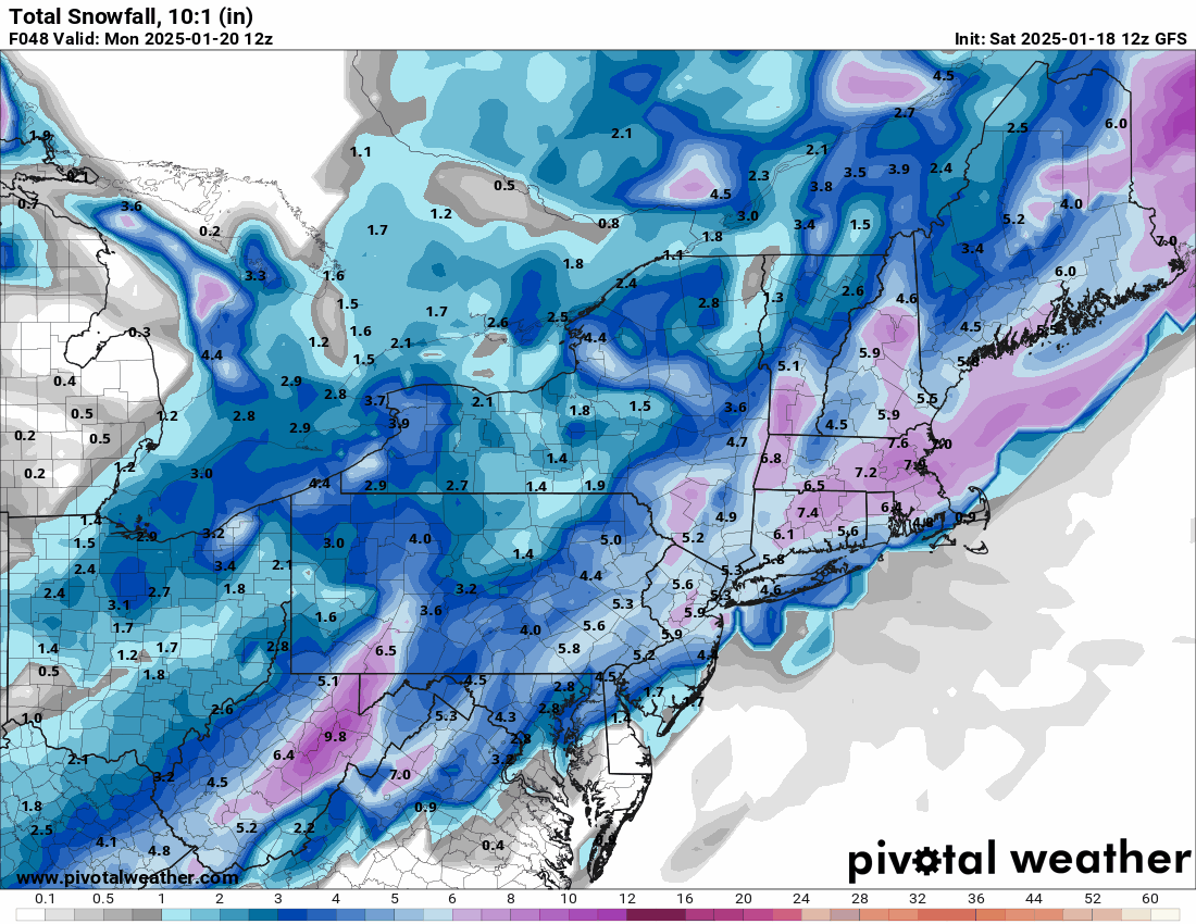
I know we are more in the short range/convective model timeframe now but since it's running, here's the 12 GFS -

-
E PA/NJ/DE Winter 2024/25 Obs/Discussion
Hurricane Agnes replied to JTA66's topic in Philadelphia Region
Made it up to 41 yesterday and everything not in a N/NE-facing area, melted. Bottomed out at 28 this morning and the temp is steadily rising. Currently 35 with dp 31, and overcast skies. -
Sunday 1/19 Eagles Game Snow and Stuff
Hurricane Agnes replied to Ralph Wiggum's topic in Philadelphia Region
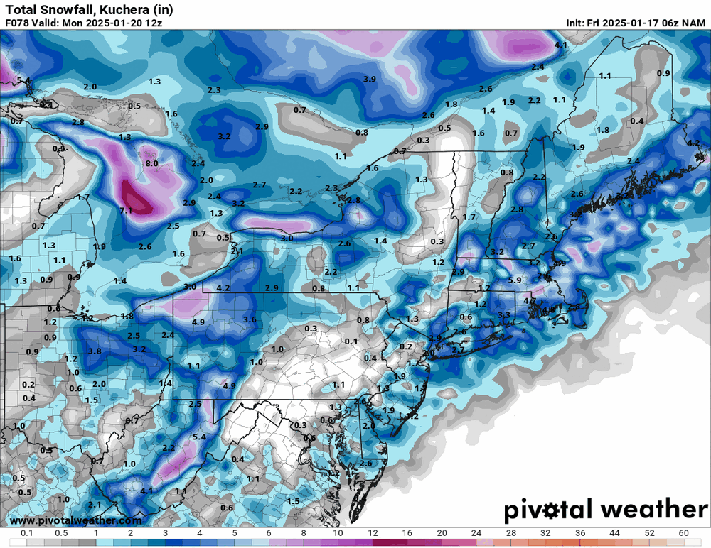
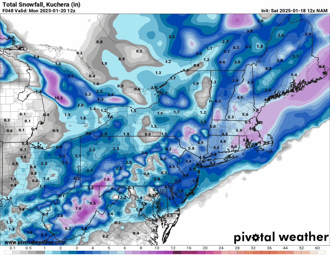
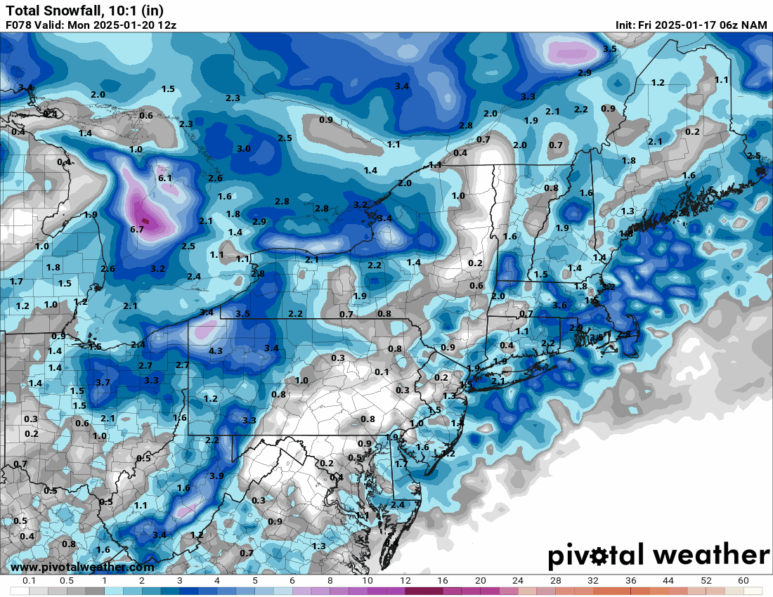
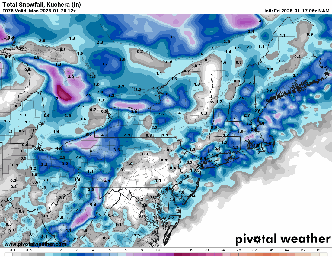
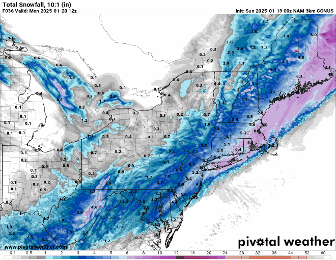
12z NAMs (12k & 3k)
-
Sunday 1/19 Eagles Game Snow and Stuff
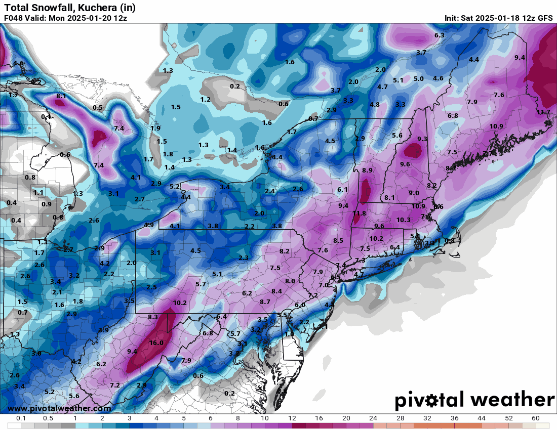
Hurricane Agnes replied to Ralph Wiggum's topic in Philadelphia Region
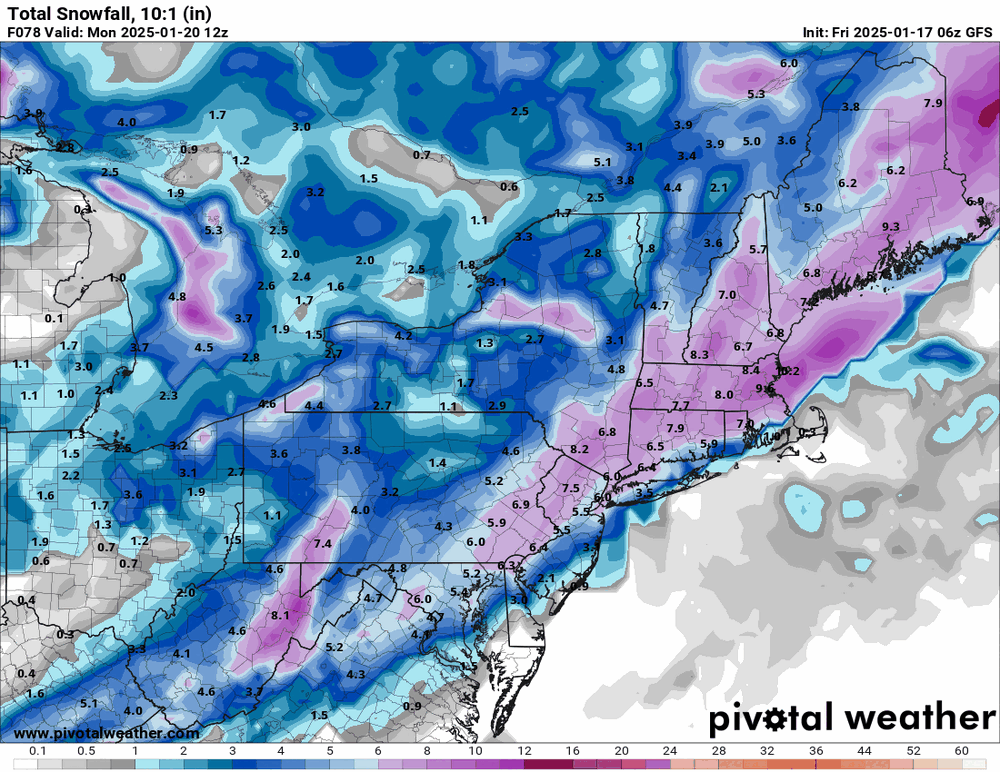
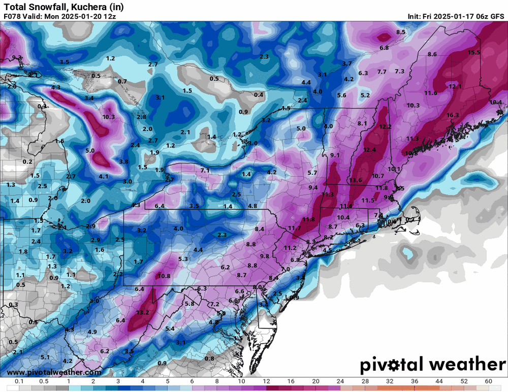
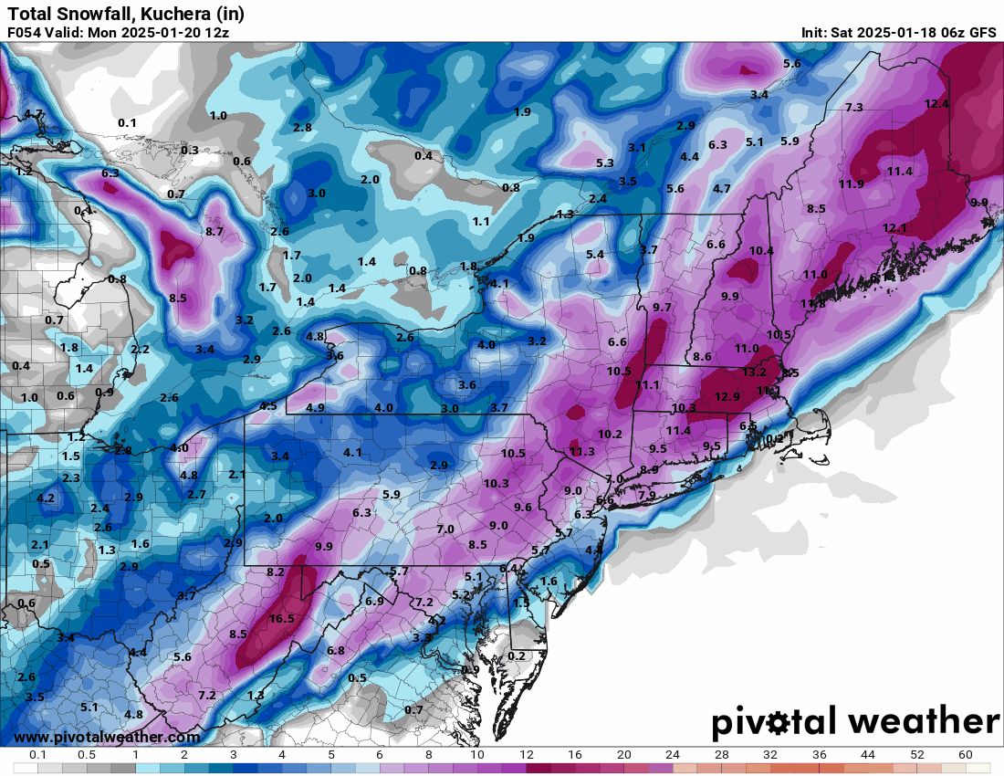
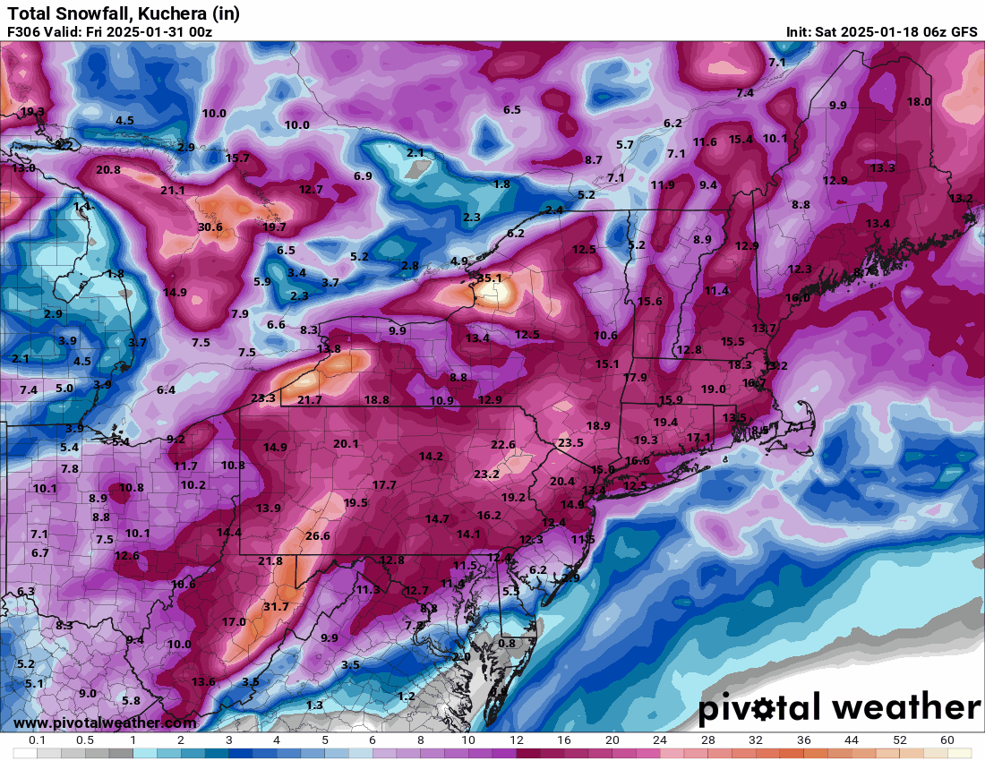
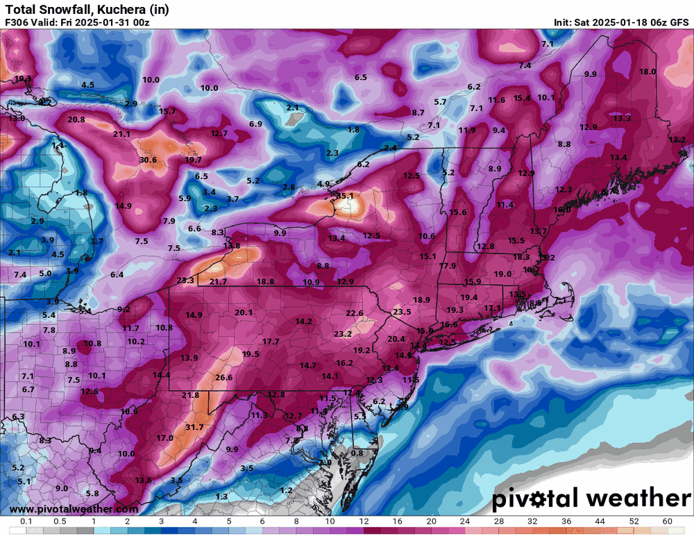
6z GFS still holding the line but when I first popped over to the site to check, I got a 306 hr HECS frame initially! Including that eye-popping image after the one for this weekend's storm.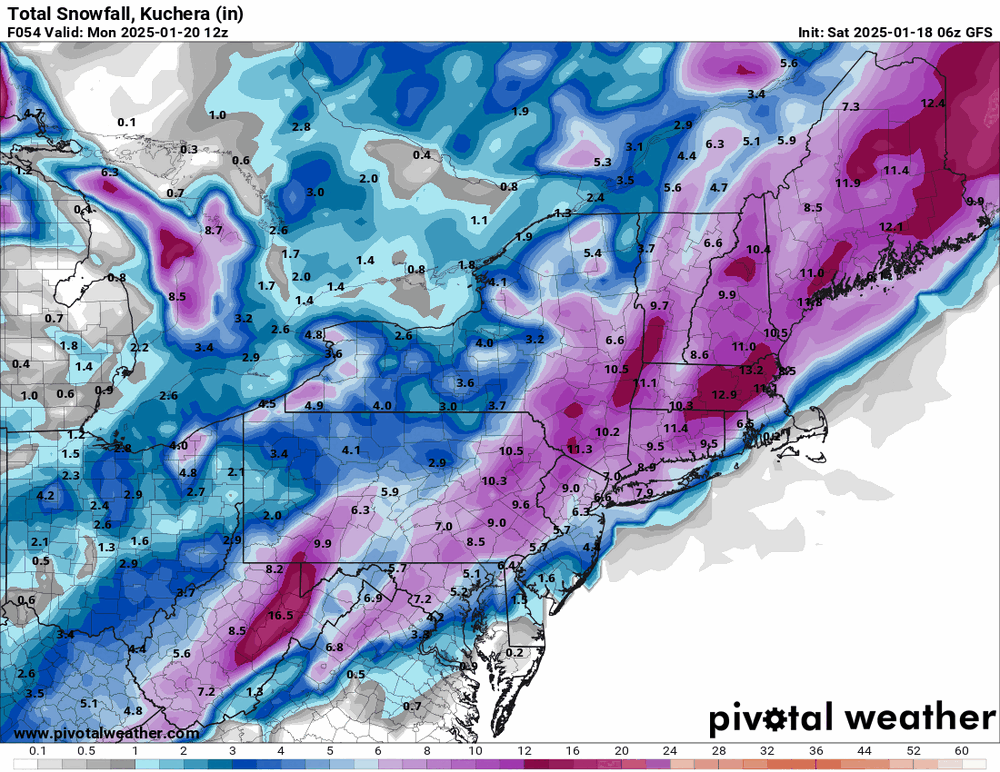
-
Sunday 1/19 Eagles Game Snow and Stuff
Hurricane Agnes replied to Ralph Wiggum's topic in Philadelphia Region
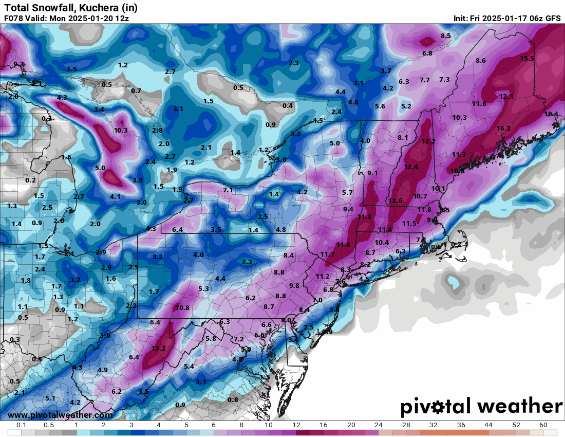
The 12k shows it better (although it goes out longer too).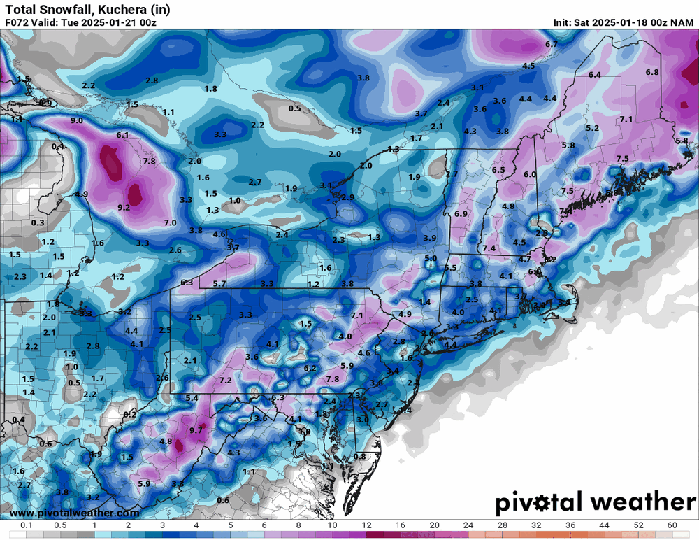
-
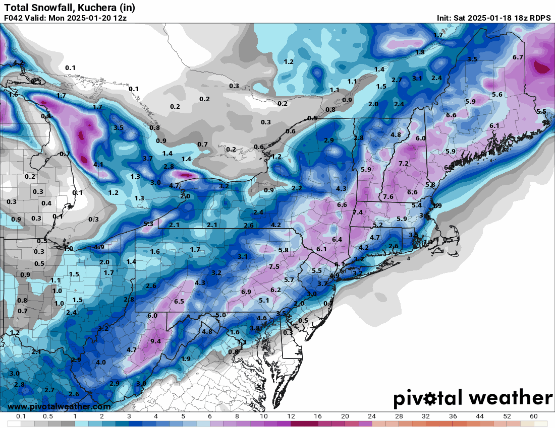
Sunday 1/19 Eagles Game Snow and Stuff
Hurricane Agnes replied to Ralph Wiggum's topic in Philadelphia Region
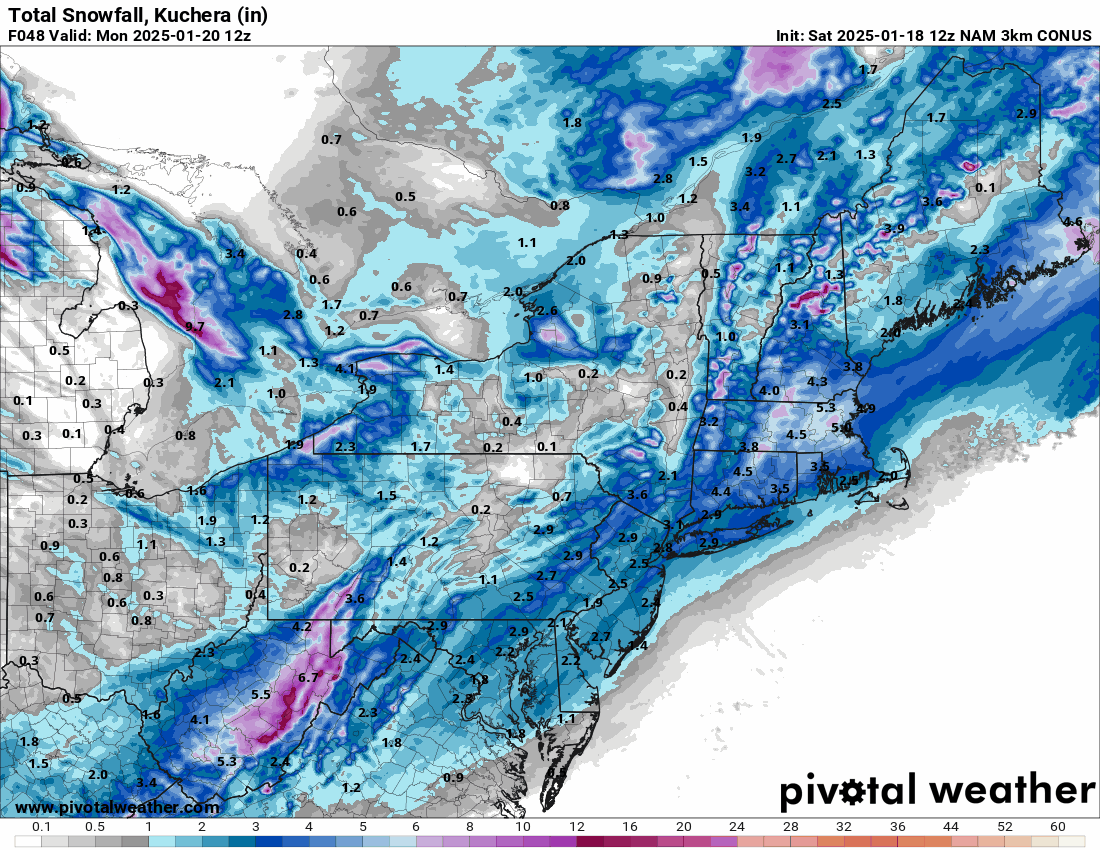
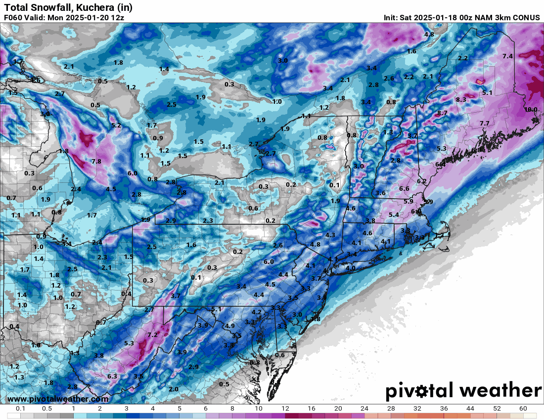
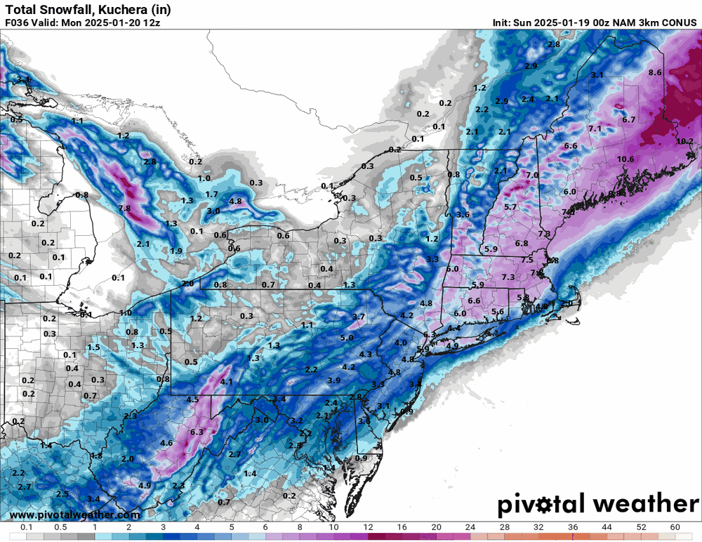
3k NAM as far as she goes out...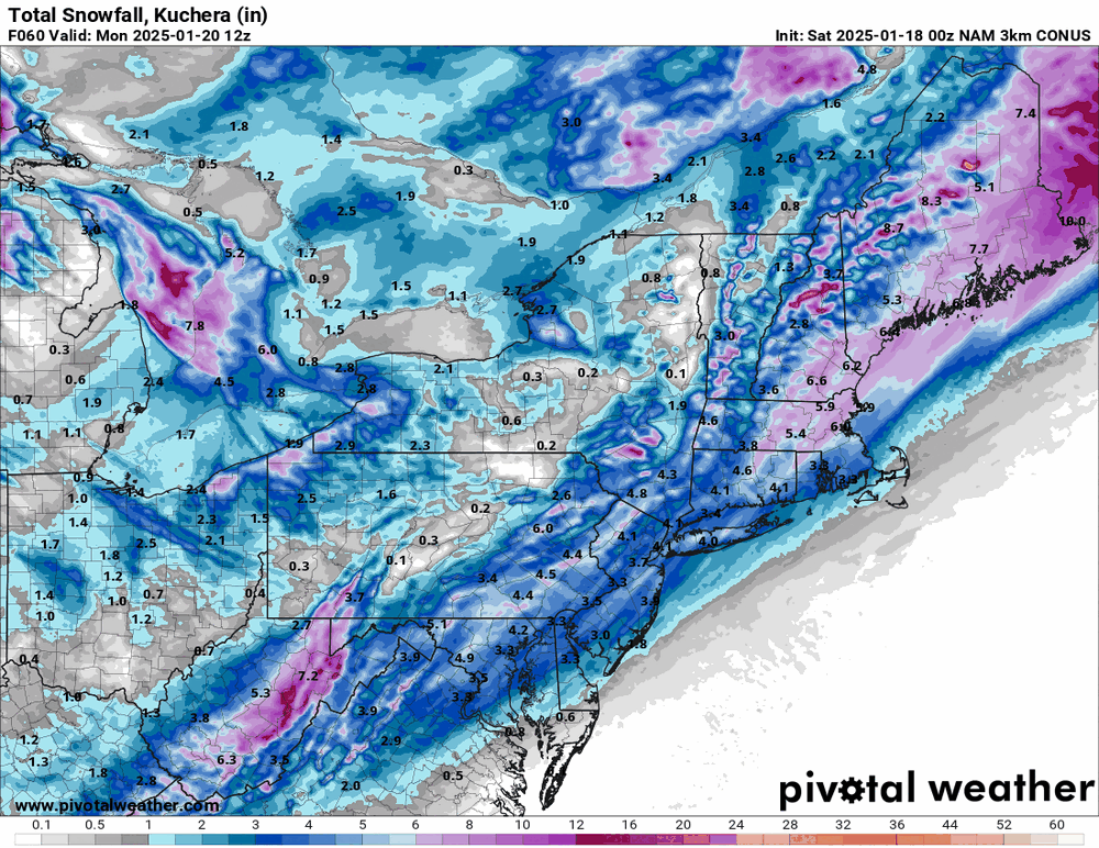
-
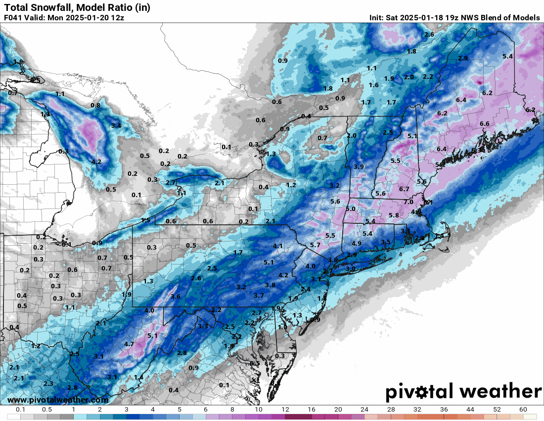
Sunday 1/19 Eagles Game Snow and Stuff
Hurricane Agnes replied to Ralph Wiggum's topic in Philadelphia Region
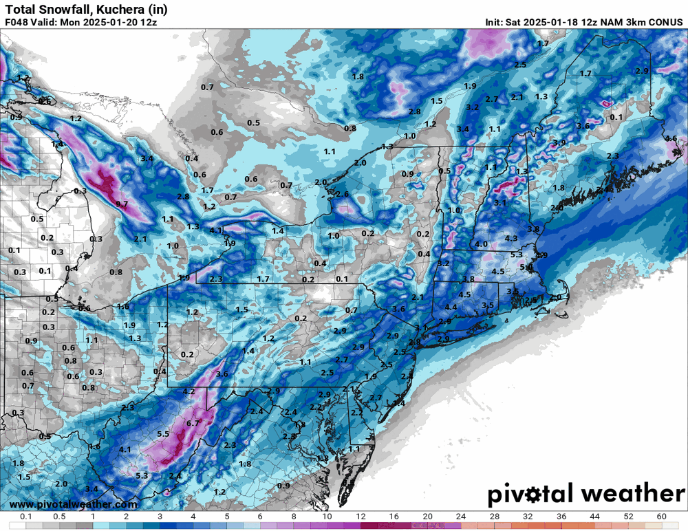
Blendy McBlendface. Keeping the powder REAL dry! It's looking a bit juicier but still has some frames to go.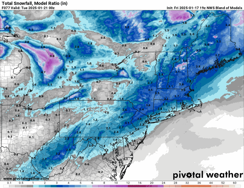
-
Sunday 1/19 Eagles Game Snow and Stuff
Hurricane Agnes replied to Ralph Wiggum's topic in Philadelphia Region
GFS still honkin'!