Hurricane Agnes
-
Posts
9,209 -
Joined
Content Type
Profiles
Blogs
Forums
American Weather
Media Demo
Store
Gallery
Everything posted by Hurricane Agnes
-
NHC 5 pm Advisory (continuing to hold NNE and 991 mb, but has now further increased forward speed to 18 mph) - And as a side note, Hurricane Grace has officially "dissipated" over south central Mexico as of 5 pm EDT.
-
Yeah have been watching that and it has been steadily moving from SE --> NW towards the river.

-
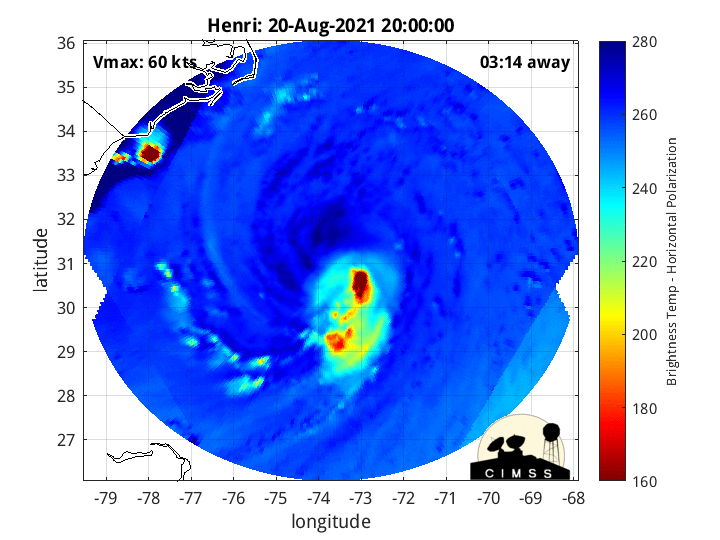
I love finding sites (I try to bookmark them) that have all sorts of stuff to play with. For example this site (has microwave gifs of tropoical systems) - http://tropic.ssec.wisc.edu/real-time/mimtc/2021_08L/web/mainpage.html I think some think they might be useless but I think they are cool visualizing the position and movement of a system.
-
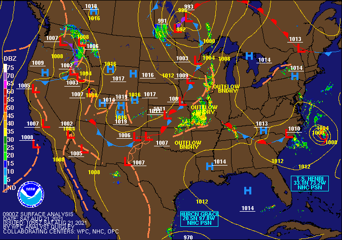
I was looking at the mid and lower level vapor sat images and there's dry air trying to get into the circulation of Henri from the west and Henri is literally jammed up against a "wall" of shear on the eastern side. So you can actually see what looks like a pipe funneling clouds up here.
-
NWS 2 pm Advisory (holding steady on the same trajectory but has now sped up to 17 mph, with pressure holding at 991 mb) -
-
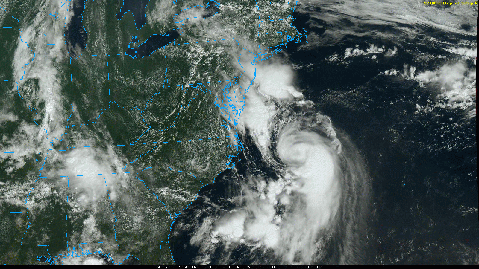
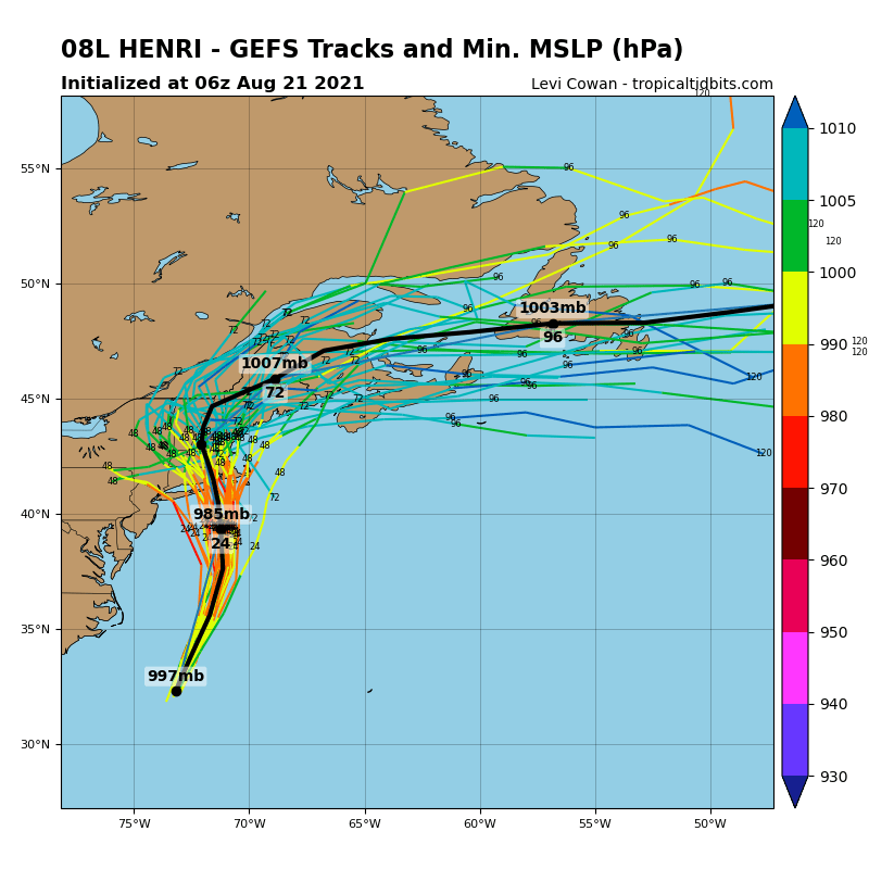
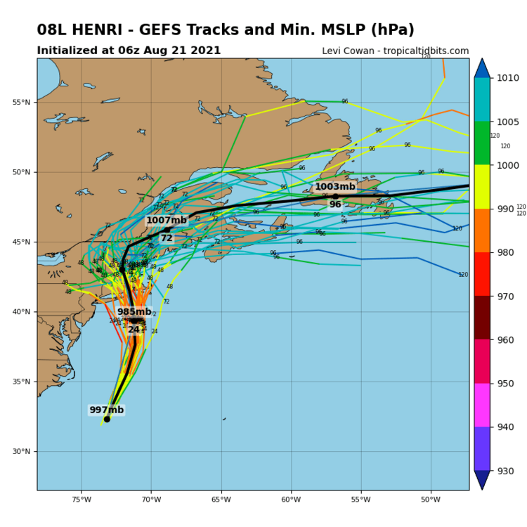
It actually has an eye-looking formation appearing on vis sat. And yeah, the models have been suggesting whatever would be an equivalent to a Fujiwara between it and the Low south of here with the two of them taking a road trip together up north. I think that Henri just got caught in some kind of flow that has been accelerating the speed since it is going faster now as of the 2 pm update.
-
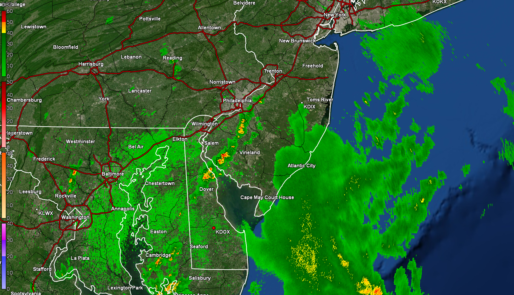
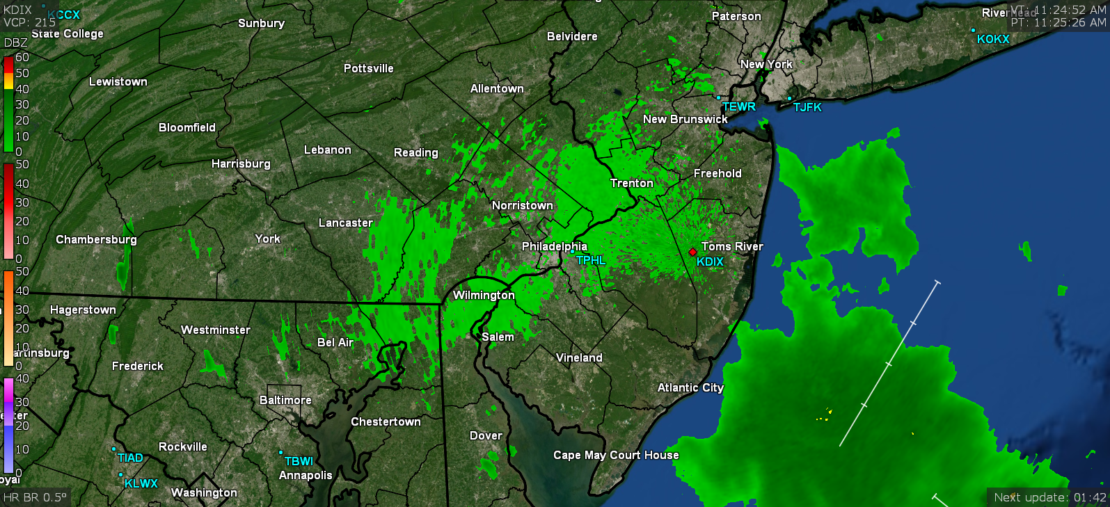
You can see the moisture feed flowing right up here. The radar is showing some kind of returns over the Toms River area but I'm not sure if there is actually rain going on there or not.

-
Hrrr still soaking the area through tomorrow morning.
-
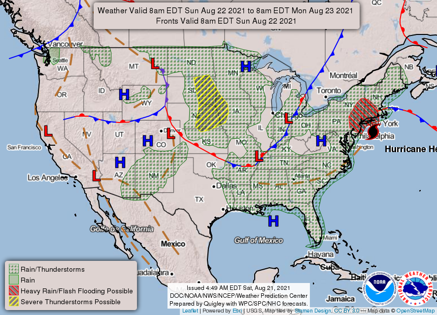
Mt. Holly is claiming "through tomorrow" so it might depend on whether the stall/loop-de-loop happens that has been showing up in some models and it hangs around a bit longer and/or whether it does actually speed up its forward motion and gets swept away back off the coast. Your point forecast for Mt. Holly is calling for 70% chance of showers all day tomorrow and then down to 50% overnight and 40% Monday.
- 216 replies
-
- 1
-

-
- hurricane
- tropical storm
- (and 2 more)
-
I think it may start sometime late this afternoon and overnight into tomorrow. I'm looking at the doppler and the top part of one of Henri's bands is right off the coast.

- 216 replies
-
- 1
-
-
- hurricane
- tropical storm
- (and 2 more)
-
Henri is gonna grab his buddy Low and run on up to Boston to smack the sh!t outta them after that Iggles debacle.
- 216 replies
-
- 2
-

-
- hurricane
- tropical storm
- (and 2 more)
-
Blame South Jersey for being the flat "coastal plain". Will soon have a beach along the Delaware River with the Atlantic lapping up along it!
- 216 replies
-
- 1
-
-
- hurricane
- tropical storm
- (and 2 more)
-
We called that the "death band". Seriously though, the issue will be if something like that does come to fruition and Henri pivots around leaving the band in place across the same areas as the storm slowly moves further N/NE. It's currently accelerated from its slow 6/7 mph up to 12/14 mph, but some earlier comments had been that it might not do a typical "getting swept up in the jetstream bolt" to something like 20+ mph like these storms tend to do when they get up here. So if it stays in the low-mid teens for forward motion, that could produce some prolonged rain banding as it creeps over the colder water and weakens.
- 216 replies
-
- 1
-
-
- hurricane
- tropical storm
- (and 2 more)
-
Slapping my obs in for the time being as it may be a busy day/evening. I ended up with an 82 high yesterday and actually picked up 0.07" of rain from the system that moved through during the early morning. The low this morning was 70 and the sun really came out nicely, with few clouds - literally the calm before the storm. But they are streaming in now with the northern most bands of Henri getting closer (although still offshore). Currently getting overcast skies and temp at 79 with dp 73. One thing that is slowly being pointed out too is that we are now under a Full Moon so that is definitely going to impact the tides as the storm moves by.
-
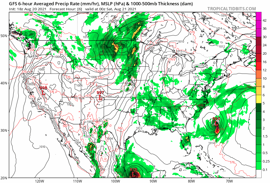
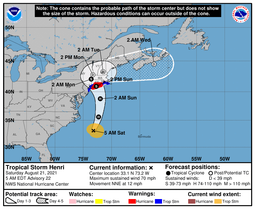
NHC 11 am Advisory (now upgraded to a hurricane, has intensified to 991 mb, and sped up a bit to 14 mph) -
-
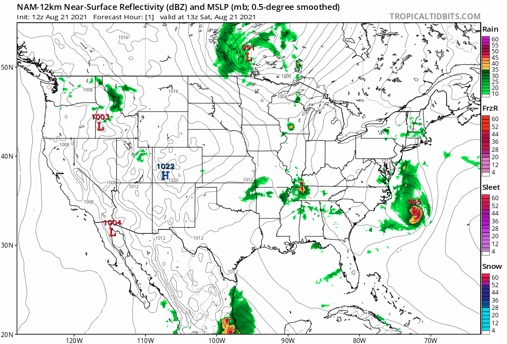
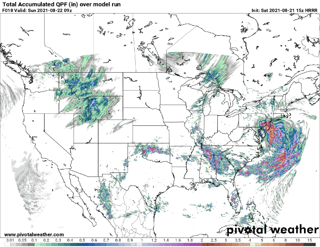
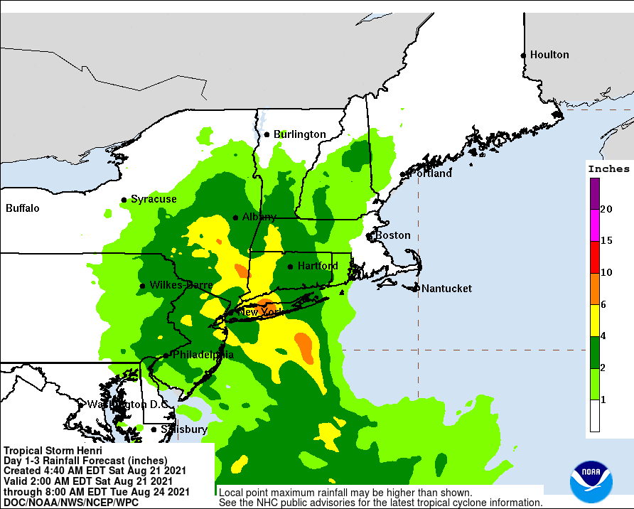
12z NAM showing that prolonged band of rain over south Jersey and SE PA.
-
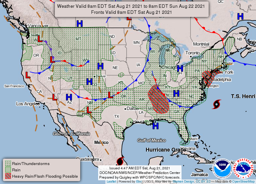
Some messages from Mt. Holly for the CWA -
-
WPC agrees with this and has this area highlighted for flash flooding.
-
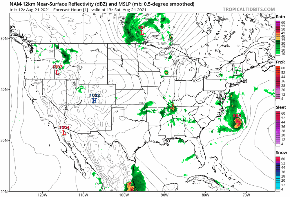
Last night it had weakened to about 996/997 but as of the last report, it was down to 993 so it did strengthen a bit and at least on visible, it seems to be stacking a bit better with the naked swirl tucked under the mid levels a bit better and the shear that was keeping it from moving north has started to shift away, allowing it to pick up some speed. But it looks like some dry air got ingested into the lower level circulation so it's trying to form an eye somehow with that going on. There's a recon in the storm right now that is still finding the 993.
-
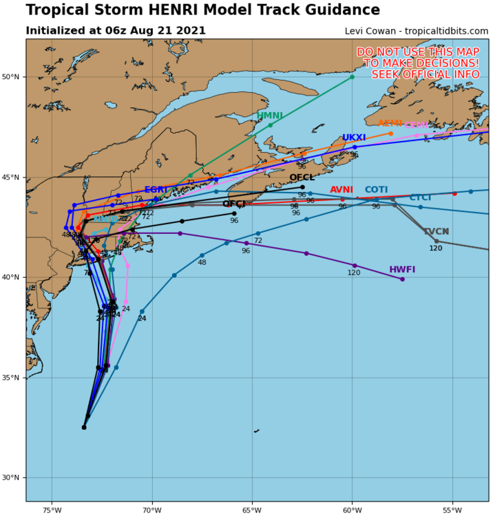
Both the Ukie and Euro were showing Henri inland due north into east central NY merging with some ULL and then moving due east across the rest of NE. The one down in the Carolinas is already doing a playdate with Henri.
-
NHC intermediate Advisory (storm still headed to the NNE @12 mph but has strengthend to 993 mb and does look a bit more stacked on vis) - Almost all the model runs so far (0z & 6z) have shifted back to the east. The ensembles seem a tick east vs the operational but the range is pretty narrow on where the track is going to go, unless it does a "S word" special (left hook) at the last minute.
-
NHC 5 am Advisory (has weakened a bit, picked up speed and now moving to the NNE) -
-
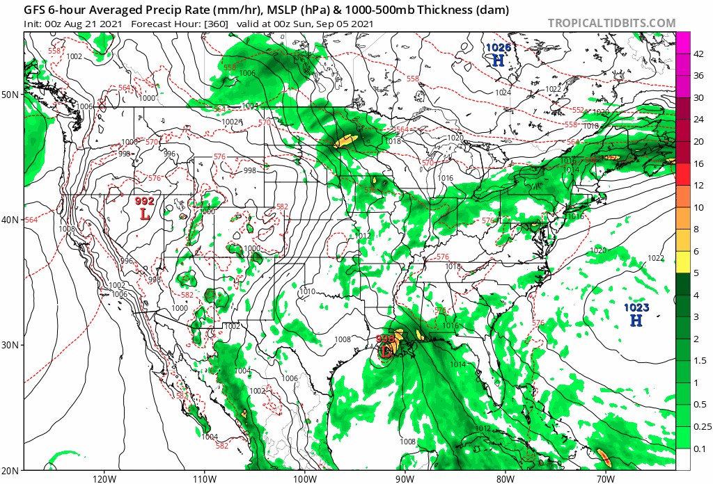
OMG both the 18z and 0z GFS were showing what appears to be some TC running right into LA right at the end of the runs. Yes I know but.... 0z GFS seems steady but I noticed a trend of a slight swinging out to the east and then recurving back around to the west before doing a landfall. And am seeing that loop-de-loop/stall around SE NY/NE PA before heading back east once on land. Am adding the TC into LA too for posterity.
-
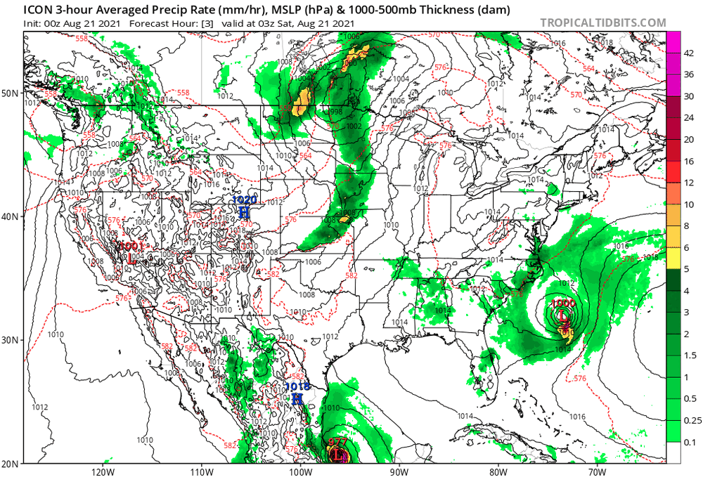
0z ICON doing a loop-de-loop around NE PA.
-
11 pm Advisory. Cone (with landfall) about the same but possibly a tiny tick west. Speed has picked up a little...