Hurricane Agnes
-
Posts
9,270 -
Joined
Content Type
Profiles
Blogs
Forums
American Weather
Media Demo
Store
Gallery
Everything posted by Hurricane Agnes
-
Getting a gully washer again, over 1" an hour. So loud I can hear it. Temp up to 75 with dp 74/
-
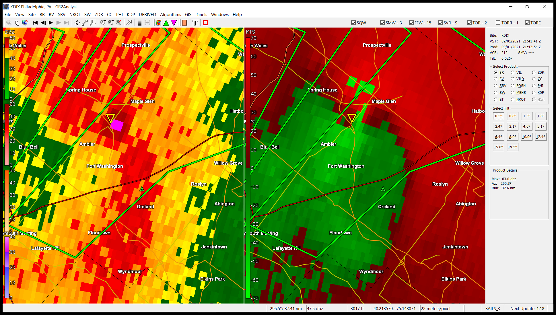
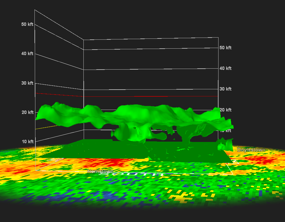
New TOR over me and am seeing what looks like something that could be at Plymouth Meeting (about 5 miles from me).
- 487 replies
-
- 1
-

-
- hurricane
- flooding potential
- (and 2 more)
-
Hope they get you back quickly. I know the last heavy rain here mine went out, but PECO got to it within a couple hours.
- 487 replies
-
- 1
-
-
- hurricane
- flooding potential
- (and 2 more)
-
Under a TOR with Emergency Alert. Phones going nuts. I heard a big thump before it (thunder?)
-
Getting moderate rain and am now at 1.10" for the event so far (0.54" from round 2). There's a heavier slug to my SW that if it holds together, may rotate up through the city to here.
-
I was seeing this type of stuff over by North Wales and Landsdale.
- 487 replies
-
- 2
-

-
- hurricane
- flooding potential
- (and 2 more)
-
Still getting some rain - light to moderate (at around 1/3rd inch/hr). Temp is 74 but dp is now up to 73. Was looking at those cells up by Landsdale and the other by Doylestown. They looked almost like they were trying to make some funnels.
-
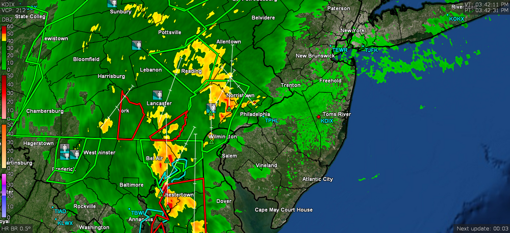
All kinds of pre-issuing of river flood warnings being issued right now. Weather radio going nuts. Schuylkill Norristown and at the mouth.
- 487 replies
-
- 1
-
-
- hurricane
- flooding potential
- (and 2 more)
-
Under a steamy window gully washer with rates just over 1"/hr. Sky went right to night time with street lights on. Getting convection incoming as well. Now up to 0.74" for the event (0.18" from round 2 so far).
- 487 replies
-
- 1
-
-
- hurricane
- flooding potential
- (and 2 more)
-
Am now under that little pop-up. Getting about 1/3rd"/hr. Round 1 was 0.56" and now up to 0.62 with round 2
-
"Yellows" are umm... swampin' ya!! I know you are glad you aren't out in that in the field.
-
It will depend on whether there is back-building. This little blob just spontaneously formed east of me. Am starting to get some light rain. Not enough to tip the bucket but it is wetting the sidewalk.
-
Stuff right on my doorstep. Considering how slow it was all moving earlier today, it's moving in pretty quickly now and drifting up from the SW too. Temp is 73 dp 71.
- 487 replies
-
- 1
-
-
- hurricane
- flooding potential
- (and 2 more)
-
NWS MARFC 48-hr observed rainfall through to 2 pm today -
- 487 replies
-
- 1
-
-
- hurricane
- flooding potential
- (and 2 more)
-
More stuff headed your way!
-
I'm seeing all kinds of scary stuff blobbed around southern Chesco.
-
Just as I saw your message I was getting a FFW alarm out of my weather radio from NWS (this is west of me but getting close now).
-
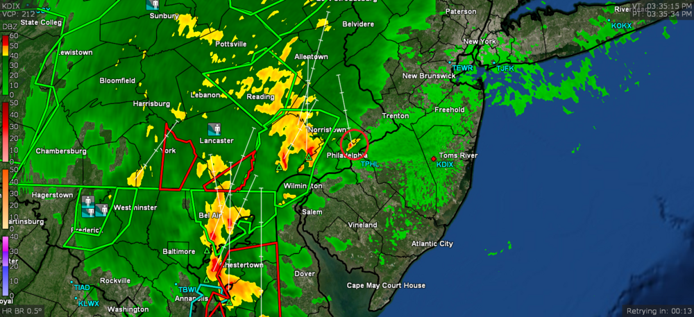
Temp has crept up to 74 and dp to 71. I noticed the western edge of the band seems to be moving faster now. RedSky should be getting something up yonder in Bucks. The "yellows" are about to roll in there.
-
There's a whole pile of rough stuff all around you right now (although not sure where you are commuting from to get home)! Good luck with the commute. I hate driving in white-out rain.
-
Streamers of stuff starting to advect in from the SW along the band west of here. Some might be hitting Paul soon in Chesco.
-
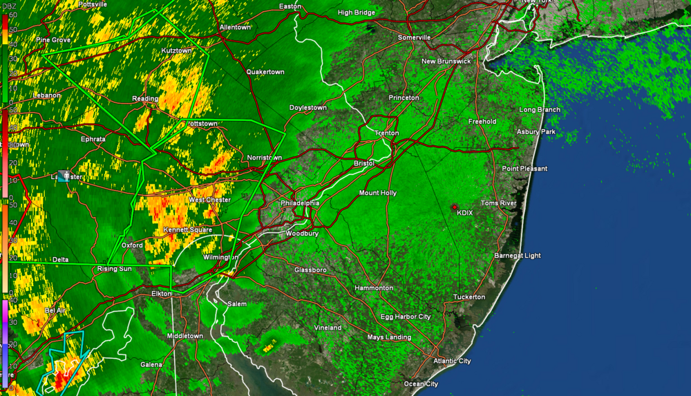
Saw there is a FFW in Berks including Reading -
-
I *think* the warm front is on the move north. Temp here has crept up to 73 after being in the upper 60s most of the morning and early afternoon, but the dp is moving up now too and is at 70 (was in the mid-upper 60s earlier). The band to the west is creeping slowly east.
-
If the warm front moves further north we might be TOR'd further north. Ida is now moving ENE so angling further this way.