Hurricane Agnes
-
Posts
9,098 -
Joined
Content Type
Profiles
Blogs
Forums
American Weather
Media Demo
Store
Gallery
Everything posted by Hurricane Agnes
-
The wind products were only lofted at the shore locations - My temp continues to rise and I'm now at 35 with dp rising in tandem at 34 and rain. Haven't registered anything in the bucket yet as there's obviously snow on top of the opening but I expect that will dissolve away and get the tipper going again eventually.
-
Temp now up to 34 with dp 33 and plain rain has commenced. The winds have picked up too. R/S line continues to move to the NW.

-
Temp now 33 and still have a general pause in precipitation except for some DZ. Dripping is beginning to commence.
-
Temp now up to 31 and except for some FRDZ, all precip has ceased, as if someone from above is getting one last look before washing it all away.
-
Now all ZR. Will go with the 1.25" as the snow total before this switch. I expect it may go back and forth with the p-types but the end is nigh. Didn't get pingers as a transition (although I won't rule out any that might happen as it vacillates in the upper atmosphere).
-
Getting mix snow/white rain. Temp now at 30 with dp 29.
-
That must suck for them. Temp now up to 29 with dp 28. No pingers yet but the pancake/dinnerplate flakes had thinned out some.
-
Have been getting pancake flakes the past 10 minutes or so that are laying down a nice layer and went out and measured with this current band and got 1.25". Temp is now up to 28 with dp 28 and fog. Will be listening for the inevitable pingers.
-
My sis in Upper Darby just texted that sleet is now mixing in with the snow where she is. She said she had "a couple inches" (not sure if she actually went out to measure but I know she was getting it there before I got any here).
-
https://www.aviationweather.gov/metar/symbol
-
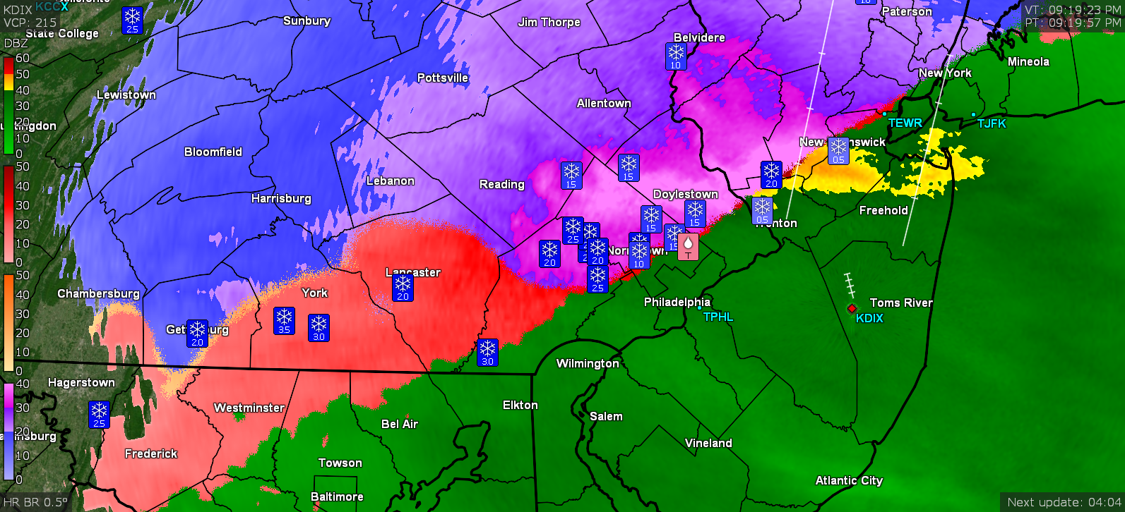
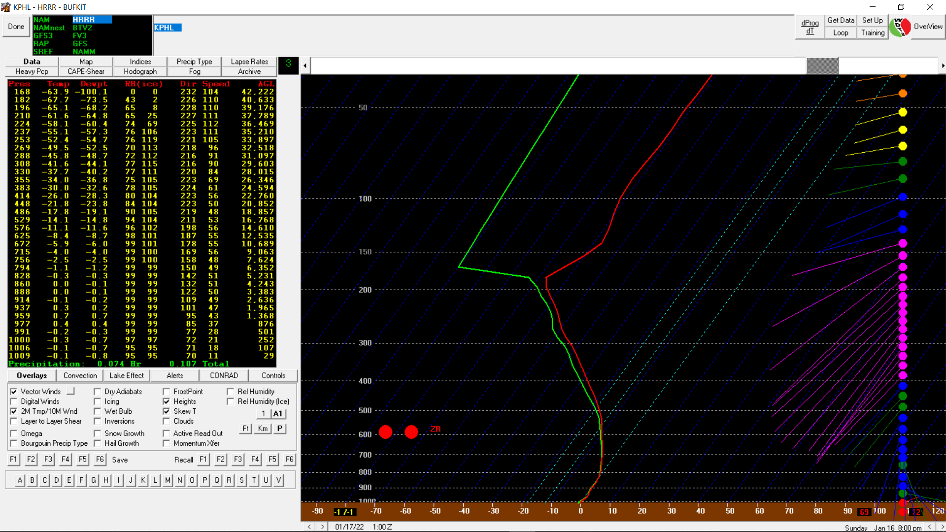
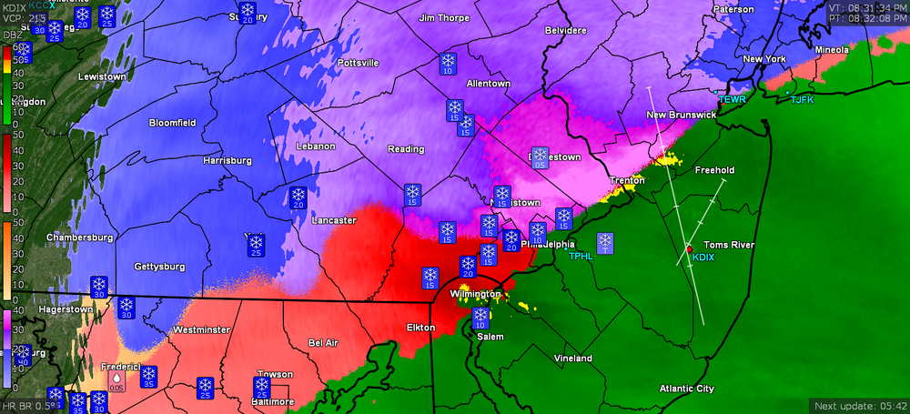
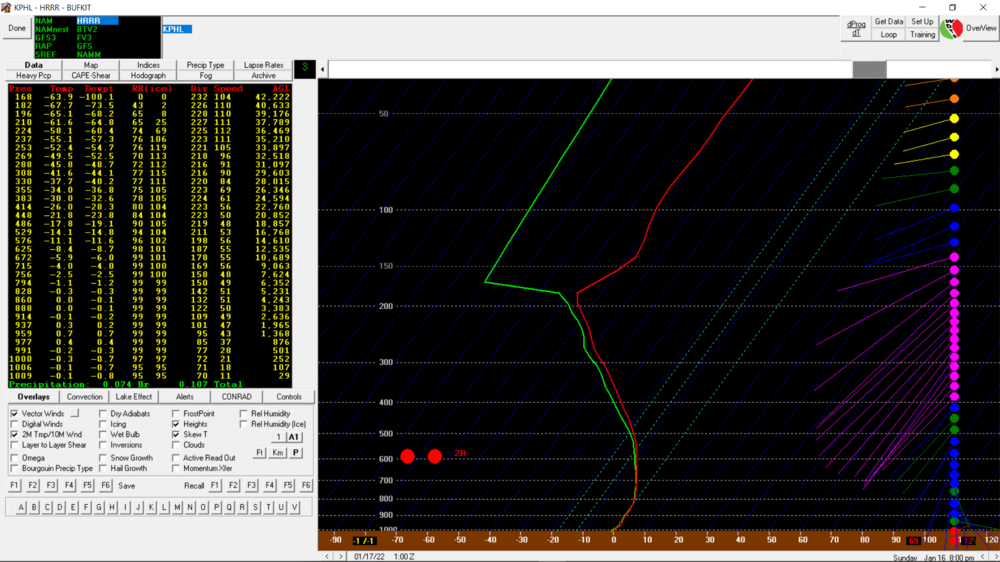
Under a heavier band now with moderate snow. Finally hitting 1/2". Temp/dp holding at 27/26. Bufkit HRRR soundings progged KPHL changeover to ZR by 8:00 pm.
-
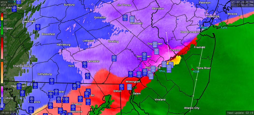
Still SN but barely. Haven't hit 1/2" yet. Temp has crept up to 27 with dp 26 and am now getting some fog. Looks to be a heavier blob moving up here imminently from the SE with the shift of the R/S line closer to the river.
-
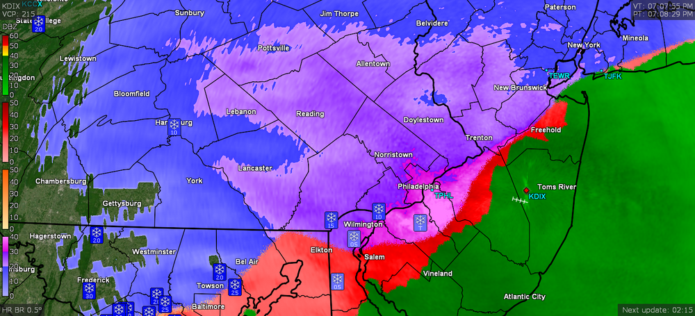
Currently SN with just over 1/4". Temp holding at 26 but dp now up to 24.
-
Getting under pieces of the heavier returns and am up to SN- to SN. Cars starting to get coated. Temp 26 with dp ticked up again to 22.
-
Have a little powdered sugar dusting on the cars and currently SN--. Looks like a heavier batch might be incoming from the southwest though. Temp still 26 but dp has ticked up to 21.
-
It's showtime! Flakes have commenced. Temp 26/dp 20.
-
Virga here so far and temp has ticked up to 26 with dp 20.
-
I have the top sub so can add up to 19.53MB files (many of the sat animations can get that big - even with just a few frames)
-
-
Currently holding at 25 wit dp 18 and overcast. Returns coming in from the SW. (edit to add cc panel)
-
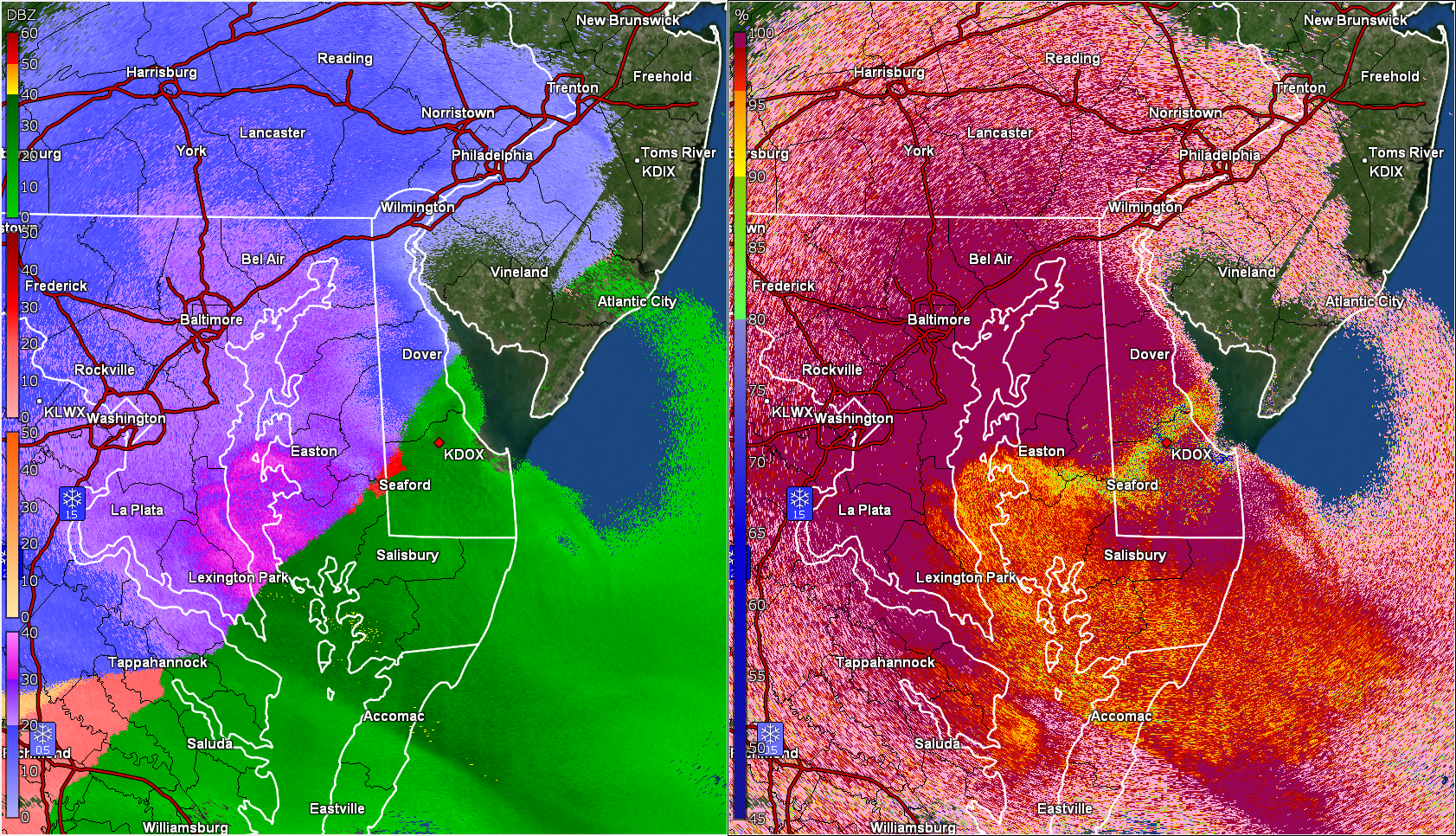
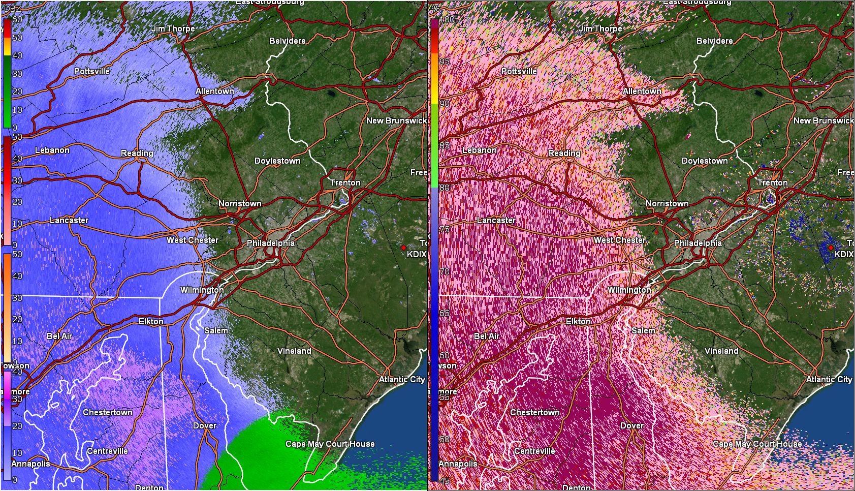
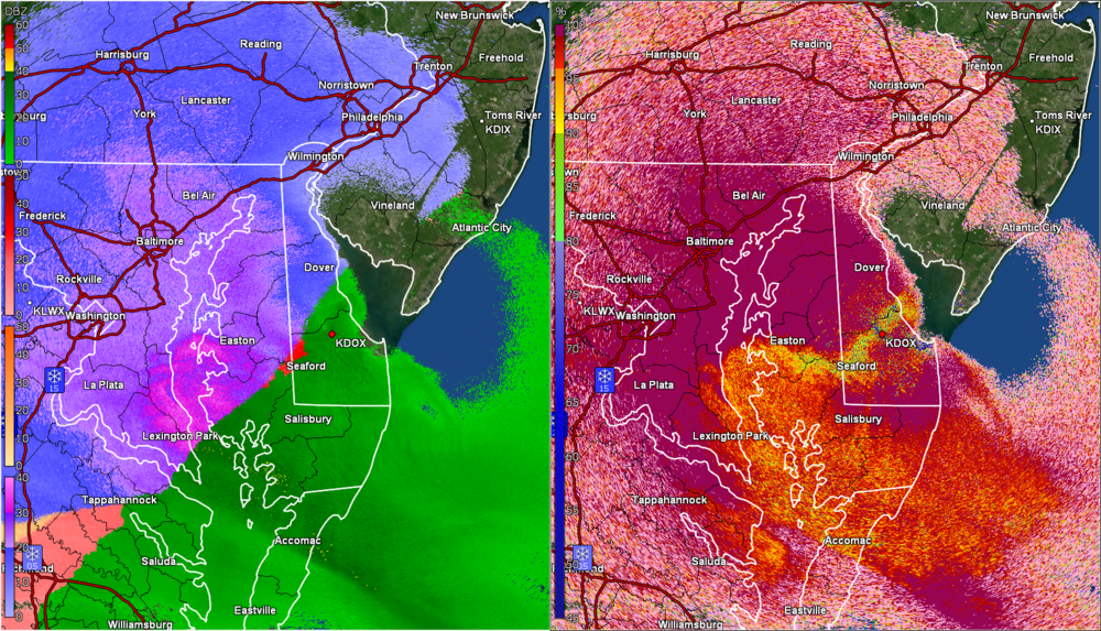
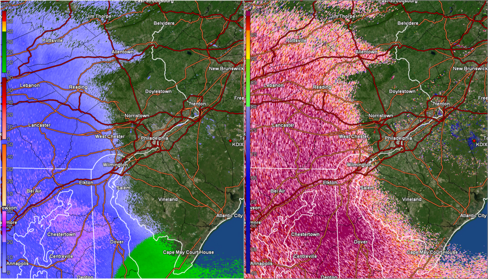
Current WSWs/WWAs (looks like another set of NJ counties, S/E, got added into the WWA) -
-
E PA/NJ/ DE Winter 2021-22 OBS Thread
Hurricane Agnes replied to JTA66's topic in Philadelphia Region
Currently overcast and I have hit 25 where it has topped off and held for the moment, with dp 16. -
MLK Storm - something for everyone
Hurricane Agnes replied to ChescoWx's topic in Philadelphia Region
if you are not suddenly under a dry slot! -
MLK Storm - something for everyone
Hurricane Agnes replied to ChescoWx's topic in Philadelphia Region
It's not a matter of eventually scouring out the ambient cold air, it's the solid ground and surfaces (including concrete and metal) that have been sitting in single digits and low 10s for a long time - i.e., initial liquid would freeze on contact unless the temp warmed up into the 40s for a bit before onset (where onset is supposed to happen late this afternoon and overnight with temps near or below freezing depending on where you live). I'm not expecting any significant "icing" per se but just that there might be some initial coating - although any snow that covers those surfaces first may mitigate it too. Edit to add - those poor folks in the central and western Carolinas are the ones who are going to have an ice storm extraordinaire. -
Am currently "up to" 16 with dp finally above 0 at 6. Despite the sky filled with a deck of cirrus, there is still sun shining through it.