Jet Stream Rider
-
Posts
1,085 -
Joined
-
Last visited
About Jet Stream Rider

- Birthday March 24
Recent Profile Visitors


-
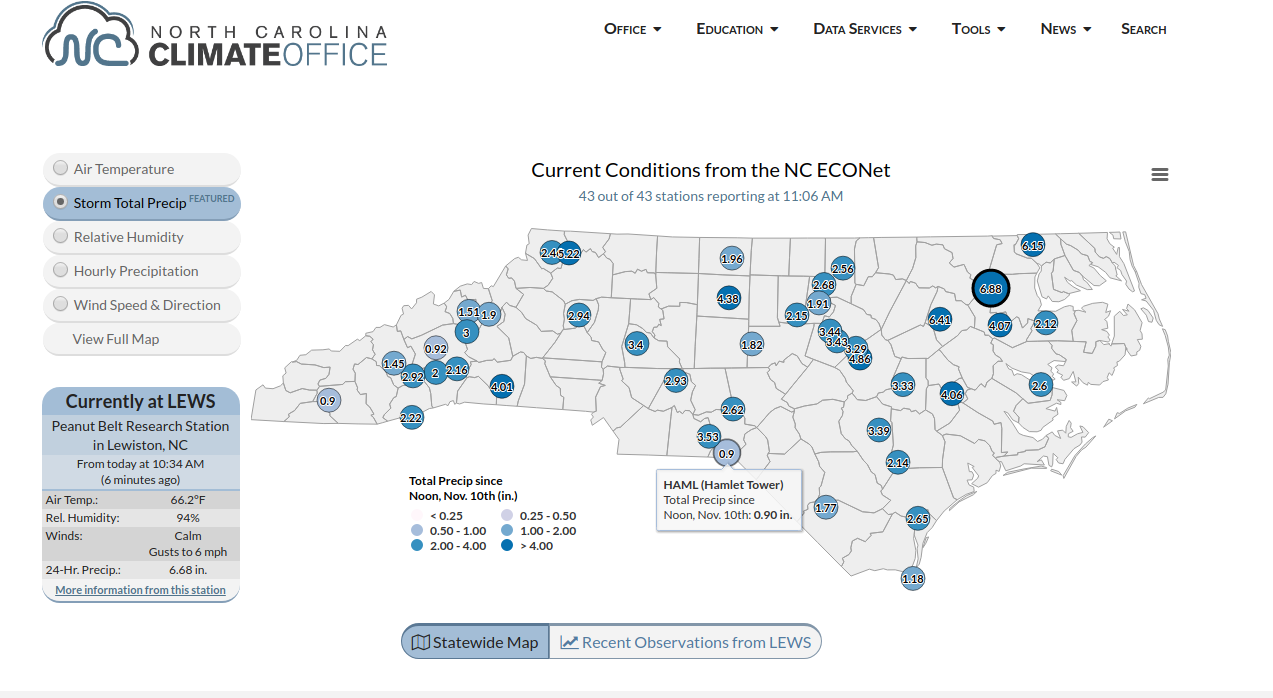
11/12 Heavy Rain/Flooding Event
Jet Stream Rider replied to NorthHillsWx's topic in Southeastern States
This site is pretty good. https://climate.ncsu.edu/
-
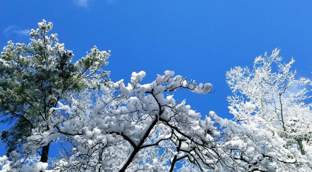
Ended up with about 3 here. Looks like jackpot with this system was well south of here. We never got the frontogenesis across large areas of the state that the models showed, slp was weaker and further east and south. The shear from the st jet that gave us all the over-running early, hampered the coastal development I think. Nice marginal event though. One of the best snows for looking great in the trees in a while! Thanks for all the diligent tracking folks! Trees from the front yard:
-
Had occasion to drive across town just now. Some accumulation on the roads now. Snowing light to moderate at 32.
-
Big flakes in light to moderate snow. dusting on vegetative surfaces. Down to 32.
-
Moderate snow now, 35. No accumulation
-
Mixed precip rn, ip, sn started here 20min ago in northeastern NC.
-
Hurricane Dorian Banter Thread
Jet Stream Rider replied to Jtm12180's topic in Tropical Headquarters
In the eyewall wow! -
December 8-10, 2018 Winter Storm
Jet Stream Rider replied to Orangeburgwx's topic in Southeastern States
There are at least two parts to it. The first part is the original west coast energy that spawned our slp (now off the NC coast), and that is being sheared as it traverses the mountains. The second part is dropping down the backside of the trough and the 2 will begin to interact.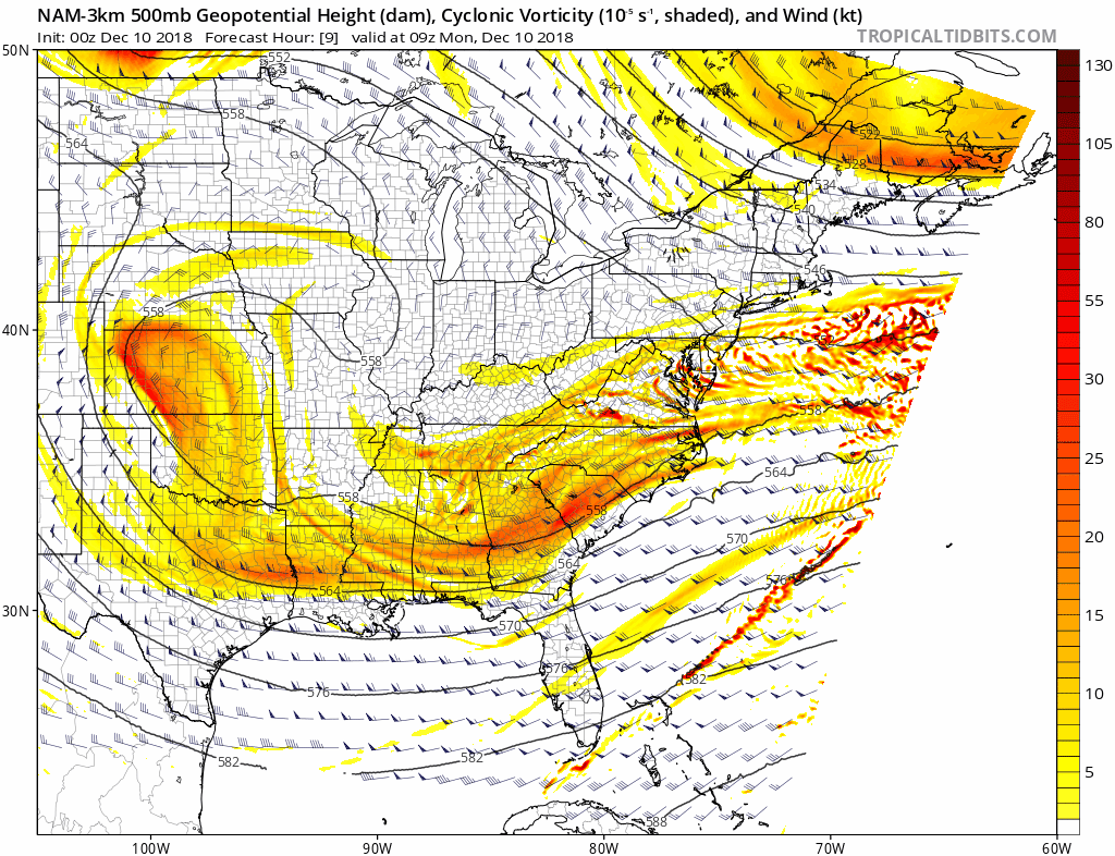
-
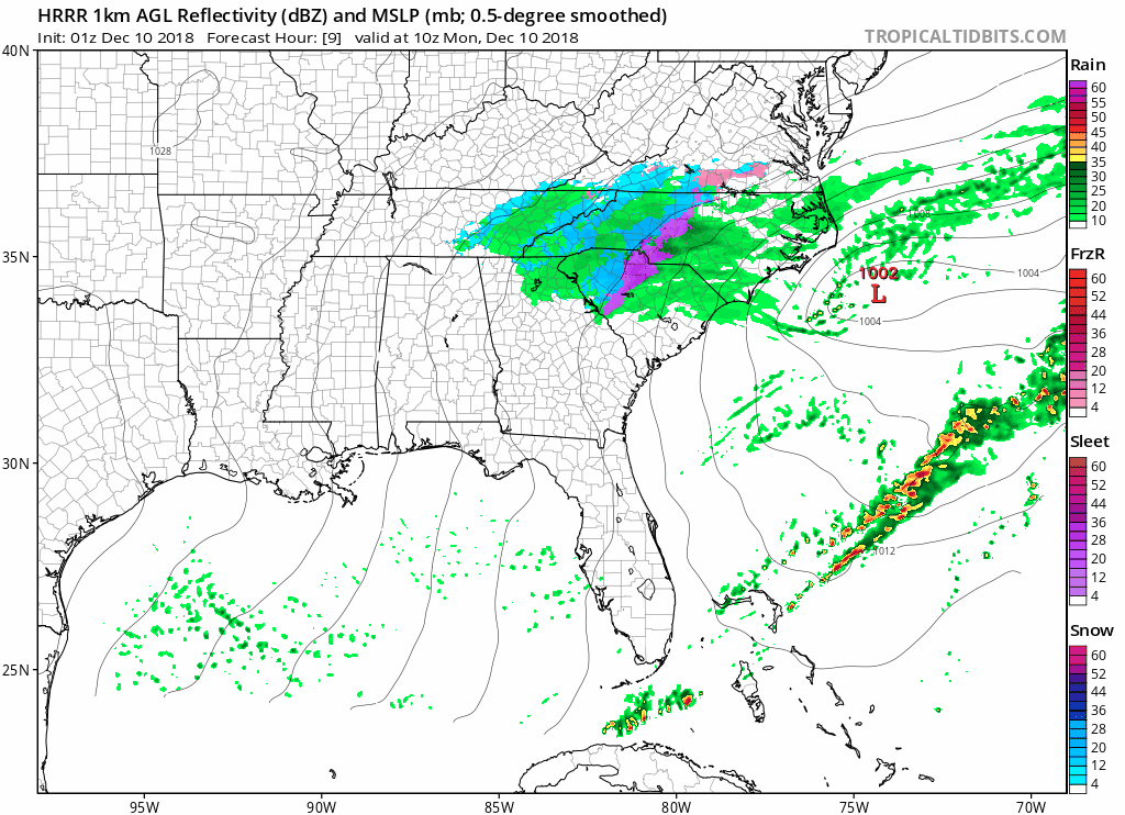
December 8-10, 2018 Winter Storm
Jet Stream Rider replied to Orangeburgwx's topic in Southeastern States
HRRR 9z-15z Monday depiction - Thats tomorrow morning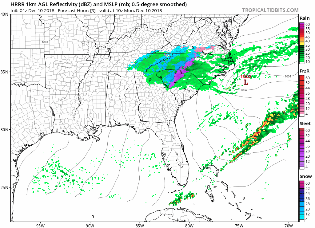
-
December 8-10, 2018 Winter Storm
Jet Stream Rider replied to Orangeburgwx's topic in Southeastern States
HRRR did better with placement of transition zone and timing for my area. -
December 8-10, 2018 Winter Storm
Jet Stream Rider replied to Orangeburgwx's topic in Southeastern States
Are you familiar with film maker Werner Herzog? -
December 8-10, 2018 Winter Storm
Jet Stream Rider replied to Orangeburgwx's topic in Southeastern States
Noticed some models reacting to the original upper level energy crossing NC tomorrow as the late diving ull from Canada rounds the bend to our south. Some localized area blobs of hot pink color maxing the snow range on the legend. -
December 8-10, 2018 Winter Storm
Jet Stream Rider replied to Orangeburgwx's topic in Southeastern States
Also; even with a well placed CAD with very cold air, it will hug the surface and the warm nose will flow right over it resulting in copious sleet or freezing rain. So yeah, the warm nose always wins if it is there at all. -
December 8-10, 2018 Winter Storm
Jet Stream Rider replied to Orangeburgwx's topic in Southeastern States
Its a good question. My general thinking is that this situation is maybe not a great example of well placed CAD just because the air mass is marginal in its coldness. Also, warm noses are more pronounced with a vigorous slp that is sub 1K and is riding up the coastline. In that case you have strong east or southeast winds that bring an intense warm air temperature advection from the coastal flow. In this case with the slp being rather weak and having a more suppressed track with a more easterly trajectory, the warm nose is less pronounced and is more associated with the slp air mass itself rather than bringing in a massive amount of coastal air. My thinking, Mets or others please feel free to correct this. -
December 8-10, 2018 Winter Storm
Jet Stream Rider replied to Orangeburgwx's topic in Southeastern States
This morning the NWS moved my county (Halifax) into the WSW area. I'm right on the edge of the piedmont, nothing but coastal plain to my east, so of course I expect a mix with sleet and rain. that initial hit though looks substantial. We have our slp just west of New Orleans this morning, here we go! Good luck everyone!