

TimB
-
Posts
17,229 -
Joined
Content Type
Profiles
Blogs
Forums
American Weather
Media Demo
Store
Gallery
Everything posted by TimB
-

Western PA/Pittsburgh Winter 2021/22 Discussion
TimB replied to meatwad's topic in Upstate New York/Pennsylvania
Hard to envision a scenario where winter isn’t over. We’ve currently had 1.6” from Feb 6 on. Outside of a couple years in the 1880s (which we all know I question the accuracy of), we’ve never had less than 3.6” from February 6 until the end of the snowfall season. Normally I’d say we can pick up 2” in March, but we’ve gotten barely half that the last two years combined and the pattern for this March doesn’t look good. -
Western PA/Pittsburgh Winter 2021/22 Discussion
TimB replied to meatwad's topic in Upstate New York/Pennsylvania
Nice to see a little snow shower just before the sun goes down to whiten things up a little. -
Western PA/Pittsburgh Winter 2021/22 Discussion
TimB replied to meatwad's topic in Upstate New York/Pennsylvania
No, if anything, it did exactly what it was supposed to. But I think the point is it’s easier to stomach these defeats when there were no big winners. -
Western PA/Pittsburgh Winter 2021/22 Discussion
TimB replied to meatwad's topic in Upstate New York/Pennsylvania
I think he means the storm as a whole, across the northeast. On another note, PIT got 1.07” of rain, which brings our monthly total to 5.10”, making this the 7th wettest February of all time (2018, 1887, 1891, 1956, 1890, 2008*). *2008 was at 4.97” through 2/28 but recorded 0.48” on the 29th. -
Pittsburgh/Western PA Spring 2022 Discussion Thread
TimB replied to Ahoff's topic in Upstate New York/Pennsylvania
Some crazy gradients in GFS fantasy land. -
Pittsburgh/Western PA Banter & Complaint Thread
TimB replied to blackngoldrules's topic in Upstate New York/Pennsylvania
In this case, our area of the entire NE quadrant of the US. -
Western PA/Pittsburgh Winter 2021/22 Discussion
TimB replied to meatwad's topic in Upstate New York/Pennsylvania
In other news, this will be the first February 24th since 2015 where the high temperature wasn’t at least 12 degrees above normal.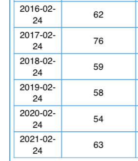
-
Pittsburgh/Western PA Banter & Complaint Thread
TimB replied to blackngoldrules's topic in Upstate New York/Pennsylvania
Does this one even need words? -
Western PA/Pittsburgh Winter 2021/22 Discussion
TimB replied to meatwad's topic in Upstate New York/Pennsylvania
0z and especially 6z GFS runs are a parade of storms that we’re on the wrong side of. Also, I saw a few pellets of sleet on the ground when I was outside this morning, which will probably be the only non-rain precip that occurs with this system. -
Pittsburgh/Western PA Banter & Complaint Thread
TimB replied to blackngoldrules's topic in Upstate New York/Pennsylvania
This winter sucked. Just let us pretend we had one moral victory. -
Pittsburgh/Western PA Banter & Complaint Thread
TimB replied to blackngoldrules's topic in Upstate New York/Pennsylvania
Yeah, last spring without thunderstorms was weird, then we go and get more tornadoes in October than in all of the previous Octobers combined. -
Pittsburgh/Western PA Banter & Complaint Thread
TimB replied to blackngoldrules's topic in Upstate New York/Pennsylvania
Thunder snow and 11 degrees? I wonder if those conditions have ever been reported in Pittsburgh in 150+ years of record keeping. -
GFS wants to bring a massive ridge to start met spring. Could you imagine a third snowless March in a row?
-
Pittsburgh/Western PA Banter & Complaint Thread
TimB replied to blackngoldrules's topic in Upstate New York/Pennsylvania
GFS appears to be the last domino to fall. Massive ridge develops mid to late next week in what was supposed to be a good cold pattern, bringing it into agreement with pretty much all the rest of the operational and ensemble models. Unbelievable. Why is it that even when most indicators and teleconnections would support a cold pattern, the models can flip this fast and converge on the solution of a warm pattern? Is it climate change? Something else? It’s frustrating as hell how hard it is to get a good pattern these days. -
Pittsburgh/Western PA Banter & Complaint Thread
TimB replied to blackngoldrules's topic in Upstate New York/Pennsylvania
It’s just unbelievable how quick the models turned a largely BN period into a largely AN period. If the EC is right, we’ll be back in the upper 40s by Monday, which all the other models suggest should be a cold day. -
Western PA/Pittsburgh Winter 2021/22 Discussion
TimB replied to meatwad's topic in Upstate New York/Pennsylvania
You’re right, it didn’t belong in this thread, there’s a complaint thread for a reason. But yeah, these all day rainy days make me grouchy as all hell even in July and even more so during months when it should be snow. -
Pittsburgh/Western PA Banter & Complaint Thread
TimB replied to blackngoldrules's topic in Upstate New York/Pennsylvania
And there it is… -
Western PA/Pittsburgh Winter 2021/22 Discussion
TimB replied to meatwad's topic in Upstate New York/Pennsylvania
You only get 3 months where you can reasonably expect to get any appreciable snowfall, and two of them were complete and total garbage this year. Despite a rockin’ January, our only hope to even get to normal snowfall for the season is a 1993 redux in March. -
Western PA/Pittsburgh Winter 2021/22 Discussion
TimB replied to meatwad's topic in Upstate New York/Pennsylvania
NWS mentions the possibility of isolated thunderstorms today in their discussion. Might be the only game in town as far as interesting weather for the balance of February. -
Would think it would be MUCH more useful in Celsius, as zero actually means something and isn’t an arbitrary point on a scale.
-
No, you’re correct for sure. Signed zero in weather is definitely a matter of whether the unrounded number is positive or negative.
-
^This. You see negative zeroes in things like 5-min obs that do that Fahrenheit to Celsius to Fahrenheit thing, as -18C = -0.4F which shows up as -0 on there.
-
Western PA/Pittsburgh Winter 2021/22 Discussion
TimB replied to meatwad's topic in Upstate New York/Pennsylvania
You’re in luck. In an almost comical fashion, next week, which was looking cold, is now looking warmer with temperatures popping back up close to 50 by midweek. -
Western PA/Pittsburgh Winter 2021/22 Discussion
TimB replied to meatwad's topic in Upstate New York/Pennsylvania
I guess that’s more my point. If you take every February that finished near normal on temps, this one was probably near or at the bottom as far as being a quality winter month. -
Western PA/Pittsburgh Winter 2021/22 Discussion
TimB replied to meatwad's topic in Upstate New York/Pennsylvania
Maybe we can have another top 5 wettest year after just a couple years break.
