

TimB
-
Posts
17,230 -
Joined
Content Type
Profiles
Blogs
Forums
American Weather
Media Demo
Store
Gallery
Everything posted by TimB
-
Well it won’t get the low of 31 stricken from the record, but it at least seems to make sense. (Though what kind of system is this? This implies that 31.1 and 29.3 get displayed as 30.) But truly inspiring that you asked and they got back to you right away. Now I’m emboldened to try to settle my two issues with NWS Pittsburgh tomorrow - I was too busy today. But now this has me wondering if the +0.1 winter thing has something to do with this, let’s call it “compound rounding”, that they do.
-
Exercise plan? You mean @winterwx21? Or Bills QB Josh Allen, perhaps? Sorry, folks.
-
Likewise. I thought something was wrong with me.
-
And that’s not the only thing I have to b*tch about with the NWS. In early September 2018, there were some suspect temperature readings at PIT that were several degrees higher than any other nearby location, which persisted for about a week, and it still bothers me to this day. I mentioned it in the Western PA thread on here a little while back and someone seemed to recall something about them getting new equipment that needed to be recalibrated. A daily record high was tied and a record warm min was set during that stretch, but more importantly, temperatures running 3 degrees above what I think they should have been for a week vaulted that September into the warmest one ever recorded since observations moved to the airport in 1948.
-
This is almost like my beef with NWS Pittsburgh about their winter climate summary. December’s mean was 1.1 degrees above normal according to the monthly climate summary, January was +1.9 and February was -3.5, but the seasonal climate summary for DJF showed +0.1. Even if you assume that those numbers rounded to the tenth are the highest they could possibly be (1.1499, 1.9499, and -3.4501) and weight them by the number of days in the month, then divide by 90 days, you still get an average of -0.006, which I believe should be recorded as -0.0 when rounded to the tenth on the seasonal climate summary (which does matter, since it’s the difference between an above average season and a below average season). Should I call them?
-
Exactly the point. People need to get vaccinated before this happens, so we can finish this thing off before a variant develops that renders the vaccines ineffective. You think the divisions in this country are bad now? Wait until the anti-vaxxers are the reason we weren’t able to end the pandemic.
-

Western PA/Pittsburgh Spring Discussion 2021
TimB replied to Ahoff's topic in Upstate New York/Pennsylvania
To a certain extent I agree with that. We need some rain, but I could go the rest of my life without seeing another year like 2018 or even 2019 and not feel like I missed out on anything. -
Thundersnow is rare, why didn’t the NWS issue a severe thunderstorm warning for such a rare event? /s But back to reality for a minute - has there ever been thundersnow that met severe criteria?
-
Western PA/Pittsburgh Spring Discussion 2021
TimB replied to Ahoff's topic in Upstate New York/Pennsylvania
Someone with the wild idea that spring should feel like spring (but also doesn’t like thunderstorms) started a spring thread... -
Western PA/Pittsburgh Spring Discussion 2021
TimB replied to Ahoff's topic in Upstate New York/Pennsylvania
One more tidbit of data: it looks like the airport was at 38 at midnight (yesterday’s low was 38 at 11:59 pm). Daily record low max is 41 (1875 yet again - seems like a pretty solid analog to this April, though that year did set probably the hardest to break cold temperature daily records anywhere on Pittsburgh’s calendar), and there are only 6 days on record on or after 4/21 that have failed to reach 40. -
NWS Pittsburgh tweeted that they measured 1.6” officially before the band of snow moved out. Edit: final total for the day was 1.8”. Top snowfalls on or after 4/21 for PIT: 1. 5/9/1966 (3.1”) T-2. 4/28/1928 & 4/21/1922 (3.0”) T-4. 5/1/1963 & 4/21/2021 (1.8”)
-
Western PA/Pittsburgh Spring Discussion 2021
TimB replied to Ahoff's topic in Upstate New York/Pennsylvania
You win. Winter is allowed to be over now. Between the snow at the start of April and today’s once in a generation event, the sour taste March left in my mouth is completely gone. -
Western PA/Pittsburgh Spring Discussion 2021
TimB replied to Ahoff's topic in Upstate New York/Pennsylvania
A tale of two Wednesdays. Next week we’ll be on the plus side of 80. -
There might only be a small area with incredible totals, but the wide area that has seen accumulating snow is impressive.
-
I’ve driven the Ohio Turnpike way too many times.
-
I believe that’s actually Ohio.
-
Can confirm.
-
Western PA/Pittsburgh Spring Discussion 2021
TimB replied to Ahoff's topic in Upstate New York/Pennsylvania
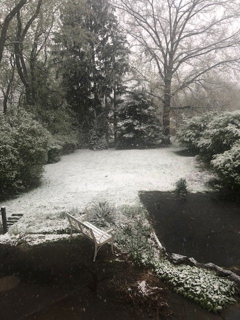
Waking up to a dusting of snow on the grass is good enough for me! Edit: looks like NWS measured 1.1” at 7am. That’s 7th highest for this late in the season and also assures us of above average April snowfall. Edit 2: for those keeping score, the GFS wins this one, at least in our area. It showed over an inch of snow long before any other model caught it. (And some never did) -
I’m certainly aware of this, but it’s yet another opportunity to smear Texas. But those opportunities are low hanging fruit these days.
-
Texas. Well look at that, the defiance of the people of Texas managed to produce a covid variant that hopefully isn’t resistant to the vaccine.
-
Western PA/Pittsburgh Spring Discussion 2021
TimB replied to Ahoff's topic in Upstate New York/Pennsylvania
And yet everything is magnificently green, that part is fantastic. -
Western PA/Pittsburgh Spring Discussion 2021
TimB replied to Ahoff's topic in Upstate New York/Pennsylvania
I don’t think we get an inch or more like some models want to show, but if we do, that’s something that has only happened 8 times on or after 4/21 and only once since 1966 (4/24/05). -
Even with the massive jump SE/weaker that it just made on the 12z run?
-
I hope you’re right. Fortunately, I don’t plan on traveling to Burkina Faso or something, so I could live with those types of restrictions. But I’m afraid if we experience a surge that’s even 10% of what happened this past winter, which is possible given all the people who are digging in their heels and refusing to get the vaccine, governments will still be skittish about removing the restrictions on travel. (At the same time, does a US “do not travel” advisory actually bar us from traveling to those countries, or is it just an advisory and the determination is made by the other country whether or not to allow US tourists?) Bottom line: I feel like the anti-vax conspiracy theorists have all the power in determining whether or not we will be able to go to other countries anytime soon. And most of them don’t care, because a fair number of them have never left their state or even county, let alone the US.
-
Possible. I’d say it’s 50/50, whereas a few weeks ago I would have put it at 90/10. And if there are any more setbacks, even that is in serious jeopardy.

