SnowenOutThere
-
Posts
5,659 -
Joined
-
Last visited
Content Type
Profiles
Blogs
Forums
American Weather
Media Demo
Store
Gallery
Everything posted by SnowenOutThere
-

80 Degrees to Ripping Snow: March 12th
SnowenOutThere replied to SnowenOutThere's topic in Mid Atlantic
I'd say that this thread more than lived up to its name. What a fun little storm. Arguably stuff like this is the best snows.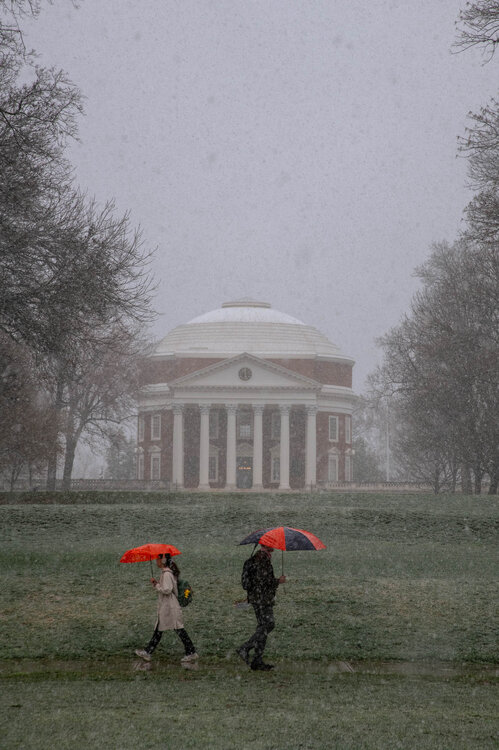

- 680 replies
-
- 23
-

-
80 Degrees to Ripping Snow: March 12th
SnowenOutThere replied to SnowenOutThere's topic in Mid Atlantic
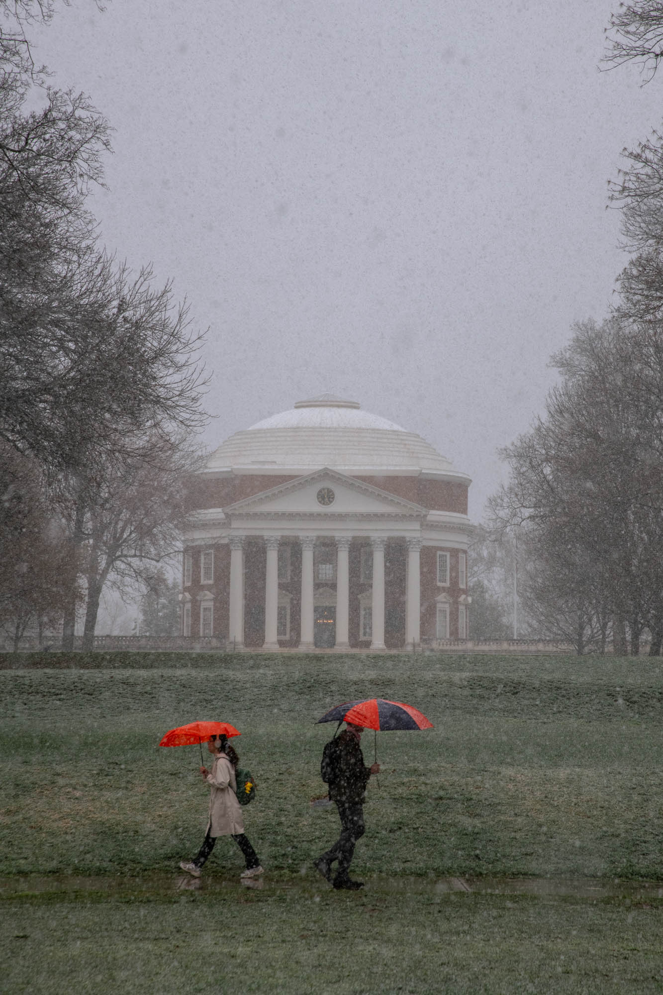
Legit heavy snow with surface whitening -
80 Degrees to Ripping Snow: March 12th
SnowenOutThere replied to SnowenOutThere's topic in Mid Atlantic
Snowing in Cvill! Rain snow mix but its reaching the ground! -
80 Degrees to Ripping Snow: March 12th
SnowenOutThere replied to SnowenOutThere's topic in Mid Atlantic
Air temperatures have started to level off a bit and I think the mountains are blocking most of it from progressing into the valley. Hoping to get a brief turn to snow but we'll see what happens. -
80 Degrees to Ripping Snow: March 12th
SnowenOutThere replied to SnowenOutThere's topic in Mid Atlantic
Hey at least you and me are in this cold rain show together. Though I can hopefully jet out to the Afton overlook for the sunset after my lab. -
80 Degrees to Ripping Snow: March 12th
SnowenOutThere replied to SnowenOutThere's topic in Mid Atlantic
Man, if I didn't have my atmosphere and weather lab from 2-6 today I'd be out in Shenandoah today. Though, apparently we are launching a weather balloon in lab today which might get a pretty interesting sounding graph. -
80 Degrees to Ripping Snow: March 12th
SnowenOutThere replied to SnowenOutThere's topic in Mid Atlantic
Route 211 Shenandoah cam has an inch or so OTG -
80 Degrees to Ripping Snow: March 12th
SnowenOutThere replied to SnowenOutThere's topic in Mid Atlantic
Shenandoahs must be snowing according to radar and in Cvill it’s rain but some suspiciously large drops with temps in the low 40s. -
80 Degrees to Ripping Snow: March 12th
SnowenOutThere replied to SnowenOutThere's topic in Mid Atlantic
Healthy moisture shield out west. -
80 Degrees to Ripping Snow: March 12th
SnowenOutThere replied to SnowenOutThere's topic in Mid Atlantic
This is going to be the modern equivalent of Veterans Day trust. -
2026 Mid-Atlantic Severe Storm General Discussion
SnowenOutThere replied to Kmlwx's topic in Mid Atlantic
Got mesocyclones on the warned storms. Could see a potential tornado threat given some time. -
80 Degrees to Ripping Snow: March 12th
SnowenOutThere replied to SnowenOutThere's topic in Mid Atlantic
In fairness I said “ripping snow” not accumulating snow. -
80 Degrees to Ripping Snow: March 12th
SnowenOutThere replied to SnowenOutThere's topic in Mid Atlantic
BTW it has most of that snow fall in just three hours. At least the sounding isn't as bad as the last couple runs. -
2026 Mid-Atlantic Severe Storm General Discussion
SnowenOutThere replied to Kmlwx's topic in Mid Atlantic
Still locked in overcast with only scattered clearing even down south. -
80 Degrees to Ripping Snow: March 12th
SnowenOutThere replied to SnowenOutThere's topic in Mid Atlantic
You forget I was the original bncho years ago. That blood lives on. -
-
It’s happening. Get on the bus. Go all in. 6 inches is my baseline for uva (based on GFS and prior temp forecast)
-
I started our December threads so I’m down to start our possible last of the season.
-
This cannot be happening
-
2026 Mid-Atlantic Severe Storm General Discussion
SnowenOutThere replied to Kmlwx's topic in Mid Atlantic
And we’ve gained anafront “snow”. What a reversal- 1,659 replies
-
- 2
-
-

-
- severe
- thunderstorms
- (and 7 more)
-
Wait what the fuck is going on here.
-
Definitely no mid level dry air to eat away at the snow too! Just perfect conditions
-
My favorite "heavy snow" sounding I've seen yet
-
2026 Mid-Atlantic Severe Storm General Discussion
SnowenOutThere replied to Kmlwx's topic in Mid Atlantic
FV3 soundings seem legit as the squall line approaches. Steep (nearly unconditionally unstable lmao) low level lapse rates. Decent turning of wind with height and sheer increase. Just lacking in the cape department past the LCL. Would need just a bit of a trigger to get some storms I think considering the lower levels lapse rates. -
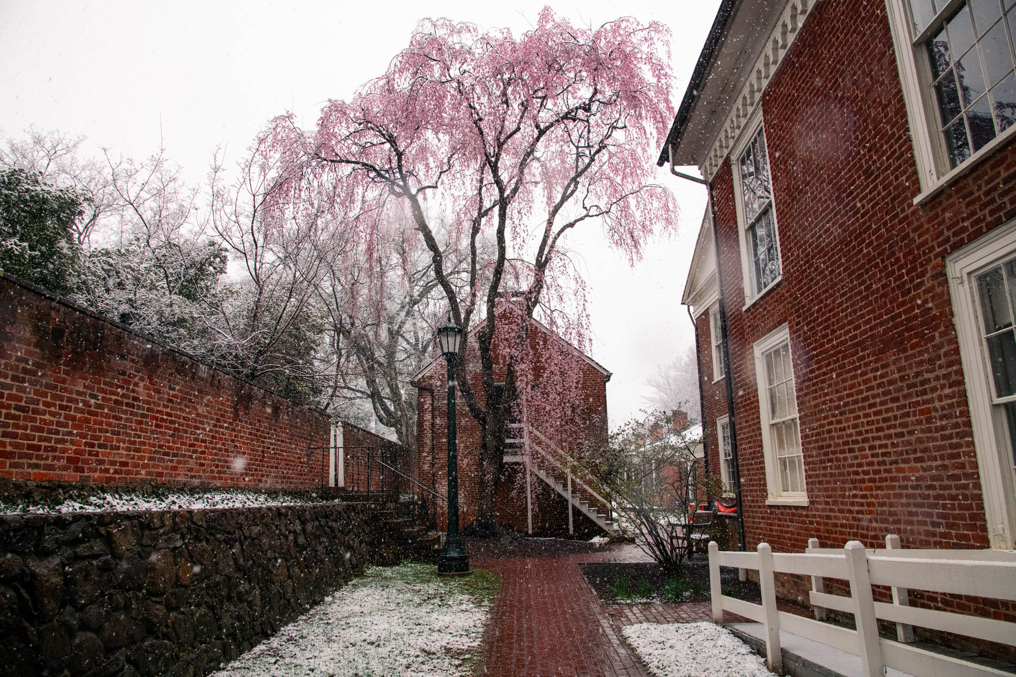
Difference between nova and cvill is astounding. Back in cvill the crickets are out and some trees/daffodils are blooming.