WXNewton
-
Posts
879 -
Joined
-
Last visited
Content Type
Profiles
Blogs
Forums
American Weather
Media Demo
Store
Gallery
Everything posted by WXNewton
-
Now we can just obsess over it for 2.5 days instead!
-
Good trends on 500 mb energy. Almost went neutral this run.
-
Trend on 18z GFS is there for sure! This thing is looking good for border counties into S.VA
-
Rgem has some 5-6 in totals now in northern Central NC!
-
Nice jump on 12z EPS!
-
Euro AI lines up pretty well with 12z GEFS
-
I was joking around about it this morning but watching the trend on the Euro the past few runs this thing really might have some legs for a legit chance. I think short-range and hi res will get interesting tomorrow.
-
12z GEFS with a good tick south with light snow accumulations...past 3 runs.
-
12z GFS headed in the right direction once again!
-
Someone's about to get NAM'ed start the thread! At this point a lot of us are playing with house money so let it Ride!! Also, FV3 is not quite cold enough but does have some heavier banding type precip building in the foothills. If the run were to continue I would think some eastern folks might get a little interesting!i
-
Just hit 5.6! One thermometer in Conover on Weather Underground was 1.1. Down near Salisbury many folks below zero, in the deepest snow pack.
-
Up to 23.4 here, after a low 7.2
-
January 30th- Feb 1st ULL and coastal storm obs
WXNewton replied to JoshM's topic in Southeastern States
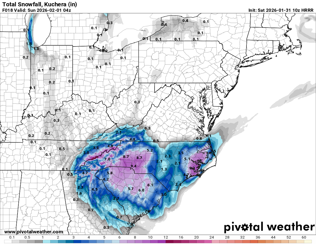
The 4 p.m. RAP run from Friday did pretty well with totals back in the central and western parts of the state. Nailed the heavier area from CLT towards Greensboro. -
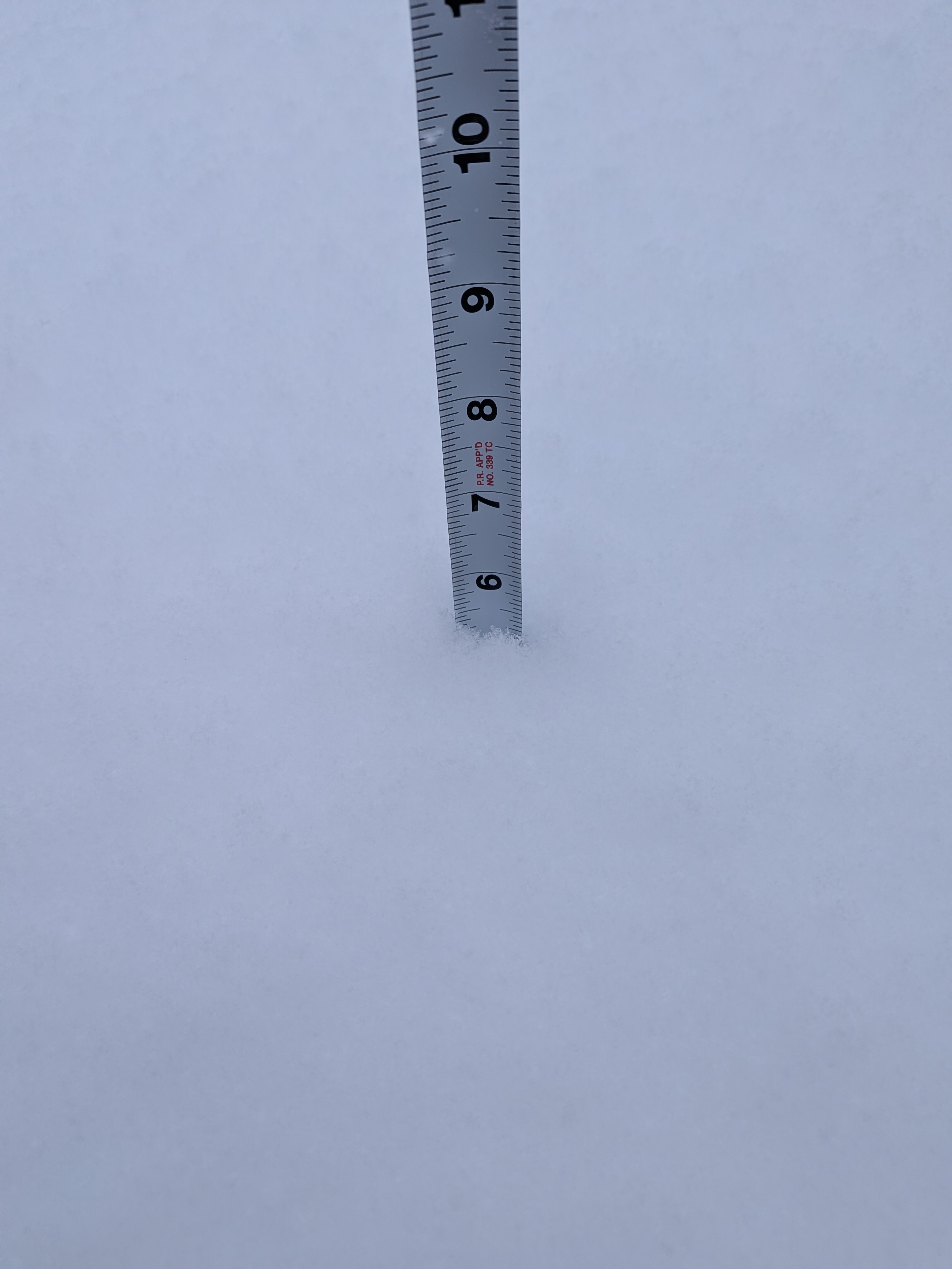
8.5 this morning!
-
Still pouring snow here, temp is down 16.2, didn't take a measurement, but we have to be closing in on 10"+ at this point in places.
-
That's correct, started at 3 o'clock on the dot and has not stopped since!
-
Absolutely! Bands coming up from the SE are still ripping here!
-
Pouring again here in Newton! What a great storm!
-
Haven't measured in the past hour or so, but eyeballing at least 6-7" now with some drifting in the ditch line of close to a foot. Definitely one of the best all snow events that I can remember in the past 15-20 years. Typically 6"+ events have always came with some mixing issues. Edit: Just measured roughly 7" and still snowing, flakes have gotten smaller but coming down fast.
-
I am right with you there on the measurements! Awesome feeling!

-
January 30th- Feb 1st ULL and coastal storm obs
WXNewton replied to JoshM's topic in Southeastern States
5.25" in Newton, been under a heavy band for past 2hrs. 20.7/16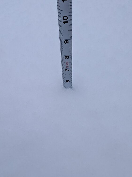
-
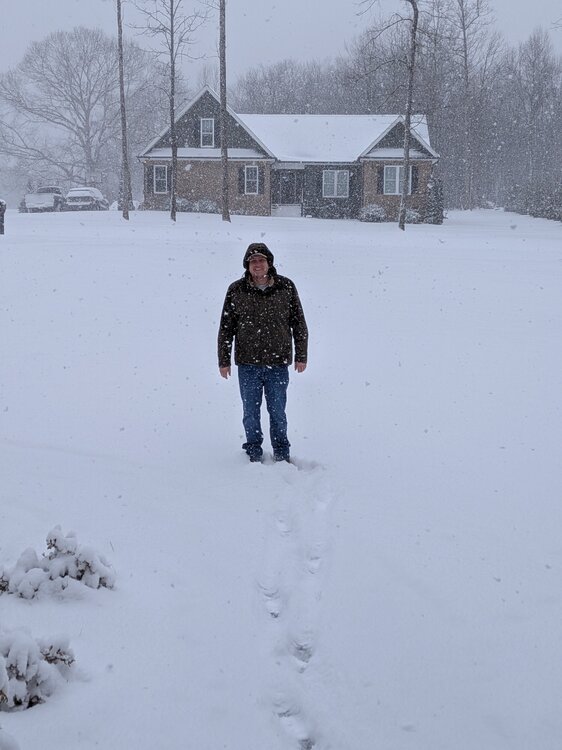
I didn't have to try hard to smile for the camera, happy right now is and understatement!!
-
This band has been absolutely hammering MBY the past 1 hr and half. Not really moving but definitely, 1"+ hr rates.
-
Yes check your sensor mine was doing the same thing cleaned it out now down from 24.7-20.6
-
HRRR agrees with RAP, here's the latest...