Ed, snow and hurricane fan
-
Posts
2,133 -
Joined
-
Last visited
Content Type
Profiles
Blogs
Forums
American Weather
Media Demo
Store
Gallery
Everything posted by Ed, snow and hurricane fan
-

Texas 2024 Discussion/Observations
Ed, snow and hurricane fan replied to Stx_Thunder's topic in Central/Western States
Rumble of thunder just now N suburbs of Houston. Earlier than expected. Radar not that impressive. I don't expect severe, it is just too cool (I still don't know how 60sF work further N but not here- confirmed rope tornado with temps in the low 60s), although I suppose marginally severe hail is possible (latest HRRR shows ~1000 mb of MUCAPE. HRRR is less enthusiastic with midnight/just after severe in the AUS-SAT corridor. -
Severe Threats: Winter 2023-2024
Ed, snow and hurricane fan replied to Chinook's topic in Central/Western States
Oh, hey. Severe Weather Statement National Weather Service San Angelo TX 536 PM CST Fri Feb 2 2024 TXC207-030015- /O.CON.KSJT.TO.W.0002.000000T0000Z-240203T0015Z/ Haskell TX- 536 PM CST Fri Feb 2 2024 ...A TORNADO WARNING REMAINS IN EFFECT UNTIL 615 PM CST FOR CENTRAL HASKELL COUNTY... At 535 PM CST, a confirmed tornado was located 7 miles southeast of Rule, moving northeast at 20 mph. At 5:31 PM law enforcement reported a rope tornado about 5 miles east of Sagerton. HAZARD...Damaging tornado and golf ball size hail. SOURCE...Law enforcement confirmed tornado. IMPACT...Flying debris will be dangerous to those caught without shelter. Mobile homes will be damaged or destroyed. Damage to roofs, windows, and vehicles will occur. Tree damage is likely. This tornado will be near... Haskell around 540 PM CST. Stamford around 555 PM CST. -
Severe Threats: Winter 2023-2024
Ed, snow and hurricane fan replied to Chinook's topic in Central/Western States
Cells ahead of the main line around Victoria forecast by 3km NAM. Shear isn't impressive above the LFC, but >8C lapse rates (and a TT over 60 because of that), there could be some decent hailers. Later, around San Antonio, a suggestion of embedded cells in the line which might also mean some hail.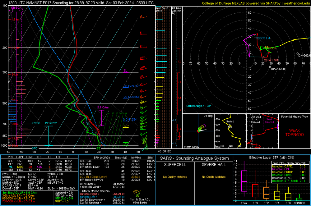
-
I'm not pessimistic. I feel Presidents Day 3 coming!
-
Texas 2024 Discussion/Observations
Ed, snow and hurricane fan replied to Stx_Thunder's topic in Central/Western States
Training storms in a SW-Ne axis looking to actually be shifting North from E of SAT up to near SHV. That line will never make Houston, but latest HRRR has more development over S Texas that should be approaching the HOU metro early morning. -
El Nino 2023-2024
Ed, snow and hurricane fan replied to George001's topic in Weather Forecasting and Discussion
Speaking of El Nino and IMBY weather- Matt Lanza, reading between the lines, doesn't think El Nino will weaken quite as fast as the models, but even so, since 1950, the first hurricane season after a strong Nino tends to be about average. Although while the recent fronts have cooled the Gulf nicely, the MDR is still abnormally warm. https://theeyewall.com/winter-prepares-to-take-a-break-so-well-talk-about-crawfish-recent-research-and-the-2024-atlantic-hurricane-season/ -
El Nino 2023-2024
Ed, snow and hurricane fan replied to George001's topic in Weather Forecasting and Discussion
Is there time for the forecast weakening of the Nino (IRI dynamic has it below 1 by mid FMA) to allow for an interesting March weather wise in the I-95 corridor? I don't post much in this thread, I don't know enough about tropical wave forcing to make informative comments or ask informed questions. -
Texas 2024 Discussion/Observations
Ed, snow and hurricane fan replied to Stx_Thunder's topic in Central/Western States
Tomorrow there should be thunder with >7C ML lapse rates, but they won't be surface based. Now, SPC has outlooked a Marginal for Wednesday. Tuesday looks sort of interesting S of I-10.

-
Texas 2024 Discussion/Observations
Ed, snow and hurricane fan replied to Stx_Thunder's topic in Central/Western States
Models have backed off a smidge on next week's rain in S/SE Texas, but widespread >3 inch rains still look possibly. FWD not going with a WWA, models came in a smidge less precip and slightly warmer temps per AFD.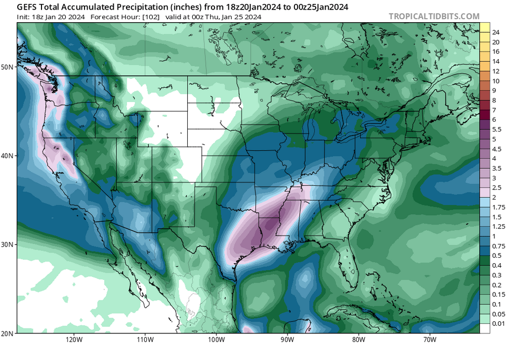
-
Texas 2024 Discussion/Observations
Ed, snow and hurricane fan replied to Stx_Thunder's topic in Central/Western States
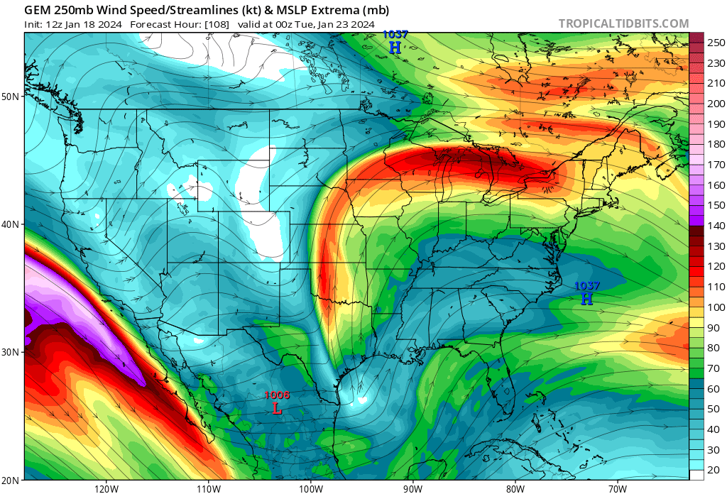
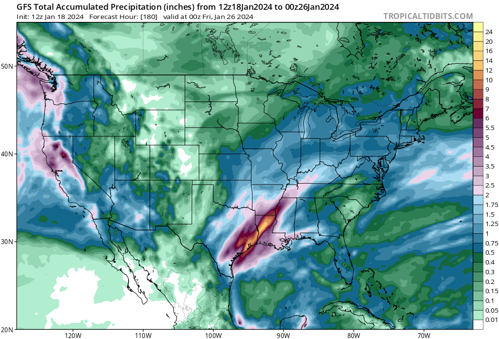
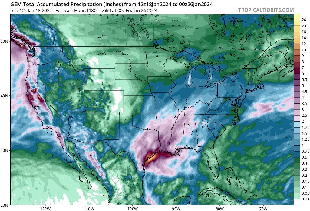
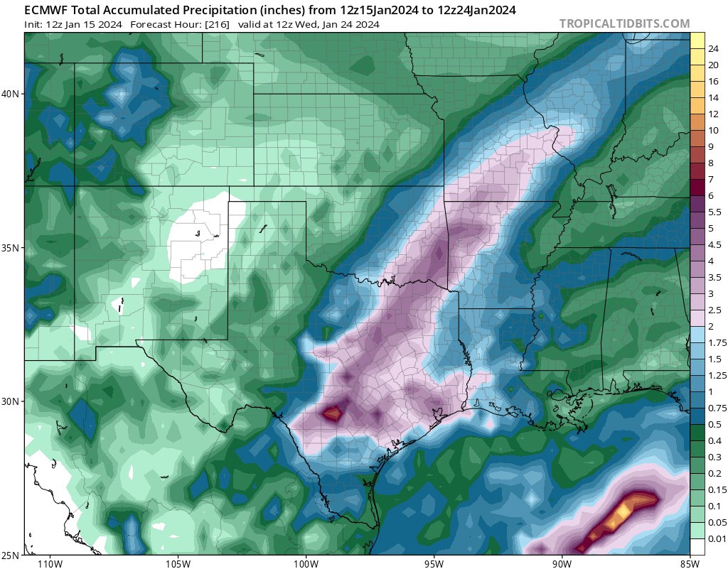
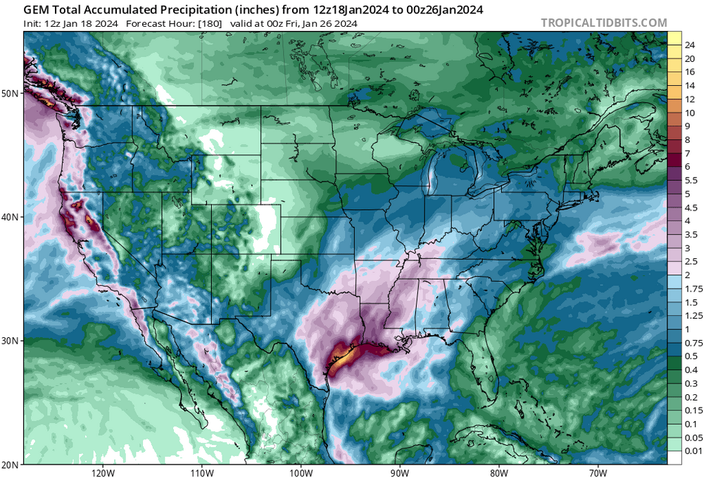
Still time for things to change for Monday, but GFS still shows the warm sector confined to the immediate coast and a near saturated sounding from the surface to 200 mb. Greater than 50 knot LLJ and PW's near 1.6 inches and a divergent jet means heavy rain, which all the important globals have been seeing for several days. GFS/CMC/Euro differ in exact amounts and locations, but all show widespread 2 inch plus amounts. Differences become more pronounced with succeeding rain events, but the neg tilt trough is in no hurry to move out. By Thursday evening the rain events have dropped a large area of 5 inches with some 10 inch amounts showing up. Not ruling out severe, the warm sector coming a bit farther inland opens up SETX and the Coastal Bend, and there are hints of that for Wednesday.

-
Texas 2024 Discussion/Observations
Ed, snow and hurricane fan replied to Stx_Thunder's topic in Central/Western States
Severe is possible, but the 2 systems early week have 5 inch rain bullseyes on both the GFS and CMC. GFS suggests CAPE is low with a nearly saturated profile. 1.6 inch PW. Of course, 6 days out, the warm sector not quite getting beyond the coast can change. On another note, 19F this morning for a min at IAH breaks the daily record of 22F from 1972. -
Texas 2024 Discussion/Observations
Ed, snow and hurricane fan replied to Stx_Thunder's topic in Central/Western States
I somehow doubt the Canadian (it shows a big DFW ice storm), but all the globals like heavy precip next Monday-Tuesday.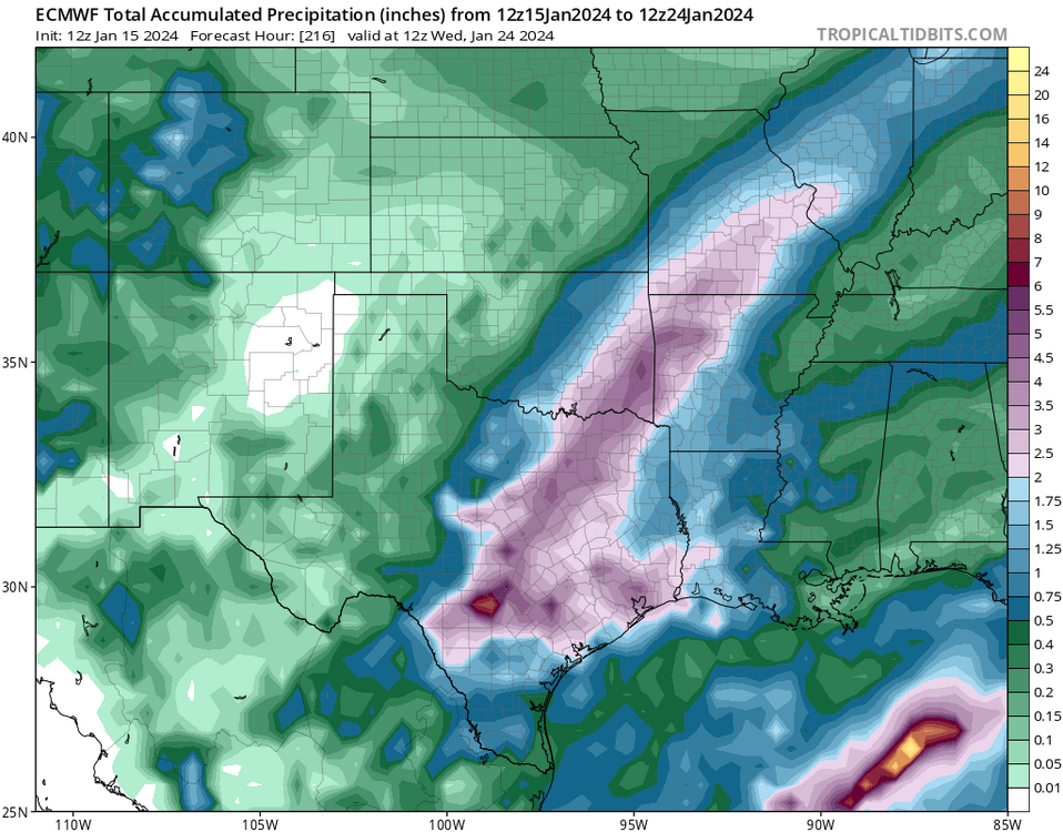
-
Texas 2024 Discussion/Observations
Ed, snow and hurricane fan replied to Stx_Thunder's topic in Central/Western States
Very light drizzle, water on the sidewalks is water, but building up on plants and cars in Houston. Klein and Tomball ISD, among others, have cancelled school. -
Texas 2024 Discussion/Observations
Ed, snow and hurricane fan replied to Stx_Thunder's topic in Central/Western States
The switch from rain to sleet was pretty fast.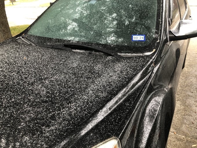
-
Texas 2024 Discussion/Observations
Ed, snow and hurricane fan replied to Stx_Thunder's topic in Central/Western States
Liquid rain halfway between IAH and DWH. 34F at airport, temp and DP are falling. If we get ice beyond a trace of freezing drizzle, I will have been wrong based on trusting models. Edit: IAH is now 28F -
Texas 2024 Discussion/Observations
Ed, snow and hurricane fan replied to Stx_Thunder's topic in Central/Western States
Driving down from DFW, about 1 pm near Alma the grassy surfaces alongside I-45 were white with sleet. No precip, down toward Corsicana, light sleet or snow flurries, not sticking to anything. Big rise in temp, about 15 degrees in maybe 30 miles around Huntsville. 18F on Toyota thermometer in DFW, 47F Spring area. No idea why Houston metro is in a WWA. A trace of precip over many hours w/ marginal temps, I guess an abundance of caution. I can see that well NW of metro Houston. Interestingly, freezing precip gets very near the coast well S of Houston, but not the Houston metro. -
Texas 2024 Discussion/Observations
Ed, snow and hurricane fan replied to Stx_Thunder's topic in Central/Western States
Canadian Reggie has a decent sleet/ice event from the Hill Country to the far W and NW suburbs of Houston. Not sure how trustworthy a mesoscale is this far from the center of the domain and this far out in time. 18Z NAM not as impressive, but similar areas. Total precip on the 12 NAM about 0.2 inches liquid equivalent of sleet and ice. Reggie has a stripe of >0.5 liquid equivalent of snow, ice and sleet from just E of DFW towards Texarkana. -
That storm comes through Houston first and local NWS is discounting the Euro in favor of the Canadian and GFS. Euro is only one w/ chance for a Houston ice disaster MLK day into Tuesday, although verbatim smidge too warm. Freakish cold, in the teens. Freakish except 2/2021 and 12/2022 also had sub 20F nights, 2021 was the power grid failure. No longer doubt CC, two months over 100F and pushing 110F many days, followed by once every 20 year cold spells happening almost every year means something has changed. What does NBM guidance show?
-
Texas 2024 Discussion/Observations
Ed, snow and hurricane fan replied to Stx_Thunder's topic in Central/Western States
HGX is pretty much dismissing Euro solution of freezing rain in Houston on MLK Day, but both KTRK (ABC 13) and KHOU (I expected better from David Paul) seem all in on the Euro. I trust NWS and the GFS. -
El Nino 2023-2024
Ed, snow and hurricane fan replied to George001's topic in Weather Forecasting and Discussion
Although El Nino winters are usually cooler on average, all the nasty, freakish (low 20s or below) cold snaps that have hit Houston happened during cold ENSOs, and NWS forecasting teens. -
Texas 2024 Discussion/Observations
Ed, snow and hurricane fan replied to Stx_Thunder's topic in Central/Western States
Oh dear. -
Texas 2024 Discussion/Observations
Ed, snow and hurricane fan replied to Stx_Thunder's topic in Central/Western States
Euro 850 temps reach freezing around 12Z Monday, with three to four tenths falling. I'm going to be optimistic and say 4 inches of snow isn't out the question. That is good news, bad news is Houston drops to between 20 and 24F Tuesday morning with near 15 hours of sub-freezing weather. This results in my palm tree looking like it is dead for 4 or 5 months after. Would have been nice to not have a hard freeze two of the last three winters. -
Texas 2024 Discussion/Observations
Ed, snow and hurricane fan replied to Stx_Thunder's topic in Central/Western States
Sleet and snow MLK day in Dallas per 0Z and 6Z GFS. -
El Nino 2023-2024
Ed, snow and hurricane fan replied to George001's topic in Weather Forecasting and Discussion
Meanwhile, IRI models suggest a neutral ENSO around the Equinox. It'll be interesting to see if the Atlantic again has record and near record warmth. The Nino style quick hitting rains every 3 or 4 days continues in Texas with cooler than normal but not cold temps. The frequency is just enough to limit deep return of Gulf moisture, although tomorrow night into Tuesday morning, I-10 corridor from Baton Rouge to Panama City is in an enhanced risk with hatched tornadoes, where enough of a warm sector looks to come ashore. That extends to ECUSA Tuesday. -
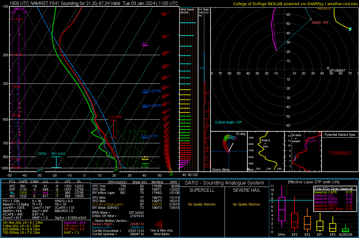
Severe Threats: Winter 2023-2024
Ed, snow and hurricane fan replied to Chinook's topic in Central/Western States
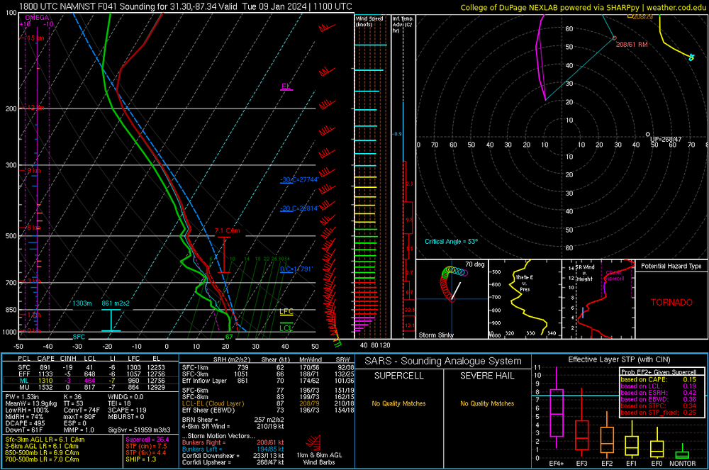
Hatched tornado Monday I-10 corridor from BTR to KECP. The worst looks to be Mississippi and Alabama after midnight. South Alabama sounding below