MN Transplant
-
Posts
17,268 -
Joined
-
Last visited
Content Type
Profiles
Blogs
Forums
American Weather
Media Demo
Store
Gallery
Everything posted by MN Transplant
-
Yesterday I checked in on the records because I figured that we must be close to a daily record, but no such luck.
-
Low max record at DCA on Christmas Eve is 23 (1989). Could be in play.
-
-
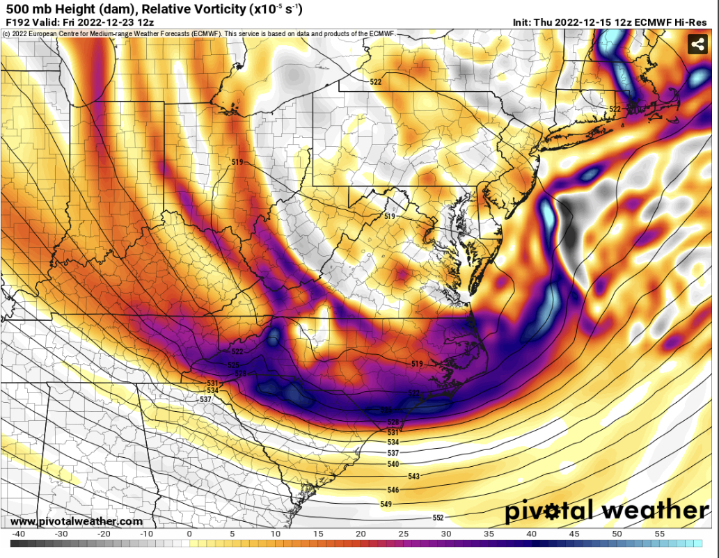
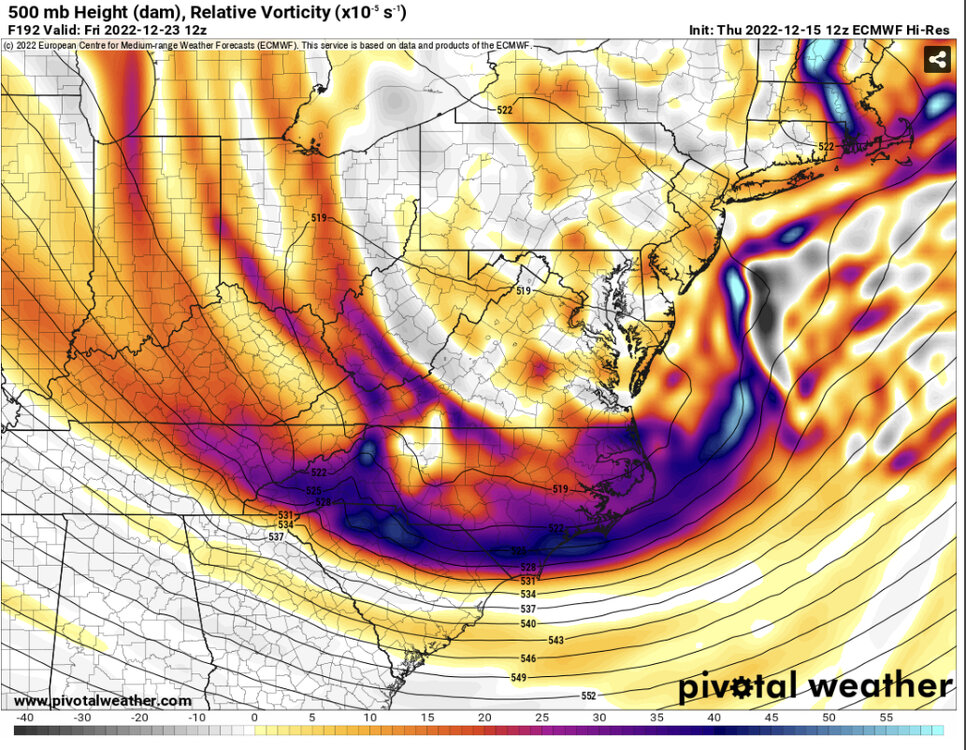
Missing the first low but a secondary low develops in a good spot edit - nice 3-6”
-
Since an OP run of the GFS at 8 days is banter, I’ll point out here that the temp at onset is in the mid-20s and falls to the mid-teens by the end.
-
Just topped an inch of rain.
-
Could not see or feel any ice when I went out to empty the rain gauge. 32.2, 0.47” in Falls Church.
-
So, you are going with the "never" scenario. Bold.
-
Euro 49 at 1am to 17 at 1pm on the 23rd. Now that would be fun to see.
-
Strictly from a White Christmas standpoint, there is a little vort that slides just to our south on the 24th. Something like that on the heels of the Arctic front could do it.
-
Matching 500
-
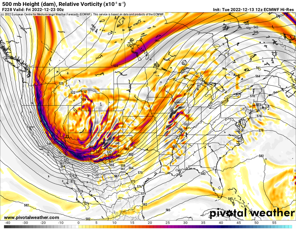
12 Euro is not too bullish. Still a mess far N and W though.
-
This is really good. You are going to have to post it multiple times this winter. I never really considered the wind, but it does physically make sense given latent heating.
-
Sleet and 40.8.
-
I'm rooting for George.
-
In safari all you have to do is tap on the icon. In this case I tapped on the weenie and it brought this up. (and now that I notice it, it is kind of like an in-browser pop-up. Maybe you have it disabled?)

-
Well, back in for now.
-
Gotta sub Pulisic out
-
There we go. What a pass on the header.
-
BWI: 10.2" DCA: 9.5" IAD: 13.1" RIC: 8.3" Tiebreaker (SBY): 5.3"
-
Sitting at a trace today. Not exactly a washout.
-
The contract that JJ is going to get will be something. A few days ago it looked like today was going to be a dreary one, but we have blue sky breaking out. Not bad at all.
-
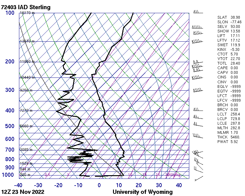
Somehow the raw numbers are even more impressive. That is nearly 20 degrees over a depth that wouldn't even get you 2/3rds of the way up the Washington Monument. ----------------------------------------------------------------------------- PRES HGHT TEMP DWPT RELH MIXR DRCT SKNT THTA THTE THTV hPa m C C % g/kg deg knot K K K ----------------------------------------------------------------------------- 1014.0 93 -3.1 -6.1 80 2.40 240 3 269.0 275.6 269.4 1013.0 100 -0.5 -7.5 59 2.16 244 3 271.6 277.7 272.0 1011.0 115 2.0 -8.0 48 2.08 252 4 274.3 280.2 274.6 1008.0 138 4.2 -9.8 35 1.81 263 5 276.7 282.0 277.0 1005.0 161 9.0 -11.0 23 1.65 275 6 281.8 286.7 282.0 1004.0 169 9.8 -11.2 22 1.63 279 7 282.6 287.5 282.9 1000.0 200 10.6 -11.4 20 1.61 295 8 283.8 288.6 284.0
-
And this is why my low was 39 and IAD's was 24. Holy inversion.
-
Woo! Thanks for running the contest.