MN Transplant
-
Posts
17,731 -
Joined
-
Last visited
Content Type
Profiles
Blogs
Forums
American Weather
Media Demo
Store
Gallery
Everything posted by MN Transplant
-
0.90” in the past month. Not great.
-
Coverage looks good, but intensity is relatively weak. Garrett Co looked like they were in a good spot and they have all of 0.15” per the mesonet.
-
My grass is fairly lush right now despite the dry and hard ground. The moderate temps are helping slow the moisture loss, but once it heats up it’ll be toast like normal.
-
Currently running at my low year-to-date precip over my 13-year CoCoRahs record. Not great.
-
Damn fine evening yesterday for my Wild and Timberwolves.
-
I still love Jaden for getting under Denver's skin.
-
0.13", but at least I (barely) crossed the 1" mark for April. Hope Wednesday delivers.
-
Not a drop.
-
I didn't have a language problem. The barrier was mostly with clerks at stores and then you can figure things out without verbal language. The translate apps on the phone help a lot with signs.
-
I'm really only familiar with the part of Switzerland that I've been to, but the Alps obviously cross several borders. If I were particularly focused on soaking in the Alps, I might have gone to Zermatt and done the Glacier Express train and the gondola. For a shorter trip without a car, I would have probably based in Interlaken, Switzerland and take the train into Lauterbrunnen/Grindelwald/etc.
-
Can confirm graupel here too. Fun.
-
Yeah, on the HRRR and NAM 3k everyone gets something, but the lower totals are around 0.05".
-
IAD also. DCA river winded and dropped back into the mid-80s, so unless there is a later wind shift, they may just tie.
-
Each of the stations tied the record at the 1pm ob. 89.2 at home.
-
We are on record high watch today. DCA: 89 BWI: 88 IAD: 87 I'm running ahead of the airports right now, already 78.3.
-
Dead on 70.0 for the high at my house.
-
30.4. Lots of 20s on the MD mesonet.
-
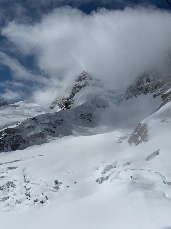
We had originally intended to do Zermatt and do the Italy trip that you note, but we were hitting multiple countries and had limited time in Switzerland. We ended up choosing Lauterbrunnen as a base and went up to Jungfraujoch for my high-altitude fix. The Eiger Express aerial tram is a smooth piece of engineering. Still hope to do northern Italy and the Matterhorn at some point in my life.
-
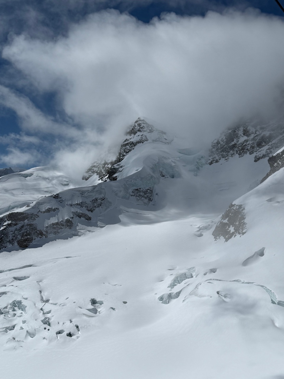
Special for you, the mountains of Switzerland. Amazing up here.
- 193 replies
-
- 16
-

-

-
I just filled up a small SUV in Germany for $120. Cost of travel and all, but ouch.
-
Checking in from abroad to see that I got 0.01” at home yesterday, which tracks.
-
It's time to grade Winter 2025-26(now that it's actually over)
MN Transplant replied to CAPE's topic in Mid Atlantic
B+. A blockbuster winter storm followed by about as cold of a streak as we can muster. Just a shame it didn’t snow more. -
The stuff in my yard is late, but curiously the cherry blossoms at the Tidal Basin are only slightly behind normal. Extension of Florets was March 16. In 2015 it was Apr 4!
-
We are so lucky to have 4 radars
-
Outage numbers aren’t huge, but they are climbing. Dominion VA is up to 95k, with Stafford county as the hardest hit in northern-ish VA.
- 1,093 replies
-
- 1
-
-
- severe
- thunderstorms
- (and 1 more)