MN Transplant
-
Posts
17,625 -
Joined
-
Last visited
Content Type
Profiles
Blogs
Forums
American Weather
Media Demo
Store
Gallery
Everything posted by MN Transplant
-
5.83” over the past week. Couldn’t have spread that out over the summer, huh?
-
0.07" from that band that prompted the FFW. I'm ok with that.
-
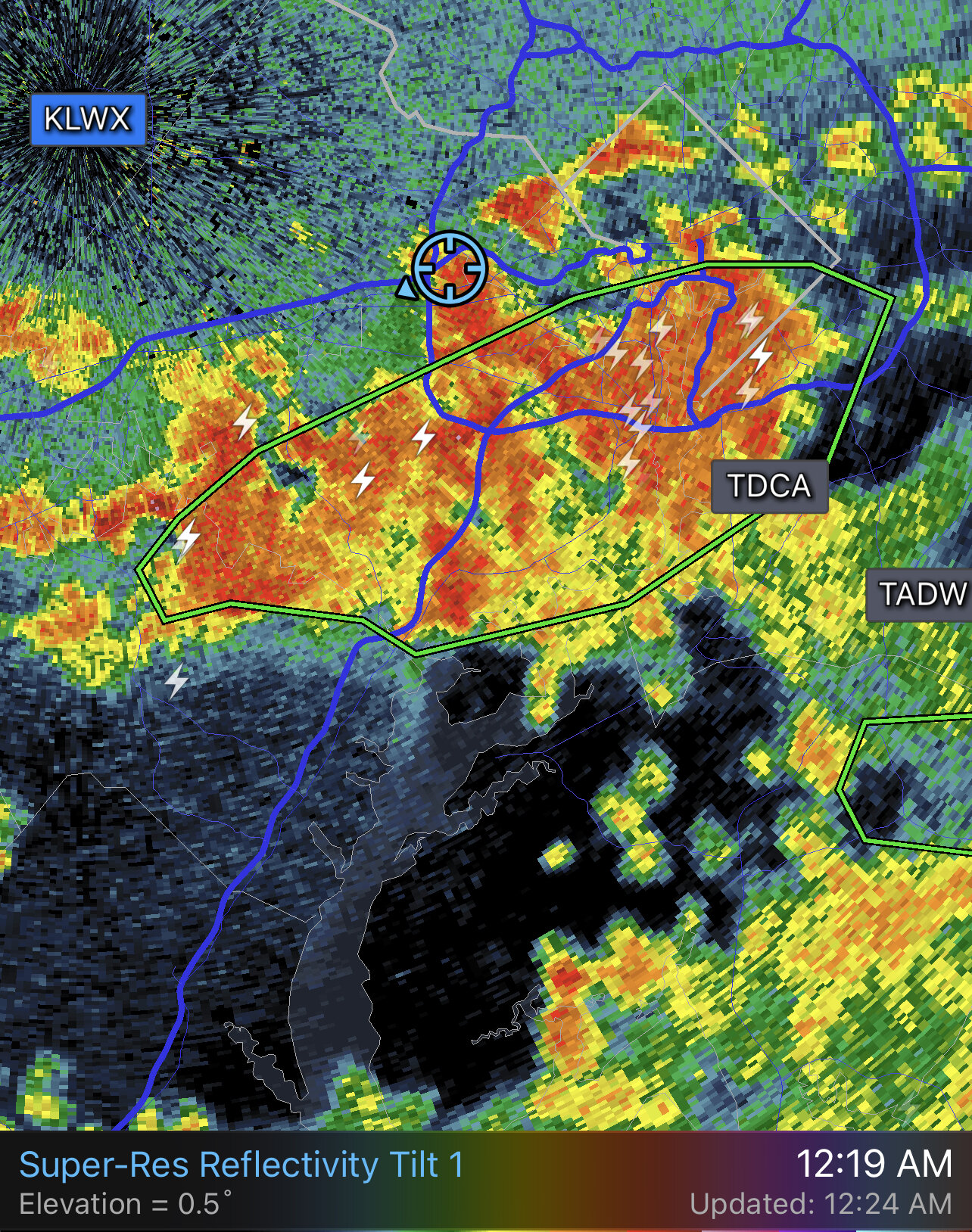
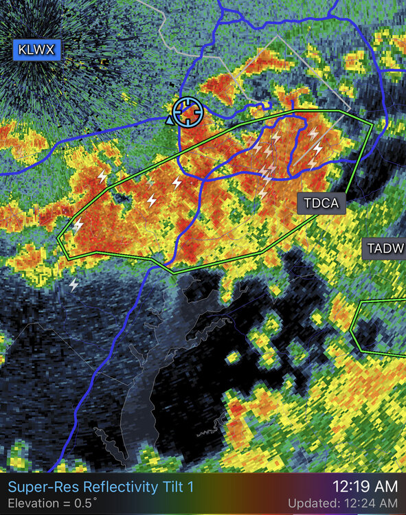
That was an aggressive FFW issuance.
-
Euro’s got 5” for you over the next several days.
-
I made a homemade bird spike kit with a cut up wire clothes hanger and a zip tie.
-
0.20” of very tropical-feeling showers earlier. Dry for a month, and then the spigot turns on.
-
CoCoRahs requires a particular rain gauge, you aren't supposed to use any of the tipping bucket or other automated gauges. https://www.cocorahs.org/Content.aspx?page=store
-
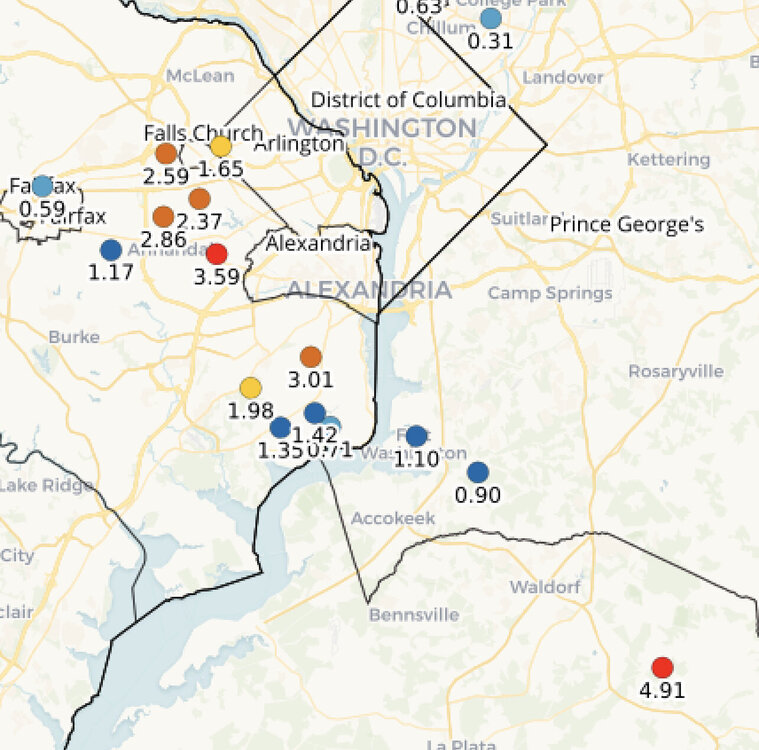
Early CoCoRaHS reports. That’s my 2.59”.
-
There is a 4” marker on radar in your vicinity now
-
It was primed, just needed a kick.
-
The new FFW is out. Adjacent to the north of the old one.
-
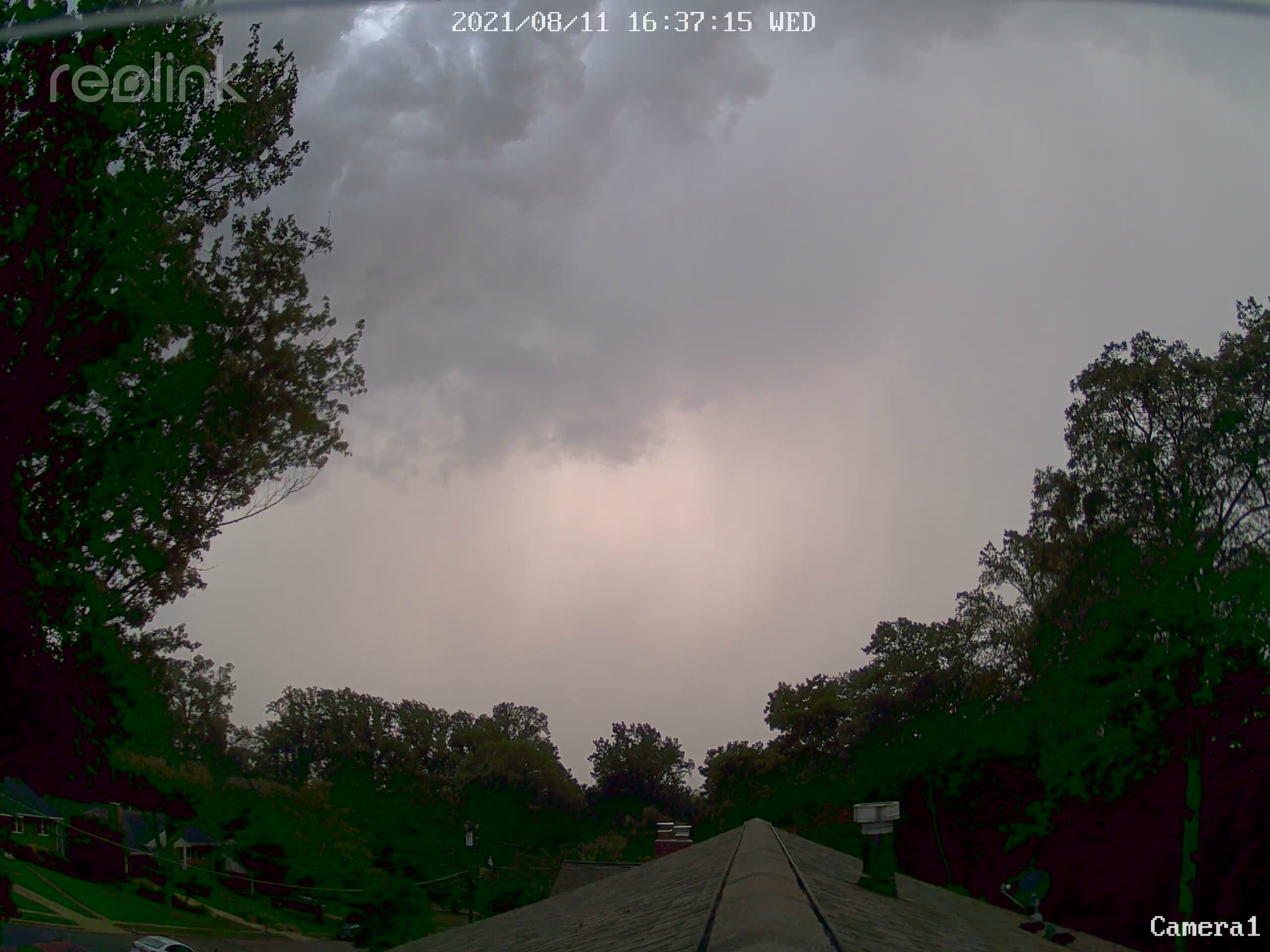
It is like the atmosphere is trying to wring out all of the moisture at once. Lightning is picking up a bit here on the western Beltway side too.
-
Close to an inch already and I’m on the periphery.
-
FFW now out for the southern DC metro. Starting to pour here also.
-
There is some convection bubbling along the boundary, but whether we get upscale growth is a different question.
-
That is a wild radar
-
100 at IAD for the only triple digits at the 4 sites.
-
DCA 94 so far today. IAD 98 BWI 96 95.7 at home
-
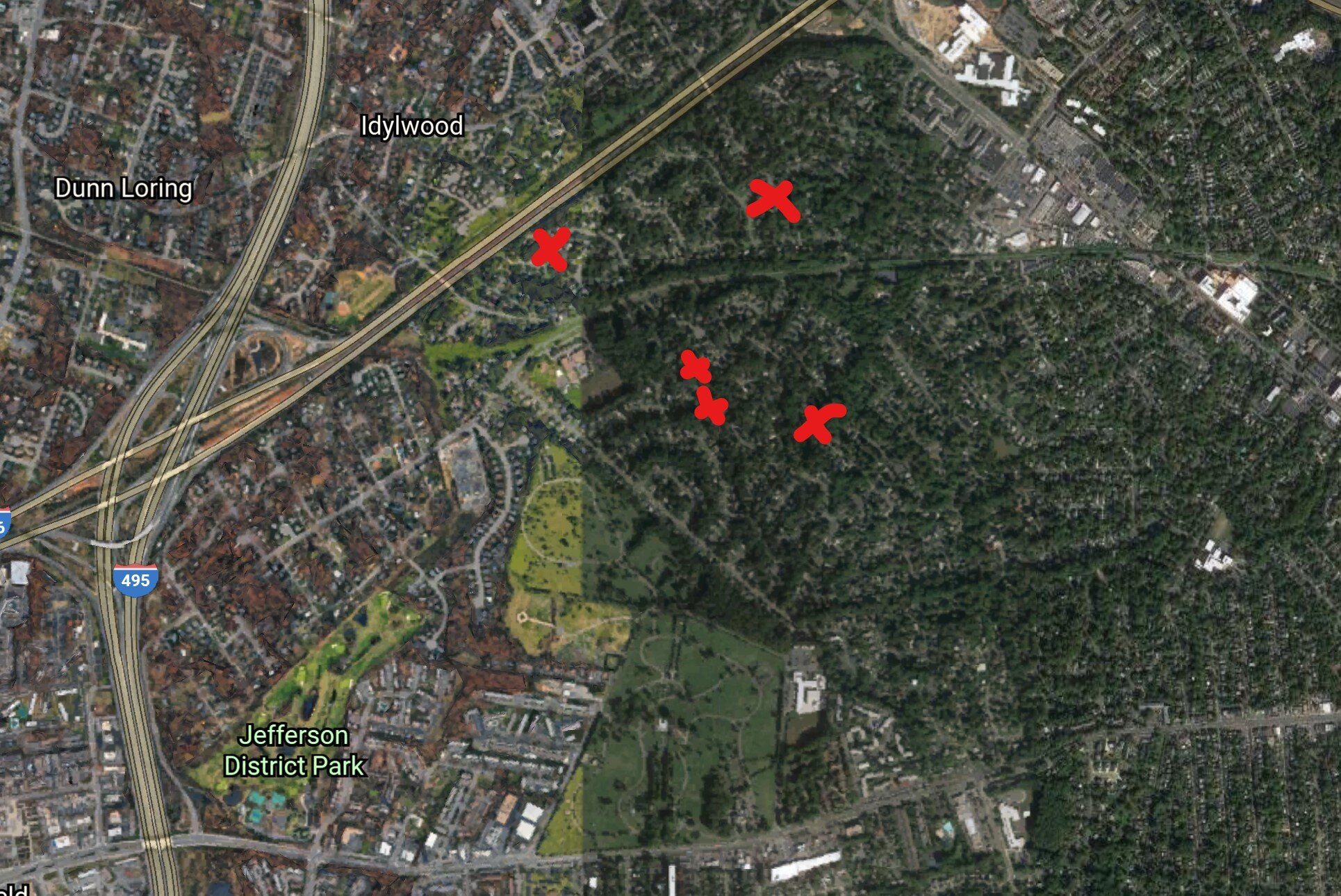
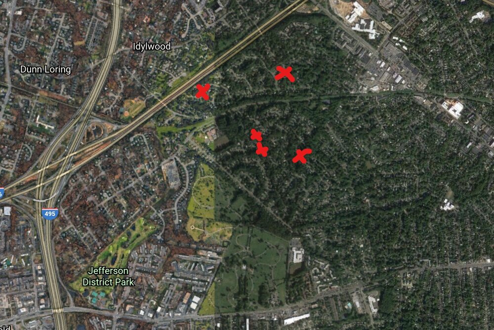
Here's the general location of the significant tree vs house hits that I'm aware of. I put an X on Salem (the NW one), but I didn't go over there to check. The Falls Hill one that we've been talking about was on Barbour.
-
IAD sets a record with 99. Records tomorrow are attainable (99 DCA/BWI, 98 IAD).
-
2021 Mid-Atlantic Severe Weather - General Discussion
MN Transplant replied to Kmlwx's topic in Mid Atlantic
Projectiles! Thankfully this one was just rain here. -
2021 Mid-Atlantic Severe Weather - General Discussion
MN Transplant replied to Kmlwx's topic in Mid Atlantic
Incoming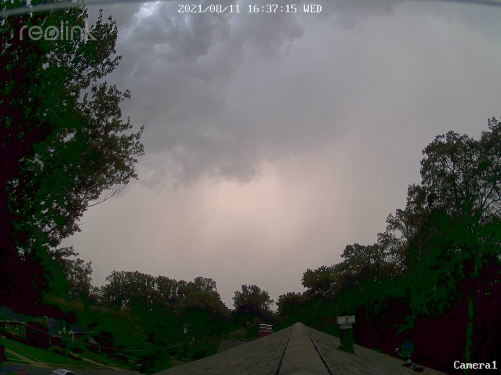
-
Sadly those are different houses. The one through the window is particularly scary. Temperatures are interesting today. It has been really dry in west central VA, and sure enough it is 97 at CHO and Culpeper. 95 BWI, 94 IAD, and 91 in the new icebox at DCA.
-
I’m just across Shreve from Falls Hill. Here is another one two blocks away.

-
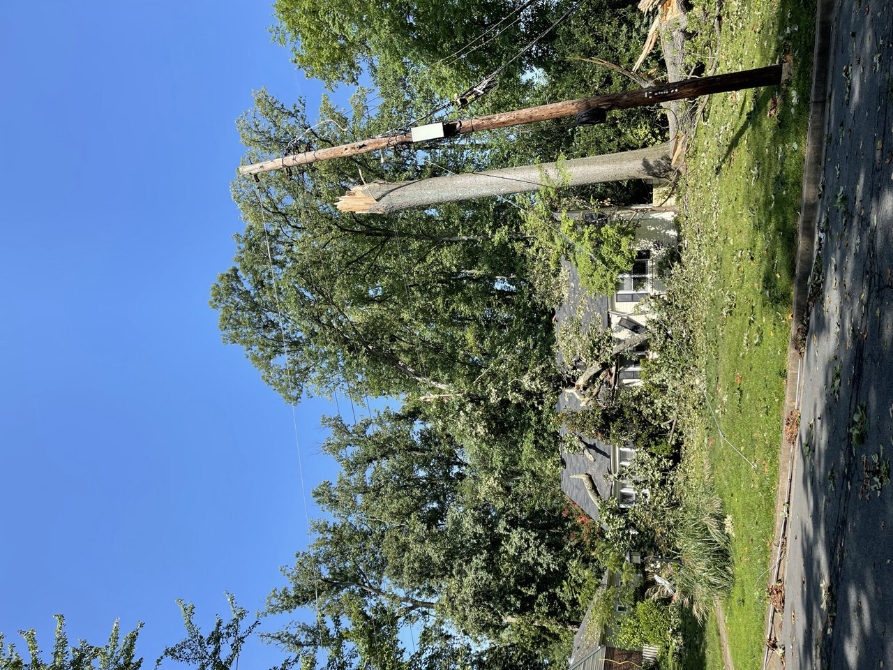
Two things that really strike me other than the obvious. Leaf parts pasted to cars/garage doors/etc. And even low things in my garden are blown over. The good part is that this was localized enough that cleanup is already going quick. Power was only out for 4 hours here and the tree companies are blanketing the neighborhood. I do feel for my neighbors about 5 houses away who had their AC unit smashed. The upcoming 105-110 HI is going to be rough. They may just bail out of town, though.