Kmlwx
-
Posts
13,592 -
Joined
-
Last visited
Content Type
Profiles
Blogs
Forums
American Weather
Media Demo
Store
Gallery
Everything posted by Kmlwx
-
THat MoCo cell looks really good all of a sudden. Tail-end charlie FTW if it holds.
-
LWX going with the big warning polygons.
-
Next line (for the moment) looks very lackluster other than the Washington County portion.
-
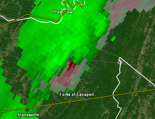
The cell crossing into Maryland near Williamsport is going to get TOR warned shortly I bet.
-
Rotation near Hedgesville is trying hard.
-
That cell in Fairfax looks suspicious again.
-
We are going to miss that stuff along I-81 unless it starts extending south. Looks like the discrete stuff out ahead is the bigger tornado risk - QLCS style stuff maybe in the line later.
-
My camera looking north from the apartment back in Columbia got something - looks like a lowering.

-
Is that rotation near Clarksville. Whoa.
-
-
The conditional prod of sigtor probabilities are really on the rise locally.
-
Tagged with the TOR possible too.
-
They were also in a radar "dead zone" of sorts. Stuff does tend to look better as it rolls off the mountains.
-
It's always something - watch flooding become the primary threat.
-
The wind? Or severe weather? Synoptic wind definitely busted here. Severe is more uncertain.
-
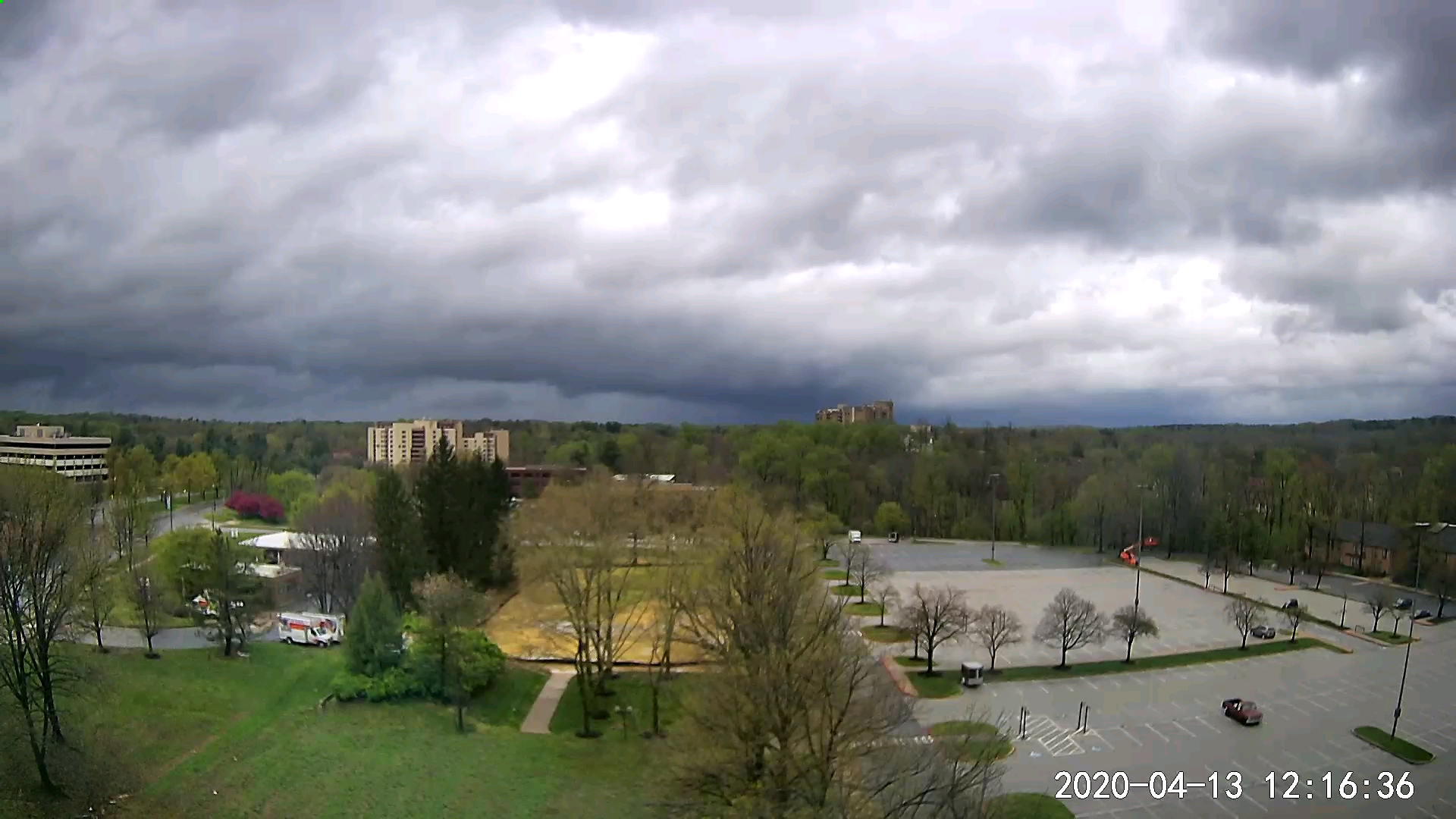
750 SBCAPE isn't bad for having no sun so far. The clearing should help boost that at-or-above 1000. Things are looking a bit better compared to earlier. It definitely feels muggy out there.
-
I'd imagine it will be a relatively low probability watch.
-
More showery junk in VA and running up into SCentral PA to keep our temps from warming. Blech
-
Chance for something isolated perhaps. But we'll need some support and it's not likely to be as widespread as earlier thought possible.
-
HRRR did kind of hint at that on a few runs with stuff getting going in like northern and northeast Maryland. Though - I can't imagine PHL and SEPA will get much more than us if the clouds don't start booking it out of here.
-
-
Normally a south wind would be helpful - but there's no warm air south of us to advect in. Dews look okay at least...
-
The RAP has dialed back instability figures for today.
-
Typical Mid-Atlantic severe day.
-
What would be really nice is if the back edge of these clouds we are under now started to erode while concurrently moving out. Not seeing that so far.