

ORH_wxman
-
Posts
93,092 -
Joined
-
Last visited
Content Type
Profiles
Blogs
Forums
American Weather
Media Demo
Store
Gallery
Everything posted by ORH_wxman
-
Primary strong and west too...this is a bad run. Trying to trend back to yesterday's 12z.
-
GFS is going to be north of 06z i think...PV up north is a bit west....although the second PV lobe to our northeast is slightly pressed vs 06z, so it might try to battle with the other one.
-
RGEM is a pretty big thump for pike...around 6"
-
Snow thump was kind of flaccid on the NAM....but honestly, if you got anything over 2" i'd think it's a net-gainer with that sfc track. 34F and rain isn't going to do much damage. Hope for more like 3-4" with a sfc reflection going SE and you'll be good. But if we start shaving the amounts on the front end and sneak some upper 30s/low 40s into the picture, then it changes.
-
At least it's a net-gainer for many. Keep that secondary reflection southeast and I'll be happy.
-
Def chekc above H85 in this setup....warm layer is going to be very elevated....750-800mb range.
-
Def some sleet for him too....sneaky 800mb warm layer.
-
You need a lot of time above 36-37F or so to start denting the pack when you’re socked in clouds and precip like today. Otherwise it will mostly just absorb the extra water when it’s mid-30s and not melt off much. Far southern and southeastern areas that spend a chunk of the afternoon above 40F will lose some (prob not enough to wipe it out) but it will probably be fairly minimal elsewhere. Anyways, this weekends storm can still turn to mostly shit…if we reverse the overnight trend then it’s back to where we were yesterday at 12z.
-
I stayed in the teens for most of that storm. Think I topped out in low 20s. This one won’t be as cold but there could be a sneaky very high-gradient CF up near your area.
-
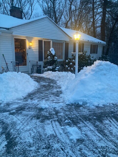
About 1.5”…now just absorbing precip. Makes for good piles though
-
Yeah 06z was a nice hit here for front end snow. Never gets ORH above freezing either. Just need to not regress on the overnight trends at 12z….small wobbles are fine but noticeable jumps will have a hit impact.
-
Euro was about 6” on the front end for the pike region before it flips.
-
If you can get an inch of QPF as ice, that will cause some pretty serious damage. It won’t be 2008, but you can accrete 4 tenths or even half an inch of radial ice. Typically 3/8ths when you really start ramping up the power outages. I agree half an inch of QPF as ice wouldn’t get it done. That would be under a quarter inch radial and probably keep power issues to a minimum. It’s def better to lean in the conservative direction when QPF isn’t super robust.
-
Looks like about 3-4”
-
Euro actually has a decent cold tuck which flips NE MA back to ZR…but it just warms up a bit more prior to that than the GFS so there’s a period of rain. Trend to watch for sure though because a little earlier in the mesolow and it’s lights out over interior.
-
GFS is some for ORH county maybe. That’s a really decent mesolow look.
-
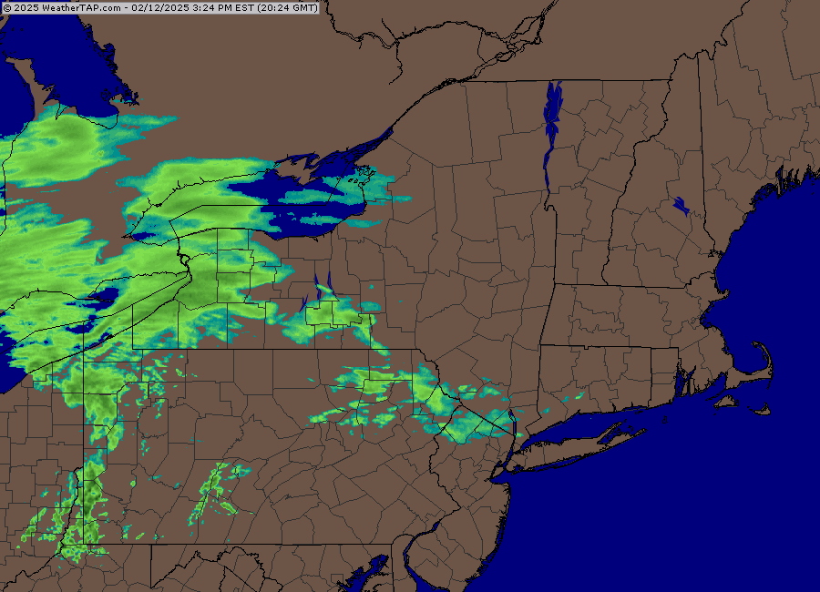
Nothing says big dynamics and front end thump like this regional loop
-
Icon def was cold. But I don’t believe it.
-
The good news about the Euro not coming in today is we can't see how bad it is. Should have us all in a better mood by this evening.
-
That’s prob where you want it at D8. Otherwise it will end up in Ottawa the way this year has gone.
-
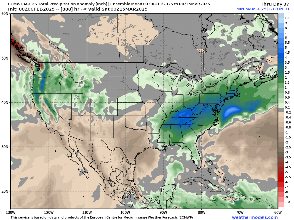
Lol, not on the weeklies…maybe someone else does. I do have a precip anomaly map
-
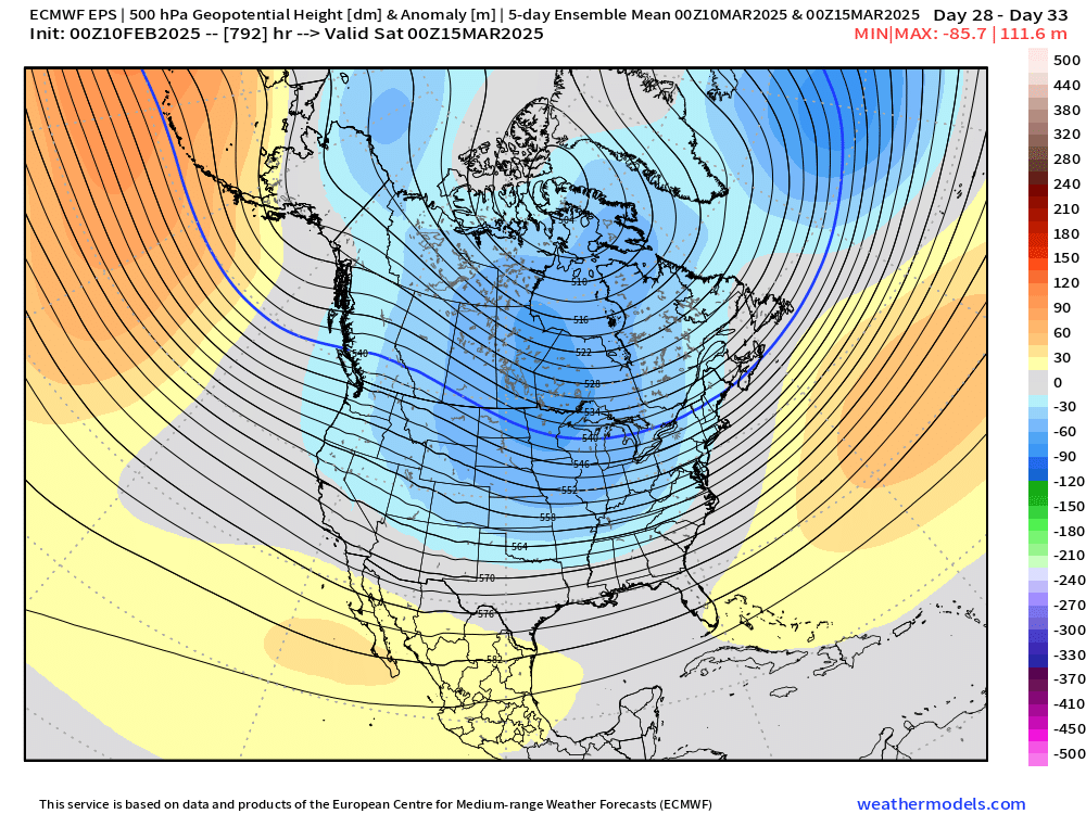
We’ll prob get teased even in the -PNA/+EPO/+AO pattern
-
Canadian is for a good chunk of CNE…maybe even down to northern SNE interior.
-
It’s close to a straight cutter. Still enough CAD to make it a mess but one more tick and we’re just about there…you tick it a little stronger and the secondary reflection will mostly disappear and just show up as kinks in the isobars from CAD. There’s going to be CAD regardless…that happens in straight cutters frequently. Just a matter if we actually get a secondary coastal or not. If we do, then it will hold in the cold at the sfc much better. If not, lots of in-situ CAD but many will warm up to 33-35F rain even if they don’t warm sector cleanly.
-
Starting to look more like euro…almost straight cutter. Give it one more tick and we’re there. Rains to Maine as one man would say.


