ORH_wxman
-
Posts
93,099 -
Joined
-
Last visited
Content Type
Profiles
Blogs
Forums
American Weather
Media Demo
Store
Gallery
Everything posted by ORH_wxman
-
Yeah it was a solid 8-10” when the forecast was 3-5”. I remember Ekster saying as soon as he woke up at 6am and heard muffled car sounds outside and no pinging and a white fog out the window, he went “ohhhh shit, the 3-5” is busting”
-
Yep…the original “Kevin dumbfounded” jokes were back when he was complaining that it was heavy snow on the Cape while he was pelting in Tolland during the 12/16/07 event
-
Trying to dump 7-8” here. Yeah, not buying it. But I’m feeling better about 4-5” before the flip.
-
What are you looking at?
-
That thing north of maine is a much bigger problem than the four corners shortwave
-
It’s a big hit for you too. It’s just the 17z hrrr doesn’t go out far enough to catch all the snow north of the pike.
-
18z rap is big hit again around the pike.
-
Yeah sounds right.
-
On pivotal it doesn’t and still has 6-7” for your backyard. I think it’s a bit aggressive but I like seeing those numbers as it gives more confidence we won’t just get 2” before the flip.
-
It’s all about the rates. It’s gonna snow for quite awhile. Prob a solid 7-9 hours before it flips…perhaps even a bit longer NOP. Most of the short term guidance really tries to ramp it up for a time between about 10pm and 3am. So yeah, if we can go like 1/2-3/4” per hour and maybe mix in a couple hours of 1”/hr during the peak 6 hour period, then you’ve got your 4-6” easy. RAP/HRRR try to go 7-8” even in spots…I think I’m selling those amounts but 4-6 is def doable.
-
RAP and HRRR are both really hammering the pike region with good WAA banding tonight. Both have 6”+ for ORH over to BOS.
-
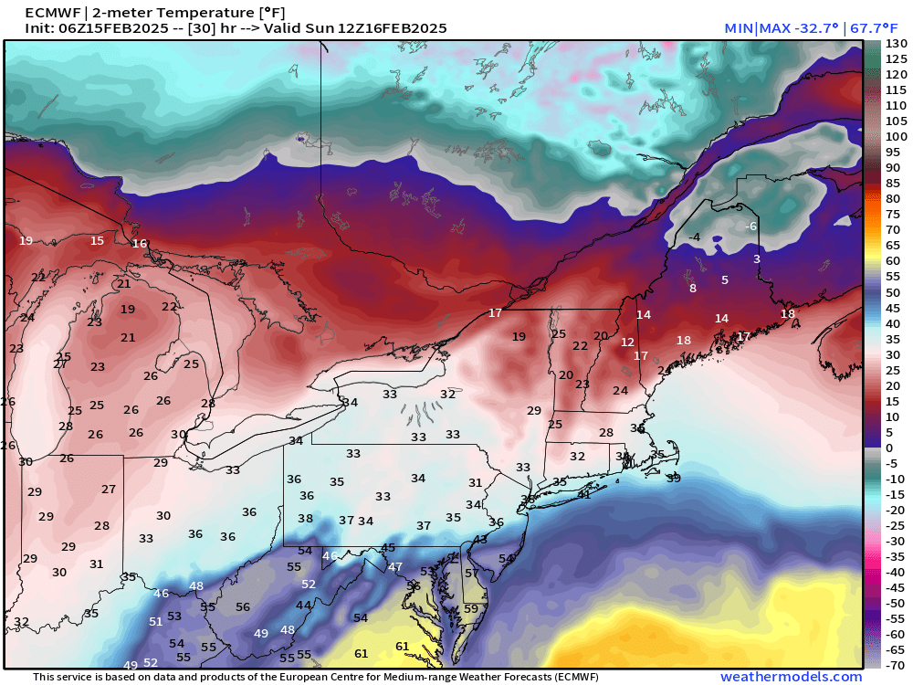
28F at Logan at 1pm. Don’t think his 37F is looking very good.
-
Yes they did. Still some decent westward spread though.
-
Or we could look at like half a dozen other KU storms in the past decade that did not lose it at all…and then count a bunch of storms that were lost at day 5 and never came back.
-
He thinks he’s getting 70mph winds with a third of an inch of radial ice.
-
Like I said to Tip yesterday…Ensembles until 12z tomorrow. Otherwise you just end up flip flopping with each OP run that comes out.
-
Yep. There’s prob some sleet contamination too. He’s outdoing even his usual obsessed weenie self. I’ve honestly been through like 10-15 icing events in ORH more interesting than this one.
-
You realize that isn’t radial ice, right? If you got half of what was shown, it would be a nuisance event.
-
Yeah there is definitely a cluster of later phasers. It could go either way…we’re still 5 days out. This isn’t like it’s 2-3 days out.
-
Yeah colder than 06z by a tick. I’ve notice the earlier parts of the transition in ptype have trended colder the last couple runs even if the ending has been similar…wonder if we’ll see tomorrow afternoon/early evening trend colder NW of the CF as it gets inside of 24h. The mesolow early on has looked a little more defined.
-
3k tries to wash out the sleet line for a couple hours. Reminds me of 12/16/07. Won’t be as much snow as that one but something to watch
-
I think people need to also understand the difference between flat ice and radial ice accretion. The flat ice is a newer way to measure it but it’s not the same as radial…it’s less. Radial ice was the old way. A half inch of radial ice is way more impactful than a half inch of flat ice….flat ice is roughly half the impact. (About a half inch of flat ice is the same as about a quarter inch of radial ice)
-
Agree that is a better chance for some impactful ice. Ineedweenies just doesn’t remotely get enough QPF as ice.
-
Doubtful on big ZR and big damage. Not enough QPF falls as ZR
-
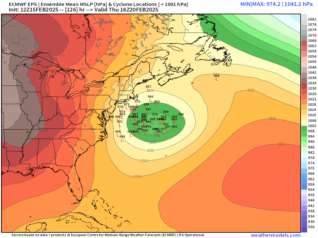
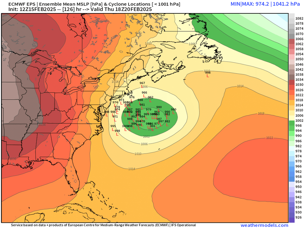
It’s somewhat close looking at euro. Here is 12z tomorrow