ORH_wxman
-
Posts
90,902 -
Joined
-
Last visited
Content Type
Profiles
Blogs
Forums
American Weather
Media Demo
Store
Gallery
Everything posted by ORH_wxman
-
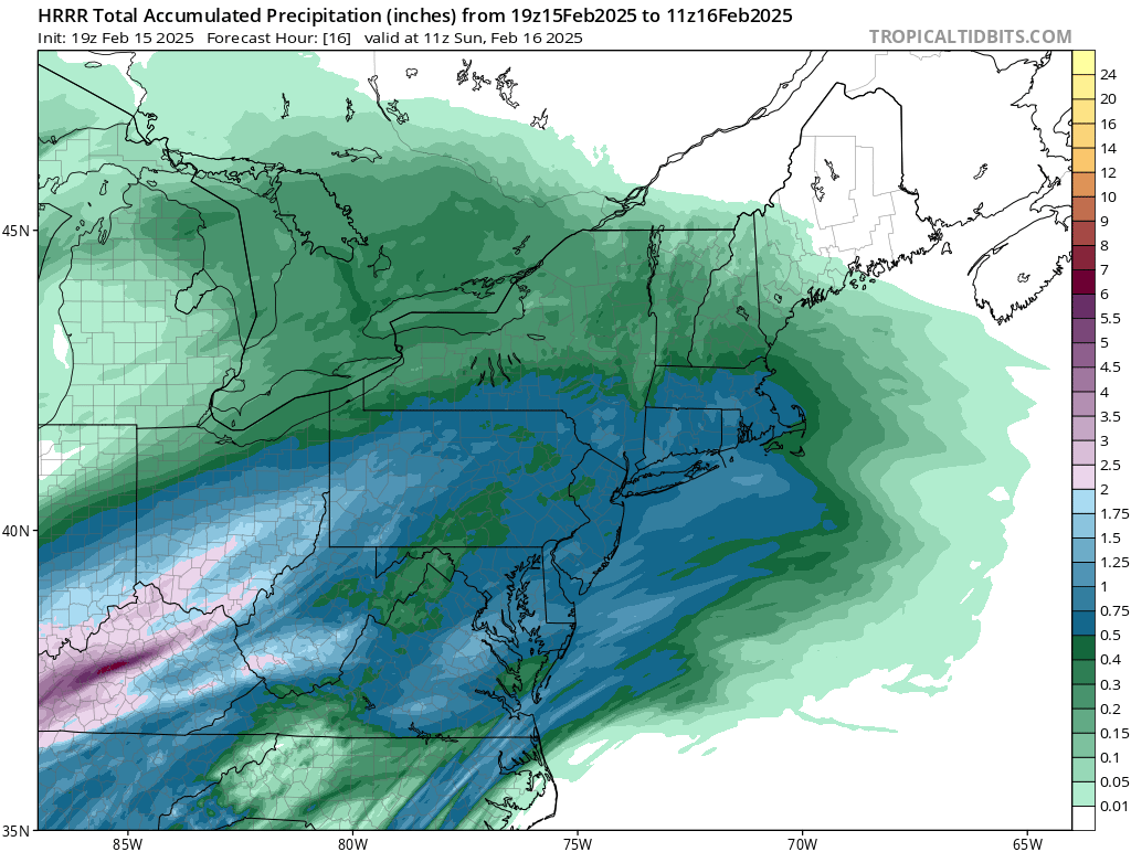
It’s close. HRRR and rap have you snowing but 3k NAM has the pingers arriving right around midnight there.
-
Much better to go old school and look for the timing of the flip and then print out total model QPF at that hour. Hrrr flips the pike between 10-11z and this is modeled QPF through 11z…I think it’s a little weenie-ish though…gotta a feeling it might be closer to the NAM 08z timeframe, so I’d shave a couple of inches off the hrrr here…not buying 6-8”

-
Yes there are definitely defense mechanisms in both directions. Very well known for anyone who has been on these forums for years. This threat is still definitely there but it’s got work to do. Silly to declare it dead or locked at this range.
-
The flip side of it is I don’t feel sorry for anyone who got emotionally invested in a 156 hour model output. No matter how “good” it looked.
-
Hrrr has 2” of QPF here. Nearly 1” falls as frozen/freezing but that leaves another 1” of QPF as 33-34F rain. Gonna be a lot of liquid in the pack. hrrr might be overdone a bit though. Esp in the slot.
-
Yeah it was a solid 8-10” when the forecast was 3-5”. I remember Ekster saying as soon as he woke up at 6am and heard muffled car sounds outside and no pinging and a white fog out the window, he went “ohhhh shit, the 3-5” is busting”
-
Yep…the original “Kevin dumbfounded” jokes were back when he was complaining that it was heavy snow on the Cape while he was pelting in Tolland during the 12/16/07 event
-
Trying to dump 7-8” here. Yeah, not buying it. But I’m feeling better about 4-5” before the flip.
-
What are you looking at?
-
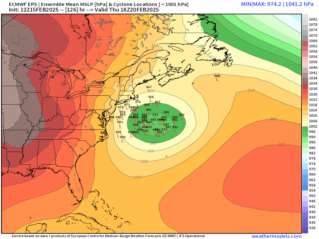
That thing north of maine is a much bigger problem than the four corners shortwave
-
It’s a big hit for you too. It’s just the 17z hrrr doesn’t go out far enough to catch all the snow north of the pike.
-
18z rap is big hit again around the pike.
-
Yeah sounds right.
-
On pivotal it doesn’t and still has 6-7” for your backyard. I think it’s a bit aggressive but I like seeing those numbers as it gives more confidence we won’t just get 2” before the flip.
-
It’s all about the rates. It’s gonna snow for quite awhile. Prob a solid 7-9 hours before it flips…perhaps even a bit longer NOP. Most of the short term guidance really tries to ramp it up for a time between about 10pm and 3am. So yeah, if we can go like 1/2-3/4” per hour and maybe mix in a couple hours of 1”/hr during the peak 6 hour period, then you’ve got your 4-6” easy. RAP/HRRR try to go 7-8” even in spots…I think I’m selling those amounts but 4-6 is def doable.
-
RAP and HRRR are both really hammering the pike region with good WAA banding tonight. Both have 6”+ for ORH over to BOS.
-
28F at Logan at 1pm. Don’t think his 37F is looking very good.
-
Yes they did. Still some decent westward spread though.
-
Or we could look at like half a dozen other KU storms in the past decade that did not lose it at all…and then count a bunch of storms that were lost at day 5 and never came back.
-
He thinks he’s getting 70mph winds with a third of an inch of radial ice.
-
Like I said to Tip yesterday…Ensembles until 12z tomorrow. Otherwise you just end up flip flopping with each OP run that comes out.
-
Yep. There’s prob some sleet contamination too. He’s outdoing even his usual obsessed weenie self. I’ve honestly been through like 10-15 icing events in ORH more interesting than this one.
-
You realize that isn’t radial ice, right? If you got half of what was shown, it would be a nuisance event.
-
Yeah there is definitely a cluster of later phasers. It could go either way…we’re still 5 days out. This isn’t like it’s 2-3 days out.
-
Yeah colder than 06z by a tick. I’ve notice the earlier parts of the transition in ptype have trended colder the last couple runs even if the ending has been similar…wonder if we’ll see tomorrow afternoon/early evening trend colder NW of the CF as it gets inside of 24h. The mesolow early on has looked a little more defined.