

ORH_wxman
-
Posts
93,092 -
Joined
-
Last visited
Content Type
Profiles
Blogs
Forums
American Weather
Media Demo
Store
Gallery
Everything posted by ORH_wxman
-
White Christmas Miracle? December 23-24th
ORH_wxman replied to Baroclinic Zone's topic in New England
We pray for dongs out east tomorrow. Still one more shot at a Christmas miracle there. -
White Christmas Miracle? December 23-24th
ORH_wxman replied to Baroclinic Zone's topic in New England
If the northern side of the band currently hitting me gets you, it’ll be worth another snow walk. Nuking in this band. Enjoy the little victories. -
White Christmas Miracle? December 23-24th
ORH_wxman replied to Baroclinic Zone's topic in New England
Solid event. Locks in white Christmas. We’re pushing about half that here, but it just might be enough. Esp with CAA during the afternoon. We’ll see. Still trying to add a little more...still ripping outside. -
White Christmas Miracle? December 23-24th
ORH_wxman replied to Baroclinic Zone's topic in New England
Nuking in this band right now. Piling up quick. Too bad it’s not gonna last too much longer.
-
White Christmas Miracle? December 23-24th
ORH_wxman replied to Baroclinic Zone's topic in New England
Looks like one more round to go through and then we’re prob done.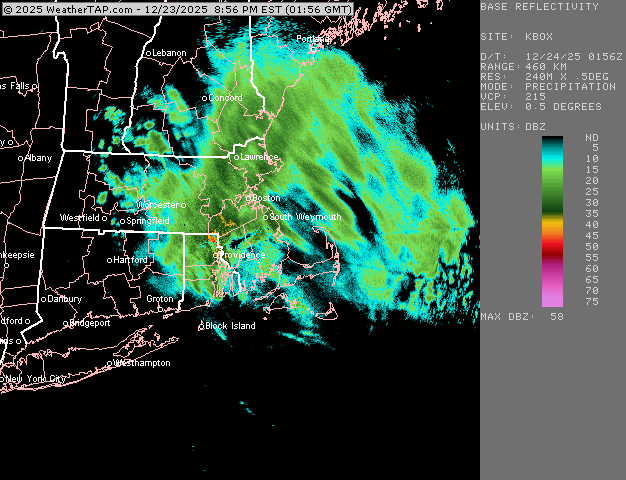
-
White Christmas Miracle? December 23-24th
ORH_wxman replied to Baroclinic Zone's topic in New England
IMG_4248-ezgif.com-gif-maker 3.mp4 -
White Christmas Miracle? December 23-24th
ORH_wxman replied to Baroclinic Zone's topic in New England
-
White Christmas Miracle? December 23-24th
ORH_wxman replied to Baroclinic Zone's topic in New England
These are massive aggregates now. Lots of nickels and quarters falling in this band. If this intensity kept up even for an hour (it won’t), I’d would be a quick 1.5-2” easy. -
White Christmas Miracle? December 23-24th
ORH_wxman replied to Baroclinic Zone's topic in New England
Yeah I’ve got iPhone SE. Not paying for a good one, lol. I also reduce the size of the photos before I upload them so that makes them crappier too. -
White Christmas Miracle? December 23-24th
ORH_wxman replied to Baroclinic Zone's topic in New England
Incoming now -
White Christmas Miracle? December 23-24th
ORH_wxman replied to Baroclinic Zone's topic in New England
A few tenths now. Best bands are just west so hoping to nuke for the next hour or two.
-
White Christmas Miracle? December 23-24th
ORH_wxman replied to Baroclinic Zone's topic in New England
Pounding aggregates right now. Everything covered including pavement. It’s now or never down here over next 2-3 hours. -
White Christmas Miracle? December 23-24th
ORH_wxman replied to Baroclinic Zone's topic in New England
Actually getting some good flakes now here. 33F Not gonna last though. Gotta wait until after 00z here. Up by Ray could get some accumulation from this batch. -
The medium range guidance for post-Christmas is some of the worst I’ve seen in a while. I mean, some of these runs were giving us pretty damned mild weather for several days in a row just a few cycles ago and it’s completely flipped. They weren’t able to handle the blocking in the Atlantic with much skill.
-
White Christmas Miracle? December 23-24th
ORH_wxman replied to Baroclinic Zone's topic in New England
I mean this basically is the thread for this event. There isn’t much to talk about down here except maybe a quick burst this evening and a chance at a little IVT clipping the coast tomorrow. -
Yeah northern outlier. If it’s gonna come back, we need the big boy models to start making a move at 00z
-
White Christmas Miracle? December 23-24th
ORH_wxman replied to Baroclinic Zone's topic in New England
Last chance will be that stuff coming down from near ART and Lake Ontario. Some guidance kind of blows it up for a good 3 hour burst….I’m remaining skeptical but if it happens then we could pick up a quick inch or two.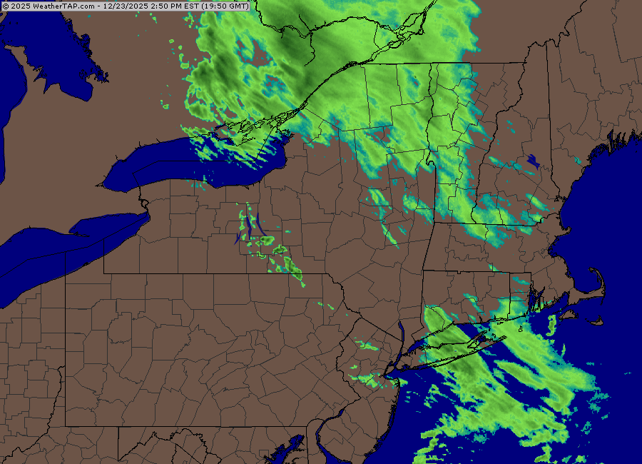
-
White Christmas Miracle? December 23-24th
ORH_wxman replied to Baroclinic Zone's topic in New England
Gonna be like a -4 or -5 December with little snow to show for it. -
‘92-93 went from a top 5 season to pretty mediocre quite quickly once you got into central CT and southwest. It was actually below normal for snowfall once you got to NYC. Pretty amazing season though for BOS-ORH corridor and northward into your hood.
-
Actually has a rare true flash freeze event during a rain to snowstorm on that solution. Doubt it verifies but every once in a while it happens.
-
White Christmas Miracle? December 23-24th
ORH_wxman replied to Baroclinic Zone's topic in New England
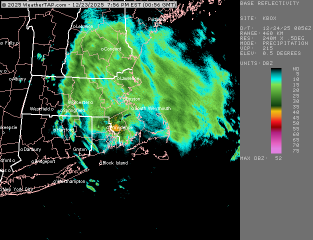
Not optimistic. There’s an area of forcing knifing SE that is supposed to blossom Some snow for eastern areas later on this evening…that’s what could give a quick burst of actual half-decent rates. But it could also stay too far northeast. The dying WAA tries to rejuvenate some weaker echoes this afternoon but I am not counting on anything from that. For far eastern MA, they might try and sneak a piece of the IVT tomorrow….but that is low probability. -
We had about 12” in the 2/4/95 storm and then I think the next biggest storm all winter was maybe 2” or 3”. It was close to being historically awful if it weren’t for that one Storm.
-
Euro is pretty nice for far SW CT for Saturday. Rest of SNE is light snow that is probably getting shredded…prob 1-2” type deal.
-
White Christmas Miracle? December 23-24th
ORH_wxman replied to Baroclinic Zone's topic in New England
You need about 1.5-2” and you’ll be good. Any coatings will melt/sublimate. -
He's been in probably the worst spot in the entire region since Feb 2022. So I get it....at least the rest of us had at least a few decent events, but his area down toward Tblizz has been really bad. ORH might have been the worst spot relative to climo from 1988-1992.


