

ORH_wxman
-
Posts
93,092 -
Joined
-
Last visited
Content Type
Profiles
Blogs
Forums
American Weather
Media Demo
Store
Gallery
Everything posted by ORH_wxman
-
December 5-6, 2020 Storm Observations and Nowcast
ORH_wxman replied to Baroclinic Zone's topic in New England
I do like the trajectory of the warm conveyor belt south of LI. That looks like it’s just going to destroy interior CT up into MA later as it pivots into the CCB.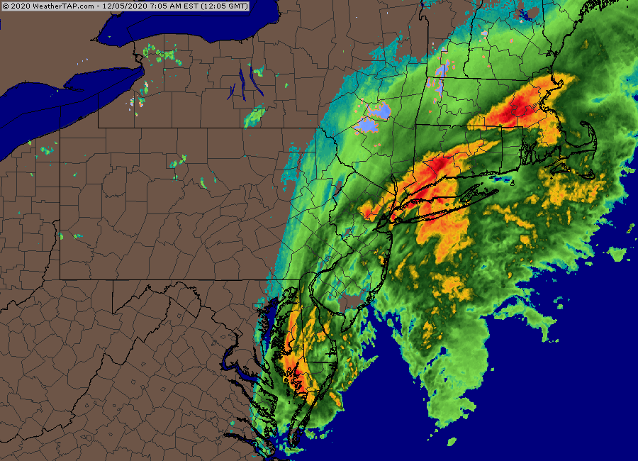
-
December 5-6, 2020 Storm Observations and Nowcast
ORH_wxman replied to Baroclinic Zone's topic in New England
Very beginning of stickage in ORH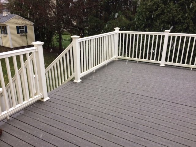
-
December 5-6, 2020 Storm Observations and Nowcast
ORH_wxman replied to Baroclinic Zone's topic in New England
Snowing on winter hill now. -
December 5-6, 2020 Storm Observations and Nowcast
ORH_wxman replied to Baroclinic Zone's topic in New England
It’s been mixing on WaWa webcam in pulses the last few min. -
Dec 5/6th major coastal/ west Atlantic cyclogenesis ...?
ORH_wxman replied to Typhoon Tip's topic in New England
Yeah the Wachusett webcams are usually live. The HD summit cam is a good one that points up the mountain. -
December 5-6, 2020 Storm Observations and Nowcast
ORH_wxman replied to Baroclinic Zone's topic in New England
WaWa webcam def looks like it’s snowing up the mountain a bit. Perhaps even some cat paws at 1050 feet on the base cam. -
December 5-6, 2020 Storm Observations and Nowcast
ORH_wxman replied to Baroclinic Zone's topic in New England
You can see the melting layer on dual pol. Im guessing about 2k feet up?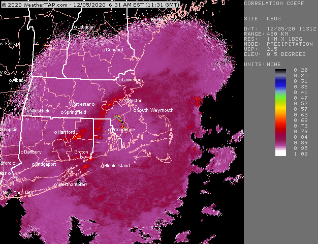
-
Dec 5/6th major coastal/ west Atlantic cyclogenesis ...?
ORH_wxman replied to Typhoon Tip's topic in New England
Thanks for the insight Walt. I agree that we’re prob looking something more like 6-10 for high terrain interior MA and not those 15” totals. I guess 12” could happen if we start seeing a changeover soon. Melting layer on BOX radar looks to be around 1500-2000 feet. ORH went from 40F to 38F last hour. I suspect mixing will start around 36F -
Dec 5/6th major coastal/ west Atlantic cyclogenesis ...?
ORH_wxman replied to Typhoon Tip's topic in New England
I’ll also take the over on ORH at 2” -
Dec 5/6th major coastal/ west Atlantic cyclogenesis ...?
ORH_wxman replied to Typhoon Tip's topic in New England
The 10 to 1 maps are def wrong for BOS. I don’t think the lowest 1500-2000 feet of the 00z sounding looks realistic though for BOS at 00z. It has extremely heavy precip over them but a steep low level lapse rate despite N/NW wind. That should prob be like 32-33F paste. My guess would be BOS gets several sloppy/pasty inches if the euro came to fruition (and adjusting for the lowest 2k feet) -
Dec 5/6th major coastal/ west Atlantic cyclogenesis ...?
ORH_wxman replied to Typhoon Tip's topic in New England
This has to be the biggest throwback thread we’ve ever seen. Mid-Atlantic posters, Ekster, DT.....LOL. -
Dec 5/6th major coastal/ west Atlantic cyclogenesis ...?
ORH_wxman replied to Typhoon Tip's topic in New England
Slower is definitely better for BOS area. Gives them a couple extra hours to get smoked by the CCB as it collapses east. Obviously the clown maps are overdone, but the rates between 18z and 00z are going to be crazy. Can’t discount some pretty good snow after 00z for far E and NE MA too. A lot of guidance is starting to show that hanging tough. -
Dec 5/6th major coastal/ west Atlantic cyclogenesis ...?
ORH_wxman replied to Typhoon Tip's topic in New England
Dude that vaporizer... Looks good on the 00z euro again. This thing slowing down a bit is going to be good for someone who gets under that CCB/deformation. That could be a lot of folks from like ORH to E NH to lake region to Sugarloaf. -
Dec 5/6th major coastal/ west Atlantic cyclogenesis ...?
ORH_wxman replied to Typhoon Tip's topic in New England
Euro slowed down again slightly but no appreciable change in track. -
Dec 5/6th major coastal/ west Atlantic cyclogenesis ...?
ORH_wxman replied to Typhoon Tip's topic in New England
I have no idea what Ekster is doing there. -
Dec 5/6th major coastal/ west Atlantic cyclogenesis ...?
ORH_wxman replied to Typhoon Tip's topic in New England
I think it was in Providence...but not 100% sure...LOL -
Dec 5/6th major coastal/ west Atlantic cyclogenesis ...?
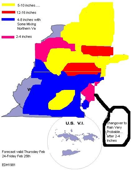
ORH_wxman replied to Typhoon Tip's topic in New England
I found this pic while searching for the Zonties and edh1981 map....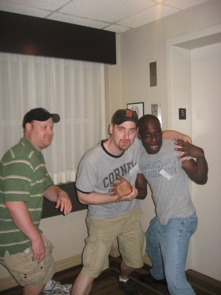
-
Dec 5/6th major coastal/ west Atlantic cyclogenesis ...?
ORH_wxman replied to Typhoon Tip's topic in New England
I want to say it was 2007. -
Dec 5/6th major coastal/ west Atlantic cyclogenesis ...?
ORH_wxman replied to Typhoon Tip's topic in New England
I had forgotten that the edh1981 map didn’t have any of New England on it. -
Dec 5/6th major coastal/ west Atlantic cyclogenesis ...?
ORH_wxman replied to Typhoon Tip's topic in New England
-
Dec 5/6th major coastal/ west Atlantic cyclogenesis ...?
ORH_wxman replied to Typhoon Tip's topic in New England
-
Dec 5/6th major coastal/ west Atlantic cyclogenesis ...?
ORH_wxman replied to Typhoon Tip's topic in New England
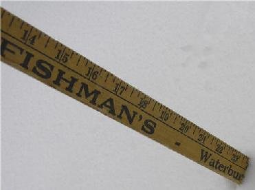
I also have the pic of Zonties posting the yard stick upside down in the feb 2006 blizzard thinking he had 23” when it was really 13”. -
Dec 5/6th major coastal/ west Atlantic cyclogenesis ...?
ORH_wxman replied to Typhoon Tip's topic in New England
Btw I still have that ridiculous map posted by “edh1981” where he colored over all the state borders and you could barely read anything. I saved it and somehow transferred it through several computers all this time. -
Dec 5/6th major coastal/ west Atlantic cyclogenesis ...?
ORH_wxman replied to Typhoon Tip's topic in New England
Yeah that was Will from St Agatha ME...LOL. I think he moved to the UP of Michigan on the Keweena peninsula. I guess he likes to find the most brutal cold/snowy spots in the CONUS east of the Mississippi. -
Dec 5/6th major coastal/ west Atlantic cyclogenesis ...?
ORH_wxman replied to Typhoon Tip's topic in New England
Yeah the models definitely have shedded some of the extreme biases they used to have. The GFS was so bad with the southeast bias on coastals. Those threads got brutal. We definitely had some SNE posters who loved to poke the hornets nest. Fun times though looking back. I usually restrained myself though...I was always the naive optimist trying to get everyone to get along...LOL. I’d go into the mid-Atlantic threads when it looked good for them...I liked discussing the technical stuff with Wes.


