

ORH_wxman
-
Posts
93,099 -
Joined
-
Last visited
Content Type
Profiles
Blogs
Forums
American Weather
Media Demo
Store
Gallery
Everything posted by ORH_wxman
-
No. Just those candy canes. They got frozen into the ground. Couldn’t get them up.
-
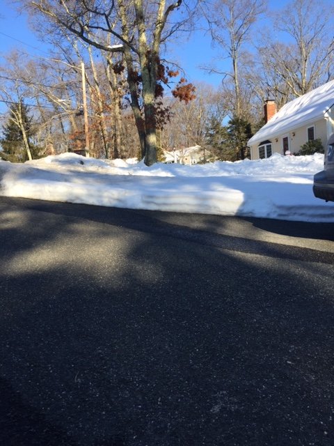
Man pack here...taken this afternoon
-
BOX discussion is a good read but not sure I buy the great snow growth for the ORH-BOS-PVD triangle. Esp on some of these solutions where the banding isn’t getting much NW of SE MA...PVD might be best spot in that triangle. The best omega is well above the SGZ on a lot of soundings I checked. However, very frequently we’ll see the fronto bands get a little NW of guidance so using that logic you could make a case. Still, I’m not all that enthusiastic about warning snows here. BOS-PVD may be in a decent spot but worried that we’ll be too far NW in the 495 belt and westward.
-
Reggie tickled NW. pretty close to NAM and Euro now. Still some very small differences. I’d not have any confidence in warning snows BOS-PVD northwestward. But it’s not going to take much for some banding to be NW of model progs to cause warning snows well into the interior.
-
Here you go Jerry
-
3km looks pretty similar to 12km too. Prob warning snows for SE MA and into southern half of RI. Advisory snows or just below advisory elsewhere.
-
18z will be out in a few min
-
NAM looking SE through 15 hours. It was the furthest NW at 12z so we’re starting to close the goalposts I think. The southern stream looks a bit stronger this run but it looks to me like it’s getting kicked more by northern stream.
-
HRRR went back a little NW. Looks close to the 12z euro now.
-
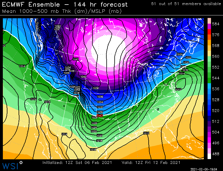
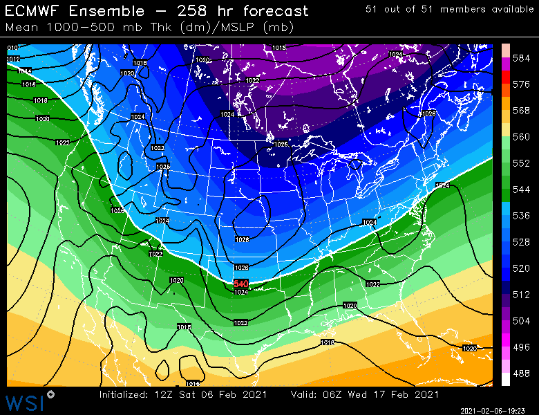
What a weenie pattern...riding the line a bit on some events but overall that is a nice look. Tuesday: Friday: And finally around 2/16-2/17 it’s getting pretty far out there, but still a signal:
-
Nice look for your ‘hood on that run.
-
Yeah I was only comparing run to run. It was slightly SE early but the northern stream wasn’t pressing as much this run so it allowed the system to make a little more northward progress late in the game before getting kicked back east...so it was actually slightly better at the end.
-
Yep it actually hooked a little N or at least spread that good stuff west in SE Ma.
-
Euro is also going to tickle SE again
-
It’s interesting in that a lot of modeling initially gets the banding up to our west like into SE NY and W MA and then it consolidates well SE. It’s like a race to see if we can rotate good banding into interior SNE before the best forcing shifts SE. Actually some similarity to the 12/29/12 system in that respect.
-
Reggie ticked back southeast.
-
Not to mention, he’s a Stoughton right? If I get 6-10 he’s prob getting 12 in this, lol
-
The ridging out west looks pretty robust on the EPS post-2/15. Though PNA is already rapidly rising by 2/12 which actually coincides with the d6 threat.
-
Yep. The man pack here is awesome right now. It has so much durability. Perfect base to get these additional events on top of. Im just hoping that this one doesn’t slip SE on us and give 3” of feathers instead of 6-10”.
-
NAM looks better through 18h
-
I’m not down...I think we all at least see an advisory event which is nice on top of a big pack in the interior. I’m just a little leery on the warning snowfall amounts outside of SE MA and RI because these things can easily tickle a little further southeast. We’re all of the sudden spoiled as we have two more events inside of 7 days after this one. But not every event is going to turn into 10” of snow and this one could end up as one of those that slips a little SE. We’ll see though. I think 12z will be telling.
-
Tuesday seems to have stabilized in model guidance. I was worried it would just getting weaker and weaker from sheared fast flow but most guidance seems to agree on an advisory type event for SNE and that probably extends into CNE/NNE as well. Then the end of the week has legs for something bigger.
-
I feel like there are more arguments for a SE tick...really fast flow, no phase, big NAO block, etc. That’s definitely the worry. That said, hopefully this southern stream vort beefs up a little in the final 24h and that could overcome some of those other issues.
-
Most of us can’t really afford another tickle SE so the 12z runs are pretty big.
-
Looks like this: 00z: All models SE except Euro which tickled NW 06z: GFS/NAM SE again, but ICON/RGEM bump back NW Hopefully we get another bump NW on the 06z euro.


