

ORH_wxman
-
Posts
93,099 -
Joined
-
Last visited
Content Type
Profiles
Blogs
Forums
American Weather
Media Demo
Store
Gallery
Everything posted by ORH_wxman
-
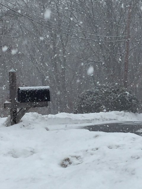
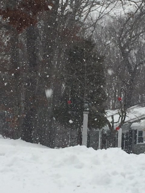
Getting smoked now. Great snow growth
-
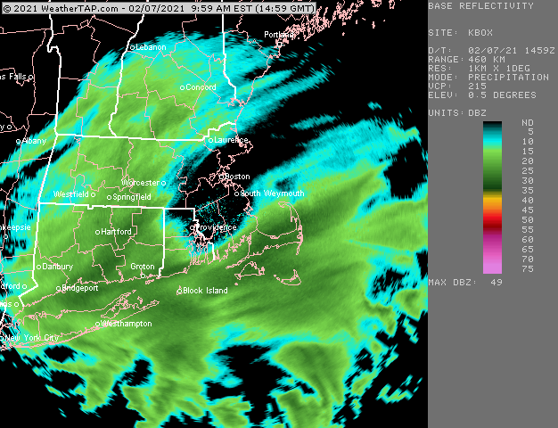
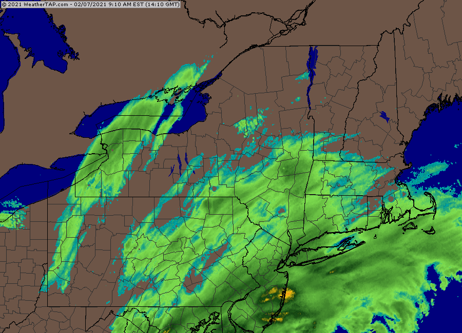
This is kind of infuriating. Weathertap isn’t updating their local scans...BOX/OKX...checked both of them. At least the regional scans are updating.
-
Excellent snow growth in this. Moderate snow and 29F
-
Might get into MA in a bit. Hoping I can catch it here. I like the latitude gain it is making.
-
@Ginx snewx @JC-CT
-
Radar looks pretty decent.
-
RGEM and GFS both ticked NW a little. Good sign especially for SE peeps who will want bigger rates with more marginal sfc temps.
-
Nice bump NW on the latest HRRR.
-
Rap has a nice weenie band from ginxy’s area up near my hood. Hopefully it’s right. Could squeak out low end warning if that happened.
-
Tuesday looking pretty nice on EPS. Not a big event but could be a nice advisory snow
-
Looks like that changes this week at least. Sprawling Scooter high makes a grand entrance.
-
Tblizz whining his way to 6-8”? The thing to watch is to see if perhaps the shortwave doesn’t decay quite as quick as model guidance shows...and we end up with some huge bands getting into the southeast half of SNE like the NAM showed. I think the odds are definitely against that but it can’t be ruled out. There’s going to be some pretty potent bands that are tantalizingly close and it not impossible they inch a little further NW. I haven’t really seen any notable trend on the HRRR other than the 09z run was really paltry, 10z came back to look kind of like most models and 11z didn’t move much from 10z though it looked a little better inland. I’ve been waiting to see if it makes a move....same with RAP. RAP looks a lot better than HRRR but haven’t seen it move much in the last few hours. One of them will be wrong.
-
-
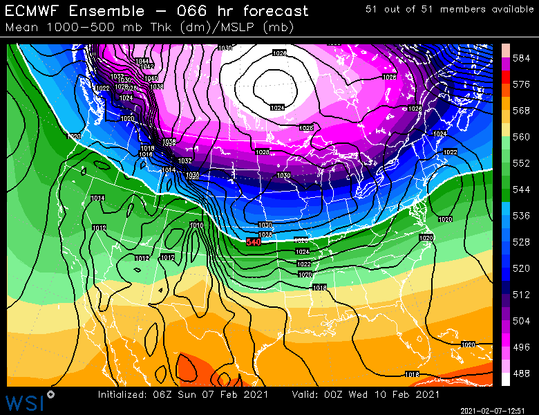
06z Euro tickled SE. First one I checked this morning was the 06z NAM and I went “holy shit, are we going to get crushed?”...then checked the rest of the guidance.
-
Lol...I noticed that both GGEM and GFS pushed through an impulse earlier than previous runs for 2/11. There’s several impulses along that arctic boundary...def a bit ‘94-esque.
-
Think I’m going 3-5” here. But hope I’m wrong and we get 6”+. Should be an interesting nowcast with the bands.
-
GFS might be a hair SE of 18z. Pretty close.
-
Ageostrophic component is more favorable. Easier wetbulbing near sfc than the last disaster straight off the water for hours. I could see the early stages of this one freaking people out though.
-
3k made a good bump too. More than than the 12k did.
-
00z NAM looks a tick NW through 9 hours.
-
My threshold seems to be around 5” on this driveway. I’ll hand shovel if it’s less than that but once higher I don’t want to deal with it. Smaller driveway, sure...but this horseshoe driveway gets long quickly when your moving 6”+ by hand.
-
Agreed. Up at our latitude we may be waiting until almost lunchtime to start and it ends maybe a quarter or two into the super bowl.
-
It’s actually still “modeled”. Granted they use remote sensing and a few actual obs from coops to try and make it as accurate as possible, but at the end of the day, it is still a model that’s producing that. They are pretty good, but I’ve seen them struggle sometimes...esp late in the season.
-
Nice little tick NW on 18z euro
-
At least that much. Prob more in shaded spots.


