

ORH_wxman
-
Posts
93,092 -
Joined
-
Last visited
Content Type
Profiles
Blogs
Forums
American Weather
Media Demo
Store
Gallery
Everything posted by ORH_wxman
-
Yeah if there’s a NW hook and the center goes into SE CT or something like that, then much of eastern SNE could be at risk for spin-ups as it would put us in the front right quadrant.
-
Labrador current. It’s always frigid water out on the east-facing outer Cape beaches.
-
Yep. For now anyway. West side of the center looks primed for some sick rain totals. Models frequently underestimate the totals too in that zone on tropical systems...particularly inland where the terrain can enhance it some.
-
Average extent loss on NSIDC over the past 10 years from this point forward is 936k....but it has been as low as 550k and as high as 1.2 million.....so that places the minimum between 4.45 million and 5.1 million sq km if we hold inside those bounds.
-
He moved to iceland. He said it liked it too much.
-
Update for 8/10 numbers on NSIDC area: 2021 had 3.9 million sq km of sea ice area on 8/10...here's how the years since 2007 compare: 2020: -500k 2019: -480k 2018: +160k 2017: -30k 2016: -340k 2015: -210k 2014: +770k 2013: +430k 2012: -810k 2011: -340k 2010: +290k 2009: +570k 2008: +60k 2007: -250k Closest matches are 2008 and 2017 in terms of value. But the ice distribution is a bit different this year. 2017 had more on the Atlantic side and 2008 had way more on that side (plus Laptev). 2021 is basically melted out in the Laptev already but it is really lagging badly in melting the Beaufort and the model guidance has the Beaufort and adjacent CAB staying quite cold and stormy through the next 10 days. The easiest ice left to melt is what is left in the Chukchi (which also had a slowish year compared to recently) and ESS. I don't think I'd change my forecast right now on area (3.00 million sqkm). Maybe hedge a little higher but it should be pretty close. My extent forecast looks in trouble though....extent is always trickier, but I had 4.3 million sqkm on the NSIDC daily minimum....and that looks like a tough task but it's not impossible. We need to really speed things up. Keep in mind that NSIDC is typically (but not always) about 200k higher than Jaxa these days because of Jaxa's revisions they made to their algorithm after the 2013 season. As of 8/10, the NSIDC daily extent was 6.05 million sq km and Jaxa was 5.76 million sq km.
-
I was starting to dive into the analogs a little more closely for La Ninas with a -AO and I still can't believe last year. This screams El Nino even though it was a moderate La Nina.
-
We'll know a lot more in another month or so. But I do think it's becoming much less likely we stay neutral. It will be hard to get anything stronger than moderate though, I agree on that point. It's starting pretty late. I'd definitely say weak La Nina is still the most likely but moderate is becoming a realistic option.
-
There's been extremely rapid cooling in the subsurface in the last 3 weeks...definitely starting to look like La Nina as we head into the fall.
-
August Disco 2021. Do record dews continue?
ORH_wxman replied to Damage In Tolland's topic in New England
It's amazing how the Euro nails every forecast for no snow. -
Id be pretty surprised if we finished above 5 million sq km on NSIDC. Though this season has admittedly ground to halt. I would have never guessed if you asked 3 weeks ago that we would have higher area than 2013 right now. 2013 goes through a pretty big stall the next week so we should fall below it at some point here. My guess is we end up in the mid/high 4s.
-
It’s more nuanced than that. For example, in our state, some of the lowest percent of vaccinated people are in areas that are very democratic by political orientation but also much poorer and a lot of minorities. Mattapan is one the lowest vaccinated communities in the state along with New Bedford and then some towns out in Berkshire county/Hamden county are behind them. Broadbrushing things is never a good way to understand a complex issue.
-
Stick a fork in any shot at a top 5 I think....area is lagging badly vs other years: 2020: -810k 2019: -590k 2018: -50k 2017: -210k 2016: -490k 2015: -280k 2014: +140k 2013: -140k 2012: -650k 2011: -530k 2010: -160k 2009: +320k 2008: +310k 2007: -400k
-
Nice airmass. Could’ve had some 40s around for lows if it had been a dry period the past couple weeks but the ground was so wet it made it harder. Still lots of low/mid 50s this AM in the rad pits.
-
Covid was always going to mutate because the virus will still circulate amongst the vaccinated. At this point, who cares about anyone remaining unvaxxed? You can protect yourself by vaxxing. If you are still scared, then stay home or wear a mask. It's a personal decision now that the vaccine has been widely available for 2-3 months to anyone who wants it. It was different back prior to the vaccine.
-
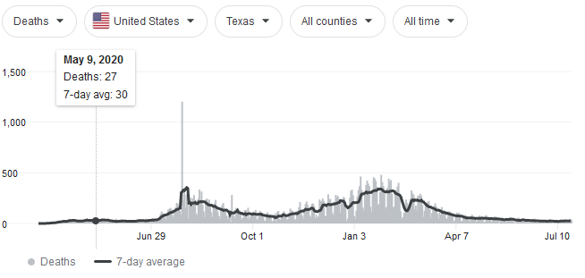
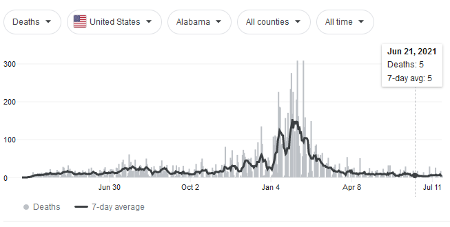
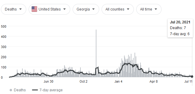
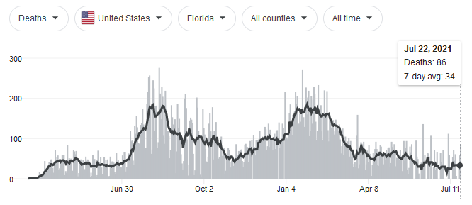
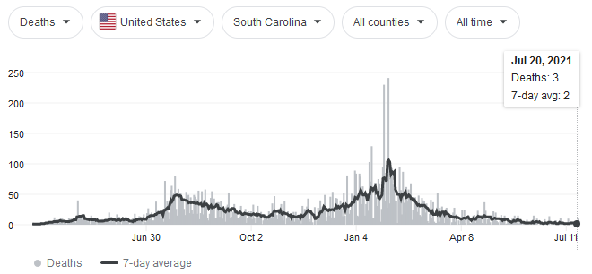
Bob said it best above...."case-demic". There will definitely be some more deaths, but they are almost all with unvaxxed. That's on them at this point. Anyone afraid can protect themselves by getting vaxxed. An overwhelming number of the most vulnerable are already vaxxed. That's why the you see the deaths not tracking the cases like they did previously....even on the usual 2-3 week lag. Most of the cases are amongst younger/healthier people. They are diverging when you look at the UK data where the "Delta" variant has been running rampant for a while now. It's become pretty meaningless hearing about cases without other metrics like deaths.
-
Looks like a bloodbath down there
-
Sound like you've been dabbling into critical fat studies.
-
DotRat's 401K is melting down!!!!
-
As with most housing, they got semi-affordable in the 2011-2013 time range near the bottom in real estate post-recession. We went up there and noticed a lot of pretty nice lakefront homes on sale for less than 500k....many under 400k. I'm not talking those 5-6 bedroom monstrosities right on Rangeley Lake...but like your typical 2 or 3 bed camps. There were probably a lot of families dumping their vacation homes because of the recession crunch. A lot of those same ones we saw are prob like 600-800k now.
-
You prob average near 50 there but you got porked last year plenty of times. There’s some seasons that you will clean up on Cape Anne.
-
What about Feb 2015? I think the max at ORH was 34F that month. I would have assumed Farmington didn’t break freezing but I guess they snuck above. Ditto January 2003 which had a max of like 37F or 38F.
-
I think it bottomed out at 952mb near CLE.
-
It was definitely a more traditional front-loaded Nina that finished with a wimper, but the first half was pretty damned good. January had no torches at all for those who like the prolonged snowpack getting deeper and deeper during the coldest climo days of winter.
-
Real estate agents just want some inventory to sell....we've gotten cold calls too. Because so little is on the market right now, they don't get their commissions. As for the more ambitious developers, they just want the land. They can buy a little ranch for 500-600k in a nice town, level it, and rebuild a McMansion for 200k and then resell the thing at 1.1 million easily after being all-in at 700-800k.


