ORH_wxman
-
Posts
93,092 -
Joined
-
Last visited
Content Type
Profiles
Blogs
Forums
American Weather
Media Demo
Store
Gallery
Everything posted by ORH_wxman
-
EPS nibbling a little but not biting yet
-
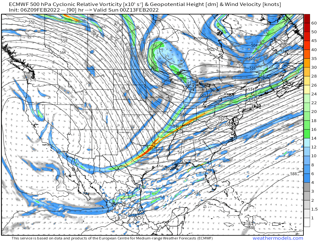
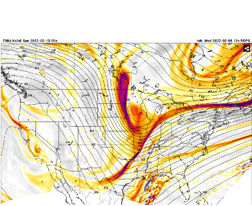
For those who aren't 100% sure what we are talking about....check out the shift in the northern stream up near Minnesota...well southwest of the 06z run.

-
Yeah I'm not sure how many people realize how quickly this can go from fish food to a storm sitting over SE MA when playing with the fire on the northern stream like that. It's what we want for a high-end event, but there's a critical point where this comes way west if you phase that in early enough.
-
If H5 improves again at the same magnitude that 12z did, you will definitely see the surface respond strongly....this run was getting close. If we were 60-72 hours out, I'd probably say this wasn't enough, but we have another couple cycles to get this into hit territory.
-
I couldn't care less at this point...the 00z run upside was a moderate event....this is way better even if it doesn't satisfy the queens at Day 4-5. It was a pretty big move for the euro.
-
That was significantly better than 00z aloft...you want that northern stream dropping in otherwise it's a moderate event as the ceiling.
-
Euro already significantly west with the northern stream than the 06z run at 72 hours
-
I'm not too worried abou the Ukie at this point...it was the outlier west at 00z and likely the outlier east at 12z....it loves to jump, but i did note that it still had the northern stream very far west at 12z, it just didn't seem to sync up with the southern energy. That northern stream piece if the key trend I'm looking at today...Ukie still had it well west which is good.
-
Definitely a much better GFS run....still need that northern stream to drop in a little further west, but that was a pretty nice step at 12z.
-
Looks better for sure, but it won't go Reggie/Ukie just yet.
-
Yeah I think that northern stream is the major key piece in turning this into a higher end threat versus "merely" a warning event. You opined at the end of your previous post on that....but yeah, that's kind of funny after we said Miller B was unlikely....and it probably still is because I think most guidance has that energy down south which will spawn the main low....though we could end up with a bit of a hybrid too.
-
Yep, that's a high-end look...not just a mundane 6-10 warning event.....though I'd obviously take 6-10 if you offered me now, lol. But we'll have to see if other guidance keeps catching onto this phase scenario because the early 12z models are definitely trending toward that.
-
Reggie would go nuclear if we could see another couple panels.
-
Feb/Mar was pretty crappy in SE areas in 2011...after the Feb 2nd storm, most of the events were N of pike type events.
-
Yes, it's actually an explosive look....Ukie did that at 00z which is why it slammed all the way back to western NE.
-
Yeah SE MA was porked pretty bad late in the 2010-2011 season and then at the start of the 2012-2013 (with the horrific 2011-2012 season sandwiched in between) so it was a 2 year slump for that area.
-
84h NAM...but it looks pretty good at 12z.
-
I wouldn't call that on life support given it's still 4.5 days out...there's several members that give at least advisory snows (I counted about 15 out of 50 that do, so that is 30%) and it's a little better looking than 00z. So the trend is in the right direction. We do need an improvement though at 12z or I would call it on life support.
-
06z eps gives tepid support. Would like to see a good bump NW on the 12z suite

-
It’s definitely getting a bit more interesting. Just sharpen up that trough just a tad and it’s a legit storm.
-
We're going March 1956 this year to throw the entire breadth of prognosticators on tilt.
-
That's a much better looking shortwave, but it gets screwed because of the 2/13-14 system being a bit too close....if the spacing was slightly better, the 2/15 shortwave would go nuts into a good Miller B.
-
The storm is still possible, but it will take some significantly better changes. The fact that we are trending in a worse direction at D5 is a pretty big negative...you'd at least like to see the status quo at D5 and not trend worse. GGEM actually liked a totally different system behind the 2/13-14 system...tries to get a Miller B going for 2/15....but GFS and Ukie weren't biting.
-
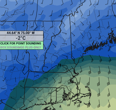
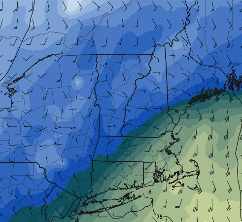
925 looks like it had a decent easterly component to it last night....here's the 03z and 06z plots:
-
I got 180.8 by arithmetic...used the 3 N Foster totals plus your 40.2 YTD total (since N Foster doesn't have data past December yet this year)....that is 180.8".