

ORH_wxman
-
Posts
93,092 -
Joined
-
Last visited
Content Type
Profiles
Blogs
Forums
American Weather
Media Demo
Store
Gallery
Everything posted by ORH_wxman
-
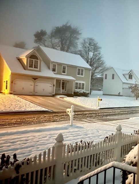
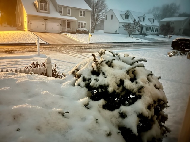
The mid-level CAD capital of New England.
-
Winter hill in ORH
-
They had between like half inch and an inch there before it flipped. Saw pics.
-
Can see the snow line pretty easily
-
Snowing to your NW in Holliston. Though it’s quite wet here and only just beginning to stick to the grass/mulch. Temp is finally ticking under 34F though now…so maybe we can make a run at measurable in the next hour.
-
34F and steady light snow.
-
Yeah he was going to block out some time this evening to track this one closely.
-
Just make sure that little bit of dry air doesn’t get down into the SGZ.
-
Weeklies shifted noticeably colder for the week before Xmas
-
We encourage new threads. Start an obs thread. I think quite a few over the interior will at least start as frozen even if it doesn’t last long for most of us.
-
Warm sector to dendrite!
-
Seems like euro suite has a much weaker MJO wave than the GFS suite. Might be something to watch in how long/intense the thaw is…though their current progged patterns for 12/5ish are pretty similar.
-
Is that blizzard24 with a new handle?
-
Yeah it’s not that warm between now and Tday…some 38F rain/drizzle after the paste isn’t going to melt much if they end up picking up 3-4”.
-
You’d think after this many seasons in New England, he’d learn to understand CAD and not forecast like he’s still on Long Island. Amazing there’s no improvement.
-
Sleet wouldn’t surprise me to start where you are. Maybe some brief flakeage.
-
Looks about average-ish for Tday. Maybe slightly below avg esp over interior NW high terrain where weak low level CAA will be ongoing.
-
First week and last week are nice. Middle two weeks are meh…though some southern stream action may still produce a threat even if it’s not all that cold (see Dec 23, 1997 as an example)
-
Guidance pushed the core of the cold to the following week and then lingering into early December whereas about 4-5 days ago, it looked like the core of the cold was Tday weekend with potentially eroding cold late the following week. I know your post is more on the troll-y side but just posting this for those who are interested in the evolution of the changes rather than one-liners.
-
I don’t think any precip will have started by 8pm tomorrow. Looks closer to 10pm-midnight timeframe.
-
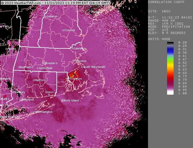
Pretty good chance you'll get at least 2-3 hours of steady snow. The question will be if it's heavy enough to produce more than a coating-1" I think....I'd not forecast more than that right now, but there is a small probability it goes moderate or briefly heavy enough to give a couple inches of paste. Gotta cool that lowest 1000-2000 feet...and that's where the rates become very important. Otherwise you get that 2 SM SN- crap at 34F that is glorified white rain.
-
Euro was def decently cold...I'd feel pretty good for at least a couple in N ORH county....whetehr someone gets 3-5" or something up there will depend on how heavy the rates are from like midnight to 4am.
-
12z GFS and 12z GGEM both have a couple of chances next week. Seems pattern is more favorable by then.
-
RGEM not quite as enthusiastic....more limited to N ORH county...esp Rt 2 elevated region.
-
3k NAM was similar too...sometimes it doesn't agree with 12km, but it does on the 12z run. Will be interesting to see if RGEM agrees too...if it does, then that would be a lot of mesos (if we throw in HRRR) agreeing with accumulating snow in that ORH to FIT to 495 corridor.


