

ORH_wxman
-
Posts
93,099 -
Joined
-
Last visited
Content Type
Profiles
Blogs
Forums
American Weather
Media Demo
Store
Gallery
Everything posted by ORH_wxman
-
Pattern of yore on the Euro today....moderate coastal followed by arctic cold, then a clipper-esque system into that arctic airmass for 1/19
-
Yeah that's all fronto stuff....it's pretty strong though, so it squeezes out warning criteria in that band on both models. I think if we are able to sort of curl that vort in underneath it at the last second then we could get a psuedo-CCB feature to enhance the fronto stuff. Right now, the vort is a bit sheared, but if it stays a bit more consolidated, then it can have a little higher potential....however, we walk the happy medium....you don't want it too strong too early or you get some track issues.
-
Don't think the Euro is going to be as amped as 00z looking at the CONUS pattern at 108h.
-
Judge it against winter climo IMHO....that's how I do it. Sure, I'd love 80-100 days of continuous pack but that only happens like once every 1-2 decades here so trying to aim for that is going to cause a failing grade most winters.....realistically climo is going to be around 50-60 days here (and hopefully a stretch of 30 in a row at some point), prob closer to 70-80 in ORH hills and 30-40 along the coast near BOS and south shore (and less down near cape and south coast).
-
1960s were the coldest winter decade here in the past 110 years....you have to go back to the 1910s to find a colder decade of winters. Not gonna happen again any time soon.
-
No it was a friday storm. There was another super bowl storm in 2015 too. The 2/2/15 storm was the day after the SB. Started right after it ended actually IIRC.
-
No that was the Jan 2016 blizzard.....2/5/16 was a late NW-trending scraper that turned into a legit 8-14" snowfall across much of the region.
-
At the very least, it does look like a more prolonged period of BN temps starting after the 1/13 system.
-
The pressures are high so a lot of them won't show up either on that product...I think they have to be sub-1005. But the mean QPF isn't that impressive anyway...it gets maybe an inch or two back to I-95.
-
Actually a pretty good hit over SE areas. But for interior more like an advisory event. But even if we're not getting huge totals, even hitting on a few of these advisory threats would go a long ways toward helping us have an AN snow season.
-
Almost looks like 3/4/19-lite based on QPF distribution that run. But hell, while 6-10 would be nice, I'd take half that prior to the arctic cold behind it.
-
GFS is going to be a lot flatter for 1/15-16 this run.
-
Haven’t had a decent retention season since 2020-21…most of our good retention seasons come during weakish ENSO….a few exceptions like 2010-11 or 2007-08…tho even that year had quite a few thaws…they just quickly were followed by another snow event. That said, a nice retention stretch wouldn’t shock me this year. February has a shot at it if we can build a semi-permanent PNA ridge.
-
1/9-1/10 Now Morphing to Less-Than-Exciting Power Cutter
ORH_wxman replied to Torch Tiger's topic in New England
We still have pack but we’re currently around 50F so we’re going to lose more during the day today.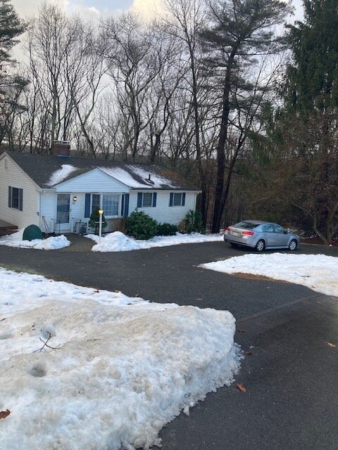
-
There's prob two windows in the next 10-12 days for good snow....first is 1/15-16 and the next is prob around 1/20-21.....then it looks like we relax the pattern a bit but I don't think that lasts long...we are already building up an aleutian low and western ridge by about 1/25....so it wouldn't surprise me if we're right back into the storm threats before the month closes out. But as mentioned earlier, if we're trying to get a solidly AN snow season, I think you really want to hit on one of the threats prior to 1/25. We cna obviously have a big February or last few days of January by extension, but you can't really afford to miss many threats at that point if you haven't already banked some.
-
This weekend doesn't really warm sector much...esp up there....you might get like a 6 hour warm sector and then we go much colder airmass. You may keep pack up there. We still have it here but I think we lose most of the rest of it today.
-
Yeah the EPS is kind of strung out and southeast of the OP....it's not showing a lot of inland bombs. Maybe just a few out of 50 members.
-
He’s never fully recovered the mental anguish of barely missing out on the December 2008 historic ice storm. He didn’t have a public meltdown but that one I think cut deeper than any of the public meltdowns like 2010 MLK had. I think he might have just sat quietly in his basement for an entire night after that one. But his time will come…we’re going to get another one at some point.
-
1/9-1/10 Now Morphing to Less-Than-Exciting Power Cutter
ORH_wxman replied to Torch Tiger's topic in New England
Flipped to pellets now. Prob grabbed around half an inch of paste. -
Feb 28, 1995 was a big icestorm in SNE. But you’re correct they seem to be more front-loaded in December and early January (or November if we’re talking about the 1921 event).
-
1/9-1/10 Now Morphing to Less-Than-Exciting Power Cutter
ORH_wxman replied to Torch Tiger's topic in New England
Crushing fatties right now. Prob not for long but it’s accumulating now.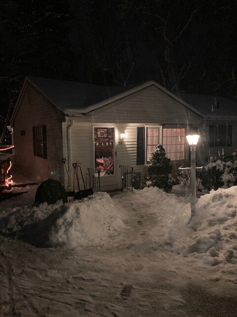
-
1/9-1/10 Now Morphing to Less-Than-Exciting Power Cutter
ORH_wxman replied to Torch Tiger's topic in New England
Ripping fatties now. Lift has temporarily washed out warm layer. Starting to stick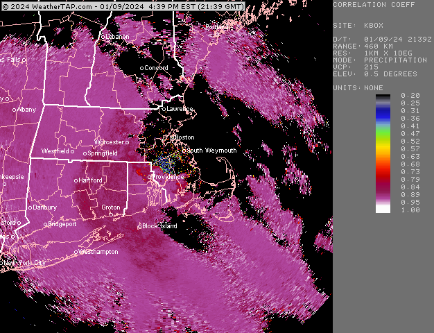
-
1/9-1/10 Now Morphing to Less-Than-Exciting Power Cutter
ORH_wxman replied to Torch Tiger's topic in New England
Started off as snow here mixed with a bit of sleet. Not typical pellets though…almost like rimed flakes -
13th has front end snow too.
-
I think we need another good sized snowstorm in the Jan 15-25 period to go into February with a decent chance at an AN snow season. You can sometimes afford to whiff on a decent pattern and still do well overall for the season but that’s usually because you already weaseled a good storm or two in a garbage pattern…but we haven’t done that this winter since we punted December.


