

ORH_wxman
-
Posts
93,099 -
Joined
-
Last visited
Content Type
Profiles
Blogs
Forums
American Weather
Media Demo
Store
Gallery
Everything posted by ORH_wxman
-
A lot of guidance has some weak isentropic lift Thursday night, so it's possible there is some light snow Thursday evening/overnight. Doesn't look like anything plowable, but a coating to an inch of pure blower feathers wouldn't be a total shock.
-
At least it's something - Jan 16th Snow/Sleet/Ice OBS Thread
ORH_wxman replied to The 4 Seasons's topic in New England
Mix is about 6-8 miles south of KBOX radar it looks like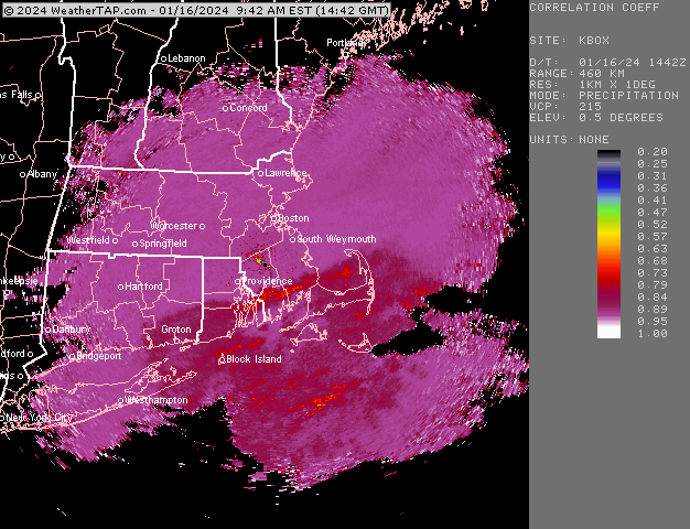
-
RGEM and ICON are mildly interesting…esp if you’re on the south coast. But would be nice to see one of the non-GGEM globals show more interest.
-
At least it's something - Jan 16th Snow/Sleet/Ice OBS Thread
ORH_wxman replied to The 4 Seasons's topic in New England
Excellent snow growth….I cleared the car off to drive my kids to school so everything on the car is in the past 2 hours. Stacking up quickly now.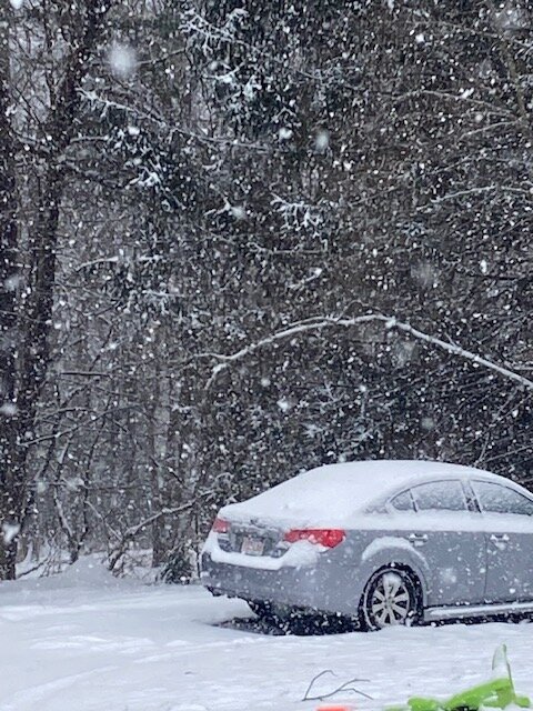
-
At least it's something - Jan 16th Snow/Sleet/Ice OBS Thread
ORH_wxman replied to The 4 Seasons's topic in New England
Yeah I mentioned earlier that this zone might be a localized jackpot with some 5-6" lollis potentially...it's just pounding dendrites.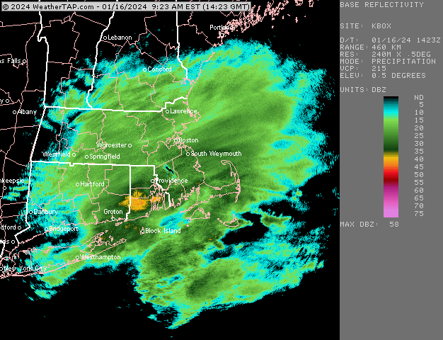
-
At least it's something - Jan 16th Snow/Sleet/Ice OBS Thread
ORH_wxman replied to The 4 Seasons's topic in New England
Poundtown in this stuff....looks really good over from about Ginxy to Scooter....some really nice returns. Even just north of those where I am, it's really coming down nicely with good snow growth.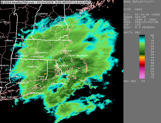
-
At least it's something - Jan 16th Snow/Sleet/Ice OBS Thread
ORH_wxman replied to The 4 Seasons's topic in New England
Should be a nice several hours coming over central/eastern areas....good steady snowfall and the radar has filled in pretty nicely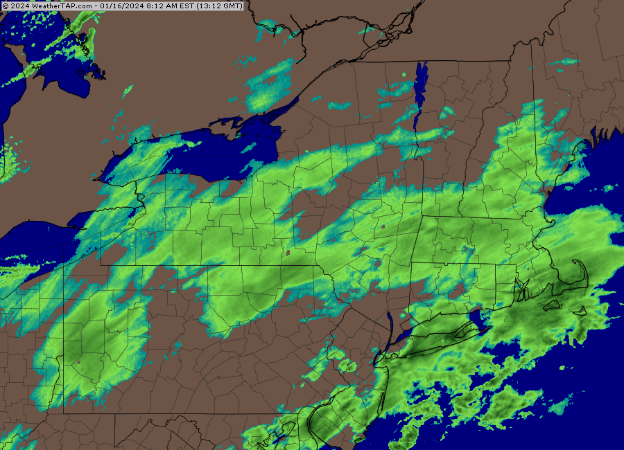
-
See, I'm viewing it less skillful than that on snowfall...I'm not sure there's much on a seasonal forecast level....I'm talking just snow, not temp forecasts where at least some skill has been demonstrated by good LR forecasters. The best teams in sports can win 70% of the time or so....so there's a clear skill element there. Nobody can forecast seasonal snowfall even close to that level of skill.
-
Sure, but whats the mechanism and why should we believe that it is predictable and not just like playing roulette? You win some and lose some....but is there any skill involved? Like if we miss 3 KUs by a hair, was that "skill" or not? OR what if we don't sniff anything big for the next month and then get a 35-40" juggernaut dumped on our head February 22nd? Was the crappy snow forecast a good one, but they got unlucky that a HECS happened late in the season to make verification look bad? The advantage gambler in me always tries to parse out what was skilled vs random noise....and I haven't seen evidence to the former on seasonal snowfall forecasts around here.
-
There is a zero percent chance to forecast whether PV lobes are going to phase or not when making forecasts 2 months out. I'm not saying this to pick on you....but I think people take the idea too seriously that seasonal snowfall forecasts in New England can be skillfully predicted to anything closer than about a 20-30 inch range. I applaud people for trying, but it's so much harder than temperatures because there are like a thousand more variables for snowfall than forecasting temps.
-
At least it's something - Jan 16th Snow/Sleet/Ice OBS Thread
ORH_wxman replied to The 4 Seasons's topic in New England
central and N RI getting hammered right now....they might be a local jack. -
At least it's something - Jan 16th Snow/Sleet/Ice OBS Thread
ORH_wxman replied to The 4 Seasons's topic in New England
Radar has filled in decent;y over the past hour
-
At least it's something - Jan 16th Snow/Sleet/Ice OBS Thread
ORH_wxman replied to The 4 Seasons's topic in New England
He might get the QPF jackpot....someone NW of him will prob have 20 to 1 feathers for a while to get an official snowfall jackpot, but Ray's area might get 10 to 1 only a little less snowfall with more QPF. Might have to watch for CF enhancement aorund there later. Very tight CF sets up in NE MA today. -
Yeah I could see it coming back a bit....but I think anything sizeable is probably off the table.
-
At least it's something - Jan 16th Snow/Sleet/Ice OBS Thread
ORH_wxman replied to The 4 Seasons's topic in New England
About 1" here.....HRRR bullish for the pike/495 region back to ORH and up to near Ray....hoping to grab at least another 2" here prior to mixing around 18-19z. -
Yes. It’s pretty typical El Niño climo for December to be warm and February to be cold. Doesn’t always work of course but it’s a pretty strong correlation.
-
It comes across as disingenuous trolling because we know your historical weather preferences from many years of previous posting. I’m going to guess pretty much the entire forum doesn’t actually believe you have an emotional investment for 1-2” of snow and then 37 and rain instead of 3-5” of snow.
-
The warm layer is pretty marginal so I could see it going either way in that 128-495 zone.
-
Def trying way too hard on this one…
-
Yeah it’s prob the best PAC look since then. But it still needs to verify and of course the big question is how long would such a look last? In 2015 it was almost a standing wave for 3-4 weeks with a brief break during the Feb 7-9 event where we got lucky anyway and Boston got 2 feet of snow when the rest of the CONUS was an utter furnace. But regardless, it’s nice to see a great PAC look even show up on guidance.
-
Don’t worry about that. It’s actually not a bad thing on the more amped solutions because we get a better WAA push of precip. So some of these more amped solutions are giving areas that change over more snow than the flatter solutions were because the lift and QPF is heavier.
-
It’s not really “slop” until you are closer to coast and SE MA. It’s quite cold lower down so it’s prob more like pixie dust sleet before the precip ends. But it’s several inches of powder snow before that. Precip is basically done when the furthest NW intrusion of warm air aloft happens.
-
Almost sounds like the early January 2005 ice storm in CT. We had warning criteria snow in ORH for that but just down to the south it was a lot of ZR. There was an elevation component to it too down there where some of the hill towns had almost a half inch of ice.
-
3k isn’t as warm as the 12k. Has a nice stripe of snow from like Danbury to Kevin to ORH to Ray.
-
Yeah sleet gets well into interior but that’s a good shot of snow before that happens. Thinking 3-5” with some spot 6”+ is a good call outside of 495….prob more like 2-4” for the 128 belt.


