

ORH_wxman
-
Posts
93,099 -
Joined
-
Last visited
Content Type
Profiles
Blogs
Forums
American Weather
Media Demo
Store
Gallery
Everything posted by ORH_wxman
-
I don’t think a big dog is really on the table, but you could envision maybe something a little higher than an advisory event only south of the pike. If we get more NAM-esque trends in the future, you could see a path to a healthy warning event.
-
Yeah but it was more because of significantly stronger dynamics rounding the trailing PV lobe really helping to pump up heights downstream and also keep the sfc baroclinic zone a bit closer
-
Ok it’s the clown range NAM but let’s see if other guidance at least partially follows it. Then that system gets more interesting.
-
At least it's something - Jan 16th Snow/Sleet/Ice OBS Thread
ORH_wxman replied to The 4 Seasons's topic in New England
Light snow falling with a “chalky coating” as Tip mentioned earlier. It is covering the glaze of ice which covered the snowfall from earlier this morning. At least it will look like winter for this colder stretch over the next week.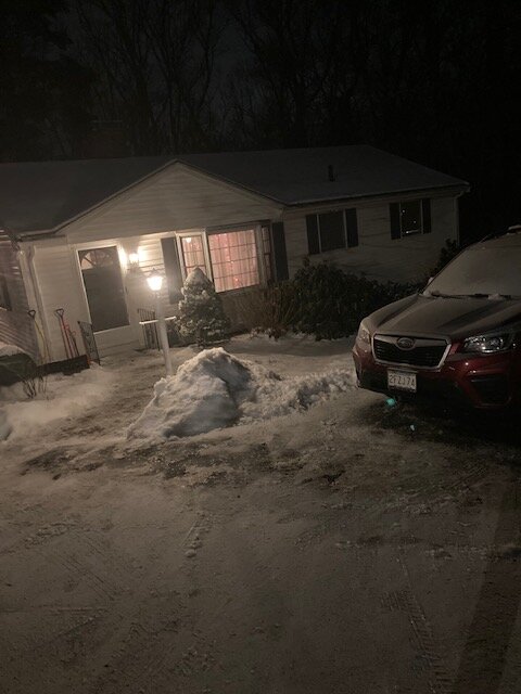
-
At least it's something - Jan 16th Snow/Sleet/Ice OBS Thread
ORH_wxman replied to The 4 Seasons's topic in New England
Scooter still doing his time in the woodshed this winter after his run of mimicking Stowe ended post-1/29/22. -
At least it's something - Jan 16th Snow/Sleet/Ice OBS Thread
ORH_wxman replied to The 4 Seasons's topic in New England
High here was 28.8F....dropped back about a degree to 27.6F now. Everything glazed though hearing a few pingers in the past 15 min, so starting to cool aloft or at least maybe saturate the DGZ again. -
At least it's something - Jan 16th Snow/Sleet/Ice OBS Thread
ORH_wxman replied to The 4 Seasons's topic in New England
Should flip all the way imminently....you can see it moving east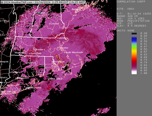
-
Pretty much all guidance has that high now...it's just a question of whether it presses down enough at the same time we're getting that low ejecting from the MS and TN valleys. I currently don't expect much of anything in SNE right now out of that setup, but it is something to keep an eye on. NNE could easily get out of the "torch period" unscathed if things break right.
-
At least it's something - Jan 16th Snow/Sleet/Ice OBS Thread
ORH_wxman replied to The 4 Seasons's topic in New England
You can see the mix line collapsing back east on CC now. Looks like it just went through Hartford and Springfield further south -
At least it's something - Jan 16th Snow/Sleet/Ice OBS Thread
ORH_wxman replied to The 4 Seasons's topic in New England
Yeah I thought it would be more sleety than ZR given how marginal the warm layer is, but we have a solid glaze on everything...pretty sure at least 0.1" already. But it's possible that the drying aloft in the mid-levels (esp in the DGZ) helped it go to ZR quicker. -
Don't overplay the trend here...it's pretty weak sauce still, but a period of light snow is looking more plausible.
-
At least it's something - Jan 16th Snow/Sleet/Ice OBS Thread
ORH_wxman replied to The 4 Seasons's topic in New England
Solid layer of ice on everything now. Crust on top of the snow. -
EPS def more robust than 00z which were basically a clean whiff. 12z gets much of CT/RI and SE MA into that 1-2" range. With maybe one more little push, there could be some advisory type snows.
-
Yeah we were even discussing how far west the ridge and trough axis was for the storm today and thinking there was a good chance it would come NW which it did. This one doesn't have that look. This one is all about separating the two broken PV pieces and that trend hasn't been favorable the last few days.
-
Maybe an inch or two for S CT. Improvement over 00z, but still not enough to entertain anything significant. Ceiling for this is probably an advisory event at this point.
-
At least it's something - Jan 16th Snow/Sleet/Ice OBS Thread
ORH_wxman replied to The 4 Seasons's topic in New England
Flipped pellets while i was outside shoveling. Had about 4" prior to flip....prob like 3.5 now with the pellets pounding into the snow. -
At least it's something - Jan 16th Snow/Sleet/Ice OBS Thread
ORH_wxman replied to The 4 Seasons's topic in New England
Puking fatties in Holliston...looks like close to 4"....but wil measure when the flip happens. -
Yeah you'd think....we get those types of systems on a semi-regular basis. GGEM trying to do it too, but it's a little warmer....more of a ZR interior threat (snow for NNE though)
-
At least it's something - Jan 16th Snow/Sleet/Ice OBS Thread
ORH_wxman replied to The 4 Seasons's topic in New England
Getting the first sign that it's warming aloft since we're starting to get larger aggregates mixed in with the smaller hooked dendrites. Really pounding right now though...this is 1" per hour stuff. -
GFS actually has a snow/ice threat for next Wednesday...sneaky high moves in and prevents everything from torching. That idea has been showing up off and on different guidance actually, so it bears watching.
-
At least it's something - Jan 16th Snow/Sleet/Ice OBS Thread
ORH_wxman replied to The 4 Seasons's topic in New England
It def overperformed for most of RI/SE MA...solid advisory snow amounts when a lot of forecasts were 1-2" or 1-3" -
At least it's something - Jan 16th Snow/Sleet/Ice OBS Thread
ORH_wxman replied to The 4 Seasons's topic in New England
Must be hammering in Scooter-land right now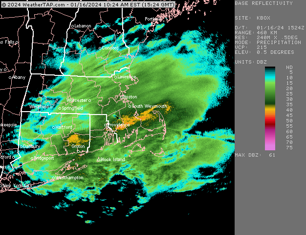
-
At least it's something - Jan 16th Snow/Sleet/Ice OBS Thread
ORH_wxman replied to The 4 Seasons's topic in New England
Prob between 4-5pm there...doubt you tack on much...maybe a few tenths or half an inch. -
At least it's something - Jan 16th Snow/Sleet/Ice OBS Thread
ORH_wxman replied to The 4 Seasons's topic in New England
Mix line has sped up in the past 30 min or so....we'll see if ti temporarily slows again before it makes it's pike push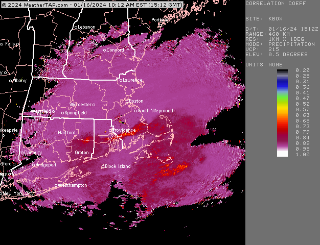
-
This event is pretty close to being something big, but the two piece of PV just aren't quite separated enough...so it gets crunched just south. Gonna be a tease in the end....might be some light snow amounts, especially for southern areas, but unlikely anyone gets warning snowfall.


