

ORH_wxman
-
Posts
93,099 -
Joined
-
Last visited
Content Type
Profiles
Blogs
Forums
American Weather
Media Demo
Store
Gallery
Everything posted by ORH_wxman
-
1/9-1/10 Now Morphing to Less-Than-Exciting Power Cutter
ORH_wxman replied to Torch Tiger's topic in New England
My grandparents had a chestnut tree in their backyard that didn’t succumb to blight until 1994…they had a large open backyard that was cut out of the woods….so I’m guessing the tree being isolated from the rest of the forest probably helped it last as long as it did. Worst thing was stepping on those damned things if you went too close to the tree in your bare feet. Once the spike coverings dried out they turned extremely sharp. -
1/16 actually does look pretty interesting on most guidance. Inhibiting factor right now is lead time but Euro obviously has it, GFS was kind of a close graze at 12z and GGEM was a hit at 12z.
-
Yeah that's not right. Maybe he measured where the tide meets the sand?
-
If there’s a decent high to the northeast, usually NNE will do well on cutters and sometime SNE gets in on the act. It’s the cutters that have no highs that are destructive to snow pack and that’s what December 18th had and last winter was the year with no highs to our north, lol.
-
Flickering hope in SNE. It needs to trend better in the next day or so or it’s junk. It does look decent for NNE. They may actually build a decent pack over the next week since some of the spots are going to get a solid net gainer on 1/10 too even though it eventually flips. Both of those systems would have been nice if they were weak vort maxes but these are both on ‘roids so they are able to overcome some initial confluence.
-
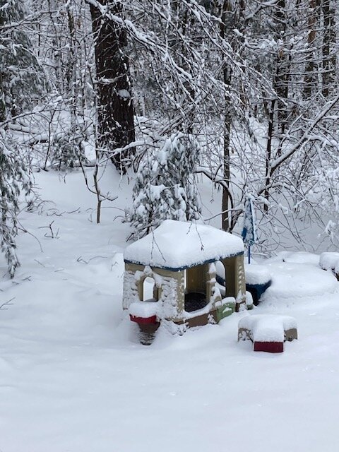
Nice fatties falling now but doubt they’ll add much of anything. But good winter feel out there just now with the puffy flakes and snow draped on everything.
-
Possible but uphill battle. Need to tame that western trough and/or really compress the heights over SE Canada enough to turn it into a SWFE.
-
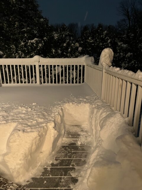
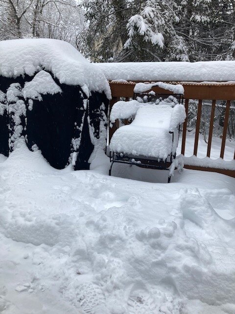
Passing 15” on winter hill in ORH.
-
Just a shade over 9 inches back in Holliston…don’t think we’ll quite make 10” unless that band rotates down and rots over us for an hour or two. Solid storm though to get off the warning mat.
-
Ray’s area into far Se NH was fairly consistently modeled for the jackpot inside of 60 hours. Nice job by models to pick up that area cleaning up.
-
13” on winter hill
-
You should be good for a couple more I’d think.
-
About an inch in the past 40 min from this stuff. Very high ratio powder compared to the paste last night.
-
Best snow growth of the storm right now. This is prob line 15 or 20 to 1 fluffer stuff with temp of 24F
-
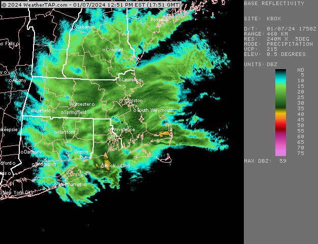
Looks like CF is through all of Boston except maybe dorchester now.
-
Looks like it’s through davis Sq down through Watertown eastern Newton and than bends back a little southwest toward Needham
-
Yeah perfect setup for him….big snows and then some epic flooding rains.
-
That 900-950 layer seems to crash pretty good from here on out
-
Might be pretty good for eastern areas that got a bit skunked last night..esp those areas like 5-10 miles west of water. With CF crashing across 128 now this CCB stuff can accumulate fairly efficiently.
-
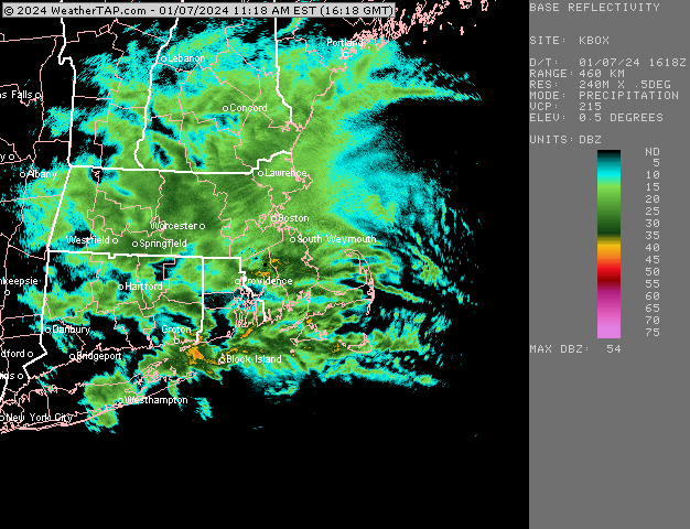
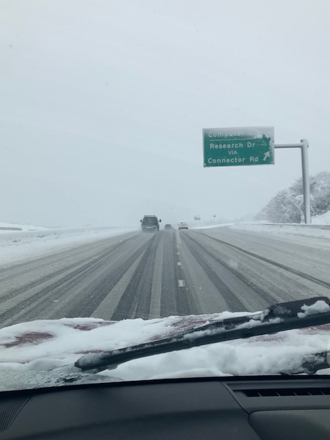
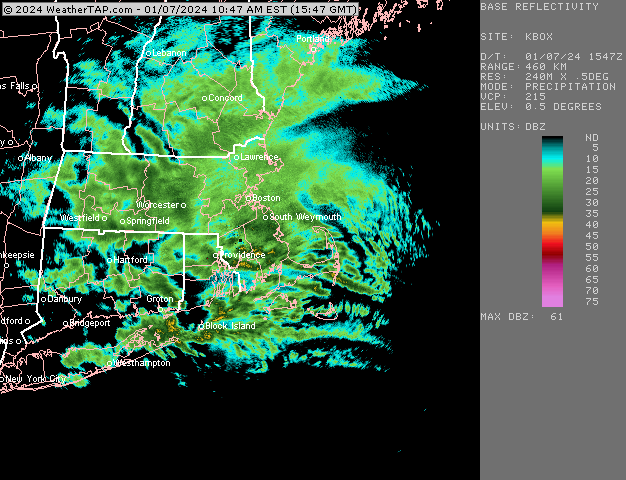
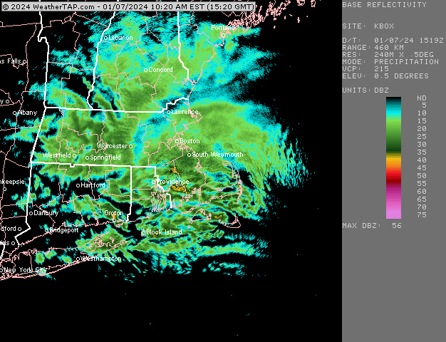
@moneypitmike will recognize this part of route 9
-
You can see it filling in nicely. I think we’ll have a decent 4-5 hour period.
-
No it’ll fill in but they already have a head start too on both round 1 and round 2
-
He legit might pull an 18 burger. 20 wouldn’t be a total shock if this afternoon overperforms there. He’s already over 12”. Passing 10” on winter hill in ORH…headed back out on the road in a bit…I’ll post conditions between ORH and Holliston for those in MA. Down in Holliston, it was very pasty overnight which held accumulations to about 4-5” at 6am but since then it’s been a lot more efficient with over 6” now. Hoping to crack 10 this afternoon.
-
Jackpot for this storm is going to be from ORH county to Ray’s hood. They’re even already setting up excellent bands for round 2
-
GFS with an another sub-980 low in Ohio for 1/13. Don’t think that one is looking very good right now. Trough is just too deep out west.


