.gif.a8150e126cebc480193fad2934fe975c.gif)
Torch Tiger
-
Posts
16,347 -
Joined
-
Last visited
Content Type
Profiles
Blogs
Forums
American Weather
Media Demo
Store
Gallery
Everything posted by Torch Tiger
-
Everything is awesome!
-
no other shots of this happening? that's strange
-
What's your average high up there at 1k? 63-65?
-
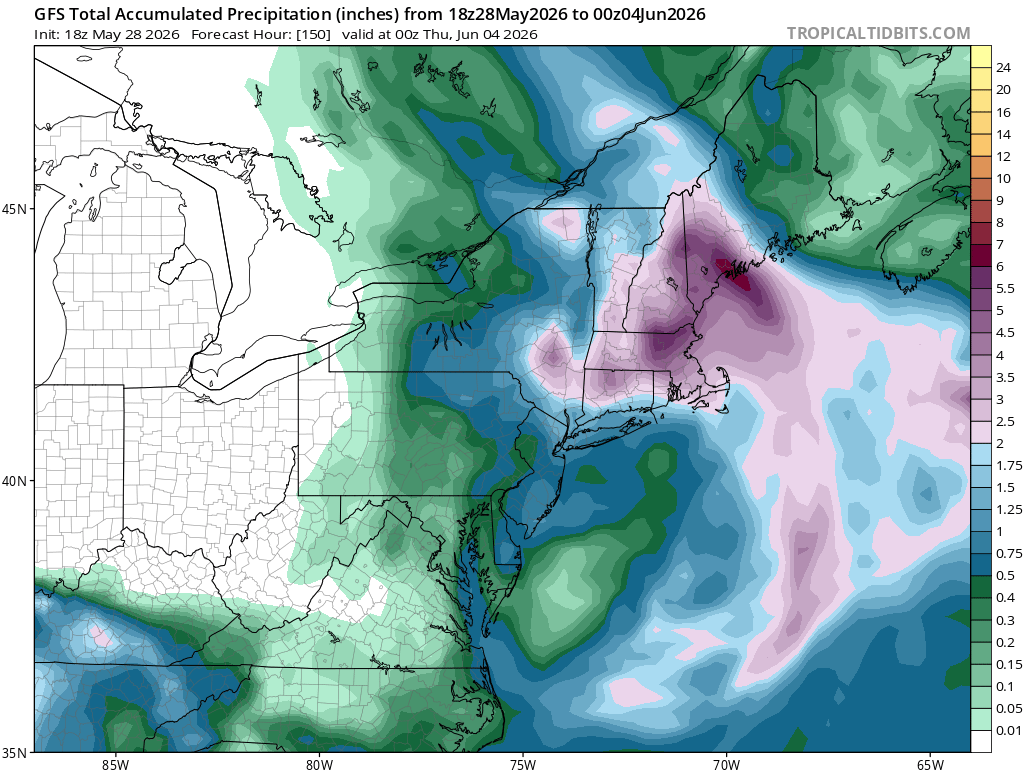
Looks dry and mild through Saturday, a few showers Sunday/early Monday then retorch next week. Overall summer vibes
-
It was far better than this last POS. no one should ever consider making a thread for that last one - mods dropped ball badly
-
lol hurricane bob and eventually 1991 halloween forever changed the landscape
-
Gorgeous afternoon out there. 12z Euro still heavy with the Stein
-
Plus a side of Oct. 91
-
Yeah wow that was quick..nice sun- splashed afternoon
-
top of cranmore? Lol If so those are pretty high snow levels
-
good size trees down in South Billerica, blocking cook st.
-
Decent wind, nothing special
-
a few lightning strikes NW?
-
bad timing....wish it were 11am days ago I posted about hail Friday.. Bust
-
Severe warning in qc?
-
A few light sprinkles/showers passing through.
-
-
I'll forfeit summer if we get a cane up here with this look

-
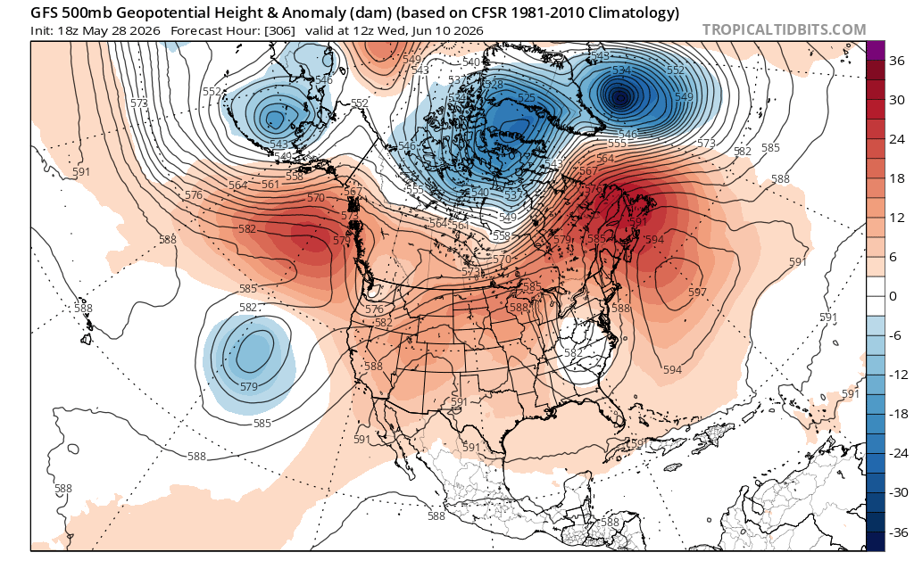
Stein dead and buried on the 18z gfs

-
Wish we could see some baseball or softball size hail ec3b14b3-d3cb-4a77-9edb-1fcc213ccb63.mp4
-
Hopefully lots of cold air aloft to fuel severe through Julorch. Still plenty of time for that "death ridge" look, like Augughst
-
we've been summering for weeks and it's basically mid-late Novie relative to winter If it were Novie 27th today would have been 27 with light snows
-
10 days = half of month. noted Thu-Sat. look great on the 18z gfs btw...more summer perfection. bangers Saturday with the front
-
-
beer
.thumb.gif.f92b16c631a1d15d405ed77b33f0710d.gif)