.gif.a8150e126cebc480193fad2934fe975c.gif)
Torch Tiger
-
Posts
16,202 -
Joined
-
Last visited
Content Type
Profiles
Blogs
Forums
American Weather
Media Demo
Store
Gallery
Everything posted by Torch Tiger
-
Radar looks like ass
-
https://www.spc.noaa.gov/products/md/md0418.html
-
83F car therm in Lowell
-
Summer!
-
looked better at 18z but not bad
-
Yeah sometimes these end up way faster or south/east of many mesos, we'll see
-
just saw that wild hrrr for tomorrow, let's do that

-
Yeah tomorrow looks way north
-
you didn't?
-
O/U you see - 1.5" of rain, before 12z 4/26?
-
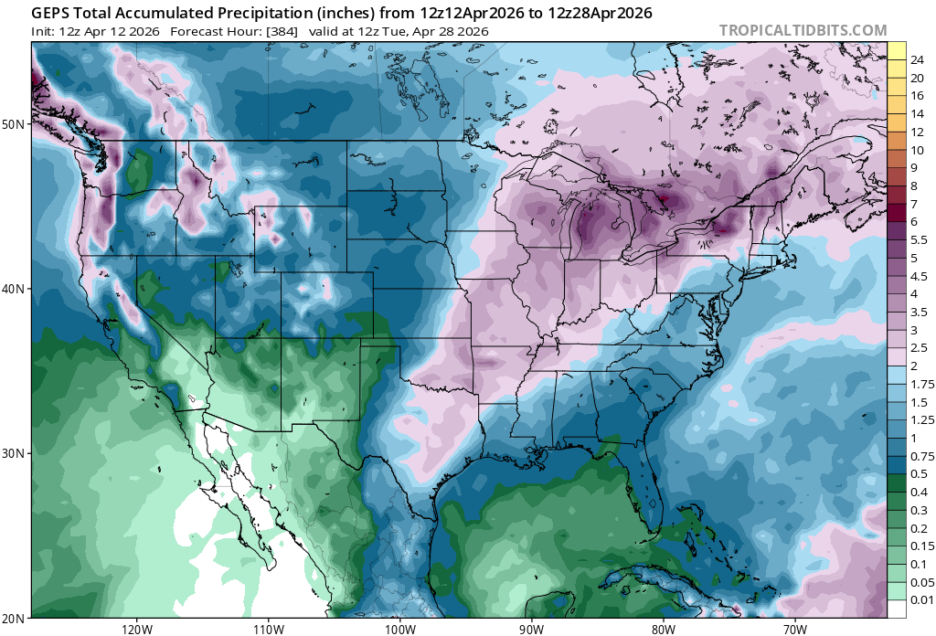
slight relief for the NNE drought, but SNE Steins

-

-
won't stay 70's and 80's very long until May
-
nape+ out there. Wow
-
Yeah SW areas will be measuring pollen
-
Less than three weeks away from true SEVERE SEASON
-
Months and months!
-
Early summer vibes!
-
mild and dry times ahead. Take!
-
it literally says L2 sig drought for the cape
-
-
lol.
-
Strongest ever Nino.. lfg
-
maybe you'll hit 60°?
-
Looks like 80's for the 14th
.thumb.gif.f92b16c631a1d15d405ed77b33f0710d.gif)